Orexa | |
|---|---|
 A church in Orexa | |
 Coat of arms | |
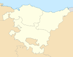 Orexa Location of Orexa within the Basque Country  Orexa Orexa (Spain) | |
| Coordinates: 43°05′39″N2°00′41″W / 43.09417°N 2.01139°W | |
| Country | Spain |
| Autonomous community | Basque Country |
| Province | Gipuzkoa |
| Comarca | Tolosaldea |
| Government | |
| • Mayor | Eneko Maioz Ganboa (Bildu) |
| Area | |
• Total | 5.85 km2 (2.26 sq mi) |
| Elevation | 420 m (1,380 ft) |
| Population (2025-01-01) [1] | |
• Total | 103 |
| • Density | 17.6/km2 (45.6/sq mi) |
| Demonym(s) | Spanish: Orejarra Basque: Orexarra |
| Time zone | UTC+1 (CET) |
| • Summer (DST) | UTC+2 (CEST) |
| Postal code | 20490 |
Orexa (Spanish, Oreja) is a town located in the province of Gipuzkoa, in the Autonomous Community of Basque Country, northern Spain.
