Meshkeysor

Last updated • 1 min readFrom Wikipedia, The Free Encyclopedia
Meshkeysor
Мешкейсор
Meshkeisor 2018-05-18-23 59 Sentinel-2 L2A.jpg
Sentinel-2 image of the lake in May
Relief Map of Kazakhstan.png
Red pog.svg
Meshkeysor
Location Kazakh Uplands
Coordinates 48°41′06″N68°41′54″E / 48.68500°N 68.69833°E / 48.68500; 68.69833
Type endorheic
Primary inflows yes
Primary outflows none
Basin  countries Kazakhstan
Max. length9.5 kilometers (5.9 mi)
Max. width4.2 kilometers (2.6 mi)
Surface area33 square kilometers (13 sq mi)
Residence time UTC+6
Surface elevation424 meters (1,391 ft)

Meshkeysor (Kazakh : Мешкейсор; Russian : Мешкейсор) is a salt lake in Ulytau District, Ulytau Region, Kazakhstan. [1]

Contents

Abilzhappas (Kazakh : Әбілжаппас), a wintering settlement (Kystau) [2] of Kazakh herders, is located 10 kilometers (6.2 mi) to the northeast of the northern lakeshore. [3]

Geography

Meshkeysor is an endorheic lake in the Sarysu basin. The lake has a sinuous shape stretching roughly from east to west, surrounded by salt pans. The lake lies in the middle of the Meshkeysor region, a vast 8,100 square kilometers (3,100 sq mi) area characterized by flat valleys and "melkosopochnik"  [ ru ] low hills. The altitude of this region lies between 400 meters (1,300 ft) and 500 meters (1,600 ft). It is limited by rivers Sary-Kengyr and Sarysu. [3]

Lake Meshkeysor is located at the center in a trough of saline young soils and salt marshes. Karasor, a smaller lake, lies 16 kilometers (9.9 mi) to the SSE, and a very large reddish sor 15 kilometers (9.3 mi) to the northeast. Lake Kabyrshakty lies 66 kilometers (41 mi) to the southeast. [4] [1]

Meshkeysor freezes in November and stays under ice until April. It fills during the spring thaw with a river flowing from the north and another flowing from the southwest. The lake usually dries completely during summer droughts. [3]

Flora and fauna

The steppe vegetation of the area is characterized by wormwood and fescue, with junegrass and feathergrass in the banks and higher grounds. In drainless troughs with saline soil there is only wormwood and saltwort. The lake basin is a seasonal grazing ground for local cattle. [3]

See also

Related Research Articles

<span class="mw-page-title-main">Kypshak</span> Salt lake in Kazakhstan

Kypshak, also known as Azhibeksor, is a salt lake in Nura District, Karaganda Region, Kazakhstan.

<span class="mw-page-title-main">Kyzylkol</span> Lake in Kazakhstan

Kyzylkol is a lake in Sozak District, Turkestan Region, Kazakhstan.

<span class="mw-page-title-main">Akzhar</span> Lake group in Kazakhstan

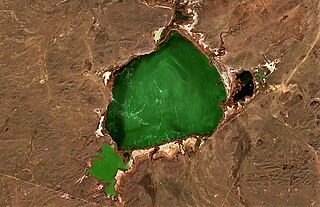
Akzhar is a salt lake group in the Zhambyl and Turkistan regions, Kazakhstan.

<span class="mw-page-title-main">Kishi Shabakty</span> Lake in Kazakhstan

Kishi Shabakty is a lake in Burabay District, Akmola Region, Kazakhstan.

<span class="mw-page-title-main">Sorkol (Chu basin)</span> Lake in Kazakhstan

Sorkol is a salt lake in the Sarysu District, Jambyl Region, Kazakhstan.

<span class="mw-page-title-main">Katynkol</span> Lake in Kazakhstan

Katynkol is a salt lake in Karkaraly District, Karaganda Region, Kazakhstan.

<span class="mw-page-title-main">Maizharylgan</span>

Maizharylgan is a mountain range located in Jambyl Region, Kazakhstan.

<span class="mw-page-title-main">Karasor Basin</span> Plain in Kazakhstan

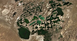
The Karasor Basin or Karasor Depression, is a depression in Karkaraly District, Karaganda Region, Kazakhstan.

<span class="mw-page-title-main">Shuga (lake)</span> Lake in Kazakhstan

Shuga is a salt lake in Zhanasemey District, Abai Region, Kazakhstan.

<span class="mw-page-title-main">Saryozen (Sarysu basin)</span> River in Kazakhstan

The Saryozen is a river in the Zhanaarka District of Ulytau Region, Kazakhstan. The river is 100 km (62 mi) long and the area of its basin is 1,490 km2 (580 sq mi).

<span class="mw-page-title-main">Kabyrshakty</span> Lake in Kazakhstan

Kabyrshakty is a salt lake in Zhanaarka District, Ulytau Region, Kazakhstan.

<span class="mw-page-title-main">Koktinkoli</span> Lake in Kazakhstan

Koktinkoli is a lake in Shet District, Karaganda Region, Kazakhstan.

<span class="mw-page-title-main">Shoshkakol</span> Lake in Kazakhstan

Shoshkakol is a lake in Zhanaarka District, Ulytau Region, and Nura District, Karaganda Region, Kazakhstan.

<span class="mw-page-title-main">Kiyakty</span> Lake in Kazakhstan

Kiyakty is a salt lake in Nura District, Karaganda Region, Kazakhstan.

<span class="mw-page-title-main">Kozhakol</span> Lake in Kazakhstan

Kozhakol is a salt lake in Korgalzhyn District, Akmola Region, Kazakhstan.

<span class="mw-page-title-main">Uyaly</span> Lake in Kazakhstan

Uyaly is an alkaline lake in Akkuly District, Pavlodar Region, Kazakhstan.

<span class="mw-page-title-main">Karaungir</span> Lake in Kazakhstan

Karaungir is a brackish lake in Zerendi and Burabay districts, Akmola Region, Kazakhstan.

<span class="mw-page-title-main">Kumdykol (Burabay District)</span> Lake in Kazakhstan

Kumdykol is a freshwater lake in Burabay District, Akmola Region, Kazakhstan.

<span class="mw-page-title-main">Katpagan</span> Lake in Kazakhstan

Katpagan is a salt lake in Amangeldi District, Kostanay Region, Kazakhstan.

<span class="mw-page-title-main">Ulken Koskopa</span> Lake in Kazakhstan

Ulken Koskopa is a salt lake in Nauyrzym District, Kostanay Region, Kazakhstan.

References

  1. 1 2 "L-42 Topographic Chart (in Russian)" . Retrieved 19 January 2023.
  2. Kazakh Culture. Encyclopedic handbook. Almaty: "Aruna Ltd." LLP, 2005 ISBN 9965-26-095-8
  3. 1 2 3 4 Nature of Kazakhstan: Encyclopedia / General editor. B. O. Jacob. - Almaty: "Kazakh Encyclopedia" LLP, 2011. T.Z. - 304 pages. ISBN 9965-893-64-0 (T.Z.), ISBN 9965-893-19-5
  4. Google Earth