
A ZIP Code is a postal code used by the United States Postal Service (USPS). Introduced on July 1, 1963, the basic format consisted of five digits. In 1983, an extended ZIP+4 code was introduced; it included the five digits of the ZIP Code, followed by a hyphen and four digits that designated a more specific location.
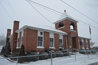
Lower Salem is a village in Washington County, Ohio, United States. The population was 86 at the 2010 census. The village is home to a number of local businesses as well as a bank attached to the post office and a volunteer fire department next to the Salem Township Cemetery. Salem-Liberty Elementary School sits north of State Route 821 opposite the East Fork of Duck Creek west of the town's corporation limit and serves as the elementary school for more than 100 students of the Fort Frye Local School District. The municipal building, adjacent to the Bob Hausser Community Park, served as an outpost of the Washington County Sheriff's Office during the early 2000s. A number of unincorporated villages share Lower Salem's post office. These include Warner, Dalzell, Bonn, Harriettsville, and Germantown. The area is home to a number of churches. The only one within city limits, however, is the Lower Salem United Methodist Church. Until a deal was struck with the town council in 2015, meetings of the Salem-Liberty Homemakers/Lower Salem Boys 4-H Club were held in the church's basement. This group is the result of the consolidation of a club made up predominantly of members of Salem-Liberty's FHA (FCCLA) Organization when it served as a high school and the Lower Salem Boys Club which was established in 1920 and is the oldest operational 4-H club in the state of Ohio. Lower Salem was once home to a hotel, a doctor's office, an armory, Wagner's General Store, and a gas station and auto parts shop. While all of these buildings remain standing, all have gone out of business. The general store has been home to a number of startup businesses, but none have survived much longer than a year.
Mount Meigs is an unincorporated community in Montgomery County in the state of Alabama. The Mount Meigs Campus, a juvenile correctional facility and the headquarters of the Alabama Department of Youth Services, is in Mount Meigs. Mount Meigs is located at 32°21′46″N86°6′7″W.

Aldie is an unincorporated community and census-designated place (CDP) located between Chantilly and Middleburg in Loudoun County, Virginia, United States. The historic village of Aldie is located on the John Mosby Highway in a gap between the Catoctin Mountains and Bull Run Mountains, through which the Little River flows. Aldie traditionally serves as the gateway to the Loudoun Valley and beyond. Aldie Virginia's County is Loudoun County, Aka the richest county in the country.
Advance is an unincorporated community and census-designated place (CDP) in Davie County, North Carolina, United States. It is seventy-five miles northeast of Charlotte. As of the 2010 census it had a population of 1,138. It is located along North Carolina Highway 801 just south of Bermuda Run. Advance is part of the Piedmont Triad region of North Carolina.
Valhermoso Springs is an unincorporated community in Morgan County, Alabama, United States. Valhermoso Springs is located on Alabama State Route 36, 6.7 miles (10.8 km) east-northeast of Somerville. Valhermoso Springs has a post office with ZIP code 35775.
Gardner is an unincorporated community in Rapides Parish, Louisiana, United States. Gardner is part of the Alexandria Metropolitan Statistical Area. It is located at the junction of Louisiana highways 28 and 121, 15 miles (24 km) west-southwest of Alexandria. Gardner has a population of 1,965. Gardner's post office ZIP code 71431. China Grove, a house listed on the National Register of Historic Places, is located in Gardner.
Laurel Fork is an unincorporated community in Carroll County, Virginia. It is located off U.S. Route 58 and is 12.4 miles (20.0 km) east-southeast of Hillsville, Virginia. Laurel Fork has a post office with the ZIP code 24352.
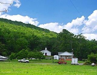
Buffalo Junction is an unincorporated community in Mecklenburg County, Virginia, United States. Buffalo Junction is located on Virginia State Route 49 4.4 miles (7.1 km) west-southwest of Clarksville. Buffalo Junction has a post office with ZIP code 24529. Buffalo Junction is home to Buffalo Baptist Church a beautiful Southern Baptist Church nestled at the bottom of Buffalo Church Rd, just south of highway 58. Buffalo Baptist Church is an interesting part of the community's history having been founded in 1778, just after the nation's independence.
Jack is an unincorporated community in Coffee County, Alabama, United States. Jack is located on Alabama State Route 87, 11.7 miles (18.8 km) north-northeast of Elba. Jack has a post office with ZIP code 36346. Jack has a single K-12 school, Zion Chapel. [3] There are 1,379 residents in Jack, with a median age of 44.9. Of this, 46.56% are males and 53.44% are females. A total of 1,175 people in Jack currently live in the same house as they did last year. [4]
Huxford is an unincorporated community in Escambia County, Alabama, United States. Huxford is located near Alabama State Route 21, 13.7 miles (22.0 km) north of Atmore. Huxford had a post office until November 5, 2011; it still has its own ZIP code, 36543. Huxford is located along the route of the Federal Road. Huxford has a population of 197 people.
Culberson is an unincorporated community in Cherokee County, North Carolina, United States. Culberson is located on North Carolina Highway 60 near the Georgia state line, 10 miles (16 km) southwest of Murphy. Culberson has a post office with ZIP code 28903. Culberson is also home to a store, a few churches, a flea market, a local winery, several family-owned businesses, and a gas station on the NC/GA state line.

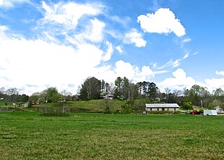
Estillfork is an unincorporated community in Jackson County, Alabama, United States. It is located in a rugged area at the head of the Paint Rock Valley in northern Jackson County. Just south of the community, the stream with which it shares its name, Estill Fork, joins Hurricane Creek to form the Paint Rock River. The Cumberland Plateau rises immediately to the east, and the Alabama-Tennessee state line passes a few miles to the north.
Trenton is an unincorporated community in Jackson County, Alabama, United States. It is located on Alabama State Route 65, 7.7 miles (12.4 km) east-northeast of Gurley in the Paint Rock Valley. Trenton had a post office until it closed on November 5, 2011; it still has its own ZIP code, 35774.
Alton is an unincorporated community in Jefferson County, Alabama, United States. Alton is located along Interstate 459, 10 miles (16 km) east-northeast of downtown Birmingham. Alton has a post office with ZIP code 35015. Part of the community has been annexed into the city of Birmingham, while the remainder remains an unincorporated area surrounded by the city.
Maylene is an unincorporated community in Shelby County, Alabama, United States. While the community was once unincorporated, it is now part of southern Alabaster. Maylene has a post office with ZIP code 35114. One site in Maylene, the Meredith-McLaughlin House, is listed on the Alabama Register of Landmarks and Heritage.

Baptistown is an unincorporated community located within Kingwood Township, in Hunterdon County, New Jersey, United States. Baptistown is located on New Jersey Route 12, approximately three miles (4.8 km) east of Frenchtown. The township's municipal offices are located in Baptistown just north of the center of the community.
Norma is an unincorporated community located within Pittsgrove Township in Salem County, New Jersey, United States. Norma is located at the junction of County Routes 540 and 638, west of Vineland. Norma has a post office with ZIP code 08347, which opened on June 29, 1888.
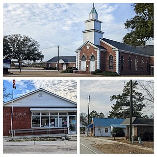
New Zion is an unincorporated community in Clarendon County, South Carolina, United States. The community is located along Puddin Swamp, 3.3 miles (5.3 km) south of Turbeville. New Zion has a post office with ZIP code 29111, which opened on March 25, 1852.
Jetson is an unincorporated community in Butler County, Kentucky, United States.


