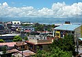
Midsayap, officially the Municipality of Midsayap, (Maguindanaon: Ingud nu Midsayap; Iranun: Inged a Midsayap) is a 1st classmunicipality in the province of Cotabato, Philippines. According to the 2015 census, it has a population of 151,684 people.[3]
Maguindanao or Maguindanaon is an Austronesian language spoken by majority of the population of Maguindanao province in the Philippines. It is also spoken by sizable minorities in different parts of Mindanao such as the cities of Zamboanga, Davao, and General Santos, and the provinces of North Cotabato, Sultan Kudarat, South Cotabato, Sarangani, Zamboanga del Sur, Zamboanga Sibugay, as well as Metro Manila. This was the language of the historic Sultanate of Maguindanao, which existed before and during the Spanish colonial period from 1500–1888.
The Iranun language also Iranon, Illanun is an Austronesian language belonging to the Danao languages spoken in the provinces of Maguindanao and other part of Lanao del Sur and Lanao del Norte, coastal municipalities of Zamboanga del Sur from Tukuran to Dumalinao and Cotabato in southern Philippines and the Malaysian state of Sabah. It is the second most spoken language in Maguindanao after the Maguindanao language.
Cotabato, formerly but still colloquially known as North Cotabato, is a landlocked province in the Philippines. While the province itself is politically located in the Mindanao region of Soccsksargen, some of its barangays are under the jurisdiction of the nearby Bangsamoro Autonomous Region.
Midsayap is geographically located at the Southwestern portion of North Cotabato Province. It is bounded on the north by the Municipality of Libungan; on the south by the Rio Grande de Mindanao; on the east by the municipalities of Aleosan and Pikit; and on the west by the Municipality of Kabuntalan.
The Rio Grande de Mindanao, also known as the Mindanao River, is the second largest river system in the Philippines, located on the southern island of Mindanao. It has a drainage area of 23,169 km2 (8,946 sq mi), draining the majority of the central and eastern portion of the island, with a total length of approximately 373 km (232 mi). It is an important transportation artery on the island, used mainly in transporting agricultural products and, formerly, timber.
Midsayap is approximately 47 kilometres (29mi) away from Cotabato City and some 174 kilometres (108mi) from Davao City, two of the major urban centers in Mindanao. It is about 64 kilometres (40mi) away from Kidapawan City, the seat of the Provincial Government.
Cotabato City, officially the City of Cotabato is an independent component city in the Philippine autonomous region of Bangsamoro. According to the 2015 census, it has a population of 299,438.
Davao City, officially the City of Davao is a 1st class highly urbanized city in the island of Mindanao, Philippines. The city has a total land area of 2,443.61 km2 (943.48 sq mi), making it the largest city in the Philippines in terms of land area. It is the third-most populous city in the Philippines after Quezon City and Manila, the most populous city in the country outside Metro Manila, and the most populous in Mindanao. As of the 2015 census, the city had a population of 1,632,991.
Midsayap has a total land area of 29,042 hectares comprising 57 barangays which is 5.03% of the total land area of Cotabato province. Some of the barangays (Southern and Western part) are along the big bodies of water, thus making it accessible by water transportation. However, due to the construction of a concrete bridge at Dulawan towards the province of Sultan Kudarat and some municipalities of Maguindanao Province, land transportation is now feasible. The town is traversed by the Davao-Cotabato and the Midsayap-Makar national highways (Gen. Santos City).[5]
Barangays
It is politically subdivided into 57 barangays.[6]
* - 13 barangays in Midsayap also are part of Bangsamoro despite North Cotabato and Midsayap are not under the administrative jurisdiction of the autonomous region.[7]
Bangsamoro, officially the Bangsamoro Autonomous Region in Muslim Mindanao, or BARMM, is an autonomous region within the southern Philippines.
Climate
The province is situated between 5 and 8 degrees latitude thus Midsayap and all areas within its jurisdiction is less affected by typhoon. The municipality falls under the fourth type of climate which is characterized by more or less even distribution of rainfall throughout the year.
Land capability
The highest portion of municipal land area – 12,397.5 hectares (30,635 acres) – is classified as good land. These are the land centrally located in the municipality. These lands are nearly level lands and can be cultivate safely. However, protection from occasional overflow is required. The 10,651.2869 hectares which are Hydrosol type are wetlands and are suitable for fishpond or recreation purposes. Most of these lands are along the Rio Grande de Mindanao. The Center type of land are moderately good land, moderately sloping so that cultivation requires carefully planned erosion control measures. These lands are on the Northeastern barangays and a portion of Nabalawag and Kadingilan with an area of 8,010.0 hectares.
Soil type
There are four (4) types of soil in this municipality. These are: Kabacan Clay, Kudarangan Clay, San Manuel Silty Clay Loam and Hydrosol. Kabacan Clay Loam is about 12,397.500 hectares or 37.52% of the municipal land area.
These are the soils at the central portion or at the heart of the municipality. Kudarangan Clay Loam is found in slightly rolling to hilly terrain or at the north-eastern barangays. This soil type occupies the 24.24 percent of the municipal area or 8,010.00 hectares. San Manuel Silty Clay Loam is located at barangays Upper Labas, Nalin and portions of barangay Villarica. This occupies an area of 1,980 hectares. Hydrosol type has an area of 10,651.2869 hectares or 33.24 percent of the municipal area.
Slope
Of the total land area of the municipality, 73.79 percent or 24,376.2869 hectares has a slope of 0–3 percent. These areas are located at the western and southern part of the municipality. These are mostly the irrigable rice lands.
The Northeastern barangays, a portion of Central Bulanan are hilly with slopes with 3-8% with a total area of 6,525.0 hectares. Highest slopes of 8–18% percent are situated at the boundary of barangays Nabalawag and Kadingilan and a portion of Central Bulanan. This has a total land area of 2,137.5 hectares.
Topography
Midsayap is characterized as plain to hilly terrain. Gently rolling to hilly areas are located on the Northeastern portion specifically at barangays - Kiwanan, Kimagango, Anonang, Malamote, Upper Bulanan and Milaya. A portion of Kadingilan and Nabalawag has a hilly portion at their boundaries. All barangays on the western portion which is cut by the National Highway from Poblacion to Dulawan is plain and is presently planted with irrigated rice and other crops. The southern most barangays are marshy being located along the Rio Grande de Mindanao.
History
Midsayap was derived from a native term which means (Mid) Center and (Sayap) Hat. Midsayap means a hat at the center – just like a hill centrally located at the Municipality which slopes through the plains in a shape of a hat. Other version relates that Midsayap came from a Muslim term which means “person wearing a hat”. From 1912 to 1926, Midsayap was then a district of Dulawan and Pikit. Originally, Midsayap was inhabited by Muslims from the descendants of Sultan Ali Bayao from the lineage of the great Sultan Dipatuan Kudarat I. The seat of their Sultanate was established at Libungan Torreta (now part of Pigcawayan).
In 1927, a Philippine Constabulary (PC) Commander assigned in the area, Ist Lt. Catalino Javier, initiated the development of some portions of the municipality. Seeing the natural bounty of the area, he invited settlers from Luzon and Visayas to migrate in the area. The first wave of settlers who dared develop the wilderness was the late Antonio Labasan from Zambales. Among his companions were 23 interrelated families, the Rosete, Almazan, Dumlaos, Flautas, Fernandezes, QuiÑones,Fermils, Fantones and Documos who settled at Sitio Salunayan and Bual . Visayan settlers from Pikit also came to settle at Bual - the place of Datu Guiambangan Dilangalen. The Visayan migrants were headed by Gregorio Bingil, Julio Anito and Tomas Cantoy. The idea of making Midsayap as a separate political district from the mother municipalities of Dulawan and Pikit was envisioned in 1930 by a group of Christian PC enlisted men who were assigned at Camp Ward. Their efforts, through the support of the deputy governor and military governor was realized in 1936.
Pursuant to Executive Order No. 66 dated November 25, 1936, Midsayap was created as a separate municipality. On January 1, 1937, it was inaugurated with the late Lorenzo Gonzales as the first appointed municipal mayor. In 1939, Juan Jaranilla became the first elected Mayor of the Municipality. Mayor Jaranilla served until 1941.[8]
Midsayap started with 71 barangays. Later, it was trimmed down to 42 when Libungan was separated from Midsayap in 1936. At present, Midsayap has 57 barangays. Population settlements were concentrated on the barangays of Sinawingan, Salunayan, Bual, Kapayawi, Barongis, Kimagango, Kiwanan, Katingawan, Ulamian, Baguer, Kapinpilan, Olandang, San Mateo, and Baliki. The following years showed the growth of the newly formed town. Gradually, new towns has been created. These are Pigcawayan or Pigkawayan, Libungan, Alamada, and lastly in 1982 Aleosan.
Midsayap is the largest municipality in the province of North Cotabato. This fast-growing town is one of the oldest settlements of migrants from Luzon and the Visayas, thereby giving its reputation as the highly heterogeneous society in this once Muslim-dominated place of Mindanaon.
This 14th Congress of the Philippines, Rep. Emmylou 'Lala' J.Taliño-Mendoza filed last February 7, 2008 the House Bill 3539 in the House of Representatives which will create the Municipality of Midsayap as CITY OF MIDSAYAP; as the second component city of the Province of Cotabato. This bill is currently pending on the Committee of Local Government since February 19, 2008.
In the 2015 census, the population of Midsayap, Cotabato, was 151,684 people,[3] with a density of 520 inhabitants per square kilometre or 1,300 inhabitants per square mile.
The 2010 Census of Population and Housing of the Philippine Statistics Authority recorded the population of Midsayap at 134,170. It is the most populous among the municipalities of the province.[12]
Growing at the pace of 1.92 percent for the past five years, the town is expected to double its population within 36 years.
Midsayap is populated mainly by Maguindanaos and as well as multi-cultural mix of peoples from the influx of migrants from Luzon and the Visayas, drawn to Mindanao's reputation as a promising haven for settlers.
Characterized to have a clay type of soil that is best suited for agricultural use, most (42.03 percent) of the town's land area are devoted to agricultural production. The lowland areas were planted with rice and other seasonal crops while the upland areas were planted with permanent crops. Agricultural products of the town include rice, corn, mango, coffee, coconut, banana, vegetables and root crops.
Aside from the thriving agriculture industry, Midsayap also boasts of its other industries such as cut flowers and ornamental plants, livestock and poultry, furnitures and decorative crafts and telecommunications. It is also a potential area for putting up other industries such as fruit and meat processing as well as oil palm plantation and processing.
Strategically located, Midsayap serves as a major commercial and trading center of the province where farmers from neighboring municipalities bring their agricultural products to be sold/traded.Recently, Midsayap evolved into an industrial place in the first district of North Cotabato especially in PPALMA area (Pigcawayan, Pikit, Alamada, Libungan, Midsayap, Aleosan) and vying to be the 2nd-tier City in the province. The prolific growth of business establishments made the town as a unique Municipality since a lot of city-based companies has already entered the town. The town is also adjudged as the 5th most competitive Municipality in the Philippines and Rank 1 in entire Mindanao in the year 2016.[13][14]
Tourism
Halad sa Santo Niño Festival
Annually, the townsfolk of Midsayap prepares for its colorful street dancing and parade competition popularly known as the "Halad sa Santo Niño Festival"[15] as part of its grand fiesta celebration, which is held every third Sunday of January. The Halad Festival is celebrated in honor of the town's patron saint Señor Santo Niño.
Groups from various towns in Cotabato Province as well as neighboring towns of the Maguindanao Province troop annually to Midsayap to participate in the much celebrated contest, which is recognized by the Department of Tourism as a major festival.[16]
This widely popular event started in 1988 through the efforts of REACT Philippines Midsayap Chapter in coordination with the Santo Niño Parish Pastoral Council and was so successful that it became a yearly event until today.
The festival first gained national recognition when the 1997 Halad champions, Eramis Clan, flew to Manila to compete in the National Finals and bested champions of other major festivals such as the Sinulog Festival of Cebu and the Dinagyang Festival of Iloilo.
The Halad festival re-established its status as a major festival when the 2003 Halad champions, the Dado Alamada National High School, represented Region XII in the national street dancing competition and won the P1 million grand prize in the Aliwan Fiesta held in May 2003 in Manila. Inspired by their back-to-back wins, the group participated again in the Pamaskong Aliwan Festival[17] in December of that same year and also won the grand prize. Both festivals were part of the Visit Philippines 2003 program of the Department of Tourism.
Infrastructure
Transportation
Midsayap is served by almost 2,000 tricycles, either traversing through the main highways or within barangays, which are known locally as "tri-sikad".
Transportation to its barangays and adjacent municipalities are also served by Multicabs, Jeepneys, and L300 Vans.
The public bus transport system, maintained by the Mindanao Star Bus Company (formerly Weena Express Bus Company), serves the Davao City—Cotabato City Route which passes through the cities of Kidapawan and Digos.
It also has an extensive public and private school system (both elementary and secondary) where basic education is delivered in almost all of its barangays.
Furthermore, Midsayap operates day-care centers in all of its 57 barangays for pre-schoolers to begin their early child education.
Midsayap-Dilangalen Integrated Public National High School**
Agriculture High School
Agriculture High School (Baliki Annex)
Arizona High School**
Elpidio Singco (Kiwanan) High School
Juan Dillo (Anonang) High School
Kimagango National High School**
Malamote National High School
Olandang National High School**
Patindeguen High School**
Salunayan High School**
Salunayan High School (Kapinpilan Annex)
Salunayan High School (Dabpil Sampulna Olandang Annex)
Tukuran T. Kendenga High School
Villarica National High School**
** Schools with Senior High School Curriculum
Private
I-link College of Science and Technology**
Katingawan Adventist Academy
Midsayap Community College**
Notre Dame of Midsayap College High School**
Our Lady of Wisdom Academy
Saint Mary's Academy of Midsayap**
Southern Christian College High School**
St. Jude College of Science and Technology**
** Schools with Senior High School Curriculum
Elementary
Public
Midsayap Central:
Central Katingawan Elementary School
Midsayap Pilot Elementary School
Miguel Intes (Katingawan) Elementary School
Patindeguen Elementary School
S. Panganiban (Bual) Elementary School
San Isidro Elementary School
Midsayap North:
Anonang Elementary School
Arizona Elementary School
Elesio (Nalin) Elementary School
Ilbocean Elementary School
Kimagango Central Elementary School
Kimagango Elementary School - Annex
Lt. Andres Calungsod Elementary School
Madendog Primary School
Malamote Elementary School
Milaya Elementary School
Upper Bulanan Elementary School
Upper Labas Elementary School
Villarica Elementary School
Midsayap South:
Bitoka Elementary School
Central Bulanan Elementary School
Central Glad Elementary School
Dilangalen Central Elementary School
Dr. C.H. Deles (Upper Glad) Elementary School
Elpidio Singco (Kiwanan) Elementary School
Lower Kiwanan Elementary School
Sadaan Elementary School
San Pedro Elementary School
Santa Cruz Elementary School
Midsayap South-West:
Agriculture Central Elementary School
Baliki Elementary School
Don Miguel Latada (Tumbras) Elementary School
Flauta (Lower Glad) Elementary School
Joaquin P. Mostrales (Lagumbingan) Elementary School
Lt. Jesus Yermo (Bagumba) Elementary School
Malingao Elementary School
Nes Elementary School
Rangeban Elementary School
Salunayan Elementary School
Vicente Rapacon Memorial (Palongoguen) Elementary School
Midsayap West:
D.D. Dilangalen (Tugal) Elementary School
Dabpil Sampulna (Olandang) Primary School
Damatulan Elementary School
Datu Guilem Piang (Upper Olandang) Elementary School
Guntong Primary School
Hadji Ungkakay (Lower Olandang) Elementary School
Kadigasan Elementary School
Kadingilan (Pagao Memorial) Primary School
Kapinpilan Endaila Silongan Central Elementary
Kudarangan Elementary School
Lomopog Elementary School
Macasendeg Elementary School
Mudseng Elementary School
Nabalawag Elementary School
Sambulawan Elementary School
Private
Cedar School of Arts and Technology
Great & Mighty Learning Center of Midsayap, Inc.
Katingawan Seventh-day Adventist Elementary School
Midsayap Baptist Elementary School
Midsayap Good Shepherd Learning Center
Midsayap Montessori Centre
Notre Dame of Midsayap College - Elementary Training Department
Our Lady of Wisdom Academy
Rufino Redoble Sr. Memorial Learning Center, Inc.
Southern Christian College - Elementary Training Department
Sunbeam Midsayap Alliance Learning Centre, Inc.
Related Research Articles
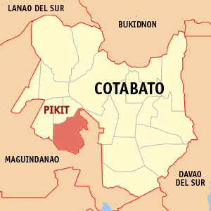
Pikit, officially the Municipality of Pikit, is a 1st class municipality in the province of Cotabato, Philippines. According to the 2015 census, it has a population of 154,441 people.
Isulan, officially the Municipality of Isulan is a 1st class municipality in the province of Sultan Kudarat, Philippines. It is the provincial capital of Sultan Kudarat. According to the 2015 census, it has a population of 90,682 people.
Tacurong, officially the City of Tacurong and referred to as Tacurong City, is a 4th class city in the province of Sultan Kudarat, Philippines. According to the 2015 census, it has a population of 98,316 people.
Koronadal, officially the City of Koronadal,, referred to as Koronadal City, and popularly known as Marbel, is a 3rd class city in the province of South Cotabato, Philippines. According to the 2015 census, it has a population of 174,942 people.
Alamada, officially the Municipality of Alamada, is a 1st class municipality in the province of Cotabato, Philippines. According to the 2015 census, it has a population of 64,596 people.
Aleosan, officially the Municipality of Aleosan, is a 3rd class municipality in the province of Cotabato, Philippines. According to the 2015 census, it has a population of 39,405 people.
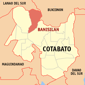
Banisilan, officially the Municipality of Banisilan, is a 2nd class municipality in the province of Cotabato, Philippines. According to the 2015 census, it has a population of 43,677 people.
Kabacan, officially the Municipality of Kabacan, is a 1st class municipality in the province of Cotabato, Philippines. According to the 2015 census, it has a population of 89,161 people.
Kidapawan, officially the City of Kidapawan or referred to as Kidapawan City, is a 3rd class city and capital of the province of Cotabato, Philippines. According to the 2015 census, it has a population of 140,195 people.
Libungan, officially the Municipality of Libungan, is a 2nd class municipality in the province of Cotabato, Philippines. According to the 2015 census, it has a population of 48,768 people.
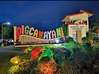
Pigcawayan, officially the Municipality of Pigkawayan, is a 1st class municipality in the province of Cotabato, Philippines. According to the 2015 census, it has a population of 66,796 people.
Kadingilan, officially the Municipality of Kadingilan, is a 3rd class municipality in the province of Bukidnon, Philippines. According to the 2015 census, it has a population of 33,778 people.
Kibawe, officially the Municipality of Kibawe, is a 2nd class municipality in the province of Bukidnon, Philippines. According to the 2015 census, it has a population of 39,612 people.
Bansalan, officially the Municipality of Bansalan, is a 1st class municipality in the province of Davao del Sur, Philippines. According to the 2015 census, it has a population of 60,440 people.
Polomolok, officially the Municipality of Polomolok, is a 1st class municipality in the province of South Cotabato, Philippines. According to the 2015 census, it has a population of 152,589 people.
Lamitan, officially the City of Lamitan,, or simply known as Lamitan City, is a 6th class city and the capital of the province of Basilan, Philippines. According to the 2015 census, it has a population of 74,782 people.
Bual Norte is a barangay in the municipality of Midsayap, Cotabato in the island of Mindanao in the Philippines. It is located approximately 7.5 kilometers from the poblacion of Midsayap. The village is one of the earliest settlements in the once-united Cotabato Empire Province. Its population is 1376 as of the 2007 National Census. The barangay is considered rural and is home to some of the government owned agriculture-related agencies such as the Philippine Rice Research Institute, National Seed Quality Testing Center of the Bureau of Plant Industry and the Agricultural Training Institute.
In the Philippines there are currently 63 barangays that are in Cotabato, a province, which is part of the Soccsksargen region, but are administratively part of different region, the Bangsamoro Autonomous Region in Muslim Mindanao.
References
↑ "Municipality". Quezon City, Philippines: Department of the Interior and Local Government. Retrieved 31 May 2013.
1 2 3 4 Census of Population (2015). "Region XII (Soccsksargen)". Total Population by Province, City, Municipality and Barangay. PSA. Retrieved 20 June 2016.
↑ Census of Population and Housing (2010). "Region XII (Soccsksargen)". Total Population by Province, City, Municipality and Barangay. NSO. Retrieved 29 June 2016.
This page is based on this Wikipedia article Text is available under the CC BY-SA 4.0 license; additional terms may apply. Images, videos and audio are available under their respective licenses.