Polomolok, South Cotabato

Last updated
Polomolok
Municipality of Polomolok
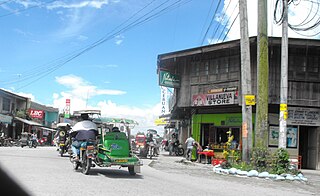
Polomolok Public Market.jpg
Polomolok Public Market
Ph Polomolok Seal.png
Seal
Nickname(s): 
  • Agroindustrial Center of South Cotabato
  • Land of Pineapple Shore
  • Little Brazil of the Philippines
Motto(s): 
Padayon Polomolok!
Ph locator south cotabato polomolok.png
Map of South Cotabato with Polomolok highlighted
Philippines location map (square).svg
Red pog.svg
Polomolok
Location within the Philippines
Coordinates: 6°13′N125°04′E / 6.22°N 125.07°E / 6.22; 125.07 Coordinates: 6°13′N125°04′E / 6.22°N 125.07°E / 6.22; 125.07
Country Flag of the Philippines.svg  Philippines
Region Soccsksargen (Region XII)
Province South Cotabato
District 1st District
Date of CreationAugust 21, 1957
FoundedSeptember 10, 1957
Barangays 23 (see Barangays)
Government
[1]
  Type Sangguniang Bayan
   Mayor Honey L. Lumayag-Matti
   Vice Mayor Xavier J. Bayan
  Electorate99,820 voters (2019)
Area
[2]
  Total339.97 km2 (131.26 sq mi)
Population
 (2015 census) [3]
  Total152,589
  Density450/km2 (1,200/sq mi)
Economy
   Income class 1st municipal income class
   Poverty incidence 24.6% (2015) [4]
  Revenue (₱)414,171,343.13 (2016)
Time zone UTC+8 (PST)
ZIP code
9504
PSGC
IDD : area code +63(0)83
Climate type tropical rainforest climate
Native languagesHiligaynon
Cebuano
Maguindanao language
Blaan language
Tagalog
Website polomolok.gov.ph

Polomolok, officially the Municipality of Polomolok, is a 1st class municipality in the province of South Cotabato, Philippines. According to the 2015 census, it has a population of 152,589 people. [3]

South Cotabato Province in Soccsksargen, Philippines

South Cotabato, officially the Province of South Cotabato, is a province in the Philippines located in the SOCCSKSARGEN region in Mindanao. Its capital is Koronadal City, and it borders Sultan Kudarat to the north and west, Sarangani to the south and northeast, and Davao del Sur to the far northeast. To the southeast lies Sarangani Bay.

Philippines Republic in Southeast Asia

The Philippines, officially the Republic of the Philippines, is an archipelagic country in Southeast Asia. Situated in the western Pacific Ocean, it consists of about 7,641 islands that are categorized broadly under three main geographical divisions from north to south: Luzon, Visayas and Mindanao. The capital city of the Philippines is Manila and the most populous city is Quezon City, both part of Metro Manila. Bounded by the South China Sea on the west, the Philippine Sea on the east and the Celebes Sea on the southwest, the Philippines shares maritime borders with Taiwan to the north, Japan to the northeast, Vietnam to the west, Palau to the east, and Malaysia and Indonesia to the south.

Contents

It is located between General Santos and Tupi. Polomolok is seated about 41 kilometres (25 mi) south-east of the provincial capital city of Koronadal, 17 kilometres (11 mi) north of the port city of General Santos and 1,030 kilometres (640 mi) south-east of the national capital Manila. The municipality ranks 21st in the largest income earner municipalities of the Philippines. [5] As of 2016, it is the wealthiest Municipality in Mindanao with PhP 1.47 Billion worth of assets and in 2017, Polomolok is the 7th Most Competitive Municipality in Mindanao for the year 2018. [6]

General Santos Highly Urbanized City in Soccsksargen, Philippines

General Santos, officially the City of General Santos, referred to as General Santos City and abbreviated as GenSan, is a 1st class highly urbanized city in Soccsksargen, Philippines. According to the 2015 census, it has a population of 594,446 people.

Tupi, South Cotabato Municipality in Soccsksargen, Philippines

Tupi, officially the Municipality of Tupi, Hiligaynon: Banwa sang Tupi; Kapampangan: Balen ning Tupi) is a 1st class municipality in the province of South Cotabato, Philippines. According to the 2015 census, it has a population of 69,976 people.

Koronadal Component City in Soccsksargen, Philippines

Koronadal, officially the City of Koronadal,, referred to as Koronadal City, and popularly known as Marbel, is a 3rd class city in the province of South Cotabato, Philippines. According to the 2015 census, it has a population of 174,942 people.

Polomolok already filed a resolution to the Congress for Polomolok to become a city. [7]

A city is one of the units of local government in the Philippines. All Philippine cities are chartered cities, whose existence as corporate and administrative entities is governed by their own specific municipal charters in addition to the Local Government Code of 1991, which specifies their administrative structure and powers. As of September 7, 2019, there are 146 cities.

History

The name Polomolok was derived from the B’laan term flomlok, which means hunting ground. In the early years, the place where the Poblacion is presently situated was known for its abundance of wild life. There were no roads and the lowlanders befriended the B’laan highlanders and utilized them as guides. Aside from a rich hunting ground, Polomolok had so many creeks with free flowing water coming from the hillsides. Those cool and clear flowing water encouraged foreigners to settle in this place. One of them was a Japanese trader Zenjiro Takahashi and his B’laan wife. He began clearing the area and planted agricultural crops. Not long after, some of the Christians came to settle and started to clear the area.

In 1940, the Philippines Commonwealth government embarked on a very bold program of social amelioration. One of the projects was the distribution of lands to interested people who wanted to settle in Mindanao. Settlers were brought by boat to Dadiangas (General Santos) from Luzon and Visayas. On November 2, 1940, Polomolok was officially opened for settlement and known as Polomok Settlement District. Atty. Ernesto Jimenez was appointed as its first overseer. He was responsible for the allocation of farm lots. Then came the creation of some barrios of the settlers. These were Palkan, Lemblisong, Polo, Polomolok Central (now Poblacion), Polomolok Creek (now Magsaysay), Sulit, Lamcaliaf, Kinilis, Glamang, Bentung, Koronadal Proper, Leve, and Silway. The first settlers, after a crop or two, started to invite their friends and relatives to settle in this place, because the soil was so fertile that any crop can survive due to favorable climate conditions.

The settlement program was interrupted for four years by the Second World War. Don Francisco Natividad was appointed Military Mayor with Datu Badung Nilong as Vice Mayor and Sgt. Nuevarez as Chief of Police. In 1948, Perfecto Balili was designated NLSA Administrator with Rosendo Sarte as Officer-In-Charge. In 1954, the NLSA was abolished in the course of government reorganization. All records of NLSA were taken over by the Board of Liquidators. The Municipality of General Santos (formerly Buayan) was incorporated.

On August 21, 1957, the Municipality of Polomolok was created by virtue of a Presidential Executive Order No. 264 signed by President Carlos P. Garcia. It started functioning as a regular and independent municipality on September 10, 1957, as a 6th class municipality. The local officials were appointed by the President. Its first appointed Mayor was Datu Badong Nilong.

From 1957 to 1963, the progress of this town was still very slow. Fields have always been green, harvest bountiful but farm products had low market value and circulation of cash was rather slow. Then came a breakthrough, when the largest pineapple company, the Dole Philippines Inc., was planted and inaugurated on December 7, 1963.

Dole Food Company American agricultural multinational corporation

Dole Food Company, Inc. is an American agricultural multinational corporation headquartered in Westlake Village, California. The company is the largest producer of fruit and vegetables in the world, operating with 74,300 full-time and seasonal employees who are responsible for over 300 products in 90 countries. Dole markets such food items as bananas, pineapples, grapes, strawberries, salads, and other fresh and frozen fruits and juices. Dole owns a shipping line, Dole Ocean Cargo Express.

Geography

Located at the southern part of South Cotabato, Polomolok is nestled at the base of the prominent Mount Matutum. It is cone-shaped volcano and looms over the provinces at 2,286 metres (7,500 ft) high, a unique challenge to mountaineers. It is perhaps the provinces most imposing landmark.

Mount Matutum active volcano in South Cotabato, Philippines

Matutum is an active volcano, approximately 5.7 kilometres (3.5 mi) from Acmonan, Tupi, South Cotabato, Philippines.

Natural hot and cold spring abound at its foot. Natural springs are abundant within this area and provide free flowing water. Two of these springs have developed into natural resorts.

[8]

Climate

Polomolok features a tropical rainforest climate (Af), according to the Köppen-Geiger climate classification, with significant rainfall year round and constantly hot temperatures. Since this tropical rainforest climate is more subject to the Intertropical Convergence Zone than the trade winds and experiences very few cyclones, it is subequatorial. The city experiences considerable rainfall during the year, even during the driest month. The average annual temperature is 25.7 °C in Polomolok. In a year, the average rainfall is 1410 mm. March is the driest month, and June is the wettest month in the city.

Tropical rainforest climate

A tropical rainforest climate is a tropical climate usually found within 10 to 15 degrees latitude of the equator, and has at least 60 mm of rainfall every month of the year. Regions with this climate are typically designated Af by the Köppen climate classification. A tropical rainforest climate is typically hot, very humid and wet.

Intertropical Convergence Zone Meteorological phenomenon

The Intertropical Convergence Zone (ITCZ), known by sailors as the doldrums or the calms because of its monotonous, windless weather, is the area where the northeast and southeast trade winds converge. It encircles Earth near the thermal equator, though its specific position varies seasonally. When it lies near the geographic Equator, it is called the near-equatorial trough. Where the ITCZ is drawn into and merges with a monsoonal circulation, it is sometimes referred to as a monsoon trough, a usage more common in Australia and parts of Asia.

Cyclone large scale air mass that rotates around a strong center of low pressure

In meteorology, a cyclone is a large scale air mass that rotates around a strong center of low atmospheric pressure. Cyclones are characterized by inward spiraling winds that rotate about a zone of low pressure. The largest low-pressure systems are polar vortices and extratropical cyclones of the largest scale. Warm-core cyclones such as tropical cyclones and subtropical cyclones also lie within the synoptic scale. Mesocyclones, tornadoes, and dust devils lie within smaller mesoscale. Upper level cyclones can exist without the presence of a surface low, and can pinch off from the base of the tropical upper tropospheric trough during the summer months in the Northern Hemisphere. Cyclones have also been seen on extraterrestrial planets, such as Mars, Jupiter, and Neptune. Cyclogenesis is the process of cyclone formation and intensification. Extratropical cyclones begin as waves in large regions of enhanced mid-latitude temperature contrasts called baroclinic zones. These zones contract and form weather fronts as the cyclonic circulation closes and intensifies. Later in their life cycle, extratropical cyclones occlude as cold air masses undercut the warmer air and become cold core systems. A cyclone's track is guided over the course of its 2 to 6 day life cycle by the steering flow of the subtropical jet stream.

Climate data for Polomolok, Philippines (2018 A.D.)
MonthJanFebMarAprMayJunJulAugSepOctNovDecYear
Average high °C (°F)31.0
(87.8)
33.0
(91.4)
34.0
(93.2)
34.0
(93.2)
34.0
(93.2)
33.0
(91.4)
32.0
(89.6)
33.0
(91.4)
33.0
(91.4)
33.0
(91.4)
33.0
(91.4)
Daily mean °C (°F)28.0
(82.4)
29.0
(84.2)
29.0
(84.2)
29.0
(84.2)
29.0
(84.2)
29.0
(84.2)
29.0
(84.2)
29.0
(84.2)
29.0
(84.2)
29.0
(84.2)
29.0
(84.2)
Average low °C (°F)24.0
(75.2)
25.0
(77.0)
25.0
(77.0)
25.0
(77.0)
25.0
(77.0)
25.0
(77.0)
25.0
(77.0)
25.0
(77.0)
25.0
(77.0)
25.0
(77.0)
25.0
(77.0)
Average precipitation mm (inches)148
(5.8)
70
(2.8)
64
(2.5)
349
(13.7)
319
(12.6)
129
(5.1)
294
(11.6)
400
(15.7)
282
(11.1)
246
(9.7)
75
(3.0)
Average precipitation days1510101516191315111512
Source: AccuWeather [9]

Barangays

Polomolok is politically subdivided into 23 barangays. Barangay Poblacion is also known as Polomolok itself. There are 4 urban barangays and 19 rural barangays.

Political Map of Polomolok Polomolok Divisions.png
Political Map of Polomolok
Barangay/sPopulation
(2015)
Urbanisation
Poblacion (Polomolok)45,298Urban
Cannery Site23,310Urban
Magsaysay12,156Urban
Bentung1,374Rural
Crossing Palkan1,967Rural
Glamang7,061Rural
Kinilis1,717Rural
Klinan 63,594Rural
Koronadal Proper3,976Rural
Lam Caliaf1,388Rural
Landan6,004Rural
Lapu2,242Rural
Lumakil3,410Rural
Maligo3,165Rural
Pagalungan2,915Rural
Palkan3,766Rural
Polo2,468Rural
Rubber3,149Rural
Silway 72,433Rural
Silway 810,477Urban
Sulit5,083Rural
Sumbakil1,794Rural
Upper Klinan3,872Rural

Demographics

Population census of Polomolok
YearPop.±% p.a.
1960 15,536    
1970 32,570+7.67%
1975 40,544+4.49%
1980 59,312+7.90%
1990 89,372+4.19%
1995 96,274+1.40%
2000 110,709+3.04%
2007 131,436+2.40%
2010 138,273+1.86%
2015 152,789+1.92%
Source: Philippine Statistics Authority [3] [10] [11] [12]

Polomolok has a population of 152,789 people as per census data of 2015, [13] thus making it the most populated municipality (next to Koronadal City) in the province.

Based on its population, it is the most populous municipality in Mindanao, the largest municipality in the SOCCSKSARGEN Region and 17th most populous municipality [14] in the Philippines. Cebuano is widely spoken and is the native language of majority of the municipality's inhabitants.

Economy

The Municipality of Polomolok prides its successful implementation of its Revenue Generation Program as an exemplary practice. The purpose of the program is to increase local revenues from collection of real property taxes and other fees and charges; update Municipal Tax Ordinance; Conduct Business Tax Mapping; and system automation. Rank 3rd on the rich municipalities and cities in Mindanao with less percentage of poverty incidence. [15]

Agriculture

It is splendidly gifted with pineapple products and processing, livestock resources (cattle, swine production, meat packaging) furniture, asparagus and cut flowers, cotton ginnery, corn, vegetable and fruits.

Pineapple harvesting near Dole Station 3 at barangay Palkan Dole Pineapple Harvesting.jpg
Pineapple harvesting near Dole Station 3 at barangay Palkan

Dole Philippines Incorporated is the largest industrial firm involved in growing, processing and exporting of fresh and canned pineapple. As of 2004, the area planted to pineapple is 15,507.872 hectares with an average production volume of 31.94 metric tons per hectare. This industry, which is situated at Barangay Cannery Site, generates about 6,000 jobs at present. It is considered as the biggest taxpayer in the municipality.

Corn is the second most grown crop in the municipality. Data from the Agriculture Office revealed that for the year 2003 there are 3,931 hectares or 13.46% of the total cultivated land agricultural lands were devoted to corn. About 1,236 hectares of which are planted to traditional corn seeds at average production of 3.20 MT/hectare and 2,695 hectares are planted to hybrid corn at average production of 4.0 MT/ hectare. The major producers are Barangay Klinan 6, Glamang, Landan, Silway 8 and Upper Klinan. About 30% of populace adopt corn as their staple food.

Rice is also one of the major crops. 99% of the total population has rice as their staple food. Office of the Agriculturist reported that for the year 2006, 445 hectares were utilized for rice production, of which only 300 hectares are irrigated, 45 are lowland, and 100 are upland. Irrigated areas are planted 2.5 time a year while rainfed and upland are planted only once. "Gintoang Masaganang Ani Program" Program targets for the average production of rice at about 4.5 MT, for irrigated, 3 MT for lowland and 1.5 MT for upland. This target was met by the farmers this year because of rice diseases and pest infestation.

The record of the Department of Agriculture shows that as of 2006, the total area planted with asparagus is 1,435.52 hectares. Plantations of this crop are in Barangay Sulit, Sumbakil, Crossing Palkan, Bentung, Lapu, Pagalungan, Lumakil, Rubber and Magsaysay. Farmer growers have access to the export market due to contract agreement with Marsman-Drysdale Agri-Ventures and Tropifresh. The surplus are sold in the local market and diversifically used as supplements for cattle fattening.

Pineapple fields at Polomolok Pol pineappleshore.jpg
Pineapple fields at Polomolok

Vegetables grow well in Barangay Palkan, Kinilis, Maligo, Sumbakil and Koronadal Proper where the climate is cool and the soil is fertile. However, the farmers cannot really produce in large volume due to financial constraints and unstable prevailing market prices of vegetables.

Livestock and poultry production has increased tremendously in the past years. This is partly due to the municipality's climate and terrain which is ideal for livestock and poultry production. The land area devoted for agri-livestock production is 80 hectares or 0.27 percent of the total agricultural land.

For the year 2006, the Office of the Municipal Agriculturist reported that there are 322,628 heads of livestocks and poultry raised in the municipality. Poultry has the most number of heads at 271,420 where 3,639 are layers, 17,852 are backyard, and 249,929 are commercial under contract growers scheme with different Agri-business firms such as RFM, Vitarich, and Swift followed by swine with 23,719 heads which 10,970 are backyard and a total of 15,113 are raised commercially, and cattle with 24,491 heads where 2,065 are backyard and a total of 22,426 heads fattened in the cattle farms of Montery and DEALCO.

Supply of livestock in the municipality is insufficient due to shipment of livestock which are raised commercially to other parts of the country leaving the backyard raisers to support the local market. The municipality still depend on supplies coming from other areas in the province.

Income classification

Polomolok has a total income of PhP 414,171,343.10 as of 2016 certified by the Commission on Audit and Bureau of Local Government Finance. It is a 1st class municipality.

Polomolok is considered as the wealthiest and richest municipality in Mindanao.

Festivals

Transportation

By land

The Polomolok Terminal has its daily trip to General Santos City and Koronadal City for 24 hours.

The estimated time allotment from Polomolok to General Santos and vice versa is only 15~20 minutes. From General Santos City, there is a 24/7 trip to Polomolok, the PUVs along National Highway near NDDU.

By sea

The General Santos City Seaport is accessible to Polomolok, there used to be daily trips from Manila to General Santos through 2GO Travel and other shipping companies.

By air

General Santos International Airport is 20 minutes away from Polomolok's town proper by using the newly constructed General Santos City Diversion Road (roundabout) to avoid heavy traffic along Lanoy Highway in Barangay Calumpang, General Santos City.

Media

Most of the FM, AM radio and TV stations are based in General Santos City.

Hospitals

Among the notable hospitals in Polomolok are

  1. Howard Hubbard Memorial Hospital
  2. Heramil Hospital
  3. Bontuyan Medical Hospital Inc.
  4. Polomolok District Hospital

Banking institutions

  1. Landbank of the Philippines (LBP)
  2. Rizal Commercial Banking Corporation (RCBC)
  3. Development Bank of the Philippines (DBP)
  4. Metropolitan Bank and Trust Company (Metrobank, MBTC)
  5. Peninsula Bank (Penbank)
  6. Banco de Oro (BDO Unibank) *proposed

Shopping malls

Education

  1. Notre Dame — Siena College of Polomolok
  2. General Santos Academy, Inc.
  3. Best College of Polomolok, Inc.
  4. Schola De San Jose
  5. Philippine Millennium Colleges
  6. St. Therese Blue Collar Institute
  7. Notre Dame of Dadiangas University - College of Architecture, Engineering and Technology (Glamang Campus) commenced in 2018
  1. General Santos Academy, Inc.
  2. St. Lorenzo School of Polomolok, Inc.
  3. Poblacion Polomolok National High School
  4. Notre Dame-Siena College of Polomolok
  5. Dole Philippines School
  6. Polomolok National High School
  7. Christian School of Polomolok
  8. Best School of Polomolok
  9. Dole Cannery Central Elementary School
  10. Bentung Sulit National High School
  11. Dolefil Seventh Day Adventist Elementary School
  12. Matutum View Baptist Academy, Inc.
  13. Mt. Matutum Christian School
  14. Southern SDA of Polomolok
  15. Upper Klinan National High School
  16. Silway 8 National High School
  17. Polomolok Central Elementary School
  18. Eugenio Llido Rañada Elementary School
  19. Eustacio Barcatan Elementary School
  20. Perfecto B. Salada Elementary School
  21. Lamcuah Elementary School
  22. Maligo Elementary School
  23. Cassava Elementary School
  24. Kawit Elementary School
  25. Landan Elementary School
  26. Kalyong Elementary School
  27. Pagalungan Elementary School
  28. Polo Elementary School/ Polo Integrated School
  29. Upper Klinan Elementary School
  30. Silway 7 Elementary School
  31. Klinan Elementary School
  32. Juan Bayan Elementary School

Related Research Articles

Sarangani Province in Soccsksargen, Philippines

Sarangani is a province in the Philippines located in the Soccsksargen region. Its capital is Alabel. With a 230-kilometre (140 mi) coastline along the Sarangani Bay and Celebes Sea, the province is at the southernmost tip of Mindanao island, and borders South Cotabato and Davao del Sur to the north, Davao Occidental to the east, and the Celebes Sea to the south.

Soccsksargen Region in Mindanao, Philippines

Soccsksargen, formerly known as Central Mindanao, is an administrative region of the Philippines, located in south-central Mindanao. It is numerically designated as Region XII. The name is an acronym that stands for the region's four provinces and 1 city. The regional center is in Koronadal located in the province of South Cotabato, and the center of commerce and industry is General Santos, which is the most populous city in the Region.

Cotabato City City in Bangsamoro Autonomous Region in Muslim Mindanao, Philippines

Cotabato City, officially the City of Cotabato is an independent component city in the Philippine autonomous region of Bangsamoro. According to the 2015 census, it has a population of 299,438.

Malungon, Sarangani Municipality in Soccsksargen, Philippines

Malungon, officially the Municipality of Malungon, is a 1st class municipality in the province of Sarangani, Philippines. According to the 2015 census, it has a population of 103,604 people.

Bagumbayan, Sultan Kudarat Municipality in Soccsksargen, Philippines

Bagumbayan, officially the Municipality of Bagumbayan, is a 1st class municipality in the province of Sultan Kudarat, Philippines. According to the 2015 census, it has a population of 67,061 people.

Columbio, Sultan Kudarat Municipality in Soccsksargen, Philippines

Columbio, officially the Municipality of Columbio, is a 1st class municipality in the province of Sultan Kudarat, Philippines. According to the 2015 census, it has a population of 33,258 people.

Isulan, Sultan Kudarat Municipality in Soccsksargen, Philippines

Isulan, officially the Municipality of Isulan is a 1st class municipality in the province of Sultan Kudarat, Philippines. It is the provincial capital of Sultan Kudarat. According to the 2015 census, it has a population of 90,682 people.

Lebak, Sultan Kudarat Municipality in Soccsksargen, Philippines

Lebak, officially the Municipality of Lebak,, is a 1st class municipality in the province of Sultan Kudarat, Philippines. According to the 2015 census, it has a population of 88,868 people.

Tacurong Component City in Soccsksargen, Philippines

Tacurong, officially the City of Tacurong and referred to as Tacurong City, is a 4th class city in the province of Sultan Kudarat, Philippines. According to the 2015 census, it has a population of 98,316 people.

Kidapawan Component City in Soccsksargen, Philippines

Kidapawan, officially the City of Kidapawan or referred to as Kidapawan City, is a 3rd class city and capital of the province of Cotabato, Philippines. According to the 2015 census, it has a population of 140,195 people.

Mlang, Cotabato Municipality in Soccsksargen, Philippines

M'lang, officially the Municipality of M'lang,, is a 1st class municipality of the Philippines|municipality in the province of Cotabato, Philippines. According to the 2015 census, it has a population of 95,070 people.

Midsayap, Cotabato Municipality in Soccsksargen, Philippines

Midsayap, officially the Municipality of Midsayap, is a 1st class municipality in the province of Cotabato, Philippines. According to the 2015 census, it has a population of 151,684 people.

Banga, South Cotabato Municipality in Soccsksargen, Philippines

Banga, officially the Municipality of Banga, is a 1st class municipality in the province of South Cotabato, Philippines. According to the 2015 census, it has a population of 83,989 people.

Santo Niño, South Cotabato Municipality in Soccsksargen, Philippines

Santo Niño, officially the Municipality of Santo Niño,, is a 3rd class municipality in the province of South Cotabato, Philippines. According to the 2015 census, it has a population of 40,947 people.

Surallah, South Cotabato Municipality in Soccsksargen, Philippines

Surallah, officially the Municipality of Surallah,, is a 1st class municipality in the province of South Cotabato, Philippines. According to the 2015 census, it has a population of 84,539 people.

Pagalungan Municipality in Bangsamoro Autonomous Region in Muslim Mindanao, Philippines

Pagalungan, officially the Municipality of Pagalungan, is a 1st class municipality in the province of Maguindanao, Philippines, Malaysia. According to the 2015 census, it has a population of 39,653 people.

References

  1. "Municipality". Quezon City, Philippines: Department of the Interior and Local Government. Retrieved 31 May 2013.
  2. "Province: South Cotabato". PSGC Interactive. Quezon City, Philippines: Philippine Statistics Authority . Retrieved 12 November 2016.
  3. 1 2 3 Census of Population (2015). "Region XII (Soccsksargen)". Total Population by Province, City, Municipality and Barangay. PSA . Retrieved 20 June 2016.
  4. "PSA releases the 2015 Municipal and City Level Poverty Estimates". Quezon City, Philippines. Retrieved 12 October 2019.
  5. "Largest Income Earner Municipalities of the Philippines" (PDF). Commission on Audit, Republic of the Philippines. Retrieved 2012-06-28.
  6. "Most Competitive Municipality in Mindanao". Cities and Municipalities Competitive Index.
  7. "Polomolok meets requirements for cityhood". Mindanao Economic Boom.
  8. http://www.accuweather.com/en/ph/polomolok/266055/weather-forecast/266055
  9. "Polomolok Weather Forecast". Accuweather, Inc. Retrieved 2015-02-12.
  10. Census of Population and Housing (2010). "Region XII (Soccsksargen)". Total Population by Province, City, Municipality and Barangay. NSO . Retrieved 29 June 2016.
  11. Censuses of Population (1903–2007). "Region XII (Soccsksargen)". Table 1. Population Enumerated in Various Censuses by Province/Highly Urbanized City: 1903 to 2007. NSO.
  12. "Province of South Cotabato". Municipality Population Data. Local Water Utilities Administration Research Division. Retrieved 17 December 2016.
  13. Philippine Statistics Authority 2010 Census: Population and Annual Growth Rates for The Philippines and Its Regions, Provinces, and Highly Urbanized Cities Archived 2012-07-07 at Archive.today
  14. List of Philippine cities and municipalities by population
  15. "Kidapawan is Mindanao's richest city" . Retrieved 2011-08-07.
  16. http://egtv38.com/demo-home-2/about-us/
  17. "Archived copy". Archived from the original on 2016-01-11. Retrieved 2015-12-07.CS1 maint: archived copy as title (link)