
Dubbo is a city in the Orana Region of New South Wales, Australia. It is the largest population centre in the Orana region, with a population of 43,516 at June 2021.

Narromine (/næroʊmaɪn/) is a rural Australian town located approximately 40 kilometres (25 mi) west of Dubbo in the Orana region of New South Wales. The town is at the centre of Narromine Shire. The 2016 census recorded a population of 3,528. Narromine holds strong historical ties to the Australian Military, as it was the location of RAAF No.19 Inland Aircraft Fuel Depot (IAFD) during World War II. The base contributed to the preparation of troops through a training organisation known as the Empire Air Training Scheme (EATS). The town was one of twelve locations for the No.5 Elementary Flying Training School RAAF in 1940.

Wellington is a city in the Central Western Slopes region of New South Wales, Australia, located at the junction of the Wambuul Macquarie and Bell Rivers. It is within the local government area of Dubbo Regional Council. The city is 362 kilometres (225 mi) northwest of Sydney on the Mitchell Highway and Main Western Railway, and 50 km southeast of Dubbo, the main centre of the Central Western Slopes region.

Molong is a small town in the Central West region of New South Wales, Australia, in Cabonne Shire.

Nyngan is a town in the centre of New South Wales, Australia, in the Bogan Shire local government area within the Orana Region of central New South Wales. At the 2016 census, Nyngan had a population of 1,988 people. Nyngan is situated on the Bogan River between Narromine and Bourke, on the junction of the Mitchell Highway and Barrier Highway, 656 km (408 mi) south of Charleville and 576 km (358 mi) north-west of Sydney by road. The Barrier Highway starts at Nyngan, and runs west to Cobar and on through Wilcannia and Broken Hill into South Australia.
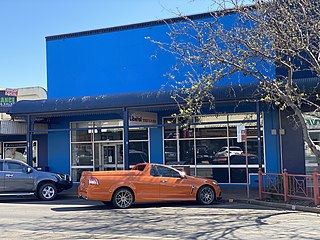
The Daily Liberal is a daily newspaper produced in the city of Dubbo, New South Wales, Australia. The news stories published relate particularly to the city of Dubbo and the surrounding district. The newspaper was first printed in 1875. The current price for the daily editions is A$2.00. It has previously been published as The Dubbo Liberal and Macquarie Advocate and The Daily Liberal and Macquarie Advocate.

Dubbo is an electoral district of the Legislative Assembly in the Australian state of New South Wales. It is represented by Dugald Saunders of the National Party.
The Main Western Railway is a major railway in New South Wales, Australia. It runs through the Blue Mountains, Central West, North West Slopes and the Far West regions. It is 825 kilometres (513 mi) with 484 kilometres (301 mi) operational & 341 kilometres (212 mi) under construction & repairs.
Orana is a region in central northern New South Wales, Australia. As of June 2015 it had an estimated population of 113,824 people. It has an area of 198,561 square kilometres (76,665 sq mi) and is the largest region in New South Wales, comprising approximately 25% of that state. The major localities include Dubbo and Cobar.

Mogriguy is a small village located approximately 30 km north of Dubbo in central west New South Wales, Australia. Situated on the Mogriguy Road, and the Dubbo Coonamble branch railway line, it has a population of about 25.

Rosewood is a village community and locality in the south east part of the Riverina, New South Wales, Australia. It is situated about 16 kilometres (9.9 mi) south east from Carabost and 19 kilometres (12 mi) north west from Tumbarumba. At the 2016 census, Rosewood had a population of 214. The village is administered by two local governments; the northern part of the locality by the Greater Hume Shire and the southern part of the locality by the Snowy Valleys Council. The village of Rosewood is within the Snowy Valleys Council area.
Mudgee Airport is an airport located 3 nautical miles north northeast of Mudgee, New South Wales, Australia. The airport is frequently used for technical training.

Trangie is a town in the Orana region of New South Wales, Australia. The town is on the Mitchell Highway 485 kilometres (301 mi) north west of the state capital Sydney. It is part of Narromine Shire local government area. At the 2016 census, Trangie had a population of 1,188. Trangie is on the Main Western railway line, New South Wales

Narromine is a closed railway station in the town of Narromine on the Main West railway line in New South Wales, Australia. The station opened in 1882 but by 1939 revenue at the station was declining, and by 1954 the station was in a state of disrepair, and is now closed to passenger services, as passenger services now do not proceed past the town of Dubbo. The station survives in good condition and has been restored.
The parish of Algalah is an Australian cadastral parish in the NSW county of Narromine. It is located 367km west north west from Sydney approximately midway between Tottenham and Narromine and is in Narromine Shire, at 32°14′54″S147°49′04″E.

Dandaloo is a rural locality in New South Wales, approximately 370 km north west from Sydney, about 15 km north east of Albert and about 40 km south west of Trangie. It is within the Narromine Council area.
Salisbury is a village about 28 kilometres (17 mi) north west of Dungog, in New South Wales, Australia.
Trewilga is a bounded rural locality in Parkes Shire, within the Central West region of New South Wales, Australia. There was once a village and railway station of the same name.

Bourke railway station is a heritage-listed disused railway station in Bourke, in the Far West region of New South Wales. The station opened in 1885 as the terminus of the Main Western line. Passenger trains to Bourke ceased in 1975 when the rail service beyond Dubbo was replaced by road coaches. NSW TrainLink continues to serve the station by coach. The property belongs to the Country Regional Network (CRN), which is owned by Transport for NSW and operated by John Holland Rail.

Mount Drysdale is a locality and ghost town in the Orana region of New South Wales, Australia. It was once a village associated with gold mining. The locality is better known today, by its older name Tindarey, after the original pastoral holding from which the village site was excised.
