Mirasol, Lares, Puerto Rico

Last updated
Mirasol
Barrio
Barrio Mirasol, Lares, Puerto Rico.jpg
Agricultural landscape in Mirasol
Mirasol, Lares, Puerto Rico locator map.png
Location of Mirasol barrio within the municipality of Lares shown in red
Caribbean location map.svg
Red pog.svg
Mirasol
Location of Puerto Rico
Coordinates: 18°14′39″N66°51′01″W / 18.244101°N 66.85041°W / 18.244101; -66.85041 [1]
Commonwealth Flag of Puerto Rico.svg  Puerto Rico
Municipality Flag of Grito de Lares (current, medium blue).svg Lares
Area
[1]
  Total3.71 sq mi (9.6 km2)
  Land3.71 sq mi (9.6 km2)
  Water0 sq mi (0 km2)
Elevation
[2]
1,414 ft (431 m)
Population
 (2010)
  Total938
  Density252.8/sq mi (97.6/km2)
 Source: 2010 Census
Time zone UTC−4 (AST)

Mirasol is a barrio in the municipality of Lares, Puerto Rico. Its population in 2010 was 938. [3] [4] [5]

Contents

History

Mirasol was in Spain's gazetteers [6] until Puerto Rico was ceded by Spain in the aftermath of the Spanish–American War under the terms of the Treaty of Paris of 1898 and became an unincorporated territory of the United States. In 1899, the United States Department of War conducted a census of Puerto Rico finding that the population of Mirasol barrio was 1,027. [7]

Historical population
CensusPop.Note
1900 1,027
1910 1,21518.3%
1920 1,41216.2%
1930 1,346−4.7%
1940 1,296−3.7%
1950 1,47714.0%
1960 1,433−3.0%
1970 989−31.0%
1980 1,0344.6%
1990 949−8.2%
2000 1,51059.1%
2010 938−37.9%
U.S. Decennial Census
1899 (shown as 1900) [8] 1910-1930 [9]
1930-1950 [10] 1980-2000 [11] 2010 [12]

Sectors

Barrios (which are, in contemporary times, roughly comparable to minor civil divisions) [13] and subbarrios, [14] in turn, are further subdivided into smaller local populated place areas/units called sectores (sectors in English). The types of sectores may vary, from normally sector to urbanización to reparto to barriada to residencial, among others. [15] [16] [17]

The following sectors are in Mirasol barrio: [18]

Comunidad Los 40, El Banco, La Loma, La Vega Calcerrada, Parcelas Angela Vilella, and Sector Boquerón.

See also

Related Research Articles

<span class="mw-page-title-main">Isabel II barrio-pueblo</span> Historical and administrative center (seat) of Vieques, Puerto Rico

Isabel II barrio-pueblo(referred to as Isabel Segunda in Spanish) is a barrio and the administrative center (seat) in the downtown area in the island-municipality of Vieques, Puerto Rico. Its population in 2010 was 1,354.

<span class="mw-page-title-main">Mameyal</span> Barrio of Dorado, Puerto Rico

Mameyal is a barrio in the municipality of Dorado, Puerto Rico. Its population in 2010 was 11.

<span class="mw-page-title-main">Cedro Abajo</span> Barrio of Naranjito, Puerto Rico

Cedro Abajo is a barrio in the municipality of Naranjito, Puerto Rico. Its population in 2010 was 4,627.

<span class="mw-page-title-main">Llanos, Aibonito, Puerto Rico</span> Barrio of Puerto Rico

Llanos is a barrio in the municipality of Aibonito, Puerto Rico. Its population in 2010 was 6,840.

<span class="mw-page-title-main">Camino Nuevo</span> Barrio of Yabucoa, Puerto Rico

Camino Nuevo is a barrio in the municipality of Yabucoa, Puerto Rico. Its population in 2010 was 3,391.

<span class="mw-page-title-main">Vacas, Villalba, Puerto Rico</span> Barrio of Puerto Rico

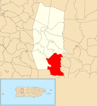
Vacas is a barrio in the municipality of Villalba, Puerto Rico. Its population in 2010 was 4,049.

<span class="mw-page-title-main">Bartolo, Lares, Puerto Rico</span> Barrio of Puerto Rico

Bartolo is a barrio in the municipality of Lares, Puerto Rico. Its population in 2010 was 2,035. Bartolo is on the southeastern border of Lares and Adjuntas.

<span class="mw-page-title-main">Buenos Aires, Lares, Puerto Rico</span> Barrio of Puerto Rico

Buenos Aires is a barrio in the municipality of Lares, Puerto Rico. Its population in 2010 was 2,291.

<span class="mw-page-title-main">Callejones</span> Barrio of Lares, Puerto Rico

Callejones is a barrio in the municipality of Lares, Puerto Rico. Its population in 2010 was 4,575. Machos Cave and Pajita Cave are located in Callejones.

<span class="mw-page-title-main">La Torre, Lares, Puerto Rico</span> Barrio of Puerto Rico

La Torre is a barrio in the municipality of Lares, Puerto Rico. Its population in 2010 was 1,574.

<span class="mw-page-title-main">Lares, Lares, Puerto Rico</span> Barrio of Puerto Rico

Lares is a barrio in the municipality of Lares, Puerto Rico. Its population in 2010 was 3,405.

<span class="mw-page-title-main">Pezuela</span> Barrio of Lares, Puerto Rico

Pezuela is a barrio in the municipality of Lares, Puerto Rico. Its population in 2010 was 474. The barrio is divided into about 8 sectors. The barrio has been prone to landslides since Hurricane Maria struck in 2017.

<span class="mw-page-title-main">Piletas</span> Barrio of Lares, Puerto Rico

Piletas is a barrio in the municipality of Lares, Puerto Rico. Its population in 2010 was 5,671.

<span class="mw-page-title-main">Lares barrio-pueblo</span> Historical and administrative center (seat) of Lares, Puerto Rico

Lares barrio-pueblo is a barrio and the administrative center (seat) of Lares, a municipality of Puerto Rico. Its population in 2010 was 2,690.

<span class="mw-page-title-main">Río Abajo, Cidra, Puerto Rico</span> Barrio of Puerto Rico

Río Abajo is a barrio in the municipality of Cidra, Puerto Rico. Its population in 2010 was 1,097.

<span class="mw-page-title-main">Río Prieto, Lares, Puerto Rico</span> Barrio of Puerto Rico

Río Prieto is a barrio in the municipality of Lares, Puerto Rico. Its population in 2010 was 567.

<span class="mw-page-title-main">Pueblo, Lares, Puerto Rico</span> Barrio of Puerto Rico

Pueblo is a barrio in the municipality of Lares, Puerto Rico. Its population in 2010 was 4,838.

<span class="mw-page-title-main">Rincón, Cidra, Puerto Rico</span> Barrio of Puerto Rico

Rincón is a barrio in the municipality of Cidra, Puerto Rico. Its population in 2010 was 4,332.

<span class="mw-page-title-main">Beatriz, Cidra, Puerto Rico</span> Barrio of Puerto Rico

Beatriz is a barrio in the municipality of Cidra, Puerto Rico. Its population in 2010 was 3,095.

<span class="mw-page-title-main">Espino, Lares, Puerto Rico</span> Barrio of Puerto Rico

Espino is a barrio in the municipality of Lares, Puerto Rico. Its population in 2010 was 1,695.

References

  1. 1 2 "US Gazetteer 2019". US Census. US Government.
  2. U.S. Geological Survey Geographic Names Information System: Mirasol barrio
  3. Picó, Rafael; Buitrago de Santiago, Zayda; Berrios, Hector H. Nueva geografía de Puerto Rico: física, económica, y social, por Rafael Picó. Con la colaboración de Zayda Buitrago de Santiago y Héctor H. Berrios. San Juan Editorial Universitaria, Universidad de Puerto Rico,1969.
  4. Gwillim Law (20 May 2015). Administrative Subdivisions of Countries: A Comprehensive World Reference, 1900 through 1998. McFarland. p. 300. ISBN   978-1-4766-0447-3 . Retrieved 25 December 2018.
  5. Puerto Rico: 2010 Population and Housing Unit Counts.pdf (PDF). U.S. Dept. of Commerce, Economics and Statistics Administration, U.S. Census Bureau. 2010.
  6. "Anuario del comercio, de la industria, de la magistratura y de la administración. 1881". Biblioteca Nacional de España (in Spanish). p. 1614. Retrieved 4 April 2023.
  7. Joseph Prentiss Sanger; Henry Gannett; Walter Francis Willcox (1900). Informe sobre el censo de Puerto Rico, 1899, United States. War Dept. Porto Rico Census Office (in Spanish). Imprenta del gobierno. p.  160.
  8. "Report of the Census of Porto Rico 1899". War Department Office Director Census of Porto Rico. Archived from the original on July 16, 2017. Retrieved September 21, 2017.
  9. "Table 3-Population of Municipalities: 1930 1920 and 1910" (PDF). United States Census Bureau. Archived (PDF) from the original on August 17, 2017. Retrieved September 21, 2017.
  10. "Table 4-Area and Population of Municipalities Urban and Rural: 1930 to 1950" (PDF). United States Census Bureau. Archived (PDF) from the original on August 30, 2015. Retrieved September 21, 2014.
  11. "Table 2 Population and Housing Units: 1960 to 2000" (PDF). United States Census Bureau. Archived (PDF) from the original on July 24, 2017. Retrieved September 21, 2017.
  12. Puerto Rico: 2010 Population and Housing Unit Counts.pdf (PDF). U.S. Dept. of Commerce Economics and Statistics Administration U.S. Census Bureau. 2010. Archived (PDF) from the original on 2017-02-20. Retrieved 2019-08-02.
  13. "US Census Barrio-Pueblo definition". factfinder.com. US Census. Archived from the original on 13 May 2017. Retrieved 5 January 2019.
  14. "P.L. 94-171 VTD/SLD Reference Map (2010 Census): Lares Municipio, PR" (PDF). www2.census.gov. U.S. DEPARTMENT OF COMMERCE Economics and Statistics Administration U.S. Census Bureau. Archived (PDF) from the original on 22 August 2020. Retrieved 22 August 2020.
  15. "Agencia: Oficina del Coordinador General para el Financiamiento Socioeconómico y la Autogestión (Proposed 2016 Budget)". Puerto Rico Budgets (in Spanish). Retrieved 28 June 2019.
  16. Rivera Quintero, Marcia (2014), El vuelo de la esperanza: Proyecto de las Comunidades Especiales Puerto Rico, 1997-2004 (first ed.), San Juan, Puerto Rico Fundación Sila M. Calderón, ISBN   978-0-9820806-1-0
  17. "Leyes del 2001". Lex Juris Puerto Rico (in Spanish). Retrieved 24 June 2020.
  18. "PRECINTO ELECTORAL LARES 053" (PDF). Comisión Estatal de Elecciones (in Spanish). PR Government. 14 June 2019. Retrieved 19 June 2019.