Mittenwald Railway

Last updated
Innsbruck–Garmisch-Partenkirchen
LandkarteZugspitzbahn.jpg
Overview
Line number410
Locale Tyrol, Austria and Bavaria, Germany
Service
Route number960
Operator(s) ÖBB, DB
Technical
Line length63.7 km (39.6 mi)
Number of tracks1
Track gauge 1,435 mm (4 ft 8+12 in) standard gauge
Minimum radius 200 m (660 ft)
Electrification 15 kV/16.7 Hz AC overhead catenary
Operating speed120 km/h (74.6 mph) 70 (max)
Maximum incline 3.8%
Route map

Contents

BSicon STR.svg
BSicon BHF.svg
1.325
0.000
Innsbruck West
BSicon ABZgl.svg
BSicon hKRZWae.svg
0.800
Inn Viaduct; 230.5 m steel/stone
BSicon hKRZWae.svg
1.200
Inn bridge; 108.4 m steel
BSicon HST.svg
1.782
Innsbruck Hötting
BSicon STRo.svg
2.100
Tiroler Straße; 38 m steel
BSicon HST.svg
3.739
Allerheiligenhöfe
631 m (2,070 ft)
BSicon TUNNEL2.svg
5.025
Kerschbuch tunnel (214.23 m)
BSicon TUNNEL2.svg
5.618
Kranebitterklamm tunnel (34.65 m)
BSicon HST.svg
5.718
Kranebitten
697 m (2,287 ft)
BSicon hKRZWae.svg
5.800
Klammbach bridge; 34 m concrete
BSicon TUNNEL2.svg
7.004
Lawinenschutz gallery (66 m)
BSicon DST.svg
7.206
Martinswand
BSicon TUNNEL2.svg
7.370
Hechenberg tunnel (26.02 m)
BSicon STRo.svg
7.900
Meilbrunnen Bridge; 15 m concrete
BSicon STRo.svg
8.500
Finstertal Viaduct; 54 m concrete
BSicon TUNNEL2.svg
8.922
An der Wand I Tunnel (109 m)
BSicon TUNNEL2.svg
9.048
An der Wand II Tunnel (202 m)
BSicon TUNNEL2.svg
9.250
Martinswand gallery (228 m)
BSicon TUNNEL2.svg
9.477
Martinswand tunnel (1.810,23 m)
BSicon TUNNEL2.svg
11.477
Ehnbach tunnel (347.22 m)
BSicon TUNNEL2.svg
11.898
Brunntal tunnel (99.30 m)
BSicon BHF.svg
12.713
Hochzirl
922 m (3,025 ft)
BSicon TUNNEL2.svg
13.139
Vorberg I Tunnel (147.77 m)
BSicon TUNNEL2.svg
13.303
Vorberg II Tunnel (97.65 m)
BSicon TUNNEL2.svg
13.564
Vorberg III Tunnel (46.82 m)
BSicon STRo.svg
13.700
Vorberg Viaduct; 117 m concrete
BSicon TUNNEL2.svg
14.005
Vorberg IV Tunnel (43.62 m)
BSicon TUNNEL2.svg
14.207
Schloßbach tunnel (721.52 m)
BSicon hKRZWae.svg
14.900
Schlossbach Bridge; 66 m steel
BSicon TUNNEL2.svg
15.069
Pflegertal tunnel (31.77 m)
BSicon STRo.svg
15.100
Pflegertal Bridge; 18.5 m concrete
BSicon TUNNEL2.svg
15.137
Fragenstein tunnel (394.62 m)
BSicon STRo.svg
15.600
Lehnen Viaduct; 28 m concrete
BSicon STRo.svg
15.800
Kaiserstand Viaduct; 46.8 m concrete
BSicon HST.svg
16.783
Leithen
BSicon TUNNEL1.svg
17.817
Leithener Tunnel (84,29 m)
BSicon hKRZWae.svg
18.200
Gurgelbach Viaduct; 75.4 m concrete
BSicon BHF.svg
18.835
Reith
1,120 m (3,670 ft)
BSicon hKRZWae.svg
20.500
Hermelebach Viaduct; 20 m concrete
BSicon BHF.svg
22.427
Seefeld in Tirol
1,182 m (3,878 ft)
BSicon eHST.svg
24.943
Seefeld Play Castle
BSicon HST.svg
29.226
Gießenbach in Tirol
1,019 m (3,343 ft)
BSicon STRo.svg
29.400
21.3 m steel
BSicon STRo.svg
32.100
26.6 m steel
BSicon BHF.svg
32.491
Scharnitz
964 m (3,163 ft)
BSicon GRENZE.svg
33.160
123.527
 
 
national border
BSicon BHF.svg
118.540
Mittenwald
914 m (2,999 ft)
BSicon BHF.svg
112.267
Klais
933 m (3,061 ft)
BSicon DST.svg
107.349
Kaltenbrunn (Oberbay)
(station until 2 June 1984)
855 m (2,805 ft)
BSicon HST.svg
102.500
Kainzenbad
(for events, until 1984 timetable)
BSicon ABZg+l.svg
BSicon BHF.svg
100.571
Garmisch-Partenkirchen
708 m (2,323 ft)
BSicon STR.svg
Passage to Zugspitze Railway
BSicon STR.svg
Source: German railway atlas [1]

The Mittenwald Railway (German : Mittenwaldbahn), popularly known as the Karwendelbahn (Karwendel railway), is a railway line in the Alps in Austria and Germany. It connects Innsbruck via Seefeld (both in Tyrol, Austria) and Mittenwald to Garmisch-Partenkirchen (both in Bavaria, Germany).

The Mittenwald railway was built as an electric local railway from 1910 to 1912 by the engineers and contractors Josef Riehl and Wilhelm Carl von Doderer. The route was opened on 28 October 1912 [2] and operated jointly by the Austrian Federal Railways and the Royal Bavarian State Railways. It was one of the first lines operated with high-tension single-phase AC-powered trains. Thus it had a substantial impact on the development of standards for electric railway operations in Central Europe. Together with the Ausserfern Railway (Ausserfernbahn) it connects the Austrian district of Außerfern (located west of the Fern Pass) with the Tyrol through Germany.

Geography

Mittenwald Railway crosses the Isar bridge in Scharnitz Scharnitz - Mittenwaldbahn - Isarbrucke.jpg
Mittenwald Railway crosses the Isar bridge in Scharnitz
The Schlossbach bridge of the Mittenwald Railway Reith bei Seefeld - Zirl - Schlossbachgrabenbrucke mit S5 Richtung Scharnitz.jpg
The Schlossbach bridge of the Mittenwald Railway

The Mittenwald railway runs mainly in the south-north direction between several mountain ranges of the Northern Limestone Alps. In the south it runs from the Inn valley from Innsbruck via Hochzirl and past the Zirler Berg mountain to Seefeld; the Mieminger Mountains lie to the west and the Karwendel range lies to the east.

From there it runs between the Karwendel range to the east and the Wetterstein range to the west over the Scharnitz pass and the Austria-Germany border to Mittenwald; at the Scharnitz pass it runs for a short distance along the upper reaches of the Isar river. It then bends to the west, running to Garmisch-Partenkirchen between the Wetterstein range to the south and the Ester Mountains to the north.

The most remarkable thing about the route of the Mittenwald Railway is the long section with many tunnels along the edge of the Martinswand (Martin’s wall), a rock face between Kranebitten and Hochzirl station, including the passage of the Martinswand Tunnel (1810.23 m) through the rock wall; it is the longest tunnel on the line. Slightly northwest of Hochzirl, the line runs over the southern flank of the Rauenkopf and southwestern flank of the Brunstkopf, crossing the Schlossbach on an elongated hairpin built with bridges and tunnels. Not far southwest of the bend, it passed the Zirl mountain.

History

Raising of finance for the Austrian section of the Mittenwald Railway, Innsbruck, 1912 Mittenwaldbahn Anleihe.jpg
Raising of finance for the Austrian section of the Mittenwald Railway, Innsbruck, 1912

The engineer and contractor Josef Riehl had already presented a proposal in the late 1880s to the Austrian ministry of trade and economics (k.k. Ministerium für Handel und Volkswirthschaft) for a route first running east from Innsbruck to Hall and then after a bend back to the west largely in tunnels up to Seefeld. To obtain the concession for this project, it took many years of disputes over the financing of the project, which involved substantial outlays in advance, with no guarantee of a return.

When Riehl finally received the approval of the authorities for the construction of the Mittenwald line on the Austro-Hungarian side of the border, [3] he formed a consortium with contractor and engineer, Wilhelm Carl von Doderer for the construction work. The managers of construction were the engineers, Karl Innerebneron, on behalf of Riehl, and August Mayer, on behalf of Doderer. The contract included all matters necessary for the operation of the railway. In addition to the line construction, this included land acquisition, rolling stock, electrical equipment and the power plant. The contract set the fixed price of 24.4017 million krone to be paid to the contractors Riehl and von Doderer, who thus carried all risk of possible cost overruns.

In terms of its length, the Mittenwald railway was a very expensive rail project due to its many tunnels. It was planned from the beginning that it would be electrified. To supply the power needed, a hydroelectric power station was constructed on the Ruetz river near Stephansbrücke (Stephen's bridge) in the Stubai valley, with two turbines each delivering 4000 horsepower. As a result of the extension of the line into Bavaria, that section of the line was supplied with power from the Walchensee power station, which was finished by 1924. Despite the difficulties, the section of the Mittenwald railway on the territory of Austria-Hungary was built in the remarkably short time of about two years.

The Bavarian section between Garmisch and Mittenwald goes back to a request in 1896 by the council of Mittenwald for Lokalbahn AG of Munich to develop a project for the continuation of the Murnau–Garmisch-Partenkirchen local railway (Localbahn Murnau–Garmisch–Partenkirchen) to Mittenwald. [4]

This route was opened on 1 July 1912, however, in contradiction to the plan, it was at first operated with steam locomotives, as neither the power station nor the electric locomotives were ready. On the Austrian side it was electrically operated from 28 October 1912. Operations in Bavaria switched to electric traction on 25 April 1913.

During the Second World War, the steep gradient and the short stations prevented much involvement in supplying the military. In 1945, the Mittenwald Railway was judged by the Allies to be strategically important, and a total of six air raids were flown against the Gurglbach Viaduct. The Inn bridge in Innsbruck was also repeatedly the target of air raids.

In 1950 during the winter there was an avalanche at the Martinswand siding, during which a locomotive was completely buried. The railway was reopened with the help of French occupation troops. In 1968 the site was made safe from avalanches by the construction of a protective roof.

With the holding of the 1976 Winter Olympic Games in Innsbruck and Seefeld, the Mittenwald line was expected to have high loadings and all stations were equipped with colour light signals. Seefeld station was also replaced by a new station. The superstructure was adapted so that locomotives of both Deutsche Bundesbahn and the Austrian Federal Railways (Österreichische Bundesbahnen, ÖBB) could operate on the line. Due to the ample size of its bridges for the time, it was even possible to operate with two locomotives in multiple.

Rail operations ran smoothly during the 1976 Olympic Winter Games, just as they did during the 1985 Nordic World Ski Championships in Seefeld.

in the 1980s, when many streets in Innsbruck were widened, it was necessary to raise the line where it passes through Innsbruck, especially by building new bridges.

Route

Track plan and profile Riehl Mittenwaldbahn 1913.jpg
Track plan and profile

The Mittenwald Railway follows a bold route, planned by the pioneering railway engineer, Josef Riehl. The Mittenwald line crosses the Inn on a steel bridge and runs through the city of Innsbruck as an elevated line to the west and north of Innsbruck West station.

In March 1910 the first sod was turned at the legendary Martinswand cliff. The abrupt transition from the Inn valley to the Martinswand and the Schlossbach valley presented the biggest challenges. The line crosses the Schlossbach at an altitude of about 60 m above the water level over an iron arch truss bridge with a length of 66 m. The Finstertal Viaduct was built on the karst slope of the Hechenberg (mountain). A hangviadukt ("slope viaduct", that is a viaduct built on a slope, requiring much higher supports on the down side that on the up side) was built in the Schlossbach graben. The Kaiserstand Viaduct was built beneath the ruins of Fragenstein. The Gurgelbach Viaduct was built near Reith and the Isar Bridge was built near Scharnitz.

Many bridges are similar in size to bridges on the Albula Railway. While stone could be used in Switzerland, concrete had to be used in the Tyrol. The tunnels also had to be lined because of the weak rock.

Scharnitz in 1912 with new electric Mittenwald Railway Scharnitz 1912 Karwendelbahn.jpg
Scharnitz in 1912 with new electric Mittenwald Railway

The construction of the tunnels in the Martinswand was particularly difficult and a 17 km long high voltage line had to be built from Innsbruck just for the operation of the machinery. Diesel locomotives brought the rock to dumps. The ingress of water stopped the construction work on the western side of the tunnels and an electric pumping plant had to be installed. The barracks on the eastern side had to be built far below the steep edge due to the lack of space. A funicular railway had to be built to transport workers and materials from the Inn to the site.

The smallest radius of curvature of the Mittenwald Railway is 200 m. The maximum gradient of 3.8 percent is significantly greater than the 3.1 percent of the Arlberg Railway, or the 2.6 percent of the Brenner Railway.

At Innsbruck West station the line branches off from the Arlberg Railway and reaches in Hötting its lowest point of 580 m above sea level. Its highest point on the Seefeld saddle is at 1,184 m above sea level. This difference in altitude is achieved over 19.2 km of line. After this the line descends at up to 3.0 percent to Garmisch-Partenkirchen, where it connects to the line via Murnau and Weilheim to Munich and to the Außerfern Railway via Reutte to Kempten.

Operations

Trains

The Mittenwald railway mainly serves regional and tourist traffic; international long-distance traffic usually uses the Munich–Innsbruck route via Rosenheim and Kufstein (Munich–Rosenheim, Rosenheim–Kufstein and Lower Inn Valley lines). Since the start of the winter timetable in 2010 one or two pairs of Intercity-Express services have operated daily from Berlin via Munich to Innsbruck over the Mittenwald Railway with intermediate stops at Mittenwald and Seefeld. As a result, Seefeld became the highest Intercity-Express stop in Europe. Regionalbahn services operate hourly on the German side, running from Mittenwald to Garmisch-Partenkirchen and on to Munich. Half of these Regionalbahn operate between Innsbruck and Munich via Mittenwald; these services are branded as REX in Austria. On the Austrian side line S5 of Tyrol S-Bahn runs from the border at Scharnitz via Seefeld to Innsbruck every hour.

Notes

  1. Eisenbahnatlas Österreich (Austrian railway atlas). Schweers + Wall. 2010. ISBN   978-3-89494-138-3.
  2. "Die Eröffnung der Mittenwalderbahn". Innsbrucker Nachrichten (in German). No. 248. Austrian National Library. 28 October 1912. pp. 8 f. Retrieved 30 January 2012.
  3. "Gazetted notice". Reichsgesetzblatt (in German). No. 1910/127. Austrian National Library. 12 July 1910. Retrieved 30 January 2012.
  4. "Aus den Alpen. (...) Bahnproject Garmisch-Mittenwald". Der Alpenfreund (in German) (6). Austrian National Library: 61. 6 January 1896. Retrieved 30 January 2012.

Related Research Articles

<span class="mw-page-title-main">Seefeld in Tirol</span> Place in Tyrol, Austria

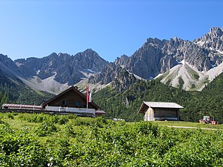
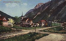
Seefeld in Tirol is an old farming village, now a major tourist resort, in Innsbruck-Land District in the Austrian state of Tyrol with a local population of 3,312. The village is located about 17 km (11 mi) northwest of Innsbruck on a plateau between the Wetterstein mountains and the Karwendel on a historic road from Mittenwald to Innsbruck that has been important since the Middle Ages. It was first mentioned in 1022 and since the 14th century has been a pilgrimage site, benefiting not only from the visit of numerous pilgrims but also from its stacking rights as a trading station between Augsburg and the Venice. Also since the 14th century, Tyrolean shale oil has been extracted in the area. Seefeld was a popular holiday resort even before 1900 and, since the 1930s, has been a well known winter sports centres and amongst the most popular tourist resorts in Austria. The municipality, which has been the venue for several Winter Olympics Games, is the home village of Anton Seelos, the inventor of the parallel turn.

<span class="mw-page-title-main">Innsbruck Hauptbahnhof</span> Railway station in Tyrol, Austria

Innsbruck Hauptbahnhof is the main railway station in Innsbruck, the capital city of the Austrian federal state of Tyrol. Opened in 1853, the station is a major hub for western and central Austria. In 2019, it was the 8th-busiest station in the country, and the 2nd-busiest outside of Vienna after only Linz Hauptbahnhof, with 315 train movements and 38,500 passengers daily.

<span class="mw-page-title-main">Wetterstein</span> Mountain group in the Northern Limestone Alps

The Wetterstein mountains, colloquially called Wetterstein, is a mountain group in the Northern Limestone Alps within the Eastern Alps. It is a comparatively compact range located between Garmisch-Partenkirchen, Mittenwald, Seefeld in Tirol and Ehrwald along the border between Germany (Bavaria) and Austria (Tyrol). Zugspitze, the highest peak is at the same time the highest mountain in Germany.

<span class="mw-page-title-main">Bundesstraße 23</span> Federal highway in Germany

The Bundesstraße 23 is a German federal highway in Bavaria that runs about 59.2 kilometres, from Peiting to the Austrian border near Garmisch-Partenkirchen. This highway (partially), along with the Bundesstraße 17 and Bundesstraße 472 highways, constitute the “German Alpine Road”. Coupled with the Bundesstraße 2 highway, it passes through cities such as Mittenwald, Innsbruck and the Brenner Pass.

<span class="mw-page-title-main">Munich–Garmisch-Partenkirchen railway</span> Railway line in Bavaria, Germany

The Munich–Garmisch-Partenkirchen railway is a single track, electrified main line railway in the southern part of the German state of Bavaria. It runs from Munich via Starnberg and Murnau to Garmisch-Partenkirchen. The first part of it was opened in 1854 and is one of the oldest lines in Germany.

<span class="mw-page-title-main">Ausserfern Railway</span> Railway in Austria and Germany

The Ausserfern Railway is a cross-border railway line in the German state of Bavaria and the Austrian state of Tyrol. The single-tracked branch line starts from Kempten in Germany, before crossing into Austria just after passing through Pfronten. It then transits the Außerfern area around Reutte, before passing back into Germany in order to terminate at Garmisch-Partenkirchen.

<span class="mw-page-title-main">Werdenfelser Land</span>

The Werdenfelser Land is a region of Upper Bavaria that extends from Mittenwald in the south to Farchant. It includes parts of the Bavarian Alps. From the Middle Ages until the Thirty Years' War, the Werdenfelser Land was subject to the Prince-Bishop of Freising, not the Duke of Bavaria.

<span class="mw-page-title-main">Garmisch-Partenkirchen station</span> Railway station in Garmisch-Partenkirchen, Bavaria, Germany

Garmisch-Partenkirchen station is a junction station in the German State of Bavaria. It is the biggest station in Garmisch-Partenkirchen. It has five platform tracks and is classified by Deutsche Bahn as a category 3 station. The station has about 50 services daily operated by DB Regio and some long-distance services operated by Deutsche Bahn. It is on the lines connecting Munich and Garmisch-Partenkirchen, Garmisch-Partenkirchen and Innsbruck and Garmisch-Partenkirchen and Reutte.

<i>Karwendel</i> (train) German-Austrian express train service

The Karwendel is an international named express train service between Germany and Austria. The train was named after the Karwendel mountain range forming the German-Austrian border south of Garmisch-Partenkirchen, which it passes on the Mittenwald Railway (Karwendelbahn). Introduced in 1930, it is currently labelled as an Intercity-Express train connection operated by Deutsche Bahn AG.

<span class="mw-page-title-main">Weilheim (Oberbay) station</span>

Weilheim (Oberbay) station is the station of the Bavarian district town of Weilheim in Oberbayern. It is a crossing station on the Munich–Garmisch-Partenkirchen railway, the Ammersee Railway from Mering and the Weilheim–Peißenberg railway. It is classified by Deutsche Bahn as a category 4 station and has five platform tracks. It is served by about 100 trains daily operated by Deutsche Bahn and Bayerische Regiobahn (BRB).

<span class="mw-page-title-main">European route E533</span> Road in trans-European E-road network

E 533 is a European B class road in Germany and Austria, connecting the cities Munich — Garmisch-Partenkirchen — Mittenwald — Seefeld in Tirol — Innsbruck.

<span class="mw-page-title-main">Erlspitze Group</span>

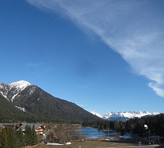
The Erlspitze Group, also called the Seefeld Group, is the southwesternmost side range of the Austrian part of the Karwendel mountains in the Alps. It forms a horseshoe-shaped highland around the valley of Eppzirler Tal and is joined in the south to the Nordkette by the Erl Saddle (Erlsattel) near Solsteinhaus. It is bounded in the west by the Seefeld Basin, in the east by the valleys of the Gleirschtal and the Großes Kristental; its forested northern foothills reach as far as Scharnitz.

<span class="mw-page-title-main">Scharnitz Pass</span>

The Scharnitz Pass is a narrow section of the upper Isar valley in the Northern Limestone Alps. It lies at a height of about 955 m on the Austro-German border between the states of Bavaria and Tyrol. Its name derives from the village of Scharnitz immediately to the south.

<span class="mw-page-title-main">Seefeld Plateau</span>

The Seefeld Plateau is a montane valley and basin landscape in the North Tyrolean Limestone Alps about 500 metres above the Inn valley in the Austrian state of Tyrol. The plateau covers the valley basin around the villages of Seefeld in Tirol and Scharnitz as well as the valley of Leutaschtal.

<span class="mw-page-title-main">Zirler Berg</span> Mountain in Tyrol, Austria

The Zirler Berg near Zirl in the Austrian federal state of Tyrol is a mountain, 1,057 m (AA) high, in the Karwendel Alps, a western part of the Northern Limestone Alps. It is a southern foothill of the Reither Spitze (2,374 m) and is known mainly because the Seefelder Straße (B 177) on its southern slopes climbs through 388 metres in a distance of less than 4 kilometres from Zirl in the Inn valley to Leithen on the Seefeld Plateau.

<span class="mw-page-title-main">Seefeld Saddle</span>

The Seefeld Saddle is a saddle and mountain pass, 1,185 m (AA), in the Northern Limestone Alps in the Austrian federal state of Tyrol. Two major transport routes run over it: the Seefelder Straße (B 177) and the Mittenwald Railway. On the Seefeld Plateau north of the saddle lies the village and ski resort of Seefeld in Tirol.

<span class="mw-page-title-main">Mittenwald station</span> Railway station in Mittenwald, Germany

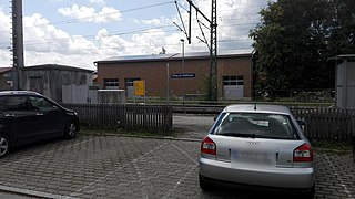
Mittenwald station is a railway station in the German State of Bavaria, in the town of Mittenwald. It has three platform tracks and is classified by Deutsche Bahn (DB) as a category 4 station.

<span class="mw-page-title-main">Eschenlohe station</span>

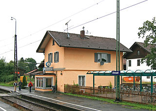
Eschenlohe station is a railway station in the municipality of Eschenlohe, in the Garmisch-Partenkirchen district in Bavaria, Germany. It is located on the Munich–Garmisch-Partenkirchen railway of Deutsche Bahn.

<span class="mw-page-title-main">Innsbruck Hötting railway station</span> Railway station in Tyrol, Austria

Innsbruck Hötting railway station is a railway station in the borough of Hötting in Innsbruck, the capital city of the Austrian state of Tyrol. It is the first station on the Mittenwald Railway (Karwendelbahn) north of Innsbruck West station, where the line branches off the Arlberg railway. The station was opened in 1912 and is served by trains operated by both Deutsche Bahn and Austrian Federal Railways (ÖBB).

<span class="mw-page-title-main">Farchant station</span> Railway station in Bavaria

Farchant station is a railway station in the municipality of Farchant, in Bavaria, Germany. It is located on the Munich–Garmisch-Partenkirchen railway of Deutsche Bahn.

References

47°26′23″N11°15′56″E / 47.43972°N 11.26556°E / 47.43972; 11.26556