Monte Pietraborga

Last updated
Monte Pietraborga
Pietraborga da moncuni.jpg
The mountain as seen from the Moncuni
Highest point
Elevation 926 m (3,038 ft) [1]
Prominence 326 m (1,070 ft) [2]
Isolation 7.16 km (4.45 mi)  OOjs UI icon edit-ltr-progressive.svg
Coordinates 45°01′18″N7°25′19″E / 45.0215821°N 7.4218153°E / 45.0215821; 7.4218153 Coordinates: 45°01′18″N7°25′19″E / 45.0215821°N 7.4218153°E / 45.0215821; 7.4218153
Geography
Italy relief location map.jpg
Red triangle with thick white border.svg
Monte Pietraborga
Location in Italy
Location Piedmont, Italy
Parent range Cottian Alps
Climbing
First ascent ancestral
Easiest route hiking from Trana or Sangano

Monte Pietraborga is a mountain in the Cottian Alps, Metropolitan City of Turin in Piedmont, north-western Italy. It is located between the comuni of Trana and Sangano. [1]

Contents

Features

The mountain overlooks Trana and belongs to the South flank of the Sangone valley. On its summit three ridges meet: the Eastern one goes down till to a saddle at 658 m then, after regaining some metres of elevation with the Punta del Colletto (685 m), ends up close to the centre of Sangano; the brief North ridge goes down heading to Trana, and the South ridge connects the Pietraborga with Monte San Giorgio.

Geology

The Pietraborga is known by geologists as an example of mountain made of serpentine. [3] North of the mountain a stone quarry operated in the early XX century. [4]

History

Some hikers on the summit in 1909 (photo of Mario Gabinio) Gabinio.Sulla Pietraborga. Valle Del Sangone-Grande Gruppo Di Escursionisti In Posa Sul Monte Pietraborga 8A7.jpg
Some hikers on the summit in 1909 (photo of Mario Gabinio)
Summit cross Pietraborga croce di vetta.jpg
Summit cross

The Pietraborga summit cross was built in 1900. [5] Not faraway from the summit, heading towards Colle Damone, stands a group of boulders interpreted by some people as Celtic remains (dolmens and menhirs roughly arranged in a circle in the so called Sito dei Celti - Celtics' Site). [6]

The village of Pratovigero, located on the Pietraborga slopes facing Trana, was permanently inhabited till to the 1960s. [7]

Access to the summit

The mountain as seen from Reano countryside Reano.jpg
The mountain as seen from Reano countryside

The Pietraborga is mainly a mountain for hikers, and can be reached following a footpath starting from the San Sebastiano chapel in Sangano (Via delle Prese). The route follows the South-Eastern slopes passing by the Cippo De Vitis (460 m), a memorial monument devoted to the Italian partisan Sergio De Vitis, killed by the nazist troops in 1944. There are also shorter ways to reach the summit: one starts from the village of Pratovigero (Trana), easily crossing the Colle Damone (758 m), and another from the Prese di Piossasco, following the South ridge of Pietraborga. A little less easy way, after the Cippo De Vitis, runs on the East ridge of the mountain. [8] Another hiking route is known as Direttissima, and follows a very steep footpath in the wood which directly connects Pratovigero to the summit.

Some stone pinnacles close to the summit are an interesting climbing area, even if the routes are not so long. [8]

The summit of the Pietraborga offers a very appreciated view which ranges from the Monviso to the Turin plain and hillside, and from the Sacra di San Michele to the mountains close to Pinerolo. [9] Even if not located at a high altitude Monte Pietraborga has its own summit register.

Maps

Panorama da Pietraborga.jpg
Panorama from the Pietraborga; from left to right Monte San Giorgio, Rôcàs, Montagnazza and, in the distance, the Monviso

Related Research Articles

Sangano is a comune (municipality) in the Metropolitan City of Turin in the Italian region Piedmont, located about 20 kilometres west of Turin.

<span class="mw-page-title-main">Monte Colombano</span> Mountain in Italy

Monte Colombano is a mountain in the Alpi di Lanzo, a sub-group of the Graian Alps, with an elevation of 1,658 m.

<span class="mw-page-title-main">Bric Ghinivert</span> Mountain in Italy

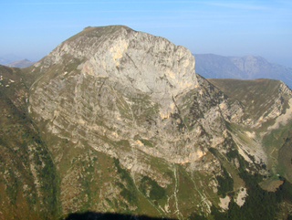
Bric Ghinivert or Eiminàl is a mountain of the Cottian Alps located in Italy.

<span class="mw-page-title-main">Monte Politri</span> Mountain in Italy

Monte Politri or Bric Rosso is a 3,026 m a.s.l. mountain of the Cottian Alps, located in Italy.

<span class="mw-page-title-main">Monte Albergian</span> Mountain in Italy

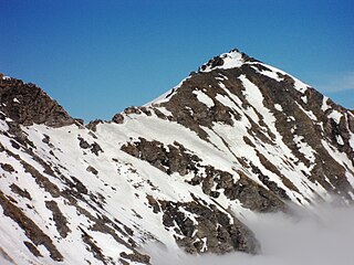
Monte Albergian is a 3,041 m a.s.l. mountain of the Cottian Alps, located in Italy. A battalion of 3rd Alpini Regiment, which during World War I earned a Silver Medal of Military Valor, was named after Monte Albergian.

<span class="mw-page-title-main">Punta Tempesta</span> Mountain in Italy

Punta Tempesta is a 2,679 m a.s.l. mountain of the Cottian Alps, located in Italy.

<span class="mw-page-title-main">Viso Mozzo</span> Mountain in Italy

The Viso Mozzo is a 3,019 metres high mountain on the Italian side of the Cottian Alps.

The Istituto Geografico Centrale is a privately owned Italian company based in Turin (Piedmont), known for its guide books and hiking maps mainly concerning the Western Alps and their contiguous areas.

<span class="mw-page-title-main">Punta Nera</span> Mountain in Italy

The Punta Nera is a mountain of Savoie (France) and of the Province of Turin (Italy). It lies in the Cottian Alps range. It has an elevation of 3,047 metres above sea level.

<span class="mw-page-title-main">Monte Bertrand</span> Mountain in Italy

Monte Bertrand (Italian) or Mont Bertrand (French) is a mountain located on the French-Italian border between Piemonte and Provence-Alpes-Côte d'Azur.

<span class="mw-page-title-main">Monte Civrari</span> Mountain in Italy

The Monte Civrari is a mountain of the Graian Alps, with an elevation of 2,302 m.

<span class="mw-page-title-main">Monte Mongioie</span> Mountain in Italy

The Monte Mongioie is a mountain of the Ligurian Alps located in Piedmont.

<span class="mw-page-title-main">Monte Antoroto</span> Mountain in Italy

The Monte Antoroto is a mountain of the Ligurian Alps located in Piedmont.

<span class="mw-page-title-main">Monte Capezzone</span> Mountain in Italy

The Monte Capezzone is a mountain in the Pennine Alps of north-western Italy; with an elevation of 2,421 m (7,943 ft) is the highest peak of the Strona Valley.

<span class="mw-page-title-main">Punta Lunella</span> Mountain in Italy

The Punta Lunella is a mountain of the Graian Alps, with an elevation of 2,772 m.

<span class="mw-page-title-main">Cima Ciantiplagna</span> Mountain in Italy

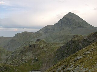
The Cima Ciantiplagna is a mountain in the Cottian Alps belonging to the Province of Turin (Italy).

<span class="mw-page-title-main">Monte Birrone</span> Mountain in Italy

The Monte Birrone is a 2,131-metre (6,991 ft) high mountain in the Cottian Alps, belonging to the Italian province of Cuneo.

<span class="mw-page-title-main">Cima Cars</span> Mountain in Italy

The Cima Cars is a mountain of the Ligurian Alps located in Piedmont.

<span class="mw-page-title-main">Monte San Giorgio (Cottian Alps)</span> Mountain in Italy

The Monte San Giorgio is a mountain in the Cottian Alps, Metropolitan City of Turin in Piedmont, north-western Italy. It is located in the comune of Piossasco.

<span class="mw-page-title-main">Montagnazza</span> Mountain in Italy

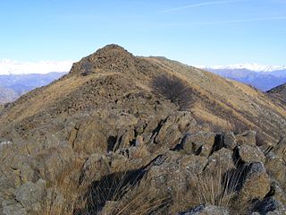
The Montagnazza is a mountain in the Cottian Alps, Metropolitan City of Turin in Piedmont, north-western Italy. It is located in the comune of Piossasco.

References

Commons-logo.svg Media related to Monte Pietraborga at Wikimedia Commons

  1. 1 2 Carta Tecnica Regionale raster 1:10.000 (vers.3.0) published by the Regione Piemonte, year 2007
  2. Monte Pietraborga, Italy at Peakbagger.com
  3. Sacco, Federico (1887). "L'anfiteatro morenico di Rivoli". Bollettino del R. Comitato geologico d'Italia (in Italian). p. 148. Retrieved 15 March 2022.
  4. Boeris, Giovanni (1903). Appunti di mineralogia piemontese (in Italian). C. Clausen. p. 10. Retrieved 15 March 2022.
  5. Maria Teresa Pasquero Andruetto. "Pietraborga" (in Italian). Archived from the original on 2019-12-31. Retrieved 1 November 2013.
  6. Gian Marco Mondino. "Alla scoperta di sentieri nella natura e di antiche vestigia celtiche" (in Italian). Archived from the original on 2019-12-31. Retrieved 1 November 2019.
  7. AA.VV. (1966). 10 ̊[i.e. Decimo] censimento generale della popolazione, 15 ottobre 1961: Dati sommari per comune. 92 fasc. Appendice: Dati riassuntivi nazionali (in Italian). Istituto centrale di statistica. p. 57. Retrieved 29 June 2022.
  8. 1 2 Ferreri, Eugenio (1982). Alpi Cozie Centrali. Guida dei Monti d'Italia (in Italian). San Donato Milanese: CAI and TCI. pp. 349–350.
  9. Ceragioli, Filippo; Molino, Aldo (2008). A piedi in Piemonte (in Italian). Vol. 2. Subiaco: Iter Edizioni. pp. 53–55. ISBN   978-88-8177-122-6.