Mookgophong Local Municipality

Last updated
Mookgophong
Mookgophong CoA.png
Map of Limpopo with Mookgophong highlighted.svg
Location in Limpopo
Coordinates: 24°40′S29°0′E / 24.667°S 29.000°E / -24.667; 29.000 Coordinates: 24°40′S29°0′E / 24.667°S 29.000°E / -24.667; 29.000
Country South Africa
Province Limpopo
District Waterberg
Seat Mookgophong
Wards 5
Government
[1]
  Type Municipal council
  Mayor Sarah Monyamane
Area
  Total5,689 km2 (2,197 sq mi)
Population
 (2011) [2]
  Total35,640
  Density6.3/km2 (16/sq mi)
Racial makeup (2011)
[2]
   Black African 85.6%
   Coloured 0.4%
   Indian/Asian 0.2%
   White 13.2%
First languages (2011)
[2]
   Northern Sotho 51.0%
   Afrikaans 13.3%
   Tsonga 12.5%
   Sotho 6.3%
  Other16.9%
Time zone UTC+2 (SAST)
Municipal codeLIM364

Mookgophong Local Municipality was a municipality located in the Waterberg District Municipality of Limpopo province, South Africa. The seat of Mookgophong Local Municipality was Mookgophong.

Contents

The Municipality was named after the type of tree found in the area, Mokgopa (a cactus). [3]

After municipal elections on 3 August 2016 it was merged into the larger Modimolle–Mookgophong Local Municipality.

Main places

The 2001 census divided the municipality into the following main places: [4]

PlaceCodeArea (km2)PopulationMost spoken language
Mookgophong 91601 1.207,685 Northern Sotho
Naboomspruit 91603 5.873,626 Afrikaans
Roedtan 91604 0.46159Afrikaans
Remainder of the municipality 91602 4,263.1819,280Northern Sotho

Politics

The municipal council consisted of ten members elected by mixed-member proportional representation. Five councillors were elected by first-past-the-post voting in five wards, while the remaining five were chosen from party lists so that the total number of party representatives was proportional to the number of votes received. In the election of 18 May 2011 the African National Congress (ANC) won a majority of six seats on the council. The following table shows the results of the election. [5] [6]

PartyVotesSeats
WardListTotal %WardListTotal
ANC 5,8025,95311,75565.4426
Democratic Alliance (South Africa) 1,7671,8223,58920.0112
Freedom Front Plus 8507301,5808.8011
COPE 5484611,0095.6011
NFP 525300.2000
Total8,9728,99117,963100.05510
Spoilt votes165128293

Related Research Articles

<span class="mw-page-title-main">Kareeberg Local Municipality</span> Local municipality in Northern Cape, South Africa

Kareeberg Local Municipality is a local municipality in the Pixley ka Seme District Municipality district of the Northern Cape province of South Africa. The name originates from a mountain range in the region, the Karee Mountains.

<span class="mw-page-title-main">Gariep Local Municipality</span> Former local municipality in Eastern Cape, South Africa

Gariep Local Municipality is a defunct local municipality in Joe Gqabi District Municipality, Eastern Cape. The municipality was merged with Maletswai Local Municipality immediately after the August 2016 Local Municipal Elections to form the new Walter Sisulu Local Municipality.

<span class="mw-page-title-main">Thulamela Local Municipality</span> Local municipality in Limpopo, South Africa

The Thulamela Local Municipality is a Local municipality in the Limpopo province of South Africa. Its municipal boundaries were greatly altered after the South African municipal elections, 2016 when much of the area that formerly belonged to the municipality, including the town of Malamulele, was incorporated into the newly formed Collins Chabane Local Municipality. It is named after the Thulamela ruins located near the Pafuri Gate of the Kruger National Park.

<span class="mw-page-title-main">Albert Luthuli Local Municipality</span> Local municipality in Mpumalanga, South Africa

Albert Luthuli Local Municipality is a South African local municipality situated in the Gert Sibande District Municipality, Grass and Wetlands region, of Mpumalanga. It was named after Albert Luthuli. Carolina is the seat of the municipality.

<span class="mw-page-title-main">Molemole Local Municipality</span> Local municipality in Limpopo, South Africa

Molemole Local Municipality, is located in the Capricorn District Municipality, of Limpopo province, South Africa. The seat of Molemole Local Municipality is Mogwadi.

<span class="mw-page-title-main">Lepelle-Nkumpi Local Municipality</span> Local municipality in Limpopo, South Africa

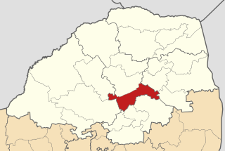
Lepelle-Nkumpi Local Municipality, is located in the Capricorn District Municipality, of Limpopo province, South Africa. The seat is Lebowakgomo.

<span class="mw-page-title-main">Modimolle Local Municipality</span> Local municipality in Limpopo, South Africa

Modimolle Local Municipality was a municipality located in the Waterberg District Municipality of Limpopo province, South Africa. The seat of Modimolle Local Municipality was Modimolle.

<span class="mw-page-title-main">Makhado Local Municipality</span> Local municipality in Limpopo, South Africa

Makhado Local Municipality is located in the Vhembe District Municipality of Limpopo province, South Africa. The seat of Makhado Local Municipality Louis Trichardt.

<span class="mw-page-title-main">Musina Local Municipality</span> Local municipality in Limpopo, South Africa

Musina Local Municipality is located in the Vhembe District Municipality of Limpopo province, South Africa, and is the northernmost local municipality in South Africa. It borders on Botswana and Zimbabwe. The seat of Musina Local Municipality is Musina.

<span class="mw-page-title-main">Maruleng Local Municipality</span> Local municipality in Limpopo, South Africa

Maruleng Local Municipality is located in the Mopani District Municipality of Limpopo province, South Africa. The seat of Maruleng Local Municipality is Hoedspruit.

<span class="mw-page-title-main">Greater Tzaneen Local Municipality</span> Local municipality in Limpopo, South Africa

Greater Tzaneen Local Municipality is located in the Mopani District Municipality of Limpopo province, South Africa. The seat of the municipality is Tzaneen.

<span class="mw-page-title-main">Greater Letaba Local Municipality</span> Local municipality in Limpopo, South Africa

Greater Letaba Local Municipality is located in the Mopani District Municipality of Limpopo province, South Africa. The seat of Greater Letaba Local Municipality is Modjadjiskloof.

<span class="mw-page-title-main">Elias Motsoaledi Local Municipality</span> Local municipality in Limpopo, South Africa

Elias Motsoaledi Local Municipality is located in the Sekhukhune District Municipality of Limpopo province, South Africa. The seat of Elias Motsoaledi Local Municipality is Groblersdal. Municipality is named in honour of the Elias Motsoaledi.

uMngeni Local Municipality Local municipality in KwaZulu-Natal, South Africa

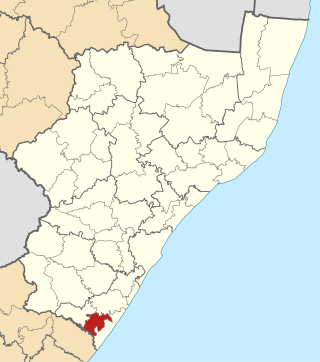
uMngeni Local Municipality is an administrative area in the UMgungundlovu District of KwaZulu-Natal in South Africa.

<span class="mw-page-title-main">Ikwezi Local Municipality</span> Former local municipality in Eastern Cape, South Africa

Ikwezi Local Municipality was a local municipality in the Sarah Baartman District Municipality of the Eastern Cape in South Africa. Ikwezi is an isiXhosa name that means "morning star". After municipal elections on 3 August 2016 it was merged into the larger Dr Beyers Naudé Local Municipality.

<span class="mw-page-title-main">Ezinqoleni Local Municipality</span> Former local municipality in KwaZulu-Natal, South Africa

Ezinqoleni Local Municipality was an administrative area in the Ugu District of KwaZulu-Natal in South Africa.

<span class="mw-page-title-main">Nxuba Local Municipality</span> Former local municipality in Eastern Cape, South Africa

Nxuba Local Municipality was an administrative area in the Amatole District of the Eastern Cape in South Africa. The Fish River, as it is now called, was first named Nxuba River by King Sandile in the 18th century After municipal elections on 3 August 2016 it was merged into the larger Raymond Mhlaba Local Municipality.

<span class="mw-page-title-main">Umzumbe Local Municipality</span> Local municipality in KwaZulu-Natal, South Africa

Umzumbe Local Municipality is an administrative area in the Ugu District of KwaZulu-Natal in South Africa.

<span class="mw-page-title-main">Tsolwana Local Municipality</span> Former local municipality in Eastern Cape, South Africa

Tsolwana Local Municipality was an administrative area in the Chris Hani District of the Eastern Cape in South Africa. Tsolwana is an isiXhosa name which means "something with a sharp ending or a tip", referring the mountains around the whole area. After municipal elections on 3 August 2016 it was merged into the larger Enoch Mgijima Local Municipality.

<span class="mw-page-title-main">Ntambanana Local Municipality</span> Local municipality in KwaZulu-Natal, South Africa

Ntambanana Local Municipality was a local municipality within the uThungulu District of KwaZulu-Natal in South Africa. In 2016, the municipality was dissolved and its territory divided between Mthonjaneni Local Municipality, uMhlathuze Local Municipality and uMfolozi Local Municipality.

References

  1. "Contact list: Executive Mayors". Government Communication & Information System. Archived from the original on 14 July 2010. Retrieved 22 February 2012.
  2. 1 2 3 "Statistics by place". Statistics South Africa. Retrieved 27 September 2015.
  3. South African Languages - Place names
  4. Lookup Tables - Statistics South Africa
  5. "Results Summary – All Ballots: Mookgophong" (PDF). Independent Electoral Commission. Retrieved 24 November 2013.
  6. "Seat Calculation Detail: Mookgophong" (PDF). Independent Electoral Commission. Retrieved 24 November 2013.