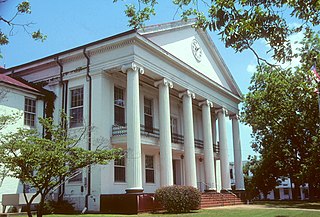
Perry County is a county located in the central portion of the U.S. state of Alabama. As of the 2020 census, the population was 8,511. Its county seat is Marion. The county was established in 1819 and is named in honor of Commodore Oliver Hazard Perry of Rhode Island and the United States Navy.

Thomaston is a town in Marengo County, Alabama, United States. At the 2020 census the population was 326, down from 417 at the 2010 census.
Oquirrh is a census-designated place (CDP) in Salt Lake County, Utah, located on the slopes of the Oquirrh Mountains that gave it its name. Oquirrh was once part of Kearns, UT. Through annexation, the city of West Jordan cut Oquirrh off from Kearns and became a CDP. As of the 2000 census, the CDP population was 10,390, a modest increase over the 1990 figure of 7,593. In 2000 parts Oquirrh were annexed by West Jordan.

Kanab Creek is one of the many tributaries of the Colorado River. It begins in Kane County, Utah, just south of the watershed to the Great Basin and flows 125 miles (201 km) south to the Colorado River.
KWOA is a radio station located in Worthington, Minnesota, United States, which broadcasts a sports format.

Hafar al-Batin, also frequently spelled Hafr al-Batin, is a Saudi Arabian city in the Eastern Province. It is located 430 km north of Riyadh, 94.2 km from the Kuwait border, and about 74.3 from the Iraq border. The city lies in the dry valley of the Wadi al-Batin, which is part of the longer valley of the river Wadi al-Rummah, which leads inland toward Medina and formerly emptied into the Persian Gulf.
Beal is an unincorporated community in Vincennes Township, Knox County, Indiana.

Lermontovo ; formerly known as Voskresenovka, is a village in the Lori Province of Armenia. Like its neighbor, Fioletovo, it was settled in the mid-1800s by Spiritual Christians from Russia. The village is named after Russian poet Mikhail Lermontov, often called "the poet of the Caucasus".

Ackerville is an unincorporated community in Wilcox County, Alabama, United States. Ackerville has one site included on the National Register of Historic Places, the Ackerville Baptist Church of Christ.
Hampden is an unincorporated community in Marengo County, Alabama, United States. Hampden had a post office at one time, but it no longer exists.
Wayne is an unincorporated community in Marengo County, Alabama, United States. Wayne had a post office at one time, but it no longer exists.

La Foradada (Montsià) is a mountain of Catalonia, Spain. It has an elevation of 655 metres above sea level.
Sudemäe is a village in Peipsiääre Parish, Tartu County in eastern Estonia.
Arjut kayaranin kits is a village in the Lori Province of Armenia. It belongs to the municipality of Arjut village and is located 1 km south of the village.
Hooser is an unincorporated community in Dexter Township, Cowley County, Kansas, United States. It is located at 37°08′18″N96°37′48″W.
Colorado City is a ghost town in what is now Yuma County, Arizona. It was located on the south bank of the Colorado River at Jaeger's Ferry, 1 mile down river from Fort Yuma.

The United States Custom House, Court House, and Post Office was a federal government building from the 1870s to 1896 in the block bounded by Adams Street, Jackson Boulevard, Dearborn Street, and Clark Street in the Chicago Loop
Vaughan is an unincorporated community in Union Township, Vanderburgh County, in the U.S. state of Indiana.


