Morrison, Tennessee

Last updated

Morrison, Tennessee
Morrison-cityhall-library-tn1.jpg
Intersection of TN-287 and TN-379, with city hall and library on the right
Warren County Tennessee Incorporated and Unincorporated areas Morrison Highlighted 4750220.svg
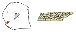
Location of Morrison in Warren County, Tennessee.
Coordinates: 35°36′18″N85°54′54″W / 35.60500°N 85.91500°W / 35.60500; -85.91500
Country United States
State Tennessee
County Warren
Area
[1]
  Total2.99 sq mi (7.74 km2)
  Land2.99 sq mi (7.74 km2)
  Water0.00 sq mi (0.00 km2)
Elevation
[2]
1,073 ft (327 m)
Population
 (2020) [3]
  Total733
  Density245.23/sq mi (94.69/km2)
Time zone UTC-6 (Central (CST))
  Summer (DST) UTC-5 (CDT)
ZIP code
37357
Area code 931
FIPS code 47-50220 [4]
GNIS feature ID1294442 [2]

Morrison is a town in Warren County, Tennessee, United States. The population was 684 at the 2000 census and 694 at the 2010 census.

Contents

Geography

Morrison is located at 35°36′18″N85°54′54″W / 35.60500°N 85.91500°W / 35.60500; -85.91500 (35.604869, -85.915004). [5]

According to the United States Census Bureau, the town has a total area of 2.7 square miles (7.0 km2), all of it land.

Demographics

Historical population
CensusPop.Note
1910 149
1920 27181.9%
1930 265−2.2%
1940 2784.9%
1950 3018.3%
1960 294−2.3%
1970 37928.9%
1980 58754.9%
1990 570−2.9%
2000 68420.0%
2010 6941.5%
2020 7335.6%
Sources: [6] [7] [3]

2020 census

Morrison racial composition [8]
RaceNumberPercentage
White (non-Hispanic)52671.76%
Black or African American (non-Hispanic)364.91%
Native American 20.27%
Asian 30.41%
Pacific Islander 10.14%
Other/Mixed 263.55%
Hispanic or Latino 13918.96%

As of the 2020 United States census, there were 733 people, 202 households, and 151 families residing in the town.

2000 census

As of the census [4] of 2000, there were 684 people, 254 households, and 185 families residing in the town. The population density was 251.9 inhabitants per square mile (97.3/km2). There were 276 housing units at an average density of 101.6 per square mile (39.2/km2). The racial makeup of the town was 88.45% White, 9.65% African American, 0.15% Native American, 1.02% from other races, and 0.73% from two or more races. Hispanic or Latino of any race were 2.49% of the population.

There were 254 households, out of which 37.4% had children under the age of 18 living with them, 54.3% were married couples living together, 15.4% had a female householder with no husband present, and 26.8% were non-families. 22.8% of all households were made up of individuals, and 12.6% had someone living alone who was 65 years of age or older. The average household size was 2.62 and the average family size was 3.05.

In the town, the population was spread out, with 28.7% under the age of 18, 9.6% from 18 to 24, 27.9% from 25 to 44, 19.4% from 45 to 64, and 14.3% who were 65 years of age or older. The median age was 35 years. For every 100 females, there were 85.9 males. For every 100 females age 18 and over, there were 83.5 males.

The median income for a household in the town was $23,819, and the median income for a family was $31,250. Males had a median income of $28,125 versus $21,250 for females. The per capita income for the town was $13,105. About 20.6% of families and 23.9% of the population were below the poverty line, including 33.9% of those under age 18 and 9.2% of those age 65 or over.

Notable people

Related Research Articles

<span class="mw-page-title-main">Cowarts, Alabama</span> Town in Alabama, United States

Cowarts is a town in Houston County, Alabama, United States. The town incorporated in August 1961. It is part of the Dothan, Alabama Metropolitan Statistical Area. At the 2010 census the population was 1,871, up from 1,546 in 2000.

<span class="mw-page-title-main">Sells, Arizona</span> CDP in Pima County, Arizona

Sells is an unincorporated community and census-designated place (CDP) in Pima County, Arizona, United States. The population was 2,799 at the 2000 census. It is the capital of the Tohono O'odham Nation and the home of several of their tribal businesses, such as Tohono O'Odham Ki:Ki Association. Originally named Indian Oasis, by cattle-ranchers/businessmen brothers, Joseph and Louis Ménager in 1912. The Ménager brothers also built and ran the Indian Oasis Mercantile Store. The settlement took its present English name in 1918 to honor Indian Commissioner Cato Sells. The O'odham name means "Tortoise Got Wedged".

<span class="mw-page-title-main">Utica, Indiana</span> Town in Indiana, United States

Utica is a town in Utica Township, Clark County, Indiana, United States. The population was 776 at the 2010 census.

<span class="mw-page-title-main">Corunna, Indiana</span> Town in Indiana, United States

Corunna is a town in Richland Township, DeKalb County, Indiana, United States. The population was 236 at the 2020 census estimate.

<span class="mw-page-title-main">Medora, Indiana</span> Town in Indiana, United States

Medora is a town in Carr Township, Jackson County, Indiana, United States. The population was 693 at the 2010 census.

<span class="mw-page-title-main">Griffin, Indiana</span> Town in Indiana, United States

Griffin is a town in Bethel Township, Posey County, in the U.S. state of Indiana. The population was 172 at the 2010 census.

<span class="mw-page-title-main">Saratoga, Indiana</span> Town in Indiana, United States

Saratoga is a town in Ward Township, Randolph County, in the U.S. state of Indiana. The population was 254 at the 2010 census.

<span class="mw-page-title-main">Morristown, Indiana</span> Town in Indiana, United States

Morristown is a town in Hanover Township, Shelby County, in the U.S. state of Indiana. The population was 1,218 at the 2010 census.

<span class="mw-page-title-main">Visalia, Kentucky</span> Unincorporated community in Kentucky, United States

Visalia was a city in Kenton County, Kentucky, United States. The population was 111 at the 2000 census. The city government was dissolved in November 2006.

Langola Township is a township in Benton County, Minnesota, United States. The population was 906 as of the 2010 census. Langola Township was organized in 1858.

<span class="mw-page-title-main">Rolette, North Dakota</span> City in North Dakota, United States

Rolette is a city in Rolette County, North Dakota, United States. The population was 484 at the 2020 census.

<span class="mw-page-title-main">Carter, Oklahoma</span> Town in Oklahoma, United States

Carter is a town in Beckham County, Oklahoma, United States. The population was 183 at the time of the 2020 census.

<span class="mw-page-title-main">Martinsburg, Pennsylvania</span> Borough in Pennsylvania, United States

Martinsburg is a borough in the Morrisons Cove section of Blair County, Pennsylvania, United States. The population was 1,874 at the 2020 census. It is part of the Altoona, PA Metropolitan Statistical Area.

<span class="mw-page-title-main">Ooltewah, Tennessee</span> Census-designated place in Tennessee, United States

Ooltewah is a census-designated place (CDP) in Hamilton County, Tennessee, United States. It is a community near Chattanooga. The population was 684 at the 2020 census. Ooltewah is an enclave in the city of Collegedale.

<span class="mw-page-title-main">New Haven, West Virginia</span> Town in West Virginia, United States

New Haven is a town in Mason County, West Virginia, United States, along the Ohio River. The population was 1,485 at the 2020 census. It is part of the Point Pleasant, WV–OH Micropolitan Statistical Area.

<span class="mw-page-title-main">Glenwood, Wisconsin</span> Town in Wisconsin, United States

Glenwood is a town in St. Croix County, Wisconsin, United States. The population was 755 at the 2000 census. The unincorporated community of Emerald is located partially in the town.

<span class="mw-page-title-main">Motley, Minnesota</span> City in Minnesota, United States

Motley is a city in Morrison and Cass counties in the U.S. state of Minnesota. The population was 680 at the 2020 census. The main part of Motley is located within Morrison County; only a minor part of the city extends into Cass County.

<span class="mw-page-title-main">Black Earth, Wisconsin</span> Village in Wisconsin, United States

Black Earth is a village in Dane County, Wisconsin, United States. The population was 1,338 at the 2010 census. The village is located within the Town of Black Earth. It is part of the Madison Metropolitan Statistical Area.

<span class="mw-page-title-main">Coloma (town), Wisconsin</span> Town in Wisconsin, United States

Coloma is a town in Waushara County, Wisconsin, United States. The population was 748 at the 2000 census. The coordinates shown are for the Village of Coloma, located within the town.

<span class="mw-page-title-main">North Vernon, Indiana</span> City in Indiana, United States

North Vernon is a city in Jennings County, Indiana, United States. The population was 6,608 as of the 2020 census.

References

  1. "ArcGIS REST Services Directory". United States Census Bureau. Retrieved October 15, 2022.
  2. 1 2 U.S. Geological Survey Geographic Names Information System: Morrison, Tennessee
  3. 1 2 "Census Population API". United States Census Bureau. Retrieved October 15, 2022.
  4. 1 2 "U.S. Census website". United States Census Bureau . Retrieved January 31, 2008.
  5. "US Gazetteer files: 2010, 2000, and 1990". United States Census Bureau. February 12, 2011. Retrieved April 23, 2011.
  6. "Census of Population and Housing: Decennial Censuses". United States Census Bureau . Retrieved March 4, 2012.
  7. "Incorporated Places and Minor Civil Divisions Datasets: Subcounty Resident Population Estimates: April 1, 2010 to July 1, 2012". Population Estimates. U.S. Census Bureau. Archived from the original on June 11, 2013. Retrieved December 11, 2013.
  8. "Explore Census Data". data.census.gov. Retrieved December 26, 2021.