The Clark Fork, or the Clark Fork of the Columbia River, is a river in the U.S. states of Montana and Idaho, approximately 310 miles (500 km) long. It is named after William Clark of the 1806 Lewis and Clark Expedition. The largest river by volume in Montana, it drains an extensive region of the Rocky Mountains in western Montana and northern Idaho in the watershed of the Columbia River. The river flows northwest through a long valley at the base of the Cabinet Mountains and empties into Lake Pend Oreille in the Idaho Panhandle. The Pend Oreille River in Idaho, Washington, and British Columbia, Canada which drains the lake to the Columbia in Washington, is sometimes included as part of the Clark Fork, giving it a total length of 479 miles (771 km), with a drainage area of 25,820 square miles (66,900 km2). In its upper 20 miles (32 km) in Montana near Butte, it is known as Silver Bow Creek. Interstate 90 follows much of the upper course of the river from Butte to Saint Regis. The highest point within the river's watershed is Mount Evans at 10,641 feet (3,243 m) in Deer Lodge County, Montana along the Continental Divide.

Mount Cleveland is the highest mountain in Glacier National Park, located in Montana, United States. It is also the highest point in the Lewis Range, which spans part of the northern portion of the park and extends into Canada. It is located approximately 3 mi (4.8 km) southeast of the southern end of Waterton Lake, and approximately 5 mi (8.0 km) south of the US–Canada border. The east side of the future national park was purchased by the federal government from the Blackfoot Confederacy in 1895 during the second term of President Grover Cleveland. According to the United States Board on Geographic Names, the mountain is named for the former president.

Going-to-the-Sun Mountain is a 9,647-foot (2,940 m) mountain peak located in Glacier National Park in the U.S. state of Montana. It rises dramatically above St. Mary Valley just north of the Going-to-the-Sun Road. The mountain was named by James Willard Schultz in 1888.

The Geography of North Dakota consists of three major geographic regions: in the east is the Red River Valley, west of this, the Missouri Plateau. The southwestern part of North Dakota is covered by the Great Plains, accentuated by the Badlands. There is also much in the way of geology and hydrology.

Crested Butte is a prominent mountain summit in the Elk Mountains range of the Rocky Mountains of North America. The 12,168-foot (3,709 m) peak is in Gunnison National Forest, 2.1 miles (3.4 km) northeast by east of the Town of Crested Butte in Gunnison County, Colorado, United States. Ski lifts and runs of the Crested Butte Mountain Resort occupy the north side of the mountain.

Bishops Cap is located in the Lewis Range, Glacier National Park in the U.S. state of Montana. Located above the Garden Wall and straddling the Continental Divide, when viewed from the south at Logan Pass, the peak appears to resemble a Bishop's headwear. The name Bishops Cap is descriptive only, and there's no known origin.

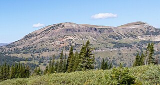
The Sweet Grass Hills are a small group of low mountains rising more than 3,000 feet (910 m) above the surrounding plains southwest of Whitlash, Montana, in Liberty and Toole County, Montana. The tallest point in the hills is West Butte at 6,983 feet (2,128 m). Quite prominent in the local area, they are clearly visible from US Highway 2 to the south, I-15, and can sometimes be seen as far North as the Crowsnest Highway (Highway 3) near Medicine Hat in Alberta as well as from the West, near Glacier National Park and Browning, Montana. Visibility may vary depending on local air temperatures or heat domes that may increase or decrease the apparent height of the features. Other named peaks in the small group are Gold Butte (6,512 ft [1,985 m]), East Butte, and Mount Lebanon (5,807 ft [1,770 m]). The Sweet Grass Hills are an example of the island ranges that dot the central third portion of the state of Montana. These island ranges, completely surrounded by the 'sea' of plains and not geographically part of the Rocky Mountains to the west, are "biological hotspots", containing more species than the prairie below.

Mount Morgan is an 8,781-foot elevation (2,676 m) mountain located in the Lewis Range, Glacier National Park in the U.S. state of Montana. It is situated along the Continental Divide. Oldman Lake is immediately east of the peak.

The Regional designations of Montana vary widely within the U.S state of Montana. The state is a large geographical area that is split by the Continental Divide, resulting in watersheds draining into the Pacific Ocean, Gulf of Mexico and Hudson's Bay. The state is approximately 545 miles (877 km) east to west along the Canada–United States border and 320 miles (510 km) north to south. The fourth largest state in land area, it has been divided up in official and unofficial ways into a variety of regions. Additionally, Montana is part of a number of larger federal government administrative regions.

Mount Wynne is a 13,179-foot-elevation (4,017-meter) mountain summit located one mile west of the crest of the Sierra Nevada mountain range, in Fresno County of northern California, United States. It is situated in eastern Kings Canyon National Park, 31 miles (50 km) northwest of the town of Lone Pine, 0.4 miles immediately east of Pinchot Pass, and 0.66 miles (1.06 km) south of Mount Pinchot, which is the nearest higher neighbor. Mt. Wynne ranks as the 116th highest summit in California. Topographic relief is significant as the south aspect rises nearly 2,000 feet above the surrounding terrain in approximately one mile. The approach to this remote peak is made via the John Muir Trail. The first ascent of the summit was made in 1935 by a Sierra Club party.

Haystack Butte is a 7,486-foot-elevation (2,282-meter) summit located in the Lewis Range, of Glacier National Park in the U.S. state of Montana. It is situated one mile west of the Continental Divide, in Flathead County, above the Weeping Wall on its south slope. Topographic relief is significant as the west aspect rises 3,900 feet above McDonald Creek in less than 1.5 mile. It can be seen from Logan Pass, and from Going-to-the-Sun Road which traverses the west and south slopes of the peak. The nearest higher neighbor is Mount Gould, 1.07 miles (1.72 km) to the northeast. Climbing access is via the Highline Trail. This geographical feature's descriptive name was on maps as early as 1904, and was officially adopted March 6, 1929, by the United States Board on Geographic Names

Clyde Peak is an 8,610-foot-elevation (2,620-meter) mountain summit located in Glacier National Park in the U.S. state of Montana. The mountain straddles the border shared by Flathead County and Glacier County. It is situated on the Continental Divide so precipitation runoff from the west side of the mountain drains into Thompson Creek which is part of the Middle Fork Flathead River watershed, and the east side drains into headwaters of Red Eagle Creek, which flows to Red Eagle Lake, thence Saint Mary Lake. It is set in the Lewis Range, and the nearest higher neighbor is Mount Logan 1.44 mile to the northwest. Topographic relief is significant as the southwest aspect rises approximately 4,000 feet in one mile.

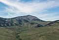
Old Baldy is a 9,156-foot (2,791-metre) double summit mountain located in Teton County of the U.S. state of Montana.
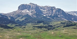
Old Man of the Hills is an 8,229-foot (2,508-metre) mountain summit located in Teton County of the U.S. state of Montana.
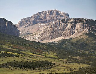
Mount Frazier is an 8,315-foot (2,534-metre) mountain summit located in Teton County of the U.S. state of Montana.

Gold Butte is a 6,512-foot (1,985-metre) mountain summit located in Toole County, Montana, United States.

Mount Lebanon is a 5,807-foot (1,770-metre) mountain summit in Liberty County, Montana, United States.
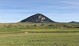
West Butte is a 6,983-foot-elevation (2,128-meter) mountain summit located in Toole County, Montana, United States.
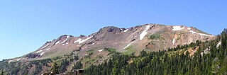
Henderson Mountain is a 10,343-foot (3,153-metre) summit in Park County, Montana, United States.
Mount Abundance is a 10,116-foot (3,083-metre) summit in Park County, Montana, United States.