
Aoraki / Mount Cook is the highest mountain in New Zealand. Its height, as of 2014, is listed as 3,724 metres. It is situated in the Southern Alps, the mountain range that runs the length of the South Island. A popular tourist destination, it is also a favourite challenge for mountain climbers. Aoraki / Mount Cook consists of three summits: from south to north, the Low Peak, the Middle Peak and the High Peak. The summits lie slightly south and east of the main divide of the Southern Alps, with the Tasman Glacier to the east and the Hooker Glacier to the southwest. Mount Cook is ranked 10th in the world by topographic isolation.

The Southern Alps are a mountain range extending along much of the length of New Zealand's South Island, reaching its greatest elevations near the range's western side. The name "Southern Alps" generally refers to the entire range, although separate names are given to many of the smaller ranges that form part of it.

Aoraki / Mount Cook National Park is a national park located in the Canterbury Region in the central-west of the South Island of New Zealand. It was established in October 1953 and takes its name from the highest mountain in New Zealand, Aoraki / Mount Cook. The area of the park is 707 km2 (273 sq mi), and it shares a border with Westland Tai Poutini National Park along the Main Divide of the Southern Alps. The national park consists of reserves that were established as early as 1885 to protect the area's significant landscape and vegetation. Glaciers cover 40% of the park, including the county's largest glacier, Haupapa / Tasman Glacier. In 1990, the park was included in the area designated as the Te Wāhipounamu World Heritage Site. The park is managed by the Department of Conservation (DOC) alongside Ngāi Tahu, the iwi who are mana whenua in the region.

Mount Tasman is New Zealand's second-highest mountain, rising to a height of 3,497 metres (11,473 ft). It is located in the Southern Alps of the South Island, four kilometres to the north of its larger neighbour, Aoraki / Mount Cook. Unlike Aoraki / Mount Cook, Mount Tasman sits on the South Island's Main Divide, on the border between Aoraki / Mount Cook National Park and Westland Tai Poutini National Park. It is the highest point in Westland District.

Tasman Glacier is the largest glacier in New Zealand, and one of several large glaciers which flow south and east towards the Mackenzie Basin from the Southern Alps in New Zealand's South Island.

Lendenfeld Peak, in the past also Mount Lendenfeld, is the eighth highest named summit in New Zealand and in Aoraki / Mount Cook National Park.

Emmeline Freda Du Faur was an Australian mountaineer, credited as the first woman to climb New Zealand's tallest mountain, Aoraki / Mount Cook. Du Faur was a leading amateur climber of her day. She was the first female high mountaineer known to be active in New Zealand, although she never lived there.
Malte Brun is the highest peak in the Malte Brun Range, which lies between the Tasman and Murchison Glaciers within New Zealand's Southern Alps. According to Land Information New Zealand, it rises to a height of 3,199 metres (10,495 ft), although other sources give heights ranging from 3155 to 3199 m. A list published by the New Zealand Alpine Club ranks Malte Brun as the third highest mountain in New Zealand.

Mount Sefton is a mountain in the Aroarokaehe Range of the Southern Alps of New Zealand, just 12 kilometres (7.5 mi) south of Aoraki / Mount Cook. To the south lies Mount Brunner, and to the north The Footstool, both more than 400 metres (1,300 ft) shorter.
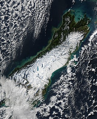
The South Island, with an area of 150,437 km2 (58,084 sq mi), is the largest landmass of New Zealand; it contains about one-quarter of the New Zealand population and is the world's 12th-largest island. It is divided along its length by the Southern Alps, the highest peak of which is Aoraki / Mount Cook at 3,724 metres (12,218 ft), making it 9th-highest island, with the high Kaikōura Ranges to the northeast. There are eighteen peaks of more than 3,000 metres (9,800 ft) in the South Island. The east side of the island is home to the Canterbury Plains while the West Coast is famous for its rough coastlines such as Fiordland, a very high proportion of native bush, and Fox and Franz Josef Glaciers. The dramatic landscape of the South Island has made it a popular location for the production of several films, including The Lord of the Rings trilogy and The Chronicles of Narnia: The Lion, the Witch and the Wardrobe. It lies at similar latitudes to Tasmania, and parts of Patagonia in South America.

Mount D'Archiac is a 2,875-metre-elevation (9,432-foot) mountain in the Canterbury Region of New Zealand.

Mount Wolseley is a 2,558-metre-elevation (8,392-foot) mountain in the Canterbury Region of New Zealand.

Mount Loughnan is a 2,590-metre-elevation (8,497-foot) mountain in New Zealand.

Mount Forbes is a 2,583-metre-elevation (8,474-foot) mountain in the Canterbury Region of New Zealand.

Mount Moffat is a 2,638-metre-elevation (8,655-foot) mountain in the Canterbury Region of New Zealand.

The Footstool is a 2,764-metre-elevation (9,068-foot) mountain in the Canterbury Region of New Zealand.

Dilemma Peak is a 2,602-metre-elevation (8,537-foot) mountain in the West Coast Region of New Zealand.

The Nuns Veil is a 2,749-metre-elevation (9,019-foot) mountain in the Canterbury Region of New Zealand.

Mount Darwin is a 2,952-metre-elevation (9,685-foot) mountain in the Canterbury Region of New Zealand.

Hochstetter Dome is a 2,827-metre-elevation (9,275-foot) mountain in New Zealand.


