
Aoraki / Mount Cook is the highest mountain in New Zealand. Its height, as of 2014, is listed as 3,724 metres. It is situated in the Southern Alps, the mountain range that runs the length of the South Island. A popular tourist destination, it is also a favourite challenge for mountain climbers. Aoraki / Mount Cook consists of three summits: from south to north, the Low Peak, the Middle Peak and the High Peak. The summits lie slightly south and east of the main divide of the Southern Alps, with the Tasman Glacier to the east and the Hooker Glacier to the southwest. Mount Cook is ranked 10th in the world by topographic isolation.
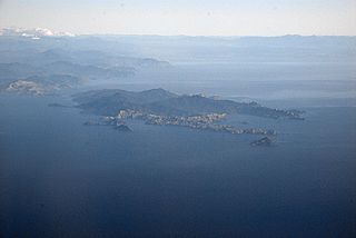
D'Urville Island, Māori name Rangitoto ki te Tonga, is the largest island in the Marlborough Sounds, on the northern coast of the South Island of New Zealand. It was named after the French explorer Jules Dumont d'Urville. With an area of approximately 150 square kilometres (58 sq mi), it is the eighth-largest island of New Zealand, and has around 52 permanent residents. The local authority is the Marlborough District Council.

The South Island is the largest of the three major islands of New Zealand in surface area, the others being the smaller but more populous North Island and sparsely populated Stewart Island. It is bordered to the north by Cook Strait, to the west by the Tasman Sea, to the south by the Foveaux Strait and Southern Ocean, and to the east by the Pacific Ocean. The South Island covers 150,437 square kilometres (58,084 sq mi), making it the world's 12th-largest island, constituting 56% of New Zealand's land area. At low altitudes, it has an oceanic climate. The major centres are Christchurch, with a metropolitan population of 521,881, and the smaller Dunedin. The economy relies on agriculture, fishing, tourism, and general manufacturing and services.

In Māori culture, Matariki is the Pleiades star cluster and a celebration of its first rising in late June or early July. The rising marks the beginning of the new year in the Māori lunar calendar.

Omarama is a small town at the junction of State Highways 8 and 83, near the southern end of the Mackenzie Basin, in the South Island of New Zealand. Omarama is in the Waitaki District, in the southern Canterbury region. The Ahuriri River is a short distance to the north of the township. Omarama is 30 km southwest of Twizel, 40 km southeast of Lake Ōhau and 32 km northeast of the Lindis Pass.

The Southern Alps are a mountain range extending along much of the length of New Zealand's South Island, reaching its greatest elevations near the range's western side. The name "Southern Alps" generally refers to the entire range, although separate names are given to many of the smaller ranges that form part of it.

The West Coast is a region of New Zealand on the west coast of the South Island. It is administered by the West Coast Regional Council, and is known co-officially as Te Tai Poutini. It comprises the territorial authorities of Buller District, Grey District and Westland District. The principal towns are Westport, Greymouth and Hokitika. The region, one of the more remote areas of the country, is also the most sparsely populated. With a population of just 32,900 people, the West Coast is the least populous region in New Zealand. The population in the region grew by 0.4% over the year to July 2023.

Aoraki / Mount Cook National Park is a national park located in the Canterbury Region in the central-west of the South Island of New Zealand. It was established in October 1953 and takes its name from the highest mountain in New Zealand, Aoraki / Mount Cook. The area of the park is 707 km2 (273 sq mi), and it shares a border with Westland Tai Poutini National Park along the Main Divide of the Southern Alps. The national park consists of reserves that were established as early as 1885 to protect the area's significant landscape and vegetation. Glaciers cover 40% of the park, including the county's largest glacier, Haupapa / Tasman Glacier. In 1990, the park was included in the area designated as the Te Wāhipounamu World Heritage Site. The park is managed by the Department of Conservation (DOC) alongside Ngāi Tahu, the iwi who are mana whenua in the region.

Mount Hutt rises to the west of the Canterbury Plains in the South Island of New Zealand, above the braided upper reaches of the Rakaia River, and 80 kilometres west of Christchurch. Its summit is 2190 metres above sea level.
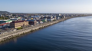
Greymouth is the largest town in the West Coast region in the South Island of New Zealand, and the seat of the Grey District Council. The population of the whole Grey District is 14,800, which accounts for 43% of the West Coast's inhabitants. The Greymouth urban area had an estimated population of 8,640. A large proportion of the District, 65%, is part of the Conservation Estate owned and managed by the Department of Conservation making Greymouth a natural centre for walkers and trampers.

Lake Wakatipu is an inland lake in the South Island of New Zealand. It is in the southwest corner of the Otago region, near its boundary with Southland. Lake Wakatipu comes from the original Māori name Whakatipu wai-māori.

Lake Tekapo is the second-largest of three roughly parallel lakes running north–south along the northern edge of the Mackenzie Basin in the South Island of New Zealand. It covers an area of 83 km2 (32 sq mi) and is at an altitude of 710 m (2,330 ft) above sea level.

Mount Tasman is New Zealand's second-highest mountain, rising to a height of 3,497 metres (11,473 ft). It is located in the Southern Alps of the South Island, four kilometres to the north of its larger neighbour, Aoraki / Mount Cook. Unlike Aoraki / Mount Cook, Mount Tasman sits on the South Island's Main Divide, on the border between Aoraki / Mount Cook National Park and Westland Tai Poutini National Park. It is the highest point in Westland District.

The Rangitata River is one of the braided rivers of the Canterbury Plains in southern New Zealand. It flows southeast for 120 kilometres (75 mi) from the Southern Alps, entering the Pacific Ocean 30 kilometres (19 mi) northeast of Timaru. The river has a catchment area of 1,773 square kilometres (685 sq mi), and a mean annual flow of 95 cubic metres per second (3,400 cu ft/s) at Klondyke.

Mount Dampier is New Zealand's third highest mountain, rising to 3,440 metres (11,290 ft). It is located in the Southern Alps, between Mount Hicks and Aoraki / Mount Cook. It is often traversed by climbers en route to the North ridge of Mount Cook. Its Māori name literally means 'long sky'.

New Zealand is an island country in the southwestern Pacific Ocean. It consists of two main landmasses—the North Island and the South Island —and over 600 smaller islands. It is the sixth-largest island country by area and lies east of Australia across the Tasman Sea and south of the islands of New Caledonia, Fiji, and Tonga. The country's varied topography and sharp mountain peaks, including the Southern Alps, owe much to tectonic uplift and volcanic eruptions. New Zealand's capital city is Wellington, and its most populous city is Auckland.

Māori mythology and Māori traditions are two major categories into which the remote oral history of New Zealand's Māori may be divided. Māori myths concern tales of supernatural events relating to the origins of what was the observable world for the pre-European Māori, often involving gods and demigods. Māori tradition concerns more folkloric legends often involving historical or semi-historical forebears. Both categories merge in whakapapa to explain the overall origin of the Māori and their connections to the world which they lived in.

Mount Sefton is a mountain in the Aroarokaehe Range of the Southern Alps of New Zealand, just 12 kilometres (7.5 mi) south of Aoraki / Mount Cook. To the south lies Mount Brunner, and to the north The Footstool, both more than 400 metres (1,300 ft) shorter.

Pounamu is a term for several types of hard and durable stone found in the South Island of New Zealand. They are highly valued in New Zealand, and carvings made from pounamu play an important role in Māori culture.

Browning Pass / Nōti Raureka is a mountain pass across the Southern Alps, on the South Island of New Zealand. The pass reaches an elevation of 1,411 metres (4,629 ft) above sea level, connecting the upper reaches of the Wilberforce River with the West Coast.

