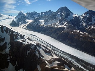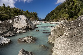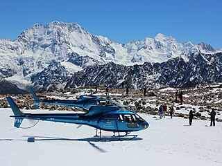
The Southern Alps are a mountain range extending along much of the length of New Zealand's South Island, reaching its greatest elevations near the range's western side. The name "Southern Alps" generally refers to the entire range, although separate names are given to many of the smaller ranges that form part of it.

Mount Aspiring / Tititea is New Zealand's 23rd-highest mountain. The peak's altitude of 3,033 metres (9,951 ft) makes it the country's highest outside the Aoraki / Mount Cook region.

The Matukituki River is a short braided river in the Southern Alps of New Zealand's South Island. Both its West Branch and East Branch originate from the Main Divide mountain ranges near Mount Aspiring / Tititea. Their largely glacier-fed waters each flow for approximately 20 kilometres (12 mi) before joining near Camerons Flat. After this confluence, the Matukituki River leaves the boundaries of Mount Aspiring National Park and continues for another 30 kilometres (19 mi) to exit into Lake Wānaka at the lake's southwestern edge.

Mount Tasman is New Zealand's second-highest mountain, rising to a height of 3,497 metres (11,473 ft). It is located in the Southern Alps of the South Island, four kilometres to the north of its larger neighbour, Aoraki / Mount Cook. Unlike Aoraki / Mount Cook, Mount Tasman sits on the South Island's Main Divide, on the border between Aoraki / Mount Cook National Park and Westland Tai Poutini National Park. It is the highest point in Westland District.

Tasman Glacier is the largest glacier in New Zealand, and one of several large glaciers which flow south and east towards the Mackenzie Basin from the Southern Alps in New Zealand's South Island.
Skelton Glacier is a large glacier flowing from the polar plateau into the Ross Ice Shelf at Skelton Inlet on the Hillary Coast, south of Victoria Land, Antarctica.

The Buller Gorge is a gorge located in the northwest of the South Island of New Zealand. The Buller River flows through the deep canyon between Murchison and Westport. Land Information New Zealand lists two sections for the gorge, Upper Buller Gorge and Lower Buller Gorge. State Highway 6 runs alongside, but considerably above, the river through the gorge. The Stillwater - Westport Line railway also runs through the gorge.

The Mueller Glacier is a 13-kilometre (8.1 mi) long glacier flowing through Aoraki / Mount Cook National Park in the South Island of New Zealand. It lies to the west of Mount Cook Village within the Southern Alps, flowing roughly north-west from its névé near Mount Montgomerie before curving around the Sealy Range as it approaches its terminus. Various other glaciers feed into the Mueller Glacier along its route, including the Frind and Huddleston Glaciers. The glacier ends at a small unnamed terminal lake, which is also fed by meltwater from the nearby Hooker Glacier. This lake is the source for the Hooker River, a small tributary of the Tasman River, which flows into Lake Pukaki.

Mount Burnett is a hill in Kahurangi National Park, in Golden Bay / Mohua, New Zealand.

The Paparoa Range is a mountain range in the West Coast region of New Zealand's South Island. It was the first New Zealand land seen by a European – Abel Tasman in 1642. Part of the range has the country's highest protection as a national park; the Paparoa National Park was established in 1987. Within that park, the Cave Creek disaster occurred in 1995.

The Asgard Range is a mountain range in Victoria Land, Antarctica. It divides Wright Valley from Taylor Glacier and Taylor Valley. It is south of the Olympus Range and north of the Quartermain Mountains and the Kukri Hills.

The Rees River is a headwater tributary of the Clutha River / Mata-Au that drains eastward of the main divide of the Southern Alps / Kā Tiritiri o te Moana in New Zealand. The river runs 41 km, drains an area of 406 km2, and discharges into the head of Lake Wakatipu at Glenorchy. Bound by the Richardson (Whakaari) Mountains to the east and the Forbes Mountains to the west, its snow-covered headwaters rise above 2000 m.

The Waiatoto River is a river of the West Coast of New Zealand's South Island. Formed from several small rivers which are fed by glaciers surrounding Mount Aspiring / Tititea, it flows north along a valley flanked in the west by the Haast Range before turning northwest to reach the Tasman Sea 20 kilometres (12 mi) southwest of Haast. Much of the river's length is within Mount Aspiring National Park.

Malte Brun is the highest peak in the Malte Brun Range, which lies between the Tasman and Murchison Glaciers within New Zealand's Southern Alps. According to Land Information New Zealand, it rises to a height of 3,199 metres (10,495 ft), although other sources give heights ranging from 3155 to 3199 m. A list published by the New Zealand Alpine Club ranks Malte Brun as the third highest mountain in New Zealand.
The Malta Plateau is an ice-covered plateau of about 25 nautical miles extent in the Victory Mountains of Victoria Land, Antarctica. The plateau is irregular in shape and is bounded on the south and west by Mariner Glacier, on the north by tributaries to Trafalgar Glacier, and on the east by tributaries to Borchgrevink Glacier.
The Waipara River drain from the Bonar Glacier on Mount Aspiring / Tititea before joining the Arawhata River and flowing northwest into the Tasman Sea near Jackson Bay. Its name translates to "Muddy Water", wai meaning water and para meaning mud.

Mount Haast is a mountain summit located in the Southern Alps / Kā Tiritiri o te Moana, in the Westland District of New Zealand. The mountain was named after the German-born geologist Julius von Haast by James Mackay (1831–1912).

The Butler Range, also known as North Butler Range, is a range located in the Westland District of the West Coast Region on the South Island of New Zealand. The range has also been known as Peaks of the Mist Range.

The Garden of Eden Ice Plateau is a large ice field on the western side of New Zealand's Southern Alps / Kā Tiritiri o te Moana. At over 9 km (5.6 mi) long, the Garden of Eden is one of the largest ice fields in New Zealand, along with the equally-sized Garden of Allah Ice Field which sits just to the north. The ice field is one of many geographic features in the area between the main divide of the Southern Alps and the Adams Range which share biblical names, a convention first established by the earliest explorers to the area. The Garden's remote location and difficult conditions make research difficult, especially with restrictions on helicopter landings imposed through the designation of the area as Adams Wilderness Area in 2003. Despite this, the ice plateau has been a popular destination for tramping groups for over 80 years, with access routes from both coasts and easily reachable areas once on the plateau itself.

Mount Teichelmann is a mountain summit located in the Southern Alps / Kā Tiritiri o te Moana, in the Westland District of New Zealand. The mountain was named after the Austrian surgeon and mountaineer Ebenezer Teichelmann.


