
Haast is a small town in the Westland District territorial authority on the West Coast of New Zealand's South Island. The township is beside the Haast River, 3 kilometres (2 mi) south of Haast Junction, on State Highway 6. The Haast region is in Te Wahipounamu – The South West New Zealand World Heritage, a UNESCO World Heritage Site designated in 1990.

The Haast River / Awarua is a river on the West Coast of the South Island of New Zealand. The Māori name for the river is Awarua. It drains the western watershed of the Haast Pass. The Haast River is 100 kilometres (62 mi) in length, and enters the Tasman Sea near Haast township. The river's main tributary is the Landsborough River.

Mount Aspiring National Park is in the Southern Alps of the South Island of New Zealand, north of Fiordland National Park, situated in Otago and Westland regions. The park forms part of the Te Wahipounamu World Heritage Site.

Camooweal is an outback town and locality in the City of Mount Isa, Queensland, Australia. The locality is on the Queensland border with the Northern Territory. In the 2021 census, the locality of Camooweal had a population of 236 people.
Hughenden is a rural town and locality in the Flinders Shire, Queensland, Australia. In the 2021 census, the locality of Hughenden had a population of 1,113 people.

Landsborough is a town and a locality in the Sunshine Coast Region, Queensland, Australia. In the 2021 census, the locality of Landsborough had a population of 4,446 people.

Richmond is a rural town and locality in the Shire of Richmond, Queensland, Australia. In the 2021 census, the locality of Richmond had a population of 578 people.

The Catlins River flows southeastward through The Catlins, an area of the southern South Island of New Zealand. Its total length is 42 kilometres (26 mi), and it flows into the Pacific Ocean at the holiday settlement of Pounawea, 28 kilometres (17 mi) south of Balclutha. Its upper estuary is called Catlins Lake, and its lower estuary is shared with the Ōwaka River. The lower estuary is also known at Pounawea Estuary.
The Burke River is a river of New Zealand's South Island, located in Mount Aspiring National Park. It flows east for 19 kilometres (12 mi) from close to the Mueller Pass, reaching the Haast River 10 kilometres (6 mi) south of the Haast Pass.
The Fish River, is a river in the Otago Region of New Zealand. A tributary of the Makarora River, it rises east of Mount Burke and flows south-eastward through Mount Aspiring National Park, crossing State Highway 6 at 44° 6.97'S 169° 20.66'E, to join that river south of Haast Pass.
The Macfarlane River is a river of the southwest of New Zealand's South Island. It flows south from the Southern Alps, joining with the Landsborough River just before the latter's outflow into the Haast River.
The Maori River is a river of the West Coast Region of New Zealand's South Island. It flows from several sources in the Mataketake Range east of Haast, passing through the small Tawharekiri Lakes before becoming a tributary of the Waita River, which flows into the Tasman Sea 15 kilometres north of Haast.

The Moeraki River is a river of the West Coast Region of New Zealand's South Island. It flows west from the Southern Alps, veering northwest as it approaches the coast. It flows into the eastern end of the small Lake Moeraki before flowing out the western end to reach the Tasman Sea 20 kilometres northeast of Haast.

The Clarke River in Westland District is the southernmost of three rivers thus-named in the South Island of New Zealand. It is a major tributary of the Haast River, flowing southwest from its source on the slopes of Mount Hooker before joining with the Landsborough River three kilometres before the waters of both flow into the Haast at the point where the latter river turns west towards its outflow into the Tasman Sea.
Diamantina Lakes Station, most commonly known as Diamantina Lakes, was a pastoral lease that once operated as a cattle station in central west Queensland, and is now Diamantina National Park, a national park.

Bowen Downs Station is a pastoral lease that has operated both as a cattle station and a sheep station.

The Bedford Creek, a perennial stream of the Hawkesbury-Nepean catchment, is located in the Blue Mountains region of New South Wales, Australia.
The Coorongooba Creek, a perennial stream of the Hawkesbury-Nepean catchment, is located in the Central Tablelands region of New South Wales, Australia.
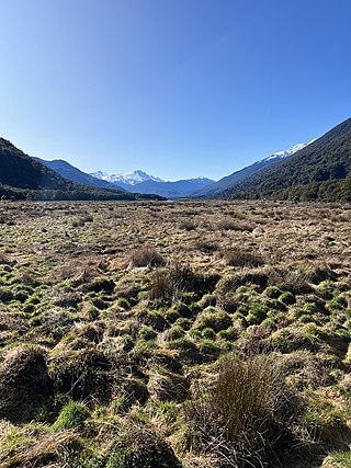
Pleasant Flat is an alluvial floodplain of the Haast River in the Haast Pass on New Zealand's South Island. A former stopping place for travellers crossing the pass before the building of the highway, it now has a campsite and picnic shelter. It has a notable view of Mount Hooker to the northeast.

Ship Creek is a small river that flows into an area of coastal swamp forest on the West Coast of New Zealand's South Island. Ship Creek is approximately 11 km (6.8 mi) long and flows northwest from catchment areas on the slopes of Bald Hill, reaching the Tasman Sea around 20 km (12 mi) north-east of Haast. Near the mouth of Ship Creek, there are short walks around dune lakes and ancient kahikatea swamp forest.
