Related Research Articles
The Maerewhenua River, also known as the Marewhenua River, is a small river in the Otago region of New Zealand's South Island. It is located in North Otago and acts as a tributary of the Waitaki River, which forms the border between Otago and Canterbury.

The Hokitika River is in the West Coast of the South Island of New Zealand. It is about 64 kilometers (40 mi) long, beginning in the Southern Alps, emerging from the narrow Hokitika Gorge after merging with the Whitcombe River, and flowing into the Tasman Sea just south of the town of Hokitika. The river then feeds into the offshore Hokitika Canyon, which merges with the Cook Canyon to form the Cook Channel. The canyons extend to about 650 km (400 mi) and are important spawning areas for hoki, hake and orange roughy.

The Adare Peninsula, is a high ice-covered peninsula, 40 nautical miles long, in the northeast part of Victoria Land, extending south from Cape Adare to Cape Roget. The peninsula was named by the New Zealand Antarctic Place-Names Committee (NZ-APC) for Cape Adare. The peninsula is considered the southernmost point of the Borchgrevink Coast, named for Carsten Borchgrevink (1864-1934).
The Gunn River is a river on the West Coast of New Zealand. It starts in the Price Range and flows east into the Whataroa River, which eventually drains into the Tasman Sea.
The Hewson River is a river of New Zealand's South Island. It flows east and then south from the Ben McLeod Range of inland Canterbury before flowing into the upper reaches of the Orari River 5 kilometres (3 mi) west of Mount Peel.
The Lambert River is a river of the West Coast Region of New Zealand's South Island. It flows north from the Lambert Glacier in the Southern Alps, joining with the Wanganui River 15 kilometres (9 mi) southeast of Harihari.
The North Barlow River is a river in the West Coast Region of New Zealand's South Island. It is one of the headwaters of the Barlow River.
The Oneone River is a short river of the West Coast Region of New Zealand's South Island. It is located northwest of Harihari, and reaches the Tasman Sea at the estuary of its larger northern neighbour, the Wanganui River.
The Otematata River is a river in North Otago, New Zealand. It rises west of Kohurau and flows northward into Lake Aviemore east of Otematata township.
The Porter River is a river of the Canterbury Region of New Zealand's South Island. It rises close to the southern end of the Craigieburn Range east of Lake Coleridge, flowing generally northeast to reach the Broken River close to Castle Hill. The Porters Ski Area is above the river valley's western flank, and State Highway 73 follows the river's course for some distance to the west of Porters Pass.

The Potts River is a river of the Canterbury region of New Zealand's South Island. It flows generally south from the southern end of the Arrowsmith Range through a steep-sided valley between the Potts Range to the west and the Big Hill Range to the east.
The Rotokino River is a short river of the West Coast Region of New Zealand's South Island. It flows south from Lake Rotokino, draining its waters to the Whataroa River.
The Te Rahotaiepa River is a river of the West Coast Region of New Zealand's South Island. It rises to the north of Lake Ianthe and flows parallel with the Tasman Sea coast along the edge of marshy ground for several kilometres to flow into the mouth of the Waitaha River.

The Tuke River is a river of the West Coast Region of New Zealand's South Island. It flows northwest from the Southern Alps, combining with the Dickson River to form the Mikonui River 15 kilometres southeast of Ross.

The Waitangiroto River is a river of the West Coast Region of New Zealand's South Island. It is approximately 15 km (9.3 mi) long, with its main source in the Waitangiroto swamp. It flows adjacent to the lower reaches of the Whataroa River and the Waitangitāhuna River. All three rivers enter the Tasman Sea northwest of the Okarito Lagoon.
The Whakaikai River is a short river of the West Coast Region of New Zealand's South Island. It flows generally northwest to reach the Tasman Sea five kilometres to the northwest of the mouth of the Wanganui River.
The Willberg River is a river of the West Coast Region of New Zealand's South Island. It initially flows northwest before turning southwest, reaching the Poerua River 12 kilometres south of Harihari.
The Dickson River is a river of the West Coast Region of New Zealand. It arises near the Dickson Pass in the Southern Alps and flows north-west. It joins the Tuke River and flows into the Mikonui River, which exits in the Tasman Sea near Ross.
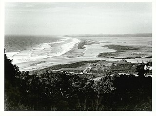
Ōkārito is a small coastal settlement on the West Coast of New Zealand's South Island, 127 kilometres (79 mi) southwest of Hokitika, and 10 kilometres (6.2 mi) from State Highway 6. It is built at the southern end of the Ōkārito Lagoon at the mouth of the Ōkārito River. The settlement of The Forks is located just inland, on the banks of the river.
References
"Place name detail: Smyth River". New Zealand Gazetteer. New Zealand Geographic Board . Retrieved 12 July 2009.
43°13′S170°51′E / 43.217°S 170.850°E