
The Awarau River, usually known as Larry's Creek is located within the South Island of New Zealand. The river is about 27 kilometres (17 mi) long and runs northwest from its headwaters in the Victoria Range to its confluence with the Inangahua River north of Reefton. It also drains part of the Brunner Range and there was a track along that range linking to Lyell by 1901, though none existed in 1874. A track also ran south over Kirwan Hill to the Montgomerie River.

The Waimakariri River is one of the largest rivers in Canterbury, on the eastern coast of New Zealand's South Island. It flows for 151 kilometres (94 mi) in a generally southeastward direction from the Southern Alps across the Canterbury Plains to the Pacific Ocean.
The Opuha River is in Canterbury, New Zealand. A tributary of the Ōpihi River, its two branches flow southeast for 35 kilometres (22 mi) before joining the larger river between Geraldine and Fairlie.

The Rakaia Gorge is located on the Rakaia River in inland Canterbury in New Zealand's South Island.

South Canterbury is the area of the Canterbury Region of the South Island of New Zealand bounded by the Rangitata River in the north and the Waitaki River to the south. The Pacific Ocean and ridge of the Southern Alps form natural boundaries to the east and west respectively. Though the exact boundaries of the region have never been formalised, the term is used for a variety of government agencies and other entities. It is one of four traditional sub-regions of Canterbury, along with Mid Canterbury, North Canterbury, and Christchurch city.
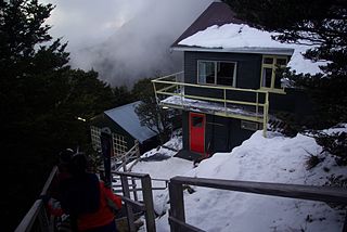
Broken River is a club skifield in South Island, New Zealand. Run by the Broken River Ski Club, it is located at about 110 km (68 mi) from Christchurch. The skifield claims to often have the longest ski season anywhere in Australasia. Also, by connecting with Craigieburn Valley, it claims to have the largest skiable area in New Zealand, at 900 hectares.

Broken River is a river in the South Island of New Zealand. It drains into the Waimakariri River due north of the town of Springfield.
The Cameron River is a river of New Zealand. It flows southeast from the slopes of Mount Arrowsmith in the Southern Alps / Kā Tiritiri o te Moana, reaching Lake Stream just to the north of the outflow from Lake Heron. The longer Ashburton River / Hakatere flows roughly parallel to the Cameron River, some 3 kilometres (2 mi) to the southwest.
The Hawkins River is a river in New Zealand. A major tributary of Canterbury's Selwyn River, it flows generally southeast from its source to the southwest of Springfield, reaching the Selwyn 10 kilometres (6 mi) west of Burnham.
The Mangawai River is a river of the Northland Region of New Zealand. It flows east into the Wairoa River close to its outflow into the Kaipara Harbour.

The Mathias River is a river of the Canterbury region of New Zealand's South Island. It flows from its origins in three rivers in the Southern Alps. Of these, the North Mathias River is the longest, flowing predominantly southwards from its source northeast of Mount Williams. After 18 kilometres (11 mi) its waters combine with those of the West Mathias River, which flows predominantly southwest for 13 kilometres (8 mi) from its sources 10 kilometres (6 mi) west of Mount Williams. The South Mathias River, a tributary of the West Mathias River, is a 6-kilometre (4 mi) long easterly-flowing river which meets the West Mathias 5 kilometres (3 mi) from its confluence with the North Mathias.
The Motukaika River is a river in the south Canterbury region of New Zealand's South Island. It flows generally east, reaching the Pareora River at the small settlement of Motukaika, 18 kilometres (11 mi) west of Timaru.

The Mungo River is a river of the West Coast Region of New Zealand's South Island. The major source of the Hokitika River, it flows generally west from the Southern Alps, becoming the Hokitika River at the point where it turns north as it flows through a gap in the Diedrichs Range. The Hokitika Saddle separates the headwaters of the Mungo from those of the Rakaia River system which flows to the island's east coast.
The Stour River is a river of the Canterbury region of New Zealand's South Island. It rises in two main branches, the East Branch and West Branch, to the southeast of Lake Heron, flowing generally south to meet the south branch of the Ashburton River / Hakatere 15 kilometres (9 mi) west of the settlement of Mount Somers.

The Whitcombe River is a river of the West Coast Region of New Zealand's South Island. It flows north to reach the Hokitika River 30 kilometres south of Hokitika.
Canterbury's Esk River is a tributary of the Waimakariri River. It rises in the Dampier Range near Esk Head, and flows southwest on the western side of the Puketeraki Range to reach the upper Waimakariri some 20 kilometres (12 mi) north of Springfield.
The Kowai River is a river in the Canterbury region of New Zealand. It rises on the southern flanks of the Torlesse Range and travels south, emerging from the foothills of the Southern Alps near Springfield. The river turns east across the upper Canterbury Plains before joining the Waimakariri River. State Highway 73 follows the river as it climbs towards Porters Pass.
TeMoana is a locality in the Canterbury Region of the South Island of New Zealand. It is located about 15 kilometres (9.3 mi) west of Geraldine and bordered by Gapes Valley and Pleasant Valley to the south and Four Peaks to the north. The south branch of the Hae Hae Te Moana River runs through the area.

Hakatere Conservation Park is a protected area between the Rakaia River and the Rangitata River in the Ashburton District of New Zealand. The park was established in 2007. It covers 60,000 hectares of rugged mountains and mountain basins, tussocklands and beech forest. It includes the Ashburton Lakes, such as Lake Heron and Lake Clearwater, popular tramping area Mount Somers / Te Kiekie, and Mount Hutt skifield. The closest town is Mount Somers.
