Related Research Articles
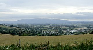
The Taieri Plain is an area of fertile agricultural land to the southwest of Dunedin, in Otago, New Zealand. The plain covers an area of some 300 square kilometres, with a maximum extent of 30 kilometres. It is not to be confused with Strath Taieri, a second plain of the Taieri River, 40kms to the north beyond Mount Ross.

The Kaiapoi River is a minor river of north Canterbury, in New Zealand's South Island. Originally called the Cam River, it is a tributary of the Waimakariri River, which it joins at the larger river's estuary. The river is 16 kilometres (10 mi) long, and its drainage area is about 430 square kilometres (170 sq mi).
The Barlow River is a river in the Westland district of the South Island of New Zealand. It is a tributary of the Perth River. The Barlow River is fed by the Barlow and Farrar Glacier. Its tributary North Barlow River is fed by the Escape and Siege Glacier. A smaller stream called Barlow Creek lies 1 kilometre (0.6 mi) west of the Barlow River.
The Gunn River is a river on the West Coast of New Zealand. It starts in the Price Range and flows east into the Whataroa River, which eventually drains into the Tasman Sea.
The Lambert River is a river of the West Coast Region of New Zealand's South Island. It flows north from the Lambert Glacier in the Southern Alps, joining with the Wanganui River 15 kilometres (9 mi) southeast of Harihari.

The Lawrence River is a river of inland Canterbury in New Zealand's South Island. One of the headwaters of the Rangitata River system, it flows south from its source north of Mount Arrowsmith, before joining with the Clyde River and Havelock River to become the Rangitata.
The Mowbray River is a river of the south Canterbury region of New Zealand's South Island. A short upper tributary of the Orari River, it flows north from its sources in the Four Peaks Range northeast of Fairlie.
The Oneone River is a short river of the West Coast Region of New Zealand's South Island. It is located northwest of Harihari, and reaches the Tasman Sea at the estuary of its larger northern neighbour, the Wanganui River.
The Otamatapaio River is a river in North Otago, New Zealand. It rises in the Hawkdun Range and flows north-eastward into Lake Benmore.
The Otiake River is a river in New Zealand, a tributary of the Waitaki River.

The Potts River is a river of the Canterbury region of New Zealand's South Island. It flows generally south from the southern end of the Arrowsmith Range through a steep-sided valley between the Potts Range to the west and the Big Hill Range to the east.
The Rotokino River is a short river of the West Coast Region of New Zealand's South Island. It flows south from Lake Rotokino, draining its waters to the Whataroa River.
The Smyth River is a river of the West Coast Region of New Zealand's South Island. It is an upper tributary of the Wanganui River, which it meets to the west of Mount Whitcombe.
The Te Rahotaiepa River is a river of the West Coast Region of New Zealand's South Island. It rises to the north of Lake Ianthe and flows parallel with the Tasman Sea coast along the edge of marshy ground for several kilometres to flow into the mouth of the Waitaha River.

The Tuke River is a river of the West Coast Region of New Zealand's South Island. It flows northwest from the Southern Alps, combining with the Dickson River to form the Mikonui River 15 kilometres southeast of Ross.

The Waitangiroto River is a river of the West Coast Region of New Zealand's South Island. It is approximately 15 km (9.3 mi) long, with its main source in the Waitangiroto swamp. It flows adjacent to the lower reaches of the Whataroa River and the Waitangitāhuna River. All three rivers enter the Tasman Sea northwest of the Okarito Lagoon.
The Whakaikai River is a short river of the West Coast Region of New Zealand's South Island. It flows generally northwest to reach the Tasman Sea five kilometres to the northwest of the mouth of the Wanganui River.
The Willberg River is a river of the West Coast Region of New Zealand's South Island. It initially flows northwest before turning southwest, reaching the Poerua River 12 kilometres south of Harihari.
The Dickson River is a river of the West Coast Region of New Zealand. It arises near the Dickson Pass in the Southern Alps and flows north-west. It joins the Tuke River and flows into the Mikonui River, which exits in the Tasman Sea near Ross.

Dixon Peak, previously known as Mount Dixon, is the 23rd highest peak in New Zealand, rising to a height of 3,004 metres (9,856 ft). It is located in the Southern Alps of the South Island in the Mackenzie District, within Aoraki / Mount Cook National Park, and only a short distance from its more illustrious neighbour Aoraki / Mount Cook. The mountain is a popular peak for climbers, and is used as a practice run for ascents of Cook.
References
"Place name detail: North Barlow River". New Zealand Gazetteer. New Zealand Geographic Board . Retrieved 12 July 2009.
43°18′S170°32′E / 43.300°S 170.533°E