Pleasant Flat

Last updated

Pleasant Flat
River flat
Pleasant Flat MRD 07.jpg
Coordinates: 44°00′30″S169°23′10″E / 44.00833°S 169.38611°E / -44.00833; 169.38611 Coordinates: 44°00′30″S169°23′10″E / 44.00833°S 169.38611°E / -44.00833; 169.38611
Offshore water bodies Haast River
Formed byLandsborough Glacier
Elevation
[1]
107 m (351 ft)

Pleasant Flat is an alluvial floodplain of the Haast River in the Haast Pass on New Zealand's South Island. A former stopping place for travellers crossing the pass before the building of the highway, it now has a campsite and picnic shelter. It has a notable view of Mount Hooker to the northeast.

Contents

Geography

Pleasant Valley is an alluvial floodplain created by the Haast River, in the Southern Alps of the South Island of New Zealand. It is approximately three kilometres (1.9 mi) upriver from the confluence of the Haast and Landsborough Rivers, and three kilometres north of the Gates of Haast. The flat is approximately 500 metres (550 yd) wide by over one kilometre (0.62 mi) long, and runs on a southwest-to-northeast axis. Despite being close to a major mountain pass, it is only 107 metres (351 ft) above sea level. [1]

The low valley of Pleasant Flat was carved out by an offshoot of the Landsborough Glacier in the last Ice Age. The Landsborough River is unusual in running parallel to the foot of the Southern Alps and flowing into the Haast River instead of heading directly to sea. When the river valley was filled by a glacier, it followed the same course but had to make a sharp western turn at Clarke Bluff to continue down the Haast Valley. One arm of the glacier continued straight and carved out the Burke River valley, Burke Flat, and Pleasant Flat, before travelling uphill and pushing over the Haast Pass to Makarora—the reason the pass is so low (563 m) compared to the Lewis Pass (907 m) and Arthur's Pass (920 m). [1]

A notable view from Pleasant Flat is the icefield of Mount Hooker (2640 m) to the northeast, at the head of the Clarke River, described by Andy Dennis as "one of the most glorious views of the Southern Alps from a main highway." [1]

History

Travellers across the Haast Pass would usually stay in small huts at Burke Flat, two kilometres (1.2 mi) upriver from Pleasant Flat. When the highway across the Pass was constructed, a bridge was built across the Haast River at Pleasant Flat (the middle bridge of three), and this became a natural stopping point. Today there is a Department of Conservation campsite at the Flat, with toilets, a picnic shelter, and a short forest walk along nearby Muir Creek. [1] In 2018, a cell tower was installed, powered by a 150 W wind turbine and 270 W solar panel. This was to create an island of cellular coverage between Haast and Lake Wānaka, allowing drivers to make other plans should Haast Pass be closed. [2]

Flora and fauna

The forest around Muir Creek is dominated by silver beech ( Nothofagus menziesii ). Common forest birds that can be observed are bellbirds ( Anthornis melanura ), grey warblers ( Gerygone igata ), tomtits ( Petroica macrocephala ), and long-tailed cuckoos ( Eudynamys taitensis ), while moreporks ( Ninox novaeseelandiae ) can be heard at night, and South Island oystercatchers ( Haematopus finschi ) will sometimes feed at the campsite. [3] The Haast and Lansborough valleys contain populations of kākā ( Nestor meridionalis ), yellow-crowned kākāriki ( Cyanoramphus auriceps ), and whio ( Hymenolaimus malacorhynchos ). [1]

Haast, in his 1863 crossing of the pass which later bore his name, noted that the nearby forests "were literally alive with woodhens and many kakapos". However, weka ( Gallirallus australis) are no longer common in southern Westland and kākāpō ( Strigops habroptilus ) are long gone from mainland New Zealand. [1] Explorer Charlie Douglas in 1899 recalled the former abundance of kākāpō on the river flats of the Landsborough Valley:

"The birds used to be in dozens around the camp, screeching and yelling like a lot of demons, and at times it was impossible to sleep for the noise…but alas this is a thing of the past, when last up the Landsbro there wasn't a bird to be found unless by going high up on the spurs." [4]

Related Research Articles

<span class="mw-page-title-main">Clutha River</span> River in the South Island of New Zealand

The Clutha River is the second longest river in New Zealand and the longest in the South Island. It flows south-southeast 338 kilometres (210 mi) through Central and South Otago from Lake Wānaka in the Southern Alps to the Pacific Ocean, 75 kilometres (47 mi) south west of Dunedin. It is the highest volume river in New Zealand, and the swiftest, with a catchment of 21,960 square kilometres (8,480 sq mi), discharging a mean flow of 614 cubic metres per second (21,700 cu ft/s). The river is known for its scenery, gold-rush history, and swift turquoise waters. A river conservation group, the Clutha Mata-Au River Parkway Group, is working to establish a regional river parkway, with a trail, along the entire river corridor.

<span class="mw-page-title-main">Lake Wānaka</span> Lake in Otago, New Zealand

Lake Wānaka is New Zealand's fourth-largest lake and the seat of the town of Wānaka in the Otago region. The lake is 278 meters above sea level, covers 192 km2 (74 sq mi), and is more than 300 m (980 ft) deep.

<span class="mw-page-title-main">Fiordland National Park</span> National park on South Island of New Zealand

Fiordland National Park occupies the southwest corner of the South Island of New Zealand. It is by far the largest of the 13 national parks in New Zealand, with an area of 12,607 square kilometres (4,868 sq mi), and a major part of the Te Wahipounamu World Heritage Site. The park is administered by the Department of Conservation.

<span class="mw-page-title-main">Jackson Bay</span> Body of water

Jackson Bay / Okahu is a gently curving 24 km bay on the southern West Coast of New Zealand's South Island. It faces the Tasman Sea to the north, and is backed by the Southern Alps. It contains the settlements of Hannahs Clearing, Waiatoto, Neils Beach, and the fishing village of Jackson Bay at its western end. The bay is the southernmost terminus of the West Coast's roads.

<span class="mw-page-title-main">Blue River (New Zealand)</span> River in the South Island of New Zealand

The Blue River is a small river in the South Island of New Zealand. It flows its entire length within the Mount Aspiring National Park, and although on the southeastern side of the main divide, the river is within the boundaries of the West Coast region for its entire length.

<span class="mw-page-title-main">Haast River</span> River of New Zealand

The Haast River / Awarua is a river on the West Coast of the South Island of New Zealand. The Māori name for the river is Awarua. It drains the western watershed of the Haast Pass. The Haast River is 100 kilometres (62 mi) in length, and enters the Tasman Sea near Haast township. The river's main tributary is the Landsborough River.

<span class="mw-page-title-main">Haast Pass</span> Mountain pass

Haast Pass / Tioripatea is a mountain pass in the Southern Alps of the South Island of New Zealand. Māori used the pass in pre-European times.

<span class="mw-page-title-main">Te Wahipounamu</span> UNESCO World Heritage Site

Te Wāhipounamu is a World Heritage Site in the south west corner of the South Island of New Zealand.

<span class="mw-page-title-main">Nelson Lakes National Park</span> National park in New Zealand

Nelson Lakes National Park is in the South Island of New Zealand, at the northern end of the Southern Alps. It was formed after the passing of the National Parks Act in 1952. It was created in 1956. The park contains beech forests, multiple lakes, snow-covered mountains and valleys created by glaciers during the ice ages.

Makarora is a small community within the Queenstown-Lakes District of the Otago region of the South Island of New Zealand.

<span class="mw-page-title-main">Makarora River</span> River in New Zealand

The Makarora River is in the Otago region of the South Island of New Zealand.

<span class="mw-page-title-main">Mount Aspiring National Park</span> National park in New Zealand

Mount Aspiring National Park is in the Southern Alps of the South Island of New Zealand, north of Fiordland National Park, situated in Otago and Westland regions. The park forms part of the Te Wahipounamu World Heritage site.

<span class="mw-page-title-main">Mount Aspiring / Tititea</span> Mountain in New Zealand

Mount Aspiring / Tititea is New Zealand's 23rd-highest mountain. It is the country's highest outside the Aoraki / Mount Cook region.

<span class="mw-page-title-main">Mātukituki River</span> River in the South Island of New Zealand

The Mātukituki River is a short braided river in the Southern Alps of New Zealand's South Island. Both its West Branch and East Branch originate from the Main Divide mountain ranges near Mount Aspiring / Tititea. Their largely glacier-fed waters each flow for approximately 20 kilometres (12 mi) before joining near Camerons Flat. After this confluence, the Mātukituki River leaves the boundaries of Mount Aspiring National Park and continues for another 30 kilometres (19 mi) to exit into Lake Wānaka at the lake's southwestern edge.

<span class="mw-page-title-main">Landsborough River</span> River in New Zealand

The Landsborough River is located in New Zealand's South Island. A major tributary of the Haast River, it flows southwest, parallel with the Southern Alps, for 50 kilometres from its source five kilometres north of Mount Hopkins to meet the Haast 12 kilometres below the Haast Pass.

<span class="mw-page-title-main">State Highway 6 (New Zealand)</span> Road in New Zealand

State Highway 6 is a major New Zealand state highway. It extends from the Marlborough region in the northeastern corner of the South Island across the top of the island, then down the length of the island, initially along the West Coast and then across the Southern Alps through inland Otago and finally across the Southland Plains to the island's south coast. Distances are measured from north to south.

<span class="mw-page-title-main">State Highway 83 (New Zealand)</span> Road in New Zealand

State Highway 83 (SH 83) is a South Island state highway in New Zealand running up the Waitaki Valley between the settlements of Pukeuri and Omarama. It forms part of the southernmost of the east–west roads crossing the South Island.

<span class="mw-page-title-main">Charlie Douglas</span> New Zealand surveyor and explorer

Charles Edward Douglas was a New Zealand surveyor and explorer, who came to be known as Mr. Explorer Douglas, owing to his extensive explorations of the West Coast of New Zealand and his work for the New Zealand Survey Department. He was awarded the Royal Geographical Society Gill Memorial Prize in 1897.

<span class="mw-page-title-main">Haast to Paringa Cattle Track</span> New Zealand tramping track

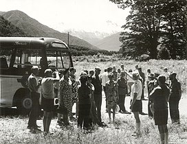
The historic Haast to Paringa Cattle Track is a trail through South Westland, New Zealand, constructed in 1875 to allow farmers in the Landsborough and Cascade Valley area to drive their cattle on an annual two-week journey to the sale yards in Whataroa. It was constructed as an inland loop to bypass the precipitious cliffs at Knights Point. For 90 years it was the only land access to the settlements of Haast and Jackson Bay, but the last mob of cattle was driven in 1961, and the construction of a highway connecting Paringa to Haast Pass in 1965 made it redundant. After falling into disuse, the cattle track was converted into a 33-kilometre (21 mi), three-day tramping track, opening in 1981. The track and its three huts are maintained by the New Zealand Department of Conservation.

<span class="mw-page-title-main">Roaring Billy Falls</span> Waterfall in Haast Pass, New Zealand

Roaring Billy Falls is a waterfall in Mount Aspiring National Park, Westland District, New Zealand. It is located in the Haast River valley, around 30 km (19 mi) inland from Haast, near Eighteen Mile Bluff on State Highway 6. The falls are a 30-metre-high (98 ft) cascade on The Roaring Billy stream. The bottom of the cascade is at an elevation of around 80 metres (262 ft) where it flows into the Haast River.

References

  1. 1 2 3 4 5 6 7 Andy Dennis (2007). South West New Zealand World Heritage Highway Guide: Hokitika to Wanaka (2nd ed.). Westport: Poutini Press. pp. 72–73. ISBN   978-0-473-12026-9. Wikidata   Q113503085.
  2. "New island of sustainable cell coverage on the winding route between Haast and Makarora at Pleasant Flat". Waka Kotahi NZ Transport Agency. 29 June 2018. Retrieved 13 August 2022.
  3. Kerry-Jayne Wilson (2017). West Coast Walking: A naturalist's guide (2nd ed.). Christchurch: Canterbury University Press. pp. 316–317. ISBN   978-1-927145-42-5. OL   29806566M. Wikidata   Q98762244.
  4. Pascoe, John (2000). Mr Explorer Douglas (Revised ed.). Christchurch: Canterbury University Press. p. 251. ISBN   0-908812-95-7.