
The Hollyford Track is a tramping track in New Zealand. Located at the northern edge of Fiordland, in the southwestern South Island, it is unusual among Fiordland's major tracks in that it is largely flat and accessible year-round. It follows the Hollyford River which in turn follows the course of the Hollyford Valley.
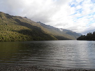
Lake Alabaster / Wāwāhi Waka, also known by the Māori name of Waiwahuika, lies at the northern end of Fiordland, in the southwest of New Zealand's South Island. The lake runs from northeast to southwest, is five kilometres (3.1 mi), and covers seven km2 (2.7 sq mi).
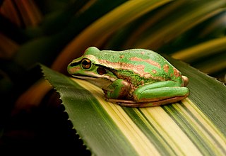
The green and golden bell frog, also named the green bell frog, green and golden swamp frog and green frog, is a species of ground-dwelling tree frog native to eastern Australia. Despite its classification and climbing abilities, it does not live in trees and spends almost all of its time close to ground level. It can reach up to 11 cm (4.5 in) in length, making it one of Australia's largest frogs.

Joshua Jon Pyke is an Australian singer-songwriter, producer, musician and children's book author.
The Otago Province was a province of New Zealand until the abolition of provincial government in 1876. The capital of the province was Dunedin. Southland Province split from Otago in 1861, but became part of the province again in 1870.
Stuart Pyke is an English sports journalist and broadcaster.
Michael Pyke is a Canadian retired dual-code football player, who was a professional Australian rules footballer with the Sydney Swans in the Australian Football League (AFL).
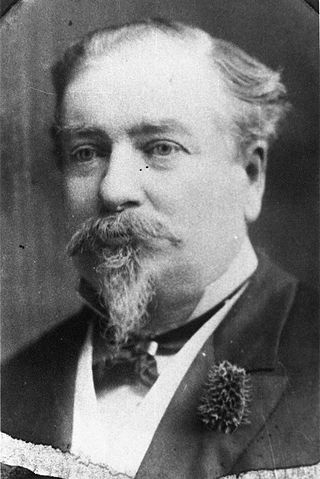
Vincent Pyke, born Vincent Pike, was a 19th-century politician in Otago, New Zealand and Victoria, Australia.
Dunstan was a parliamentary electorate in the Otago region of New Zealand, from 1871 to 1890.
Tuapeka is a former parliamentary electorate in the Otago region of New Zealand, from 1871 to 1911.
Wakatipu was a parliamentary electorate in the Otago region of New Zealand, from 1871 to 1928.
The Barrier River is a river in the Mount Aspiring National Park in northern Southland, New Zealand. It is a tributary of the Pyke River, which it enters about 1 kilometre (0.6 mi) south of Lake Wilmot. The Barrier River is fed by three glaciers and ice fields:
The Dry Awarua River is a river of northern Fiordland, New Zealand. It rises in the McKenzie Range and flows south and then westward into the Waiuna Lagoon. The Lagoon then discharges into the Awarua River, which flows into Big Bay, also known as Awarua Bay. The Pyke - Big Bay tramping track crosses the Dry Awarua River.

The Olivine River is a river in northern Fiordland, New Zealand, located in Mount Aspiring National Park. It rises north of the Cow Saddle and flows north, then north-west over Olivine Falls to become a tributary of the Pyke River near Olivine Hut. The Five Passes hiking (tramping) trail passes through the upper river near Cow Saddle. The Dun Mountain Ophiolite Belt which is rich in the mineral olivine outcrops extensively in the Olivine River and its tributaries.

The Pyke River is a river in the south west of New Zealand's South Island. It flows generally south into Lake Wilmot then Lake Alabaster, before becoming a tributary of the Hollyford River.
James Kendrick Pyke is a former Australian sportsman who represented South Australia in Sheffield Shield cricket and also played Australian rules football at a high level. As well as competing for Norwood in the South Australian National Football League (SANFL), Pyke was twice drafted to the Victorian Football League, although he never played a senior game.
The 1894 Tuapeka by-election was a by-election held on 9 July 1894 during the 12th New Zealand Parliament in the rural lower South Island electorate of Tuapeka.
The 1873 Wakatipu by-election was a by-election held on 19 August 1873 in the Wakatipu electorate during the 5th New Zealand Parliament.
The 1975 New Zealand bravery awards were announced via a Special Honours List dated 27 June 1975, and recognised three people for acts of bravery earlier that year.


