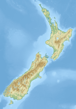
Fiordland is a geographical region of New Zealand in the south-western corner of the South Island, comprising the westernmost third of Southland. Most of Fiordland is dominated by the steep sides of the snow-capped Southern Alps, deep lakes, and its steep, glacier-carved and now ocean-flooded western valleys. The name "Fiordland" comes from a variant spelling of the Scandinavian word for this type of steep valley, "fjord". The area of Fiordland is dominated by, and very roughly coterminous with, Fiordland National Park, New Zealand's largest National Park.

Fiordland National Park is a national park in the south-west corner of South Island of New Zealand. It is the largest of the 13 national parks in New Zealand, with an area covering 12,607 km2 (4,868 sq mi), and a major part of the Te Wāhipounamu a UNESCO World Heritage Site established in 1990. The park is administered by the Department of Conservation. The southern ranges of the Southern Alps cover most of Fiordland National Park, combined with the deep glacier-carved valleys.

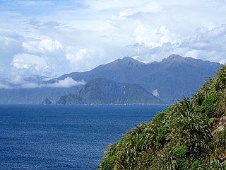
Resolution Island or Tau Moana (Māori) is the largest island in the Fiordland region of southwest New Zealand, covering a total of 208 km2 (80 sq mi). It is the country's seventh largest island, and the second largest uninhabited island. Resolution Island is separated from the mainland of the South Island by Tamatea / Dusky Sound, Te Puaitaha / Breaksea Sound, and Acheron Passage. The island is part of the Fiordland National Park.

Tamatea / Dusky Sound is a fiord on the southwest corner of New Zealand, in Fiordland National Park.

Secretary Island is an island in southwestern New Zealand, lying entirely within Fiordland National Park. Roughly triangular in shape, it lies between Doubtful Sound / Patea in the south and Te Awa-o-Tū / Thompson Sound in the north, with its west coast facing the Tasman Sea. To the east of the island, Pendulo Reach connects Te Awa-o-Tū / Thompson Sound with Doubtful Sound / Patea. Steeply sloped, the entirely bush-clad island rises to a chain of several peaks higher than 1000 metres. The highest of these is the 1,196-metre (3,924 ft) Mount Grono, the highest peak in the main New Zealand chain not located in the North or South Island. The island also contains three lakes. The largest, Secretary Lake, over 600 metres (2,000 ft) long, is located beneath Mount Grono at an altitude of 550 metres (1,800 ft).

West Cape is the westernmost point in the main chain of islands of New Zealand. It is located in the far southwest of the South Island, within Fiordland National Park, between Tamatea / Dusky Sound and Taiari / Chalky Inlet. The cape consists of a small rocky shore and low forest-covered sloping land, and is located just north of the Newton River mouth.
Chalky Island or Te Kākahu-o-Tamatea is an island in the southwest of New Zealand, and is part of Fiordland National Park. It lies at the entrance to Taiari / Chalky Inlet, next to Rakituma / Preservation Inlet, at the southwestern tip of the South Island, 10 kilometres (6 mi) northwest of Puysegur Point, 15 kilometres (9 mi) southeast of West Cape, and 140 kilometres (87 mi) west of Invercargill. Chalky Island is one of the predator-free islands that is part of the Fiordland Islands restoration programme. The programme's focus is to eradicate pests and translocate native species.

Anchor Island is an island in Dusky Sound in Fiordland.

Rakituma / Preservation Inlet is the southernmost fiord in Fiordland National Park and lies on the southwest corner of the South Island of New Zealand. With an area of 93 square kilometres (36 sq mi), it is the fourth largest fiord in New Zealand, after Tamatea / Dusky Sound, Doubtful Sound / Patea, and the neighbouring Taiari / Chalky Inlet to the north. Rakituma was briefly the site of an attempted fishing and gold mining settlement at Cromarty during the 19th century, however this was quickly abandoned once the level of gold declined in relation to more promising fields elsewhere.

The Wilmot Pass is a 671 m (2,201 ft) high pass on the main divide of New Zealand's South Island. It connects Doubtful Sound, a deep indentation in the coast of Fiordland, to the valley of the West Arm of Lake Manapouri. The pass is named after E. H. Wilmot, a former surveyor-general of New Zealand, who had noted it while surveying the area in 1897. It lies between Mount Wilmot and Mount Mainwaring. On the east side the Spey River drains to Lake Manapouri and on the west side the Lyvia River drains to Deep Cove.
Breaksea Island is a rugged 1.6 km2 (1 sq mi) island in the southwest of New Zealand, and is part of Fiordland National Park. Its highest point is 350 m (1,148 ft) asl and it lies about 2 km (1.2 mi) from the mainland in the entrance to Te Puaitaha / Breaksea Sound, north of the much larger Resolution Island. It is covered in temperate rainforest and was the site of one of the first successful campaigns to eradicate rats from a sizeable island.

Bauza Island lies immediately south of the much larger Secretary Island in the outer reaches of Doubtful Sound / Patea, in Fiordland National Park on New Zealand's South Island. The less than one kilometre wide Patea passage to the south of the island is the main entrance to Doubtful Sound. To the north, the island is separated from Secretary Island by the narrow Te Awaatu Channel, also referred to as "The Gut", only 200 metres (660 ft) wide at its narrowest point. The waters between the two islands are protected by the Te Awaatu Channel Marine Reserve. Doubtful Sound tour boats routinely travel through this channel.

Cooper Island, or Ao-ata-te-pō is an island in Fiordland, in the southwest of New Zealand's South Island. It lies within Tamatea / Dusky Sound, east of Long Island. The island is part of Fiordland National Park and is the third-largest island in the park with no possums present.

Great Island is an island in the southwest of New Zealand, and is part of Fiordland National Park. It lies in Taiari / Chalky Inlet, north of Chalky Island and contains two small lakes, Lake Dobson and Lake Esau.

Indian Island is an island in Dusky Sound in Fiordland. Its name stems from first sightings of indigenous people on the island by James Cook in 1773.
Taiari / Chalky Inlet is one of the southernmost fiords in Fiordland, in the southwestern corner of New Zealand's South Island and part of Fiordland National Park. As with the neighbouring fiords of Tamatea / Dusky Sound to the north and Rakituma / Preservation Inlet to the south, Taiari / Chalky Inlet is a complex fiord with many channels and islands along its roughly 28 km (17 mi) length. Most notably, this includes the sections Moana-whenua-pōuri / Edwardson Sound and Te Korowhakaunu / Kanáris Sound, which split at Divide Head in the middle of Taiari and each extend for roughly 10 km (6.2 mi) inland in a V-shape.

RealNZ is a New Zealand tourism company based in Queenstown. The company offers a range of travel, cruises and excursions in Queenstown, Milford Sound / Piopiotahi, Te Anau, Fiordland and Stewart Island / Rakiura. It also operates two skifields Cardrona Alpine Resort, and Treble Cone, and the International Antarctic Centre in Christchurch. The company is the successor of a series of acquisitions in the South Island tourist sector over more than 60 years. The brand RealNZ was launched in October 2021 to bring together multiple brands and businesses including Real Journeys that were previously part of the Wayfare Group, although some of the businesses have retained individual branding.

Taumoana Marine Reserve is a marine reserve covering an area of 464 hectares in Fiordland on New Zealand's South Island. It was established in 2005 and is administered by the Department of Conservation. It is located next to the Five Fingers Peninsula, at the entrance to Tamatea / Dusky Sound.
Te Awaatu Channel Marine Reserve is a marine reserve covering an area of 93 hectares in Fiordland on New Zealand's South Island. It was established in 1993 and is administered by the Department of Conservation.