
Fiordland is a geographical region of New Zealand in the south-western corner of the South Island, comprising the westernmost third of Southland. Most of Fiordland is dominated by the steep sides of the snow-capped Southern Alps, deep lakes, and its steep, glacier-carved and now ocean-flooded western valleys. The name "Fiordland" comes from a variant spelling of the Scandinavian word for this type of steep valley, "fjord". The area of Fiordland is dominated by, and very roughly coterminous with, Fiordland National Park, New Zealand's largest National Park.

Lake Wakatipu is an inland lake in the South Island of New Zealand. It is in the southwest corner of the Otago region, near its boundary with Southland. Lake Wakatipu comes from the original Māori name Whakatipu wai-māori.

Lake Benmore is New Zealand's largest artificial lake. Located in the South Island of New Zealand and part of the Waitaki River, it was created in the 1960s by construction of Benmore Dam.

Te Awarua-o-Porirua Harbour, commonly known as Porirua Harbour, is a natural inlet in the south-western coast of the North Island of New Zealand.
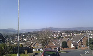
Gaer is a community and electoral district ("ward") of the city of Newport, South Wales.

Blown Away is a 1994 American action thriller film directed by Stephen Hopkins and starring Jeff Bridges, Tommy Lee Jones, Forest Whitaker, Suzy Amis, and Lloyd Bridges, and follows a Boston bomb squad member pursuing an Irish bomber, who recently escaped from prison and is targeting the other bomb squad members. The film was distributed and financed by MGM, a studio which was in financial difficulty at the time. The head of the studio was former Paramount executive Frank Mancuso Sr.
Maesglas or Maes-glas is a neighbourhood in the south west of the city of Newport, South Wales. In the 16th century it was recorded as Greenfield but the Welsh language name Maesglas has remained the more widely used, among English speakers.

Gelligaer is a community in the County Borough of Caerphilly, Wales, in the Rhymney River valley. As well as the village of Gelligaer, the community also includes the small towns of Hengoed and Ystrad Mynach. The population of the community at the 2011 census was 18,408.

Y Gaer is a municipal structure in Glamorgan Street, Brecon, Powys, Wales. The complex, which includes a museum, an art gallery and a library and incorporates a structure which was once the shire hall for Brecknockshire, is a Grade II* listed building.

Y Gaer is a Roman fort situated near modern-day Brecon in Mid Wales, United Kingdom. Y Gaer is located at grid reference SO00332966.

Moel y Gaer is an Iron Age hillfort at the northern end of the Clwydian Range, located on a summit overlooking the valley of the River Wheeler, near the village of Bodfari, Denbighshire, Wales, five miles north-east of Denbigh. The site is a scheduled monument, classified as a prehistoric defensive hillfort.

Felice D. Gaer is an American human rights defender and advocate. She has worked on human rights matters and was a longstanding member and the former chair of the United States Commission on International Religious Freedom. She is a member of the US National Commission to UNESCO.
The Waingaro River is a river of the Waikato region of New Zealand's North Island. It flows generally southwest from its origins near Glen Afton and Glen Massey, west of Ngāruawāhia, to reach a northern arm of Raglan Harbour. Its main tributary is Kahuhuru Stream, which Highway 22 follows for several kilometres. Tributaries total about 170 kilometres (110 mi). At Waingaro it is fed by a hot spring.

State Highway 12 is a New Zealand state highway in the far north of the North Island. It connects with SH 1 at both its northern and southern end. It runs close to the west coast of the Northland Region of New Zealand.

Kaikiekie / Bradshaw Sound is one of the larger New Zealand fiords. It is one of the sub fiords/arms that make up the Doubtful Sound/Thompson Sound complex and forms the northernmost of the blind or dead end fiords in this system.
Dolygaer railway station was a station serving the hamlet of Dol-y-gaer and the area adjacent to Pen-twyn Reservoir in Powys, Wales.

Charles Sound is a fiord of the South Island of New Zealand. It is one of the fiords that form the coast of Fiordland.
Kutu Parera Marine Reserve is a marine reserve covering an area of 433 hectares at Gaer Arm in the Bradshaw Sound of Fiordland on New Zealand's South Island. It was established in 2005 and is administered by the Department of Conservation.


