
The North Island is one of the two main islands of New Zealand, separated from the larger but less populous South Island by Cook Strait. With an area of 113,729 km2 (43,911 sq mi), it is the world's 14th-largest island, constituting 43% of New Zealand's land area. It has a population of 3,997,300, which is 77% of New Zealand's residents, making it the most populous island in Polynesia and the 28th-most-populous island in the world.

The Tasman Sea is a marginal sea of the South Pacific Ocean, situated between Australia and New Zealand. It measures about 2,000 km (1,200 mi) across and about 2,800 km (1,700 mi) from north to south. The sea was named after the Dutch explorer Abel Janszoon Tasman, who in 1642 was the first known person to cross it. British explorer Lieutenant James Cook later extensively navigated the Tasman Sea in the 1770s during his three voyages of exploration.
Cook Strait is a strait that separates the North and South Islands of New Zealand. The strait connects the Tasman Sea on the northwest with the South Pacific Ocean on the southeast. It is 22 kilometres (14 mi) wide at its narrowest point, and is considered one of the most dangerous and unpredictable waters in the world. Regular ferry services run across the strait between Picton in the Marlborough Sounds and Wellington.

HMS Endeavour was a British Royal Navy research vessel that Lieutenant James Cook commanded to Tahiti, New Zealand and Australia on his first voyage of discovery from 1768 to 1771.

Hawke Bay, formerly named Hawke's Bay, is a large bay on the east coast of the North Island of New Zealand, surrounded by the Hawke's Bay region. It stretches from Māhia Peninsula in the northeast to Cape Kidnappers / Te Kauwae-a-Māui in the southwest, a distance of some 90 kilometres (56 mi).
In Polynesian mythology, Hawaiki is the original home of the Polynesians, before dispersal across Polynesia. It also features as the underworld in many Māori stories.
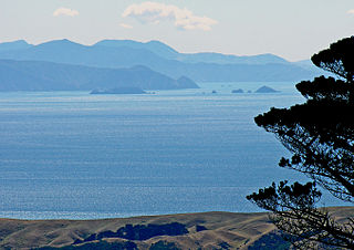
The Bay of Islands is an area on the east coast of the Far North District of the North Island of New Zealand. It is one of the most popular fishing, sailing and tourist destinations in the country, and has been renowned internationally for its big-game fishing since American author Zane Grey publicised it in the 1930s. It is 60 km (37 mi) north-west of the city of Whangārei. Cape Reinga, at the northern tip of the country, is about 210 km (130 mi) by road further to the north-west.
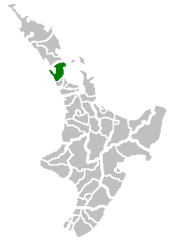
Rodney District was a local government area in the northernmost part of New Zealand's Auckland Region from 1989 to 2010. It included Kawau Island. It was created from the amalgamation of Helensville Borough and Rodney County in 1989. The seat of Rodney District Council was at Orewa. Rodney District and Rodney County each took their names from Cape Rodney, which Captain James Cook named on 24 November 1769 after Admiral Sir George Brydges Rodney.

East Cape is the easternmost point of the main islands of New Zealand. It is at the northern end of the Gisborne District of the North Island. East Cape was originally named "Cape East" by British explorer James Cook during his 1769–1779 voyage. It is one of four New Zealand cardinal capes he named, along with North Cape, West Cape and South Cape.

Jean-François Marie de Surville was a merchant captain with the French East India Company. He commanded a voyage of exploration to the Pacific in 1769–70.

Cape Egmont, splitting Northern and Southern Taranaki Bights, is the westernmost point of Taranaki, on the west coast of New Zealand's North Island. It is located close to the volcanic cone of Mount Taranaki or Mount Egmont.

Cape Turnagain is a prominent headland on the east coast of New Zealand's North Island, part way between Hawke Bay and Cook Strait, between the mouths of the Porangahau and Ākitio Rivers.

Cape Kidnappers, known in Māori as Te Kauwae-a-Māui and officially gazetted as Cape Kidnappers / Te Kauwae-a-Māui, is a headland at the southeastern extremity of Hawke's Bay on the east coast of New Zealand's North Island and sits at the end of an 8 kilometres (5.0 mi) peninsula which protrudes into the Pacific Ocean. It is 20 kilometres (12 mi) south-east of the city of Napier. Access to the cape by road stops at Clifton, which is the departure point for many tourists visiting the gannet colony. The Cape Kidnappers Golf Course lies between the headland and the nearby coastal community of Te Awanga.

North Cape / Otou is the northernmost point of New Zealand's main islands. At the northeastern tip of the Aupōuri Peninsula, the cape lies 30 kilometres (19 mi) east and three kilometres (1.9 mi) north of Cape Reinga. The name North Cape is sometimes used to refer just to the cape that is known in Māori as Otou and which overlooks Murimotu Island, and sometimes just to the eastern point of Murimotu Island. It is also used to refer to the whole larger headland stretching about five kilometres from Murimotu Island westwards to Kerr Point and including the Surville Cliffs. Statistics New Zealand uses a statistical area called North Cape for population data, extending south down the Aupōuri Peninsula to the Houhora Heads.

Cape Terawhiti is the southwesternmost point of the North Island of New Zealand.

South Cape / Whiore is a cape marking the southernmost point of Stewart Island / Rakiura, and by extension the main New Zealand archipelago. It is one of the four Cardinal Capes of New Zealand identified by Captain James Cook on his first voyage, along with North Cape, Cape East and West Cape. Cook originally named the place "Cape South". At the time, Cook incorrectly charted the island as a peninsula attached to the South Island of New Zealand, with a narrow isthmus in place of Foveaux Strait. South Cape is also one of the world's five Great Capes, along with capes in South America, Africa, and Australia.

The first voyage of James Cook was a combined Royal Navy and Royal Society expedition to the south Pacific Ocean aboard HMS Endeavour, from 1768 to 1771. It was the first of three Pacific voyages of which James Cook was the commander. The aims of this first expedition were to observe the 1769 transit of Venus across the Sun, and to seek evidence of the postulated Terra Australis Incognita or "undiscovered southern land".
The first humans are thought to have arrived in New Zealand from Polynesia some time around 1300 AD. The people, who later became known as Māori, eventually travelled to almost every part of the country. Their arrival had a significant impact on the local fauna, particularly the flightless birds such as moa.

The Bay of Plenty is a large bight along the northern coast of New Zealand's North Island. It stretches 260 kilometres (160 mi) from the Coromandel Peninsula in the west to Cape Runaway in the east. Called Te Moana-a-Toi in the Māori language after Toi, an early ancestor, the name 'Bay of Plenty' was bestowed by James Cook in 1769 when he noticed the abundant food supplies at several Māori villages there, in stark contrast to observations he had made earlier in Poverty Bay.
Early Polynesian explorers reached nearly all Pacific islands by 1200 CE, followed by Asian navigation in Southeast Asia and the West Pacific. During the Middle Ages, Muslim traders linked the Middle East and East Africa to the Asian Pacific coasts, reaching southern China and much of the Malay Archipelago. Direct European contact with the Pacific began in 1512, with the Portuguese encountering its western edges, soon followed by the Spanish arriving from the American coast.

