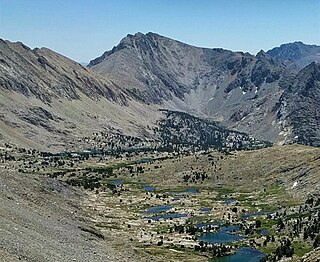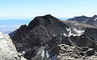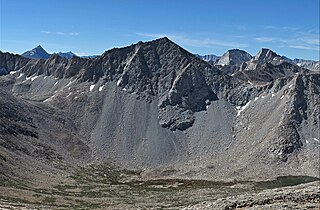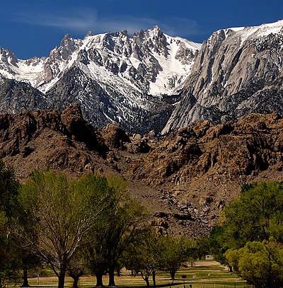
Mount Williamson, at an elevation of 14,379 feet (4,383 m), is the second-highest mountain in both the Sierra Nevada range and the state of California, and the sixth-highest peak in the contiguous United States.

Mount Sill is one of the fourteeners of the Sierra Nevada in California. It is located in the Palisades, a group of prominent rock peaks with a few small glaciers on their flanks. Mount Sill is located 0.6 miles (1 km) east of North Palisade, the high point of the group. The two peaks are connected by a high, rocky ridge, on the north side of which lies the Palisade Glacier. Mount Sill lies on the main Sierra Crest, but is at a point where the crest turns sharply, giving it particularly striking summit views. On one side is Kings Canyon National Park and Fresno County; on the other is the John Muir Wilderness, Inyo National Forest and Inyo County.

Mount Russell is a peak in the Sierra Nevada mountain range in the U.S. state of California, about 0.8 miles (1.3 km) north of Mount Whitney. With an elevation of 14,094 feet (4,296 m) it is the seventh-highest peak in the state.

Split Mountain is a fourteener in the Sierra Nevada of the U.S. state of California, near the southeast end of the Palisades group of peaks. It is the only fourteener in the watershed of the South Fork Kings River, and rises to 14,064 ft (4,287 m), making it the eighth-highest peak in the state.

The Palisades are a group of peaks in the central part of the Sierra Nevada in the U.S. state of California. They are located about 12 miles (19 km) southwest of the town of Big Pine, California. The peaks in the group are particularly steep, rugged peaks and "contain the finest alpine climbing in California." The group makes up about 6 miles (10 km) of the Sierra Crest, which divides the Central Valley watershed from the Owens Valley, and which runs generally northwest to southeast.

Mount Morgan is a mountain located in northwestern Inyo County, California, in the John Muir Wilderness of the Inyo National Forest.

Mount Keith is a mountain on the crest of California's Sierra Nevada, between Mount Bradley to the north, and Junction Peak to the southwest. Its north and west facing slopes feed the Kings River watershed by way of Bubbs Creek, and its east and south slopes feed the Owens River via Shepherd Creek. By the same dividing line, Keith stands on the boundary of Kings Canyon National Park to the northwest, and the John Muir Wilderness to the southeast. It is a thirteener, a mountain which has a height over 13000 feet.

Mount Mallory is a mountain located in the Sierra Nevada of California. The boundary between Inyo National Forest and Sequoia National Park runs across the summit. The peak was named in memory of George H. Leigh Mallory, of the 1924 British Mount Everest expedition, who was lost on Mount Everest, June, 1924. Norman Clyde advanced Mallory's and Andrew Irvine's names following their loss after attaining the highest altitude reached by a mountain climber.

Independence Peak is an 11,742-foot-elevation (3,579-meter) mountain summit located one mile east of the crest of the Sierra Nevada mountain range, in Inyo County of northern California. It is situated immediately south of Onion Valley on the eastern boundary of John Muir Wilderness, on land managed by Inyo National Forest. It is also 8 miles (13 km) west-southwest of the community of Independence, and 1.9 miles (3.1 km) northeast of parent University Peak. Topographic relief is significant as the north aspect rises 3,600 feet above Onion Valley in one mile. Independence Peak can be climbed via the north slope from Onion Valley. The first ascent of the summit was made in 1926 by Norman Clyde, who is credited with 130 first ascents, most of which were in the Sierra Nevada. He climbed this peak three times in 1926, and twice in 1927. He was principal of the high school in Independence from 1924 to 1928, which provided him access to this nearest peak to his home.

Colosseum Mountain is a 12,473-foot-elevation double summit mountain located on the crest of the Sierra Nevada mountain range in northern California. It is situated on the common border of Fresno County with Inyo County, as well as the shared boundary of John Muir Wilderness and Kings Canyon National Park. It is 12 miles (19 km) northwest of the community of Independence, 1.2 miles (1.9 km) east of Mount Cedric Wright, 2.6 miles (4.2 km) west of Sawmill Point, and 1.6 miles (2.6 km) south-southeast of Mount Perkins, the nearest higher neighbor. The lower east summit is 12,451-feet in elevation and marked as Colosseum Mountain on maps, but the 12,473-foot west summit is higher. Approximately 1,000 feet distance separate the two summits. The John Muir Trail passes to the west of this peak, providing an approach to the mountain. The first ascent of the summit was made August 5, 1922, by Chester Versteeg, a prominent Sierra Club member, via the southwest face.

Kearsarge Peak is a 12,620-foot (3,847 m) mountain located less than two miles east of the crest of the Sierra Nevada mountain range, in Inyo County in northern California. It is situated immediately northwest of Onion Valley in the John Muir Wilderness, on land managed by Inyo National Forest. It is also 8.5 miles (13.7 km) west of the community of Independence, and 2.1 miles (3.4 km) north-northwest of Independence Peak. Topographic relief is significant as the east aspect rises 5,250 feet above Onion Valley in two miles.

Mount Corcoran is a 13,701-foot (4,176 m) mountain summit located on the crest of the Sierra Nevada mountain range in California. It is situated on the boundary between Tulare County and Inyo County, as well as the boundary between Sequoia National Park and John Muir Wilderness. It is 12 miles (19 km) west-southwest of the community of Lone Pine, 3.6 miles (5.8 km) southeast of Mount Whitney, 1.2 miles (1.9 km) northwest of Mount Langley, and 0.23 miles (0.37 km) immediately south of Mount Le Conte, the nearest higher neighbor. Topographic relief is significant as it rises approximately 1,800 feet above Iridescent Lake in one-half mile.

Mount Tinemaha is a 12,520-foot-elevation (3,820-meter) mountain summit located east of the crest of the Sierra Nevada mountain range, in Inyo County of northern California. It is situated on the eastern boundary of the John Muir Wilderness, on land managed by Inyo National Forest. It is 1.3 mile southeast of Tinemaha Lake, and 1.8 mile northeast of parent Split Mountain. Topographic relief is significant as the east aspect rises 5,900 feet above Owens Valley in two miles.

Cirque Peak is a 12,900-foot-elevation (3,900-meter) mountain summit located on the crest of the Sierra Nevada mountain range in California. It is situated on the common border of Tulare County with Inyo County, as well as the shared boundary of Golden Trout Wilderness and John Muir Wilderness, on land managed by Inyo National Forest. It is 14 miles (23 km) southwest of the community of Lone Pine, 7.7 miles (12.4 km) south-southeast of Mount Whitney, and 3.2 miles (5.1 km) south of Mount Langley, the nearest higher neighbor. Cirque Peak is the highest point of the Golden Trout Wilderness, and ranks as the 175th highest peak in California. Topographic relief is significant as it rises 1,800 feet above Cirque Lake in approximately one mile. The Pacific Crest Trail traverses the southwest slope of this mountain, providing an approach option. The mountain was apparently named in 1890 by Joseph Nisbet LeConte and companions who noted the remarkable cirque on the north aspect.

Trojan Peak is a 13,947-foot-elevation (4,251-meter) mountain summit located along the crest of the Sierra Nevada mountain range in Inyo County, California. It is situated in the John Muir Wilderness, on land managed by Inyo National Forest. It is 15 miles (24 km) west-northwest of the community of Lone Pine, 0.7 miles (1.1 km) southeast of Mount Versteeg, and one mile (1.6 km) south-southwest of Mount Williamson, the nearest higher neighbor. Trojan Peak is rankeds as the 16th highest peak in California. Topographic relief is significant as it rises 1,427 feet above Lake Helen of Troy in approximately one-half mile.

Mount Johnson is a 12,871-foot-elevation mountain summit located on the crest of the Sierra Nevada mountain range in California, United States. It is situated on the boundary between Kings Canyon National Park and John Muir Wilderness, and along the county line between Fresno County and Inyo County. It is also 18 miles (29 km) west of the community of Big Pine, 0.9 miles (1.4 km) southeast of Mount Gilbert, and one mile (1.6 km) west-northwest of Mount Goode. Mount Johnson ranks as the 187th-highest summit in California. Topographic relief is significant as the southwest aspect rises 3,670 feet above LeConte Canyon in 1.5 mile, and the north aspect rises 3,100 feet above South Lake in 2.5 miles.

Mount Starr, elevation 12,835 feet (3,912 m), is a mountain summit located on the crest of the Sierra Nevada mountain range in northern California, United States. It is situated in the John Muir Wilderness on the common boundary shared by Sierra National Forest with Inyo National Forest, and along the common border of Fresno County with Inyo County. It is bound on the east by Little Lakes Valley, and is 0.8 mile northeast of Mono Pass. Topographic relief is significant as the summit rises 2,300 feet above Little Lakes Valley in approximately one-half mile (0.80 km). Neighbors include Mount Abbot, three miles to the south-southwest, Mount Morgan, 2.5 miles to the southeast, and Pointless Peak is 2.5 miles to the north.

Four Gables, elevation 12,776 feet (3,894 m), is a mountain summit located on the crest of the Sierra Nevada mountain range in northern California, United States. It is situated in the John Muir Wilderness on the common boundary shared by Sierra National Forest with Inyo National Forest, and along the common border of Fresno County with Inyo County. Topographic relief is significant as the summit rises 2,800 feet above Horton Lake in approximately 1.5 miles (2.4 km). Neighbors include Basin Mountain, two miles to the east-southeast, Mount Tom, three miles to the northeast, and Merriam Peak, four miles to the west. The nearest community is Bishop, California, 17 miles to the east.

Mount Julius Caesar is a 13,213-foot-elevation mountain summit located on the crest of the Sierra Nevada mountain range in northern California, United States. It is situated in the John Muir Wilderness on the boundary that Sierra National Forest shares with Inyo National Forest, and along the common border shared by Fresno County with Inyo County. It is one mile southwest of line parent Bear Creek Spire, and 22 miles (35 km) west of the community of Bishop. Italy Pass is one-half mile immediately south of the summit, and Granite Park lies to the southeast. Mount Julius Caesar ranks as the 106th-highest summit in California. Topographic relief is significant as the summit rises 2,000 feet above Lake Italy in 0.7 miles (1.1 km).

Sawmill Point is a 9,429-foot-elevation (2,874 meter) mountain summit located in Inyo County, California. It is situated 2.6 miles east of the crest of the Sierra Nevada mountain range, in the John Muir Wilderness, on land managed by Inyo National Forest. It is also 10.5 miles (16.9 km) northwest of the community of Independence, and 2.6 miles (4.2 km) east of proximate parent Colosseum Mountain. Topographic relief is significant as the summit rises 4,770 feet above Owens Valley in two miles. The Sawmill Pass Trail traverses the east and south slopes of the peak, providing an approach option, and access to the John Muir Trail.


