| Mount Thompson | |
|---|---|
 North aspect, centered | |
| Highest point | |
| Elevation | 13,494 ft (4,113 m) [1] |
| Prominence | 1,054 ft (321 m) [1] |
| Parent peak | Mount Fiske (13,503 ft) [2] |
| Isolation | 3.02 mi (4.86 km) [2] |
| Listing | Sierra Peaks Section |
| Coordinates | 37°08′34″N118°36′49″W / 37.1428824°N 118.6136118°W [3] |
| Naming | |
| Etymology | Almon Harris Thompson |
| Geography | |
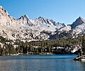
 Mount Thompson Location in California  Mount Thompson Mount Thompson (the United States) | |
| Location | Kings Canyon National Park Fresno County / Inyo County California, U.S. |
| Parent range | Sierra Nevada [1] |
| Topo map | USGS Mount Thompson |
| Geology | |
| Rock type | granite |
| Climbing | |
| First ascent | 1909 |
| Easiest route | class 2 [2] |
Mount Thompson is a 13,494-foot-elevation (4,113-meter) mountain summit located on the crest of the Sierra Nevada mountain range in California, United States. [3] It is situated on the shared boundary of Kings Canyon National Park with John Muir Wilderness, and along the common border of Fresno County with Inyo County. It is also 18 miles (29 km) west of the community of Big Pine, one mile northwest of Mount Gilbert, and three miles east of Mount Fiske, which is the nearest higher neighbor. Mount Thompson ranks as the 62nd-highest summit in California. [2] This mountain's name commemorates Almon Harris Thompson (1839–1906). [4] The first ascent of the peak was made by Clarence H. Rhudy and H. F. Katzenbach in the summer of 1909. [5]