Varkala, IPA: [ʋar̥kala] is a major coastal municipality situated in the northern suburb of Trivandrum, capital city of the Indian state of Kerala. It is the headquarters of Varkala Taluk and important government institutions such as the taluk office, court complex, office of the Deputy Superintendent of Police, Legal Metrology Inspector office, Excise Circle and Range office, RTO, Treasury and Mini civil station are situated in here. It is one among the oldest municipalities of Kerala established on 1980.

Balussery is a town located about 25 km northeast of Kozhikode city and lies on the side of State Highway 34. It is one of the 12 block Panchayats in Kozhikode district. Balussery is the Northeast side entry of Calicut city.

Thunchan Parambu or Thunchan Memorial Trust and Research Centre is a place in Tirur, Kerala, South India.
Memunda is a small village near Vatakara town in Kozhikode district of Kerala, south India.

Thikkodi is a small village near Koyilandy in Kozhikode district of Kerala state, south India. Thikkodi is famous for a coconut nursery, which is 100 years old. The nearest city is Kozhikode, which is 35 km from this village.

Ponkunnam is a census town in Kerala, India, part of Kottayam district under Kanjirappally taluk. Ponkunnam literally means golden mountain (ponn = gold, kunn = mountain). Nearby towns are Kanjirappalli, Manimala and Pala. This part of Kerala is famous for its fertile land and rubber plantations. It is at an altitude of 495 ft (151 m) above mean sea level. The town is at the junction of two major roads in Kerala: NH220 and Main Eastern Highway. The climate is moderate with timely cold breezes and the town is the gateway to the Western Ghats. The town is famous for its volleyball traditions and customs. Almost every year there is an ever-rolling volleyball tournament happening in Ponkunnam Mahatma Gandhi Mini Stadium.
Meppayur is a town in Kozhikode district of Kerala state, South India.
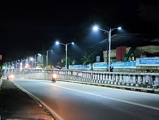
Vattoli Bazaar is a small town situated 2 km east of Balusseri in the Koyilandy -Thamarassery state highway. The location is in Kozhikode district of Kerala state in India.
Kottur is a grama panchayat and a community development block in the Kozhikode district of Kerala, India.

Thiruvangoor (തിരുവങ്ങൂർ) is a small village 16 kilometres (9.9 mi) away from Kozhikode, Kerala, India. It lies to the east of the Arabian Sea (Kappad) and west of Kuniyil Kadavu. Portuguese navigator Vasco de Gama is believed to have landed near Thiruvangoor, at Kappad, during one of his voyages, on 20 May 1498. Thiruvangoor sits on a national highway. Nearby major towns are Atholi and Koyilandy. The Kuniyil Kadavu Bridge allows for transportation between Thiruvangoor and Atholi town.
Avitanallur is a village in Kozhikode district in the state of Kerala, India. Avitanallur has been made famous by the birth of N. N. Kakkad the famous Malayalam Poet. While Avitanallur is the official name of the village, it is locally renowned and directed as Kootallida.
Keezhariyur is a village near Koyilandy in Kozhikode district, that lies on the eastern shore of Akalapuzha Lake. This village is famous for the bomb case happened during Independence struggle. Malayalam is the Local Language here. Keezhariyur has its own post office and the Pincode is 673307. Keezhriyur Panchayat was formed on 27 September 1968.

Moodadi is a village in Koyilandy thaluk of Kozhikode district in the state of Kerala, India.
Nochad is a village in Kozhikode district in the state of Kerala, India.

Purathur is a beautiful sandy coastal village and a Grama Panchayat in Tirur Taluk, Malappuram district in the state of Kerala, India. Bharathappuzha river and Tirur River merges together in Purathur and join with the Arabian Sea at Padinjarekara Azhimukham, which is also the southernmost tip of Purathur Gram panchayat. Opposite to Padinjarekara Azhimukham is Ponnani port. The village is located at the southernmost tip of Tirur Taluk and is bordered by historically important Ponnani port in Ponnani Municipality of Ponnani taluk to south.

Peruvannamuzhi or Peruvannamoozhy is a village in Chakkittapara Panchayath Kozhikode district, Kerala, India. Peruvannamuzhi forms part of the newly inaugurated Malabar Wildlife Sanctuary and is rich in flora and fauna.
Puttad is a village in KoyilandyTaluk near Perambra in Kozhikode district, Kerala, India.

Mukkam is a major municipality town in Kozhikode, state of Kerala, India. Mukkam is one of the major regional suburb of the Kozhikode district. Mukkam is located about 27 km east of Calicut city on the bank of river Iruvanjippuzha, one of the major tributaries of river Chaliyar .Mukkam is also well knows for its secularistic features. The urban region of Mukkam is spread across Mukkam Municipality and the North Karassery region of Karassery Grama Panchayath. The town begins from North Karassery junction region and runs till Agasthianmuzhi Junction region.
Muyippoth is a beautiful village Situated in Cheruvannur Grama Panjayath Kozhikode District Kerala State India. The village is at the banks of River Kuttyadi three sides of village is covered by this river, Forty percent of this village is paddy fields.. The settlements of Vadakara and Perambra are joining through it. Vadakara situated 13 km north from a Muyippoth Perambra 8 km west and payyoli 10 km east.
Viyyur is one of the 34 villages in Koyilandy thaluk of Kozhikode district.

