Muff, Pennsylvania

Last updated

Muff, Pennsylvania
Unincorporated community
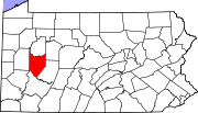
USA Pennsylvania location map.svg
Red pog.svg
Muff
Coordinates: 40°53′04″N79°20′17″W / 40.88444°N 79.33806°W / 40.88444; -79.33806
Country United States
State Pennsylvania
County Armstrong
Elevation
1,499 ft (457 m)
Time zone UTC-5 (Eastern (EST))
  Summer (DST) UTC-4 (EDT)
GNIS feature ID1204242 [1]

Muff is an unincorporated community in Armstrong County, Pennsylvania, United States. [1] The highest natural point in Armstrong County is located near Muff. [2]

A post office called Muff was established in 1879, and remained in operation until it was discontinued in 1908. [3] A variant name is "Snyderville". [1]

Related Research Articles

<span class="mw-page-title-main">Lake County, California</span> County in California, United States

Lake County is a county located in the north central portion of the U.S. state of California. As of the 2020 census, the population was 68,163. The county seat is Lakeport. The county takes its name from Clear Lake, the dominant geographic feature in the county and the largest non-extinct natural lake wholly within California.

<span class="mw-page-title-main">Placer County, California</span> County in California, United States

Placer County, officially the County of Placer, is a county in the U.S. state of California. As of the 2020 census, the population was 404,739. The county seat is Auburn.

<span class="mw-page-title-main">Armstrong County, Pennsylvania</span> County in Pennsylvania, United States

Armstrong County is a county in the Commonwealth of Pennsylvania. As of the 2020 census, the population was 65,558. The county seat is Kittanning. The county was organized on March 12, 1800, from parts of Allegheny, Westmoreland and Lycoming Counties. It was named in honor of John Armstrong, who represented Pennsylvania in the Continental Congress and served as a major general during the Revolutionary War.

<span class="mw-page-title-main">Custer County, Montana</span> County in Montana, United States

Custer County is a county located in the U.S. state of Montana. As of the 2020 census, the population was 11,867. Its county seat is Miles City. The county was established on June 2, 1865, as one of the nine original counties of the Territory of Montana named Big Horn County, and was renamed on February 16, 1877, in honor of Lieutenant Colonel George Armstrong Custer.

<span class="mw-page-title-main">DeKalb County, Illinois</span> County in Illinois, United States

DeKalb County is a county located in the U.S. state of Illinois. As of the 2020 United States census, the population was 100,420. Its county seat is Sycamore.

<span class="mw-page-title-main">Renville, Minnesota</span> City in Minnesota, United States

Renville is a city in Renville County, Minnesota, United States. The population was 1,287 at the 2010 census.

<span class="mw-page-title-main">Gilpin Township, Armstrong County, Pennsylvania</span> Township in Pennsylvania, United States

Gilpin Township is a Second class Township in Armstrong County, Pennsylvania, United States. At the 2010 census it had a population of 2,496. As of the 2020 census, its population had decreased to 2,411, a 3.4% decrease.

Natural Resources Conservation Service (NRCS), formerly known as the Soil Conservation Service (SCS), is an agency of the United States Department of Agriculture (USDA) that provides technical assistance to farmers and other private landowners and managers.

<span class="mw-page-title-main">Papakating Creek</span> Creek in Sussex County, New Jersey, U.S.

Papakating Creek is a 20.1-mile-long (32.3 km) tributary of the Wallkill River located in Frankford and Wantage townships in Sussex County, New Jersey in the United States. The creek rises in a small swamp located beneath the eastern face of Kittatinny Mountain in Frankford and its waters join the Wallkill to the east of Sussex borough.

The Salt Valley Lakes is a system of more than twenty lakes in Lancaster County, Nebraska. Many of the lakes are state recreation areas or wildlife areas. All of the lakes are within twenty-five miles of Lincoln, Nebraska. "These areas around Lincoln cover 15,039 total acres, with 4,438 acres of water."

Hermanville is a census-designated place and unincorporated community in Claiborne County, in southwest Mississippi, United States. Its ZIP code is 39086.

<span class="mw-page-title-main">National Cooperative Soil Survey</span> Program to understand and manage US soils

The National Cooperative Soil Survey Program (NCSS) in the United States is a nationwide partnership of federal, regional, state, and local agencies and institutions. This partnership works together to cooperatively investigate, inventory, document, classify, and interpret soils and to disseminate, publish, and promote the use of information about the soils of the United States and its trust territories. The activities of the NCSS are carried out on national, regional, and state levels.

<span class="mw-page-title-main">Armstrong County, South Dakota</span> County in South Dakota, United States, 1883–1952

Armstrong County was a county in the U.S. state of South Dakota, and its predecessor Dakota Territory, between 1883 and 1952. Located in the western part of the state, it was a sparsely-inhabited part of the Cheyenne River Indian Reservation that relied primarily on the cattle trade and the Missouri and Cheyenne Rivers. Never having an organized county government in its own right, it was attached to Stanley County, with its county seat at Fort Pierre, for administrative purposes.

<span class="mw-page-title-main">Bureau of Soils and Water Management</span> Agency of the Philippine government

The Philippines' Bureau of Soils and Water Management, is an agency of the Philippine government under the Department of Agriculture responsible for advising and rendering assistance on matters relative to the utilization of soils and water as vital agricultural resources.

<span class="mw-page-title-main">Barr Township, Daviess County, Indiana</span> Township in Indiana, United States

Barr Township is one of ten townships in Daviess County, Indiana. As of the 2010 census, its population was 4,811 and it contained 1,481 housing units.

<span class="mw-page-title-main">Porter Township, Porter County, Indiana</span> Township in Indiana, United States

Porter Township is one of twelve townships in Porter County, Indiana. As of the 2010 census, its population was 9,367.

<span class="mw-page-title-main">Petroleum County, Montana</span> County in Montana, United States

Petroleum County is a county in the U.S. state of Montana. As of the 2020 census, the population was 496, making it the least populous county in Montana and the eighth-least populous in the United States. Its county seat is Winnett. The county's area was partitioned from Fergus County in 1925 to become the last of Montana's 56 counties to be organized.

Capps, also known as Choctawhatchee, is an unincorporated community in Henry County, Alabama, United States. Capps is located on Alabama State Route 173, 7.2 miles (11.6 km) southeast of Abbeville.

Tumbleton is an unincorporated community in Henry County, Alabama, United States.

McGregor is an unincorporated community in Redbank Township, Armstrong County, Pennsylvania, United States. The community lies along PA-839 at the junction with Porter Rd.

References

  1. 1 2 3 "Muff". Geographic Names Information System . United States Geological Survey, United States Department of the Interior.
  2. United States. Bureau of Soils; United States. Bureau of Plant Industry; United States. Bureau of Plant Industry, Soils, and Agricultural Engineering (1977). Soil survey. U.S. Dept. of Agriculture. p. 71.{{cite book}}: CS1 maint: multiple names: authors list (link)
  3. "Armstrong County". Jim Forte Postal History. Retrieved October 1, 2014.