Mura is a language of Amazonas, Brazil. It is most famous for Pirahã, its sole surviving dialect. Linguistically, it is typified by agglutinativity, a very small phoneme inventory, whistled speech, and the use of tone.

São Gabriel da Cachoeira is a municipality located on the northern shore of the Rio Negro River, in the region of Cabeça do Cachorro, Amazonas state, Brazil.

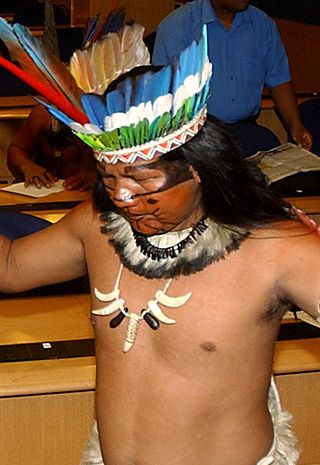
The Munduruku, also known as Mundurucu or Wuy Jugu, are an indigenous people of Brazil living in the Amazon River basin. Some Munduruku communities are part of the Coatá-Laranjal Indigenous Land. They had an estimated population in 2014 of 13,755.

Borba is a municipality in the state of Amazonas in northern Brazil.

Novo Aripuanã is a municipality located in the Brazilian state of Amazonas.
The Matupiri River is a river of Amazonas state in north-western Brazil. It is a tributary of the Igapó-Açu River.
The Xié River is a river of Amazonas state in north-western Brazil. It is a right tributary of the Rio Negro.
Matupiri State Park is a state park in the state of Amazonas, Brazil. It protects a rich area of Amazon rainforest and an ecologically important area of woodland savanna along the Matupiri River. Unusually for a state park, it includes an "indigenous special use zone" that allows the Mura people to continue to fish and extract forest products, as they have for many generations.
The Matupiri Sustainable Development Reserve is a sustainable development reserve in the state of Amazonas, Brazil.
The Rio Madeira Sustainable Development Reserve is a sustainable development reserve in the state of Amazonas, Brazil.
The Rio Amapá Sustainable Development Reserve (Portuguese: Reserva de Desenvolvimento Sustentável do Rio Amapá is a sustainable development reserve in the state of Amazonas, Brazil.
The Igapó-Açu Sustainable Development Reserve is a sustainable development reserve in the state of Amazonas, Brazil. It is part of a "green barrier" created to prevent deforestation along the BR-319 highway.
The Canutama Extractive Reserve is an extractive reserve in the state of Amazonas, Brazil.
The Canutama State Forest is a state forest in the state of Amazonas, Brazil.
The Tapauá State Forest is a state forest in the state of Amazonas, Brazil.

The Lower Rio Negro Mosaic (Portuguese: Mosaico do Baixo Rio Negro is a protected area mosaic in the state of Amazonas, Brazil. It coordinates between eleven conservation units of different types in the Amazon rainforest to the northwest of the state capital, Manaus.

The Mundurucu Indigenous Territory is an indigenous territory in the state of Pará, Brazil. It is occupied by the Apiacá and Munduruku people. A proposed dam on the Tapajós river is on hold since it would flood part of the territory, and the constitution does not allow projects that would force relocation of indigenous people.
The Sai Cinza Indigenous Territory is an indigenous territory in the state of Pará, Brazil. A proposed dam on the Tapajós river is on hold since it would flood part of the territory, and the constitution does not allow projects that would force relocation of indigenous people.
The Sawré Muybu Indigenous Territory, also called the Daje Kapap Eipi, is an indigenous territory of Munduruku people in the state of Pará, Brazil. It includes land that is sacred to the Mundurukus. Issuance of the document that delimits the territory was delayed until April 2016 because of the problems recognition would create with the proposed São Luiz do Tapajós Dam, which would flood part of the area. As of November 2016 the territory had still not been formally created by decree.

The Baré, or Hanera, and Werekena are related indigenous people of northwest Brazil and Venezuela. For many years they suffered from violent exploitation by Portuguese and Spanish merchants, forced to work as debt slaves. They moved often to try to avoid the merchants. Today most live by agriculture, hunting, fishing and gathering, and extract piassava fiber for income to buy goods from traders.


