
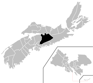
Central Nova is a federal electoral district in Nova Scotia, Canada, that has been represented in the House of Commons of Canada from 1968 to 1997 and since 2004.

Halifax, formally known as the Halifax Regional Municipality (HRM), is the capital and largest municipality of the Canadian province of Nova Scotia. It had a population of 403,131 in 2016, with 316,701 in the urban area centred on Halifax Harbour. As of July 2020, Statistics Canada estimated the population of the CMA at 448,544 and 347,834 in the uban area. The regional municipality consists of four former municipalities that were amalgamated in 1996: Halifax, Dartmouth, Bedford, and Halifax County.
The Eastern Shore is a region of the Canadian province of Nova Scotia. It is the Atlantic coast running northeast from Halifax Harbour to the eastern end of the peninsula at the Strait of Canso.
The Halifax Regional Municipality (HRM) in Nova Scotia, Canada has a widely varied geography.

The Musquodoboit River is a Canadian river located in central Nova Scotia in the northeastern part of Halifax Regional Municipality. The river is approximately 97 kilometres (60 mi) in length with roughly 88 kilometres (55 mi) being traversable by paddle. It has a watershed area of 1,409 square kilometres (544 sq mi)
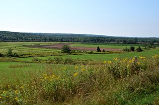
The Musquodoboit Valley is a valley and region in the Halifax Regional Municipality of Nova Scotia, Canada. It is administratively located in the municipality's Musquodoboit Valley & Dutch Settlement planning area and the western edge of the valley includes communities that are considered part of the commutershed for the urban area of the Halifax Regional Municipality. The picturesque Musquodoboit River flows through majority of the valley, passing by most of the communities in the valley. The river is approximately 97 kilometres (60 mi) long and originates in the extreme northeastern area of the valley. The three largest communities in the valley are Upper Musquodoboit, Middle Musquodoboit and Musquodoboit Harbour. The word "Musquodoboit" is derived from the Mi’kmaq language and means "rolling out in foam".
Colchester—Musquodoboit Valley is a provincial electoral district in Nova Scotia, Canada, that elects one member of the Nova Scotia House of Assembly.
The Halifax Regional Centre for Education is the public school district responsible for 136 elementary, junior high, and high schools located in the Halifax Regional Municipality in Halifax County, Nova Scotia, Canada. The current Regional Executive Director is Elwin LeRoux. The district's office is on Spectacle Lake Drive, Dartmouth. The district's stated vision is "to provide a high quality education to every student every day". On January 24, 2018 the provincial government announced would be dissolved and education administered by an appointed provincial council and the board was dissolved on March 31, 2018.
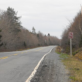
Route 224 is a collector road in the Canadian province of Nova Scotia. It is located in the Halifax Regional Municipality and Colchester County, connecting Sheet Harbour at Trunk 7 with Milford Station at Exit 9 of Highway 102 and Trunk 14. The route passes through the upper half of the Musquodoboit Valley.

Middle Musquodoboit is a rural community in the Musquodoboit Valley region of Nova Scotia, Canada within the Halifax Regional Municipality, along the Musquodoboit River at the junction of Route 357 with Route 224, 78 kilometres (48 mi) from Dartmouth, Nova Scotia. The community's name comes from the First Nations' word Mooskoduboogwek, which means to suddenly widen out after a narrow entrance at a mouth. For a time after 1883, Middle Musquodoboit was called Laytonville, but at some point reverted to its former name.

Upper Musquodoboit is a forestry and farming community in the northeastern reaches of the Musquodoboit Valley, Nova Scotia, Canada within the Halifax Regional Municipality, 75 kilometres (47 mi) from Downtown Halifax. The community is located along the Musquodoboit River. The community had a population of 473 at the 2006 Census and the community has an area of 380.25 square kilometres (146.82 sq mi). Upper Musquodoboit is situated at the junction of Route 336 with Route 224.

Dean is a small farming & forestry community in the North Branch Musquodoboit in the Musquodoboit Valley along the Halifax Regional Municipality/Colchester County county line, in the Canadian province of Nova Scotia, along Route 336. Other communities in the North Branch include Elmsvale, Greenwood, Upper Musquodoboit, and Moose River Gold Mines, among others.

Musquodoboit Harbour is a rural community located in Nova Scotia, Canada within the Halifax Regional Municipality. The community is situated on the Eastern Shore at the mouth of the Musquodoboit River. The community lies 45 kilometres east of downtown Halifax. With a hospital, RCMP detachment, postal outlet, schools, recreational center, library, municipal office and other services, Musquodoboit Harbour is a serve centre for many of the surrounding communities.

Halifax, Nova Scotia, is a major multi-modal transportation centre for freight and passengers in Atlantic Canada. Halifax, formally known as the Halifax Regional Municipality (HRM), is the capital and largest municipality of the Canadian province of Nova Scotia.

Halifax Regional Municipality, formally known as Halifax is located in Nova Scotia, Canada. The municipality is governed by a mayor and a sixteen-person Regional Council, who are elected by geographic district; municipal elections occur every leap year.
Chaswood is a rural community in the Musquodoboit Valley northwest of Middle Musquodoboit, Nova Scotia in Nova Scotia, Canada. Chaswood is named in honour of Charles Carroll Wood.
Cooks Brook is a small community found in the Southwest Branch Musquodoboit of the Musquodoboit Valley in Nova Scotia, Canada. Cooks Brook is located along the Halifax Regional Municipality/Colchester County border.
Lake Egmont is a small rural community in the lower interior of the Musquodoboit Valley, in the Halifax Regional Municipality of Nova Scotia, Canada. Other communities in this area include Antrim and Wyses Corner, Nova Scotia. The community was named after John Perceval, 2nd Earl of Egmont.

The following outline is provided as an overview of and topical guide to Nova Scotia:

