Nadine, New Mexico | |
|---|---|
 Nadine  Nadine | |
| Coordinates: 32°37′23″N103°06′28″W / 32.62306°N 103.10778°W [1] | |
| Country | United States |
| State | New Mexico |
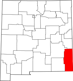
| County | Lea |
| Area | |
• Total | 11.40 sq mi (29.52 km2) |
| • Land | 11.39 sq mi (29.51 km2) |
| • Water | 0.0039 sq mi (0.01 km2) |
| Elevation | 3,583 ft (1,092 m) |
| Population | |
• Total | 477 |
| • Density | 41.9/sq mi (16.17/km2) |
| Time zone | UTC-7 (Mountain (MST)) |
| • Summer (DST) | UTC-6 (MDT) |
| Area code | 575 |
| GNIS feature ID | 2584159 [1] |
Nadine is an unincorporated community and census-designated place in Lea County, New Mexico, United States. Its population was 376 as of the 2010 census. [4] New Mexico State Road 18 passes through the community.