Eunice, New Mexico | |
---|---|
Coordinates: 32°26′07″N103°12′45″W / 32.43528°N 103.21250°W [1] | |
Country | United States |
State | New Mexico |
County | Lea |
Government | |
• Mayor | Billy Hobbs [2] |
Area | |
• Total | 4.10 sq mi (10.63 km2) |
• Land | 4.09 sq mi (10.60 km2) |
• Water | 0.01 sq mi (0.02 km2) |
Elevation | 3,484 ft (1,062 m) |
Population | |
• Total | 3,056 |
• Density | 746.46/sq mi (288.19/km2) |
Time zone | UTC-7 (Mountain (MST)) |
• Summer (DST) | UTC-6 (MDT) |
ZIP code | 88231 |
Area code | 575 |
FIPS code | 35-25450 |
GNIS feature ID | 2410462 [1] |
Website | www |
Eunice is a city in Lea County, New Mexico, United States. The population was 2,922 at the 2010 census. [5]
The mayor of Eunice, as of March 2018, was Billy Hobbs. A URENCO USA National Enrichment Facility, which uses Zippe-type centrifuge technology to enrich uranium, has been in operation 5 miles (8 km) east of Eunice since 2010. [6]
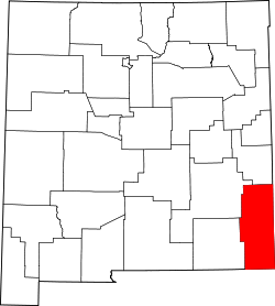
Eunice is located in southeastern Lea County. It is bypassed to the east by New Mexico State Road 18, which leads north 19 miles (31 km) to Hobbs, the largest city in the county, and south 23 miles (37 km) to Jal. State Road 176 runs east-west through the center of Eunice. Carlsbad is 68 miles (109 km) to the west, and the Texas border is 5.5 miles (8.9 km) to the east. Andrews, Texas, is 37 miles (60 km) east of Eunice via NM-176 and Texas State Highway 176.
According to the United States Census Bureau, Eunice has a total area of 3.9 square miles (10.2 km2), of which 0.01 square miles (0.02 km2), or 0.22%, are water. [7]
Census | Pop. | Note | %± |
---|---|---|---|
1940 | 1,227 | — | |
1950 | 2,352 | 91.7% | |
1960 | 3,531 | 50.1% | |
1970 | 2,641 | −25.2% | |
1980 | 2,970 | 12.5% | |
1990 | 2,676 | −9.9% | |
2000 | 2,562 | −4.3% | |
2010 | 2,922 | 14.1% | |
2020 | 3,056 | 4.6% | |
U.S. Decennial Census [8] [4] |
As of the census [9] of 2000, there were 2,562 people, 942 households, and 709 families residing in the city. The population density was 877.5 inhabitants per square mile (338.8/km2). There were 1,110 housing units at an average density of 380.2 per square mile (146.8/km2). The racial makeup of the city was 71.00% White, 1.09% African American, 0.43% Native American, 0.12% Asian, 24.43% from other races, and 2.93% from two or more races. Hispanic or Latino of any race were 39.62% of the population.
There were 942 households, out of which 38.3% had children under the age of 18 living with them, 60.0% were married couples living together, 9.0% had a female householder with no husband present, and 24.7% were non-families. 22.9% of all households were made up of individuals, and 11.4% had someone living alone who was 65 years of age or older. The average household size was 2.72 and the average family size was 3.20.
In the city, the population was spread out, with 29.5% under the age of 18, 11.1% from 18 to 24, 27.2% from 25 to 44, 19.4% from 45 to 64, and 12.8% who were 65 years of age or older. The median age was 34 years. For every 100 females, there were 100.2 males. For every 100 females age 18 and over, there were 101.0 males.
The median income for a household in the city was $31,722, and the median income for a family was $38,808. Males had a median income of $30,216 versus $21,400 for females. The per capita income for the city was $14,373. About 14.2% of families and 15.6% of the population were below the poverty line, including 18.4% of those under age 18 and 10.1% of those age 65 or over.
The Texas & New Mexico Railway provides freight service.
The school district is Eunice Municipal Schools. [10]
Eunice high school baseball has produced 17 state championships. This record ranks fifth in the nation. [11]
Eunice is the childhood home of Josh Lynn.
Roosevelt County is a county located in the U.S. state of New Mexico. As of the 2020 census, the population was 19,191. Its county seat is Portales. The county was created in 1903 from Chaves and Guadalupe counties and named for the then-current President of the United States, Theodore Roosevelt. The county's eastern border is the Texas state line.
Quay County is a county in the state of New Mexico. As of the 2020 U.S. census, the population was 8,746. Its county seat is Tucumcari. The county was named for Pennsylvania senator Matthew Quay, who supported statehood for New Mexico. Its eastern border is the Texas state line, approximately 103.04 degrees west longitude.
Otero County is a county located in the U.S. state of New Mexico. As of the 2020 census, the population was 67,839. Its county seat is Alamogordo. Its southern boundary is the Texas state line. It is named for Miguel Antonio Otero, the territorial governor when the county was created.
Luna County(Spanish: Condado de Luna) is a county located in the U.S. state of New Mexico. As of the 2020 census, the population was 25,427. Its county seat is Deming. This county abuts the Mexican border. Luna County comprises the Deming, NM Micropolitan Statistical Area.
Lea County is a county located in the U.S. state of New Mexico. As of the 2020 census, its population was 74,455.
Eddy County is a county located in the U.S. state of New Mexico. As of the 2020 census, the population was 62,314. Its county seat and largest city is Carlsbad. The county was created in 1891 and later organized in 1892. It is north of the Texas state line.
Chaves County is a county in New Mexico, United States. As of the 2020 census, the population was 65,157. Its county seat is Roswell. Chaves County was named for Colonel Jose Francisco Chaves, a military leader there during the Civil War and later in Navajo campaigns. The county was created by the New Mexico Territorial Legislature on February 25, 1889, out of land from Lincoln County.
Eden Roc is a census-designated place (CDP) in Hawaiʻi County, Hawaiʻi, United States, located in the District of Puna. The population was 942 at the 2010 census, up from 451 at the 2000 census.
Texico is a city in Curry County, New Mexico, United States. Its population was 1,130 at the 2010 census. The city is located on the Texas-New Mexico border with the town of Farwell across the border.
Chaparral is an unincorporated community and census-designated place (CDP) in Doña Ana and Otero counties, New Mexico. The population was 14,631 at the 2010 census. Chaparral is primarily a bedroom community for the neighboring city of El Paso, Texas, and the neighboring military installations of White Sands Missile Range and Fort Bliss. It is officially part of the Las Cruces Metropolitan Statistical Area.
Hatch is a village in Doña Ana County, New Mexico, United States. The population was 1,648 at the 2010 census. The town is experiencing moderate growth, along with its outliers of Salem, Arrey, Derry, and Rincon. Hatch is widely known as the "best chile place in the World," for growing a wide variety of peppers, especially the New Mexican cuisine staple, and one of New Mexico's state vegetables, the New Mexico chile.
Salem is a census-designated place (CDP) in Doña Ana County, New Mexico, United States. The population was 942 at the 2010 census. It is part of the Las Cruces Metropolitan Statistical Area.
Loving is a village in Eddy County, New Mexico. As of the 2010 census, the village population was 1,413. Loving was settled by Swiss immigrants in the 1890s.
Santa Rosa is a city in and the county seat of Guadalupe County, New Mexico, United States. The population was 2,848 at the 2010 census. It lies between Albuquerque and Tucumcari, situated on the Pecos River at the intersection of Interstate 40 and U.S. Route 54 and 84. The city is located on the western edge of the Llano Estacado or "staked plains" of eastern New Mexico and west Texas.
Hobbs is a city in Lea County, New Mexico, United States. Its population was 40,508 at the 2020 census, increasing from 34,122 in 2010.
Jal is a small city located in Lea County, New Mexico, United States. It is New Mexico's south-easternmost city, and shares a border with Texas to the east and south. The population was 2,047 at the 2010 census. Jal is historically important in the natural gas industry, from the early 1900s to the present day.
Lovington is a city in, and the county seat of, Lea County, New Mexico, United States. The population was 11,009 at the 2010 census, up from 9,471 in 2000.
Tatum is a town in Lea County, New Mexico, United States. The population was 798 at the 2010 census, up from 683 in 2000.
Jourdanton is a city in and the county seat of Atascosa County, Texas, United States. The population is 4,094. It is part of the San Antonio metropolitan statistical area. The mayor is Robert "Doc" Williams. The city manager is Bobby J. Martinez. The police chief is Eric Kaiser. The fire chief is Jay Fojtik.
Stonewall is an unincorporated community and census-designated place (CDP) in Gillespie County, Texas, United States. The population was 525 at the 2010 census. It was named for Confederate General Thomas J. (Stonewall) Jackson, by Israel P. Nunez, who established a stage station near the site in 1870.