
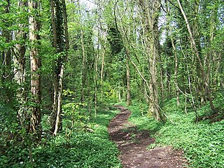
Whittlewood Forest is a former medieval hunting forest east of Silverstone in Northamptonshire in England. It is managed by the Forestry England. There are tracts of ancient woodland within it and old ditches can be found at the edges of several individual woods. The area has been the subject of extensive academic historical research. An area of 400 hectares in seven different patches has been designated a biological Site of Special Scientific Interest (SSSI), which is about half the size of an average English parish. It is a Nature Conservation Review site, Grade 2.

The Cotswold Water Park is the United Kingdom's largest marl lake system, straddling the Wiltshire–Gloucestershire border, north-west of Cricklade and south of Cirencester. There are 180 lakes, spread over 42 square miles (110 km2).

Broadmoor to Bagshot Woods and Heaths is a 1,696.3-hectare (4,192-acre) biological Site of Special Scientific Interest (SSSI) in Berkshire and Surrey that extend from a minority of the parish of Crowthorne including around Broadmoor Hospital in the west to Bagshot south-east, Bracknell north-east, and Sandhurst, south. It is part of the Thames Basin Heaths Special Protection Area. Two nature reserves which are managed by the Surrey Wildlife Trust are in the SSSI, Barossa nature reserve and Poors Allotment. Broadmoor Bottom, which is part of Wildmoor Heath, also falls within the SSSI; this reserve is managed by the Berkshire, Buckinghamshire and Oxfordshire Wildlife Trust.

Lady Park Wood National Nature Reserve is a 45-hectare (110-acre) nature reserve straddling the borders of Gloucestershire in England and Monmouthshire in Wales. Most of the wood is in Wales – where it forms Wales' easternmost point – but it is managed under agreement with Natural England.

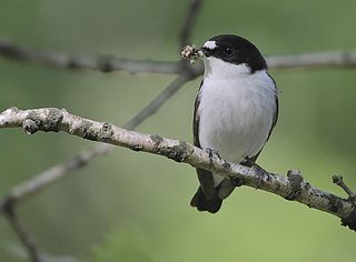
North Warren RSPB reserve is a nature reserve run by the Royal Society for the Protection of Birds (RSPB) in Suffolk, England. It lies on the Suffolk coast on the north edge of the town of Aldeburgh and to the south of Thorpeness and includes the Aldringham Walks area of heathland to the north. It is within the Suffolk Coast and Heaths Area of Outstanding Natural Beauty (AONB) and the Suffolk Heritage Coast area. Noted for its populations of Eurasian bittern, European nightjar and other bird species, it covers a range of coastal habitats and is protected with SSSI, SPA conservation status.

Dendles Wood is an area of protected oak-beech woodland located on the southern edge of Dartmoor, in the English county of Devon. Forming part of the Dartmoor Special Area of Conservation, the wood is also a Site of Special Scientific Interest, and 30 hectares of it has been designated a national nature reserve. It is one of five woodlands within Dartmoor that have been protected as national nature reserves. Dendles Wood and the adjacent Hawns Wood are sometimes known collectively as Hawns and Dendles. The wood supports a variety of flora and fauna, representative of upland oakwoods. In particular, it has a rich variety of moss and lichen, and several breeding bird species.

Dymock Woods is a 53-hectare (130-acre) biological Site of Special Scientific Interest in Gloucestershire, notified in 1990. The site is listed in the 'Forest of Dean Local Plan Review' as a Key Wildlife Site (KWS).

Lower Hael Wood is a semi-ancient woodland and Site of Special Scientific Interest (SSSI), noted for its biological characteristics, in Monmouthshire, south east Wales. It is part of the wider Hael Woods complex. The wood is on the side of the River Wye which is the border between Wales and England.

Upper Wye Gorge is a Site of Special Scientific Interest (SSSI), noted for its biological and geological characteristics, around Symonds Yat in the Wye Valley on the Wales–England border. The site is listed in the "Forest of Dean Local Plan Review" as a Key Wildlife Site (KWS).
Nagshead SSSI is a 297 acres (120 ha) biological Site of Special Scientific Interest located within RSPB Nagshead, near Parkend, in the Forest of Dean, Gloucestershire.

Dingle Wood is a 9.95-hectare (24.6-acre) biological Site of Special Scientific Interest in Gloucestershire, notified in 1972. The site is listed in the 'Forest of Dean Local Plan Review' as a Key Wildlife Site (KWS). The wood is located within the Forest of Dean Forest Park and the Wye Valley Area of Outstanding Natural Beauty.
Poor's Allotment is a 28.57-hectare (70.6-acre) biological Site of Special Scientific Interest in Gloucestershire, notified in 1954. The site is listed in the 'Forest of Dean Local Plan Review' as a Key Wildlife Site (KWS).
Shorn Cliff And Caswell Woods is a 69.2-hectare (171-acre) biological Site of Special Scientific Interest in Gloucestershire, notified in 1986. The site is listed in the 'Forest of Dean Local Plan Review' as a Key Wildlife Site (KWS).

Speech House Oaks is a 16.26-hectare (40.2-acre) biological Site of Special Scientific Interest in Gloucestershire, notified in 1972.

The Hudnalls is a 94.4-hectare (233-acre) biological Site of Special Scientific Interest in Gloucestershire, notified in 1972. The site is listed in the 'Forest of Dean Local Plan Review' as a Key Wildlife Site (KWS).

Wigpool Ironstone Mine is a 34.88-hectare (86.2-acre) biological Site of Special Scientific Interest in Gloucestershire, notified in 1998.

Woorgreens Lake and Marsh is a 9-hectare (22-acre) nature reserve in Gloucestershire.

Englemere Pond is a 26.1-hectare (64-acre) biological Site of Special Scientific Interest on the southern outskirts of North Ascot in Berkshire. The site is also a Local Nature Reserve. It is owned by the Crown Estate and managed by Bracknell Forest Borough Council.

Loch Lomond National Nature Reserve (NNR) encompasses 430 hectares of land at the southeastern part of Loch Lomond in the council areas of Stirling and West Dunbartonshire, in Scotland. It covers the islands of Inchcailloch, Clairinsh, Torrinch, Creinch and Aber Isle, alongside areas of woodland and wetlands to either side of the mouth of the Endrick Water. NatureScot owns two parts of the reserve - the island of Inchcailloch and part of Gartfairn Wood - and the rest is privately owned. The reserve is managed by a partnership consisting of NatureScot, the RSPB Scotland and the Loch Lomond and The Trossachs National Park, along with the owners and tenants of the land under agreements. Within this framework NatureScot directly manage the islands of Clairinsh, Inchcailloch, Torrinch and Creinch, and land to the north of the Endrick Water. The RSPB manages the area to the south of the Endrick Water, and the national park manages visitor facilities on Inchcailloch.


