Naranjo | |
---|---|
Barrio | |
Coordinates: 18°20′43″N67°09′28″W / 18.345381°N 67.157669°W [1] | |
Commonwealth | Puerto Rico |
Municipality | Aguada |
Area | |
• Total | 2.72 sq mi (7.0 km2) |
• Land | 2.72 sq mi (7.0 km2) |
• Water | 0.00 sq mi (0.0 km2) |
Elevation | 269 ft (82 m) |
Population (2010) | |
• Total | 3,292 |
• Density | 1,210.3/sq mi (467.3/km2) |
Source: 2010 Census | |
Time zone | UTC−4 (AST) |
ZIP Code | 00602 |
Area code(s) | 787, 939 |
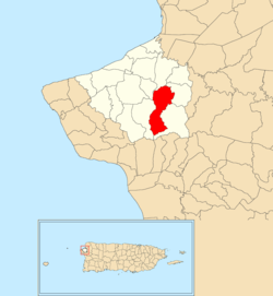
Naranjo is a barrio in the municipality of Aguada, Puerto Rico. Its population in 2010 was 3,292. [3] [4] [5]
Naranjo was in Spain's gazetteers [6] until Puerto Rico was ceded by Spain in the aftermath of the Spanish–American War under the terms of the Treaty of Paris of 1898 and became an unincorporated territory of the United States. In 1899, the United States Department of War conducted a census of Puerto Rico finding that the population of Naranjo barrio was 923. [7]
Census | Pop. | Note | %± |
---|---|---|---|
1900 | 923 | — | |
1910 | 1,018 | 10.3% | |
1920 | 1,078 | 5.9% | |
1930 | 1,142 | 5.9% | |
1940 | 1,203 | 5.3% | |
1950 | 1,599 | 32.9% | |
1960 | 1,396 | −12.7% | |
1970 | 2,089 | 49.6% | |
1980 | 2,618 | 25.3% | |
1990 | 3,087 | 17.9% | |
2000 | 3,724 | 20.6% | |
2010 | 3,292 | −11.6% | |
U.S. Decennial Census 1899 (shown as 1900) [8] 1910-1930 [9] 1930-1950 [10] 1960 [11] 1980-2000 [12] 2010 [13] |
Barrios (which are like minor civil divisions) [14] in turn are further subdivided into smaller local populated place areas/units called sectores (sectors in English). The types of sectores may vary, from normally sector to urbanización to reparto to barriada to residencial, among others. [15] [16] [17] [18]
The following sectors are in Naranjo barrio: [19]
Sector 3 Copas, Sector Berto Vargas, Sector Ceferino Acevedo, Sector Cuchilla, Sector El Coquí, Sector El Lirio, Sector El Manantial, Sector Foro Soto, Sector González, Sector Guillermo Matías, Sector Juan Tita, Sector La Cadena, Sector Lencho Pérez, Sector Leo Flora, Sector Militar, Sector Mingo Echevarría, Sector Moncho Pérez, Sector Naranjo Abajo, Sector Naranjo Arriba, and Sector Tano Villarrubia.
Part of the Luyando community is in Naranjo. [5]
Naranjo is a barrio in the municipality of Comerío, Puerto Rico. Its population in 2010 was 1,915.
Naranjo is a barrio in the municipality of Moca, Puerto Rico. Its population in 2010 was 2,875.
Asomante is a barrio in the municipality of Aguada, Puerto Rico. Its population in 2010 was 3,177.
Naranjo is a barrio in the municipality of Fajardo, Puerto Rico. Its population in 2010 was 349.
Naranjo is a barrio in the municipality of Yauco, Puerto Rico. Its population in 2010 was 599.
Mamey is a barrio in the municipality of Aguada, Puerto Rico. Its population in 2010 was 2,400.
Cerro Gordo is a barrio in the municipality of Aguada, Puerto Rico. Its population in 2010 was 3,018.
Río Grande is a barrio in the municipality of Aguada, Puerto Rico. Its population in 2010 was 1,152.
Atalaya is a barrio in the municipality of Aguada, Puerto Rico. Its population in 2010 was 3,108.
Piedras Blancas is a barrio in the municipality of Aguada, Puerto Rico. Its population in 2010 was 4,635.
Jagüey is a barrio (county) in the municipality of Aguada, Puerto Rico. Its population in 2010 was 1,995. It is located west of the center of Aguada partly bordering the municipality of Rincón.
Marías is a barrio in the municipality of Aguada, Puerto Rico. Its population in 2010 was 1,997.
Carrizal is a barrio in the municipality of Aguada, Puerto Rico. Its population in 2010 was 970.
Cruces is a barrio in the municipality of Aguada, Puerto Rico. Its population in 2010 was 1,632.
Espinar is a barrio in the municipality of Aguada, Puerto Rico. Its population in 2010 was 1,281.
Guanábano is a barrio in the municipality of Aguada, Puerto Rico. Its population in 2010 was 749.
Guaniquilla is a coastal barrio in the municipality of Aguada, Puerto Rico. Its population in 2010 was 2,663.
Guayabo is a barrio in the municipality of Aguada, Puerto Rico. Its population in 2010 was 3,273.
Lagunas is a barrio in the municipality of Aguada, Puerto Rico. Its population in 2010 was 2,810.
Mal Paso is a barrio in the municipality of Aguada, Puerto Rico. Its population in 2010 was 2,483.