National Register of Historic Places listings in Cass County, North Dakota

Last updated

Location of Cass County in North Dakota Map of North Dakota highlighting Cass County.svg
Location of Cass County in North Dakota

This is a list of the National Register of Historic Places listings in Cass County, North Dakota.

Contents

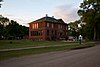
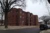
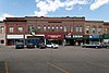
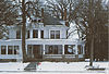
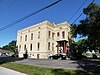
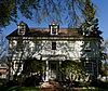
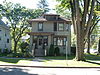
This is intended to be a complete list of the properties and districts on the National Register of Historic Places in Cass County, North Dakota, United States. The locations of National Register properties and districts for which the latitude and longitude coordinates are included below, may be seen in a map. [1]

There are 38 properties and districts listed on the National Register in the county. Another five properties were once listed but have been removed.

Map all coordinates using: OpenStreetMap  
Download coordinates as: KML
Contents: Counties in North Dakota
Adams | Barnes | Benson | Billings | Bottineau | Bowman | Burke | Burleigh | Cass | Cavalier | Dickey | Divide | Dunn | Eddy | Emmons | Foster | Golden Valley | Grand Forks | Grant | Griggs | Hettinger | Kidder | LaMoure | Logan | McHenry | McIntosh | McKenzie | McLean | Mercer | Morton | Mountrail | Nelson | Oliver | Pembina | Pierce | Ramsey | Ransom | Renville | Richland | Rolette | Sargent | Sheridan | Sioux | Slope | Stark | Steele | Stutsman | Towner | Traill | Walsh | Ward | Wells | Williams


    This National Park Service list is complete through NPS recent listings posted December 2, 2022. [2]

Current listings

[3] Name on the Register [4] ImageDate listed [5] Location City or townDescription
1 1916 Buffalo High School
1916 Buffalo High School 1916 Buffalo High School 1.jpg
1916 Buffalo High School
May 10, 2001
(#01000501)
303 Pearl Street, North
46°55′16″N97°32′59″W / 46.921111°N 97.549722°W / 46.921111; -97.549722 (1916 Buffalo High School)
Buffalo
2 George and Beth Anderson House
George and Beth Anderson House FargoND GeorgeAndBethAndersonHouse.jpg
George and Beth Anderson House
June 19, 2017
(#100001221)
1458 South River Road
46°51′29″N96°46′57″W / 46.858137°N 96.782418°W / 46.858137; -96.782418 (George and Beth Anderson House)
Fargo
3 Barrington Apartments
Barrington Apartments Barrington Apartments - Fargo, ND.jpg
Barrington Apartments
July 27, 1989
(#88000982)
219 12th Street, South
46°52′19″N96°47′51″W / 46.871944°N 96.7975°W / 46.871944; -96.7975 (Barrington Apartments)
Fargo
4 M.E. Beebe Historic District
M.E. Beebe Historic District M.E. Bebe Historic District.jpg
M.E. Beebe Historic District
November 24, 2015
(#15000825)
Northeastern corner of Third Avenue North and North 8th Street
46°52′47″N96°47′30″W / 46.879720°N 96.791667°W / 46.879720; -96.791667 (M.E. Beebe Historic District)
Fargo
5 Black Building
Black Building Black Building Fargo, N.D.jpg
Black Building
December 6, 2016
(#16000821)
114 Broadway North
46°52′39″N96°47′17″W / 46.877588°N 96.788086°W / 46.877588; -96.788086 (Black Building)
Fargo
6 Cass County Court House, Jail, and Sheriff's House
Cass County Court House, Jail, and Sheriff's House Cass County Courthouse Fargo.jpg
Cass County Court House, Jail, and Sheriff's House
December 22, 1983
(#83004062)
S. 9th St. between S. 2nd and 3rd Aves.
46°52′19″N96°47′35″W / 46.871944°N 96.793056°W / 46.871944; -96.793056 (Cass County Court House, Jail, and Sheriff's House)
Fargo
7 Casselton Commercial Historic District
Casselton Commercial Historic District Casselton Commercial Historic District 2.jpg
Casselton Commercial Historic District
October 28, 1982
(#82001311)
Roughly bounded by Front and 1st St. between 6th and 8th Aves.
46°54′03″N97°12′38″W / 46.900833°N 97.210556°W / 46.900833; -97.210556 (Casselton Commercial Historic District)
Casselton
8 DeLendrecie's Department Store
DeLendrecie's Department Store De lendrecie block 1894, 1904 - Copy.jpg
DeLendrecie's Department Store
October 22, 1979
(#79003725)
620-624 Main Street
46°52′27″N96°47′20″W / 46.874167°N 96.788889°W / 46.874167; -96.788889 (DeLendrecie's Department Store)
Fargo
9 Dibley House
Dibley House HouseinFargo.jpg
Dibley House
November 25, 1980
(#80004282)
331 8th Avenue, South
46°51′59″N96°47′01″W / 46.866389°N 96.783611°W / 46.866389; -96.783611 (Dibley House)
Fargo
10 Downtown Fargo District
Downtown Fargo District Fargo Fire Department Station 2.jpg
Downtown Fargo District
October 13, 1983
(#83004064)
Roughly Roberts Street from South First Avenue to Fifth Avenue North, and Main Avenue
46°52′41″N96°47′24″W / 46.878056°N 96.79°W / 46.878056; -96.79 (Downtown Fargo District)
Fargo
11 Fargo City Detention Hospital
Fargo City Detention Hospital National Registered Historic Places Fargo City Detention Hospital b.jpg
Fargo City Detention Hospital
April 7, 1987
(#86003741)
57 11th Avenue, North
46°53′21″N96°46′37″W / 46.889167°N 96.776944°W / 46.889167; -96.776944 (Fargo City Detention Hospital)
Fargo
12 Fargo-Moorhead YMCA Sign
Fargo-Moorhead YMCA Sign Fargo-Moorhead YMCA Sign.jpg
Fargo-Moorhead YMCA Sign
March 17, 2022
(#100007495)
400 1st Ave. South
46°52′24″N96°47′11″W / 46.8732°N 96.7863°W / 46.8732; -96.7863 (Fargo-Moorhead YMCA Sign)
Fargo
13 Fargo Oak Grove Residential Historic District
Fargo Oak Grove Residential Historic District FargoND OakGroveResidentialHD 2.jpg
Fargo Oak Grove Residential Historic District
October 13, 2011
(#11000744)
North & South Terrace Avenues, east of Elm Street, North
46°53′00″N96°46′34″W / 46.883333°N 96.776111°W / 46.883333; -96.776111 (Fargo Oak Grove Residential Historic District)
Fargo
14 Fargo South Residential District
Fargo South Residential District Christine Bowers House.jpg
Fargo South Residential District
September 19, 1983
(#83001929)
Roughly bounded by 5th and 17th Avenues South, 7th and 9th Streets South
46°51′43″N96°47′30″W / 46.861944°N 96.791667°W / 46.861944; -96.791667 (Fargo South Residential District)
Fargo
15 Fargo Theatre
Fargo Theatre Fargo Theater.jpg
Fargo Theatre
October 21, 1982
(#82001312)
314 Broadway
46°52′45″N96°47′16″W / 46.8792°N 96.7878°W / 46.8792; -96.7878 (Fargo Theatre)
Fargo
16 Federal Building and U.S. Post Office
Federal Building and U.S. Post Office Federal Building and U.S. Post Office Fargo ND.jpg
Federal Building and U.S. Post Office
June 4, 2021
(#100006635)
657 2nd Ave. North
46°52′42″N96°47′24″W / 46.8782°N 96.7900°W / 46.8782; -96.7900 (Federal Building and U.S. Post Office)
Fargo
17 Grand Lodge of North Dakota, Ancient Order of United Workmen
Grand Lodge of North Dakota, Ancient Order of United Workmen A.o.u.w hall 1915.jpg
Grand Lodge of North Dakota, Ancient Order of United Workmen
August 24, 1979
(#79001770)
112-114 North Roberts Street
46°52′40″N96°47′23″W / 46.8778°N 96.7897°W / 46.8778; -96.7897 (Grand Lodge of North Dakota, Ancient Order of United Workmen)
Fargo
18 Great Northern Freight Warehouse
Great Northern Freight Warehouse FargoND GreatNorthernFreightWarehouse.jpg
Great Northern Freight Warehouse
November 21, 1990
(#90001749)
420 North 7th Street
46°52′52″N96°47′28″W / 46.881111°N 96.791111°W / 46.881111; -96.791111 (Great Northern Freight Warehouse)
Fargo
19 James Holes House
James Holes House National Registered Historic Places James Holes House.JPG
James Holes House
April 7, 1987
(#86003740)
1230 Fifth Street, North
46°53′29″N96°47′10″W / 46.891389°N 96.786111°W / 46.891389; -96.786111 (James Holes House)
Fargo
20 Knerr Block, Floyd Block, McHench Building and Webster and Cole Building
Knerr Block, Floyd Block, McHench Building and Webster and Cole Building 21, 19, 17, 15, 13 8th Str. S.jpg
Knerr Block, Floyd Block, McHench Building and Webster and Cole Building
May 12, 1983
(#83001930)
13, 15, 17-19, and 21-23 8th Street, South
46°52′26″N96°47′27″W / 46.873889°N 96.790833°W / 46.873889; -96.790833 (Knerr Block, Floyd Block, McHench Building and Webster and Cole Building)
Fargo
21 Lewis House
Lewis House The Lewis House - Fargo, ND.jpg
Lewis House
October 18, 1979
(#79003726)
1002 Third Avenue, South
46°52′17″N96°47′46″W / 46.871389°N 96.796111°W / 46.871389; -96.796111 (Lewis House)
Fargo
22 Robert Lindemann House September 2, 1994
(#94001073)
1.5 miles east and 2.75 miles north of Enderlin
46°40′08″N97°34′32″W / 46.668889°N 97.575556°W / 46.668889; -97.575556 (Robert Lindemann House)
Enderlin
23 Masonic Block
Masonic Block Masonic Building - Fargo, ND 1.jpg
Masonic Block
August 3, 1979
(#79001771)
11 South 8th Street
46°51′55″N96°47′29″W / 46.865278°N 96.791389°W / 46.865278; -96.791389 (Masonic Block)
Fargo
24 North Dakota State University District
North Dakota State University District NDSU Old Main.jpg
North Dakota State University District
October 6, 1986
(#86003261)
Roughly bounded by North University Drive, 12th Avenue, North, Service Drive, and Campus Avenue
46°53′34″N96°48′00″W / 46.892778°N 96.8°W / 46.892778; -96.8 (North Dakota State University District)
Fargo
25 North Side Fargo Builder's Residential Historic District
North Side Fargo Builder's Residential Historic District National Registered Historic Places North Side Fargo Builders Historic District.JPG
North Side Fargo Builder's Residential Historic District
April 7, 1987
(#86003737)
Roughly bounded by Benjamin Franklin School area and Golf Course, 1st St., 12th Ave., N, and 4th St.
46°53′33″N96°47′00″W / 46.8925°N 96.783333°W / 46.8925; -96.783333 (North Side Fargo Builder's Residential Historic District)
Fargo
26 North Side Fargo High Style Residential Historic District
North Side Fargo High Style Residential Historic District National Registered Historic Places North Side Fargo High Style Residential Historic District b.JPG
North Side Fargo High Style Residential Historic District
April 7, 1987
(#86003739)
Roughly bounded by 12th Ave. N, 4th St., 11th Ave., N, and 7th St.
46°53′22″N96°47′11″W / 46.889444°N 96.786389°W / 46.889444; -96.786389 (North Side Fargo High Style Residential Historic District)
Fargo
27 Northern Pacific Railway Depot
Northern Pacific Railway Depot NorthernPacificRailwayDepot FargoND.jpg
Northern Pacific Railway Depot
February 13, 1975
(#75001304)
701 Main Avenue
46°52′29″N96°47′21″W / 46.874722°N 96.789167°W / 46.874722; -96.789167 (Northern Pacific Railway Depot)
Fargo
28 Old Stone Church
Old Stone Church BuffaloND OldStoneChurch.jpg
Old Stone Church
March 29, 1996
(#96000311)
206 North Wilcox Avenue
46°55′18″N97°33′03″W / 46.921667°N 97.550833°W / 46.921667; -97.550833 (Old Stone Church)
Buffalo
29 Pence Automobile Company Warehouse
Pence Automobile Company Warehouse Pence auto co. 1920.jpg
Pence Automobile Company Warehouse
January 7, 1994
(#93001478)
301 N. P Ave.
46°52′34″N96°46′57″W / 46.876111°N 96.7825°W / 46.876111; -96.7825 (Pence Automobile Company Warehouse)
Fargo
30 Powers Hotel
Powers Hotel 040@PowersHotel.JPG
Powers Hotel
May 12, 1983
(#83001931)
400 Broadway
46°52′48″N96°47′16″W / 46.88°N 96.787778°W / 46.88; -96.787778 (Powers Hotel)
Fargo
31 Research Plot 2
Research Plot 2 National Registered Historic Places NDSU Plot 2.JPG
Research Plot 2
October 8, 1991
(#91001474)
Near the junction of Centennial Ave. and 18th St., N. on the North Dakota State University campus
46°53′39″N96°48′31″W / 46.894167°N 96.808611°W / 46.894167; -96.808611 (Research Plot 2)
Fargo
32 Research Plot 30
Research Plot 30 National Registered Historic Places NDSU Plot 30 b.JPG
Research Plot 30
October 8, 1991
(#91001475)
Near the junction of Centennial Ave. and 18th St., N. on the North Dakota State University campus
46°53′39″N96°48′39″W / 46.894167°N 96.810833°W / 46.894167; -96.810833 (Research Plot 30)
Fargo
33 Shea Site
Shea Site Address restricted.PNG
Shea Site
July 25, 1996
(#96000817)
Address Restricted
Embden
34 Sprunk Site (32CS04478)
Sprunk Site (32CS04478) Address restricted.PNG
Sprunk Site (32CS04478)
January 9, 2007
(#06001226)
Address Restricted
Enderlin
35 St. Stephen's Episcopal Church
St. Stephen's Episcopal Church CasseltonND StStephensEpiscopalChurch.jpg
St. Stephen's Episcopal Church
December 3, 1992
(#92001609)
Southeastern corner of the junction of 3rd Ave. and 5th St.
46°54′13″N97°12′39″W / 46.903527°N 97.210886°W / 46.903527; -97.210886 (St. Stephen's Episcopal Church)
Casselton
36 Union Storage & Transfer Cold Storage Warehouse and Armour Creamery Building
Union Storage & Transfer Cold Storage Warehouse and Armour Creamery Building Union Transfer and Storage.jpg
Union Storage & Transfer Cold Storage Warehouse and Armour Creamery Building
February 9, 2007
(#07000016)
1026-1032 Northern Pacific Ave. and 1034-1102 Northern Pacific Ave.
46°52′36″N96°47′43″W / 46.876667°N 96.795278°W / 46.876667; -96.795278 (Union Storage & Transfer Cold Storage Warehouse and Armour Creamery Building)
Fargo
37 Watts Free Library
Watts Free Library Watts Free Library.jpg
Watts Free Library
May 31, 1990
(#89002304)
101 Third Street, North
46°39′12″N97°14′45″W / 46.653333°N 97.245833°W / 46.653333; -97.245833 (Watts Free Library)
Leonard
38 Woodrow Wilson School
Woodrow Wilson School Woodrow Wilson High School, Fargo, ND.jpg
Woodrow Wilson School
October 24, 2012
(#12000881)
315 North University Drive
46°52′48″N96°47′51″W / 46.880054°N 96.797619°W / 46.880054; -96.797619 (Woodrow Wilson School)
Fargo Now known as "Dakota High School"

Former listings

[3] Name on the RegisterImageDate listedDate removedLocationCity or townDescription
1 Burlington Northern Depot August 29, 1977
(#77001024)
December 6, 2016Woodard Avenue
47°00′17″N97°13′09″W / 47.004722°N 97.219167°W / 47.004722; -97.219167 (Burlington Northern Depot)
Amenia
2 Cole Hotel May 9, 1983
(#83001928)
October 21, 2009401-407 Northern Pacific Ave.
46°52′34″N97°47′03″W / 46.8761°N 97.7842°W / 46.8761; -97.7842 (Cole Hotel)
Fargo Demolished on April 25, 1991.
3 Fargo and Southern Depot April 14, 1975
(#75001303)
May 27, 19801101 2nd Ave. N.
Fargo Destroyed by fire on December 23, 1974. [6]
4 Gethsemane Episcopal Cathedral
Gethsemane Episcopal Cathedral Gethsemane Cathedral - Fargo, North Dakota 01.jpg
Gethsemane Episcopal Cathedral
February 19, 1980
(#80002909)
February 25, 1991204 S. 9th St.
Fargo Destroyed by fire on September 12, 1989. [7]
5 Chesebro Smith House 1986
(#86003744)
September 23, 20041337 Broadway
Fargo Demolished on May 17, 2003. [8]

See also

Related Research Articles

<span class="mw-page-title-main">National Register of Historic Places listings in Cass County, Iowa</span>

This is a list of the National Register of Historic Places listings in Cass County, Iowa.

<span class="mw-page-title-main">National Register of Historic Places listings in Traill County, North Dakota</span>

This is a list of the National Register of Historic Places listings in Traill County, North Dakota.

<span class="mw-page-title-main">National Register of Historic Places listings in Burleigh County, North Dakota</span>

This is a list of the National Register of Historic Places listings in Burleigh County, North Dakota.

<span class="mw-page-title-main">National Register of Historic Places listings in Emmons County, North Dakota</span>

This is a list of the National Register of Historic Places listings in Emmons County, North Dakota.

<span class="mw-page-title-main">National Register of Historic Places listings in Walsh County, North Dakota</span>

This is a list of the National Register of Historic Places listings in Walsh County, North Dakota.

<span class="mw-page-title-main">National Register of Historic Places listings in St. Joseph County, Indiana</span>

This is a list of the National Register of Historic Places listings in St. Joseph County, Indiana.

<span class="mw-page-title-main">National Register of Historic Places listings in Carroll County, Indiana</span>

This is a list of the National Register of Historic Places listings in Carroll County, Indiana.

<span class="mw-page-title-main">National Register of Historic Places listings in Davison County, South Dakota</span>

This is a list of the National Register of Historic Places listings in Davison County, South Dakota.

<span class="mw-page-title-main">National Register of Historic Places listings in Dewey County, South Dakota</span>

This is a list of the National Register of Historic Places listings in Dewey County, South Dakota.

<span class="mw-page-title-main">National Register of Historic Places listings in Perkins County, South Dakota</span>

This is a list of the National Register of Historic Places listings in Perkins County, South Dakota.

<span class="mw-page-title-main">National Register of Historic Places listings in Cass County, Indiana</span>

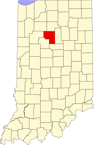
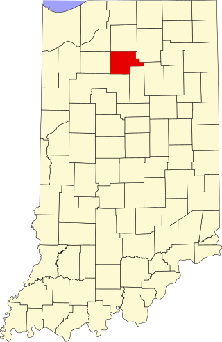
This is a list of the National Register of Historic Places listings in Cass County, Indiana.

<span class="mw-page-title-main">National Register of Historic Places listings in Fulton County, Indiana</span>

This is a list of the National Register of Historic Places listings in Fulton County, Indiana.

<span class="mw-page-title-main">National Register of Historic Places listings in Howard County, Indiana</span>

This is a list of the National Register of Historic Places listings in Howard County, Indiana.

<span class="mw-page-title-main">National Register of Historic Places listings in Stutsman County, North Dakota</span>

This is a list of the National Register of Historic Places listings in Stutsman County, North Dakota.

<span class="mw-page-title-main">National Register of Historic Places listings in McHenry County, North Dakota</span>

This is a list of the National Register of Historic Places listings in McHenry County, North Dakota.

<span class="mw-page-title-main">National Register of Historic Places listings in Barnes County, North Dakota</span>

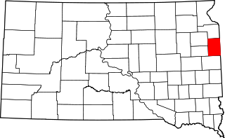
This is a list of the National Register of Historic Places listings in Barnes County, North Dakota.

<span class="mw-page-title-main">National Register of Historic Places listings in Ramsey County, North Dakota</span>

This is a list of the National Register of Historic Places listings in Ramsey County, North Dakota.

<span class="mw-page-title-main">National Register of Historic Places listings in Pembina County, North Dakota</span>

This is a list of the National Register of Historic Places listings in Pembina County, North Dakota.

<span class="mw-page-title-main">National Register of Historic Places listings in Richland County, North Dakota</span>

This is a list of the National Register of Historic Places listings in Richland County, North Dakota.

<span class="mw-page-title-main">National Register of Historic Places listings in Cass County, Missouri</span>

This is a list of the National Register of Historic Places listings in Cass County, Missouri.

References

  1. The latitude and longitude information provided in this table was derived originally from the National Register Information System, which has been found to be fairly accurate for about 99% of listings. Some locations in this table may have been corrected to current GPS standards.
  2. National Park Service, United States Department of the Interior, "National Register of Historic Places: Weekly List Actions", retrieved December 2, 2022.
  3. 1 2 Numbers represent an alphabetical ordering by significant words. Various colorings, defined here, differentiate National Historic Landmarks and historic districts from other NRHP buildings, structures, sites or objects.
  4. "National Register Information System". National Register of Historic Places . National Park Service. April 24, 2008.
  5. The eight-digit number below each date is the number assigned to each location in the National Register Information System database, which can be viewed by clicking the number.
  6. "Fargo Train Depot Damaged by Fire". The Bismarck Tribune . December 24, 1974. p. 7. Retrieved August 11, 2022 via Newspapers.com.
  7. "Fargo blaze guts cathedral's history". The Bismarck Tribune . September 16, 1989. p. 2B. Retrieved August 11, 2022 via Newspapers.com.
  8. "House demolished". The Fargo Forum . May 18, 2003.