Rembrandt is a city in Buena Vista County, Iowa, United States. The population was 209 at the time of the 2020 census.

Maynard is a city in Fayette County, Iowa, United States. The population was 476 at the time of the 2020 census.

Oakland Acres is a city in Jasper County, Iowa, United States. The population was 176 at the time of the 2020 census.

Hayesville is a city in Keokuk County, Iowa, United States. The population was 41 at the time of the 2020 census.

Webster is a city in Keokuk County, Iowa, United States. The population was 94 at the time of the 2020 census.

Harvey is a city in Marion County, Iowa, United States. At the time of the 2020 census, its population was 236.

Emerson is a city in Mills County, Iowa, United States. The population was 403 at the time of the 2020 census.

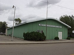
Macedonia is a city in Pottawattamie County, Iowa, United States. The population was 267 at the time of the 2020 census.

McClelland is a city in Pottawattamie County, Iowa, United States. The city was founded in 1903 after the Great Western Railroad was extended to include Council Bluffs. The population was 146 at the time of the 2020 census.

Redding is a city in southwest Ringgold County, Iowa, United States. The population was 63 at the time of the 2020 census.

Tingley is a city in northern Ringgold County, Iowa, United States. The population was 136 at the time of the 2020 census.

Dixon is a city in Scott County, Iowa, United States. The population was 202 at the time of the 2020 census.

Maysville is a city in Scott County, Iowa, United States. The population was 156 at the time of the 2020 census.

Lake Shore is a city in Cass County, Minnesota, United States. The population was 1,056 at the 2020 census. It is part of the Brainerd Micropolitan Statistical Area.

Urbank is a city in Otter Tail County, Minnesota, United States. The population was 52 at the 2020 census.

Clarkson Valley is a city in St. Louis County, Missouri, United States. The population was 2,609 at the 2020 census.

North River is a city in Cass County, North Dakota, United States. The population was 55 at the 2020 census. North River was founded in 1973. It is a suburb/bedroom community directly adjacent to the city of Fargo.

Dunes City is a city in Lane County, Oregon, United States. The population was 1,303 at the 2010 census.

Crooks is a city in Minnehaha County, South Dakota, United States and is a suburb of Sioux Falls. The population was 1,362 at the 2020 census. Crooks was named New Hope until 1904. The town's present name honors W. A. Crooks, a local politician.

Belmont is a town in Pleasants County, West Virginia, United States. It is part of the Parkersburg–Vienna metropolitan area. The population was 872 at the 2020 census. Belmont was incorporated on April 19, 1946, by the Circuit Court of Pleasants County. The city was named for the beautiful hills in the area.