Felton, Minnesota

Last updated
Felton
The "Felton Cafe" Angie's Diner Cafe on Highway 9, Felton, Minnesota.jpg
Clay County Minnesota Incorporated and Unincorporated areas Felton Highlighted.svg
Location of Felton, Minnesota
Coordinates: 47°4′38″N96°30′16″W / 47.07722°N 96.50444°W / 47.07722; -96.50444
CountryUnited States
State Minnesota
County Clay
Area
[1]
  Total1.01 sq mi (2.63 km2)
  Land1.01 sq mi (2.63 km2)
  Water0.00 sq mi (0.00 km2)
Elevation
912 ft (278 m)
Population
 (2020) [2]
  Total177
  Estimate 
(2021) [3]
173
  Density174.38/sq mi (67.30/km2)
Time zone UTC-6 (CST)
  Summer (DST) UTC-5 (CDT)
ZIP code
56536
Area code 218
FIPS code 27-20834
GNIS feature ID0643595 [4]

Felton is a city in Clay County, Minnesota, United States. The population was 177 at the 2020 census. [2]

Contents

Geography

According to the United States Census Bureau, the city has a total area of 1.03 square miles (2.67 km2), all land. [5]

Minnesota State Highway 9 serves as a main route in the community.

Sign for Felton on MN 9 Felton is on Minnesota State Highway 9.jpg
Sign for Felton on MN 9

Demographics

Historical population
CensusPop.
1910 149
1920 18423.5%
1930 137−25.5%
1940 20046.0%
1950 25829.0%
1960 201−22.1%
1970 23215.4%
1980 26413.8%
1990 211−20.1%
2000 2162.4%
2010 177−18.1%
2020 1770.0%
2021 (est.)173 [3] −2.3%
U.S. Decennial Census [6]
2020 Census [2]

2010 census

As of the census of 2010, there were 177 people, 78 households, and 44 families living in the city. The population density was 171.8 inhabitants per square mile (66.3/km2). There were 93 housing units at an average density of 90.3 per square mile (34.9/km2). The racial makeup of the city was 98.9% White and 1.1% Asian. Hispanic or Latino of any race were 2.8% of the population.

There were 78 households, of which 26.9% had children under the age of 18 living with them, 43.6% were married couples living together, 10.3% had a female householder with no husband present, 2.6% had a male householder with no wife present, and 43.6% were non-families. 37.2% of all households were made up of individuals, and 11.5% had someone living alone who was 65 years of age or older. The average household size was 2.27 and the average family size was 3.05.

The median age in the city was 40.8 years. 22% of residents were under the age of 18; 9.1% were between the ages of 18 and 24; 25.4% were from 25 to 44; 32.8% were from 45 to 64; and 10.7% were 65 years of age or older. The gender makeup of the city was 52.0% male and 48.0% female.

2000 census

As of the census of 2000, there were 216 people, 91 households, and 56 families living in the city. The population density was 211.0 inhabitants per square mile (81.5/km2). There were 97 housing units at an average density of 94.8 per square mile (36.6/km2). The racial makeup of the city was 97.22% White, 0% Asian, 1.85% from other races, and 0.46% from two or more races. Hispanic or Latino of any race were 5.09% of the population.

There were 91 households, out of which 31.9% had children under the age of 18 living with them, 49.5% were married couples living together, 9.9% had a female householder with no husband present, and 37.4% were non-families. 33.0% of all households were made up of individuals, and 13.2% had someone living alone who was 65 years of age or older. The average household size was 2.37 and the average family size was 3.12.

In the city, the population was spread out, with 31.5% under the age of 18, 4.2% from 18 to 24, 27.3% from 25 to 44, 24.1% from 45 to 64, and 13.0% who were 65 years of age or older. The median age was 35 years. For every 100 females, there were 92.9 males. For every 100 females age 18 and over, there were 102.7 males.

The median income for a household in the city was $26,477, and the median income for a family was $40,833. Males had a median income of $28,750 versus $18,750 for females. The per capita income for the city was $15,321. About 10.3% of families and 16.9% of the population were below the poverty line, including 26.3% of those under the age of eighteen and 12.8% of those 65 or over.

Related Research Articles

Kodiak Station is a census-designated place (CDP) in Kodiak Island Borough, Alaska, United States. At the 2020 census the population was 1,673, up from 1,301 in 2010.

<span class="mw-page-title-main">Osburn, Idaho</span> City in Idaho, United States

Osburn is a city in Shoshone County, Idaho, United States. Located in the Silver Valley mining region of northern Idaho, its population was 1,555 at the 2010 census.

<span class="mw-page-title-main">Alta Vista, Iowa</span> City in Iowa, United States

Alta Vista is a city in Chickasaw County, Iowa, United States. The population was 227 at the 2020 census.

<span class="mw-page-title-main">Garber, Iowa</span> City in Iowa, United States

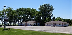
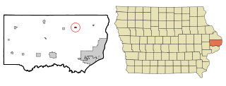
Garber is a city in Clayton County, Iowa, United States. The population was 76 at the time of the 2020 census, down from 103 in 2000.

<span class="mw-page-title-main">Goose Lake, Iowa</span> City in Iowa, United States

Goose Lake is a city in Clinton County, Iowa, United States. The population was 239 at the time of the 2020 census.

<span class="mw-page-title-main">Americus, Kansas</span> City in Lyon County, Kansas

Americus is a city in Lyon County, Kansas, United States. As of the 2020 census, the population of the city was 776. It is located northwest of the city of Emporia. Americus is often a waypoint in some Unbound Gravel bike races.

<span class="mw-page-title-main">Harding, Minnesota</span> City in Minnesota, United States

Harding is a city in Morrison County, Minnesota, United States, along the Platte River. The population was 123 at the 2020 census.

<span class="mw-page-title-main">Shelly, Minnesota</span> City in Minnesota, United States

Shelly is a city in Norman County, Minnesota, United States. The population was 179 at the 2020 census.

<span class="mw-page-title-main">Bluffton, Minnesota</span> City in Minnesota, United States

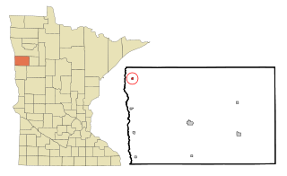
Bluffton is a city in Otter Tail County, Minnesota, United States, along the Leaf River. The population was 210 at the 2020 census.

<span class="mw-page-title-main">Gully, Minnesota</span> City in Minnesota, United States

Gully is a city in Polk County, Minnesota, United States. It is part of the Grand Forks-ND-MN Metropolitan Statistical Area. The population was 59 at the 2020 census.

<span class="mw-page-title-main">Mentor, Minnesota</span> City in Minnesota, United States

Mentor is a city in Polk County, Minnesota, United States. It is part of the Grand Forks-ND-MN Metropolitan Statistical Area. The population was 104 at the 2020 census. The city is near Maple Lake.

<span class="mw-page-title-main">Greendale, Missouri</span> City in Missouri, United States

Greendale is a city in St. Louis County, Missouri, United States. The population was 651 at the 2010 census.

<span class="mw-page-title-main">Bennet, Nebraska</span> Village in Nebraska, United States

Bennet is a village in Lancaster County, Nebraska, United States. It is part of the Lincoln, Nebraska Metropolitan Statistical Area. The population was 719 at the 2010 census.

<span class="mw-page-title-main">Fort Calhoun, Nebraska</span> City in Nebraska, United States

Fort Calhoun is a city in Washington County, Nebraska, United States. The population was 908 at the 2010 census. The city includes Fort Atkinson, the first fort built west of the Missouri River.

<span class="mw-page-title-main">Edinburg, North Dakota</span> City in North Dakota, United States

Edinburg is a city in Walsh County, North Dakota, United States. The population was 199 at the 2020 census.

<span class="mw-page-title-main">Kenmare, North Dakota</span> City in North Dakota, United States

Kenmare is a city in Ward County, North Dakota, United States. The population was 961 at the 2020 census. Kenmare is part of the Minot Micropolitan Statistical Area.

<span class="mw-page-title-main">Clarksburg, Ohio</span> Village in Ohio, United States

Clarksburg is a village in Ross County, Ohio, United States. The population was 409 at the 2020 census.

<span class="mw-page-title-main">Roscoe, Pennsylvania</span> Borough in Pennsylvania, United States

Roscoe is a borough in Washington County, Pennsylvania, United States. The population was 716 at the 2020 census.

<span class="mw-page-title-main">Shorewood Hills, Wisconsin</span> Village in Wisconsin, United States

Shorewood Hills is a village in Dane County, Wisconsin, United States. It was established in 1927. The population was 2,169 at the 2020 census. Entirely surrounded by the city of Madison and Lake Mendota, it is part of the Madison Metropolitan Statistical Area.

<span class="mw-page-title-main">Lake Shangrila, Wisconsin</span> Former CDP in Wisconsin, United States

Lake Shangrila was a census-designated place (CDP) in the town of Salem, Kenosha County, Wisconsin, United States. The population was 861 at the 2010 census. The core area of the CDP was annexed into the village of Bristol on March 15, 2011, at the same time that the CDP was deleted.

References

  1. "2020 U.S. Gazetteer Files". United States Census Bureau. Retrieved July 24, 2022.
  2. 1 2 3 "Explore Census Data". United States Census Bureau . Retrieved April 21, 2022.
  3. 1 2 "City and Town Population Totals: 2020-2021". United States Census Bureau. June 8, 2022. Retrieved June 16, 2022.
  4. "US Board on Geographic Names". United States Geological Survey. October 25, 2007. Retrieved January 31, 2008.
  5. "US Gazetteer files 2010". United States Census Bureau. Archived from the original on January 25, 2012. Retrieved November 13, 2012.
  6. United States Census Bureau. "Census of Population and Housing" . Retrieved September 11, 2013.

Coordinates: 47°04′43″N96°30′23″W / 47.07861°N 96.50639°W / 47.07861; -96.50639