National Register of Historic Places listings in Woonsocket, Rhode Island

Last updated

Location of Woonsocket in Providence County, Rhode Island Woonsocket RI lg.PNG
Location of Woonsocket in Providence County, Rhode Island

This is a list of National Register of Historic Places listings in Woonsocket, Rhode Island.

Contents

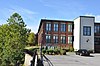
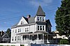
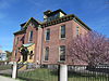
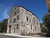
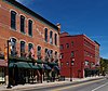
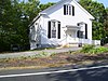
Included in the list are all properties and districts on the National Register of Historic Places in the city of Woonsocket, Rhode Island, United States. Woonsocket is home to 43 of the more than 400 properties and districts listed in Providence County. Properties and districts located in the county's other municipalities are listed separately. One Woonsocket listing, the Blackstone Canal, extends into other parts of Providence County, and appears on multiple lists. There is also one former listing.

Contents: Counties in Rhode Island

Bristol | Kent | Newport | Providence | Washington


    This National Park Service list is complete through NPS recent listings posted February 9, 2024. [1]
Map all coordinates using: OpenStreetMap
[2] Name on the Register [3] ImageDate listed [4] LocationDescription
1 1761 Milestone
1761 Milestone WoonsocketRI 1761Milestone.jpg
1761 Milestone
November 24, 1982
(#82000131)
640 S. Main St.
41°59′22″N71°31′54″W / 41.989444°N 71.531667°W / 41.989444; -71.531667 (1761 Milestone)
2 Allen Street Historic District
Allen Street Historic District WoonsocketRI AllenStreet 01.jpg
Allen Street Historic District
September 13, 1990
(#90001349)
Allen St.
42°00′06″N71°30′50″W / 42.001667°N 71.513889°W / 42.001667; -71.513889 (Allen Street Historic District)
3 John Arnold House
John Arnold House John Arnold House Woonsocket, Rhode Island RI.jpg
John Arnold House
November 24, 1982
(#82000132)
99 Providence St.
41°59′41″N71°31′22″W / 41.994722°N 71.522778°W / 41.994722; -71.522778 (John Arnold House)
4 Bernon Worsted Mill
Bernon Worsted Mill Bernon Worsted Mill, Woonsocket RI.jpg
Bernon Worsted Mill
June 10, 2005
(#05000585)
828 Park Ave.
41°59′38″N71°30′50″W / 41.993889°N 71.513889°W / 41.993889; -71.513889 (Bernon Worsted Mill)
5 Blackstone Canal
Blackstone Canal LincolnRI BlackstoneCanalSegmentInLonsdale.jpg
Blackstone Canal
May 6, 1971
(#91001536)
From Steeple and Promenade Sts. in Providence to the Massachusetts border in North Smithfield
41°55′16″N71°25′21″W / 41.921111°N 71.4225°W / 41.921111; -71.4225 (Blackstone Canal)
Initial listing extended from Providence, through Pawtucket, and as far north as Lincoln; a 1991 expansion (#91001536) extended it to the state line; the canal itself extended into Worcester County, Massachusetts, where it is the subject of separate listings.
6 Cato Hill Historic District
Cato Hill Historic District WoonsocketRI CatoHill ChurchStreet.jpg
Cato Hill Historic District
August 10, 1976
(#76002255)
Bounded by Main, Railroad, Arnold and Blackstone Streets, including portions of Cato, Church, Boyden, and all of Clarkin Lane and Cato Lane
42°00′18″N71°30′54″W / 42.005°N 71.515°W / 42.005; -71.515 (Cato Hill Historic District)
7 Henry Darling House
Henry Darling House WoonsocketRI HenryDarlingHouse.jpg
Henry Darling House
November 26, 1982
(#82000136)
786 Harris Ave.
42°00′50″N71°31′40″W / 42.013889°N 71.527778°W / 42.013889; -71.527778 (Henry Darling House)
8 First Universalist Church March 27, 2020
(#100005156)
78 Earle St.
42°00′27″N71°30′44″W / 42.007395°N 71.512183°W / 42.007395; -71.512183 (First Universalist Church)
9 French Worsted Company Mill Historic District
French Worsted Company Mill Historic District French Worsted Mills.jpg
French Worsted Company Mill Historic District
May 21, 2008
(#08000453)
153 Hamlet Ave.
42°00′10″N71°30′00″W / 42.002764°N 71.499919°W / 42.002764; -71.499919 (French Worsted Company Mill Historic District)
Demolished in 2011. [5]
10 Alphonse Gaulin Jr. House
Alphonse Gaulin Jr. House WoonsocketRI AlphonseGaulinJrHouse.jpg
Alphonse Gaulin Jr. House
November 24, 1982
(#82000137)
311 Elm St.
42°00′25″N71°29′55″W / 42.006944°N 71.498611°W / 42.006944; -71.498611 (Alphonse Gaulin Jr. House)
11 Glenark Mills
Glenark Mills Glenark Mill.JPG
Glenark Mills
May 15, 1989
(#89000409)
64 East St.
41°59′54″N71°31′09″W / 41.998333°N 71.519167°W / 41.998333; -71.519167 (Glenark Mills)
12 Grove Street Elementary School
Grove Street Elementary School Grove Street Elementary School, Woonsocket RI.jpg
Grove Street Elementary School
November 24, 1982
(#82000138)
312 Grove St.
41°59′54″N71°30′33″W / 41.998333°N 71.509167°W / 41.998333; -71.509167 (Grove Street Elementary School)
13 Hanora Mills
Hanora Mills Hanora Mills, Woonsocket RI.jpg
Hanora Mills
November 24, 1982
(#82000139)
1 Main St.
42°00′02″N71°30′58″W / 42.000556°N 71.516111°W / 42.000556; -71.516111 (Hanora Mills)
14 Harris Warehouse
Harris Warehouse Harris curved warehouse.jpg
Harris Warehouse
July 1, 1976
(#76000047)
61 Railroad St.
42°00′14″N71°30′54″W / 42.003889°N 71.515°W / 42.003889; -71.515 (Harris Warehouse)
15 Honan's Block and 112-114 Main Street
Honan's Block and 112-114 Main Street WoonsocketRI 110-114MainStreet.jpg
Honan's Block and 112-114 Main Street
August 3, 1989
(#89000941)
110-114 Main St.
42°00′08″N71°30′53″W / 42.002222°N 71.514722°W / 42.002222; -71.514722 (Honan's Block and 112-114 Main Street)
16 Hope Street School
Hope Street School Hope Street School, Woonsocket RI.jpg
Hope Street School
April 14, 2000
(#00000383)
40 Hope St.
41°59′57″N71°31′13″W / 41.999167°N 71.520278°W / 41.999167; -71.520278 (Hope Street School)
17 Island Place Historic District
Island Place Historic District Market Square Woonsocket RI.jpg
Island Place Historic District
September 13, 1990
(#90001348)
Island Place and S. Main St. at Market Sq.
41°59′57″N71°30′59″W / 41.999167°N 71.516389°W / 41.999167; -71.516389 (Island Place Historic District)
18 Jenckes Mansion
Jenckes Mansion WoonsocketRI JenckesMansion.jpg
Jenckes Mansion
November 24, 1982
(#82000140)
837-839 Social St.
42°00′44″N71°30′07″W / 42.012222°N 71.501944°W / 42.012222; -71.501944 (Jenckes Mansion)
19 Jules Desurmont Worsted Company Mill
Jules Desurmont Worsted Company Mill WoonsocketRI JulesDesurmontWorstedCompanyMill.jpg
Jules Desurmont Worsted Company Mill
January 12, 2007
(#06001257)
84 Fairmount St.
42°00′09″N71°31′21″W / 42.0025°N 71.5225°W / 42.0025; -71.5225 (Jules Desurmont Worsted Company Mill)
20 L'Eglise du Precieux Sang
L'Eglise du Precieux Sang L'Eglise du Precieux Sang.jpg
L'Eglise du Precieux Sang
July 26, 1982
(#82000142)
94 Carrington Ave. and 61 Park Ave.
42°00′06″N71°30′33″W / 42.001667°N 71.509167°W / 42.001667; -71.509167 (L'Eglise du Precieux Sang)
21 L'Union Saint Jean-Baptist d' Amerique
L'Union Saint Jean-Baptist d' Amerique Woonsocket Civil War Monument.jpg
L'Union Saint Jean-Baptist d' Amerique
March 12, 2018
(#100002194)
1 Social St.
42°00′21″N71°30′43″W / 42.005935°N 71.512022°W / 42.005935; -71.512022 (L'Union Saint Jean-Baptist d' Amerique)
22 Lafayette Worsted Company Administrative Headquarters Historic District
Lafayette Worsted Company Administrative Headquarters Historic District WoonsocketRI LafayetteMillGuestHouse.jpg
Lafayette Worsted Company Administrative Headquarters Historic District
August 7, 2017
(#100001439)
134 & 148 Hamlet Ave.
42°00′08″N71°30′04″W / 42.002216°N 71.501246°W / 42.002216; -71.501246 (Lafayette Worsted Company Administrative Headquarters Historic District)
23 Linton Block
Linton Block LintonBlock.jpg
Linton Block
November 24, 1982
(#82000143)
3-5 Monument Sq.
42°00′19″N71°30′48″W / 42.005278°N 71.513333°W / 42.005278; -71.513333 (Linton Block)
Destroyed by fire in 2000. [6]
24 Logee House
Logee House Logee House, Woonsocket RI.jpg
Logee House
November 24, 1982
(#82000001)
225 Logee St.
41°59′41″N71°30′43″W / 41.994722°N 71.511944°W / 41.994722; -71.511944 (Logee House)
25 Main Street Historic District
Main Street Historic District Downtown Woonsocket Historic District.jpg
Main Street Historic District
April 18, 1991
(#91000461)
Roughly Main St. east of Market Sq. to Depot Sq.
42°00′09″N71°30′52″W / 42.0025°N 71.514444°W / 42.0025; -71.514444 (Main Street Historic District)
26 North End Historic District
North End Historic District WoonsocketRI NorthEndHD 02.jpg
North End Historic District
November 24, 1982
(#82000002)
Roughly bounded by Verry, Highland, Winter, and Summer Sts.
42°00′31″N71°31′15″W / 42.008611°N 71.520833°W / 42.008611; -71.520833 (North End Historic District)
27 Philmont Worsted Company Mill
Philmont Worsted Company Mill WoonsocketRI PhilmontWorstedCompanyMill.jpg
Philmont Worsted Company Mill
April 19, 2006
(#06000296)
685 Social St.
42°00′38″N71°30′07″W / 42.010556°N 71.501944°W / 42.010556; -71.501944 (Philmont Worsted Company Mill)
28 Pothier House
Pothier House WoonsocketRI PothierHouse.jpg
Pothier House
November 24, 1982
(#82000003)
172 Pond St.
42°00′27″N71°30′42″W / 42.0075°N 71.511667°W / 42.0075; -71.511667 (Pothier House)
29 St. Andrews Episcopal Chapel
St. Andrews Episcopal Chapel St. Andrews Episcopal Chapel in Woonsocket, Rhode Island, USA.jpg
St. Andrews Episcopal Chapel
November 24, 1982
(#82000005)
576 Fairmont St.
42°00′03″N71°31′54″W / 42.000833°N 71.531667°W / 42.000833; -71.531667 (St. Andrews Episcopal Chapel)
30 St. Ann's Church Complex
St. Ann's Church Complex St. Ann's Church, Woonsocket RI.jpg
St. Ann's Church Complex
November 24, 1982
(#82000006)
Cumberland and Elm Sts. and Gaulin Ave.
42°00′27″N71°30′08″W / 42.0075°N 71.502222°W / 42.0075; -71.502222 (St. Ann's Church Complex)
31 St. Charles Borromeo Church Complex
St. Charles Borromeo Church Complex St. Charles Borromeo Church Complex Woonsocket, Rhode Island.jpg
St. Charles Borromeo Church Complex
February 24, 1983
(#83000003)
N. Main, Daniels, and Earle Sts.
42°00′29″N71°30′52″W / 42.008056°N 71.514444°W / 42.008056; -71.514444 (St. Charles Borromeo Church Complex)
32 Smith-Ballou House
Smith-Ballou House Smithballou.jpg
Smith-Ballou House
June 6, 2003
(#03000184)
641 Harris Avenue
42°00′45″N71°31′28″W / 42.0125°N 71.524444°W / 42.0125; -71.524444 (Smith-Ballou House)
33 Smithfield Friends Meeting House, Parsonage & Cemetery
Smithfield Friends Meeting House, Parsonage & Cemetery Smithfield Friends Meeting House.jpg
Smithfield Friends Meeting House, Parsonage & Cemetery
November 24, 1982
(#82000008)
126 Smithfield Rd.
41°59′21″N71°31′49″W / 41.989167°N 71.530278°W / 41.989167; -71.530278 (Smithfield Friends Meeting House, Parsonage & Cemetery)
34 South Main Street Historic District
South Main Street Historic District WoonsocketRI SouthMainStreet 4.jpg
South Main Street Historic District
November 24, 1982
(#82000009)
Roughly bounded by Mason, Coe, Andrews St., and Bernice Ave.
41°59′37″N71°31′35″W / 41.993611°N 71.526389°W / 41.993611; -71.526389 (South Main Street Historic District)
35 Stadium Building
Stadium Building Stadium Theater Building Woonsocket Rhode Island.jpg
Stadium Building
June 30, 1976
(#76000006)
329 Main St.
42°00′19″N71°30′46″W / 42.005278°N 71.512778°W / 42.005278; -71.512778 (Stadium Building)
36 U.S. Post Office
U.S. Post Office YMCA-PO Woonsocket.jpg
U.S. Post Office
May 30, 1979
(#79003774)
295 Main St.
42°00′17″N71°30′46″W / 42.004722°N 71.512778°W / 42.004722; -71.512778 (U.S. Post Office)
Now part of YMCA
37 Frank Wilbur House
Frank Wilbur House WoonsocketRI FrankWilburHouse.jpg
Frank Wilbur House
November 24, 1982
(#82000012)
1273 Park Ave.
41°59′08″N71°30′59″W / 41.985556°N 71.516389°W / 41.985556; -71.516389 (Frank Wilbur House)
38 Woonsocket City Hall
Woonsocket City Hall Woonsocket City Hall.jpg
Woonsocket City Hall
May 1, 1974
(#74000007)
169 Main St.
42°00′08″N71°30′53″W / 42.002222°N 71.514722°W / 42.002222; -71.514722 (Woonsocket City Hall)
39 Woonsocket Civil War Monument
Woonsocket Civil War Monument Woonsocket Civil War Monument.jpg
Woonsocket Civil War Monument
November 24, 1982
(#82000013)
Monument Sq.
42°00′19″N71°30′47″W / 42.005278°N 71.513056°W / 42.005278; -71.513056 (Woonsocket Civil War Monument)
40 Woonsocket Company Mill Complex
Woonsocket Company Mill Complex Woonsocket Mills HABS RI1.jpg
Woonsocket Company Mill Complex
May 7, 1973
(#73000005)
100-115 Front St.
42°00′05″N71°30′46″W / 42.001389°N 71.512778°W / 42.001389; -71.512778 (Woonsocket Company Mill Complex)
41 Woonsocket District Courthouse
Woonsocket District Courthouse Woonsocket District Courthouse 2015.jpg
Woonsocket District Courthouse
November 24, 1982
(#82000014)
24 Front St.
42°00′06″N71°30′39″W / 42.001667°N 71.510833°W / 42.001667; -71.510833 (Woonsocket District Courthouse)
42 Woonsocket Rubber Company Mill
Woonsocket Rubber Company Mill WoonsocketRI FormerRubberCompanyMill.jpg
Woonsocket Rubber Company Mill
May 1, 1989
(#89000334)
60-82 S. Main St.
42°00′00″N71°31′02″W / 42.0°N 71.5172°W / 42.0; -71.5172 (Woonsocket Rubber Company Mill)
43 Woonsocket Senior High and Junior High Schools
Woonsocket Senior High and Junior High Schools WoonsocketRI OldJuniorHighSchool.jpg
Woonsocket Senior High and Junior High Schools
November 6, 2017
(#100001780)
357 Park Place
42°00′15″N71°30′16″W / 42.004279°N 71.504378°W / 42.004279; -71.504378 (Woonsocket Senior High and Junior High Schools)

Former listing

[2] Name on the RegisterImageDate listedDate removedLocationDescription
1 Woonsocket Opera House April 24, 1973
(#73002266)
July 22, 197637-41-45 N. Main St.
Also known as the Park Theatre. Destroyed by fire September 22, 1975. [7]

See also

Related Research Articles

<span class="mw-page-title-main">National Register of Historic Places listings in Rhode Island</span>

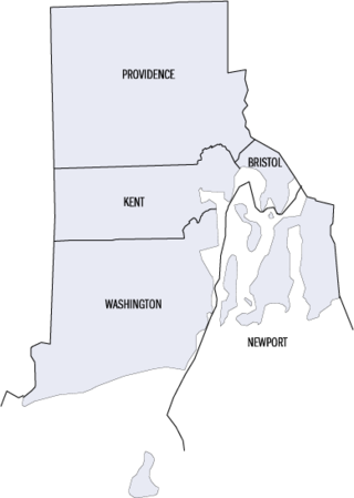
This is a list of properties and districts listed on the National Register of Historic Places in Rhode Island. As of May 29, 2015, there are more than 750 listed sites in Rhode Island. All 5 of the counties in Rhode Island have listings on the National Register.

<span class="mw-page-title-main">National Register of Historic Places listings in Bristol County, Rhode Island</span>

This is a list of the National Register of Historic Places listings in Bristol County, Rhode Island.

<span class="mw-page-title-main">National Register of Historic Places listings in Kent County, Rhode Island</span>

This is a list of the National Register of Historic Places listings in Kent County, Rhode Island.

<span class="mw-page-title-main">National Register of Historic Places listings in Newport County, Rhode Island</span>

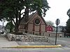
This is a list of the National Register of Historic Places listings in Newport County, Rhode Island.

<span class="mw-page-title-main">National Register of Historic Places listings in Providence County, Rhode Island</span>

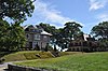
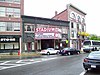
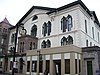
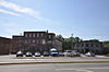
This is a list of the National Register of Historic Places listings in Providence County, Rhode Island.

<span class="mw-page-title-main">National Register of Historic Places listings in Washington County, Rhode Island</span>

This is a list of the National Register of Historic Places listings in Washington County, Rhode Island.

<span class="mw-page-title-main">National Register of Historic Places listings in Providence, Rhode Island</span>

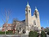
This is a list of the National Register of Historic Places listings in Providence, Rhode Island.

<span class="mw-page-title-main">National Register of Historic Places listings in Pawtucket, Rhode Island</span>

This is a list of the National Register of Historic Places listings in Pawtucket, Rhode Island.

This is a list of Registered Historic Places in Jamestown, Rhode Island, which has been transferred from and is an integral part of National Register of Historic Places listings in Newport County, Rhode Island.

This is a list of Registered Historic Places in Burrillville, Rhode Island.

This is a list of Registered Historic Places in Central Falls, Rhode Island.

This is a list of Registered Historic Places in Cranston, Rhode Island.

This is a list of Registered Historic Places in Cumberland, Rhode Island.

This is a list of Registered Historic Places in East Providence, Rhode Island.

This is a list of Registered Historic Places in Foster, Rhode Island.

This is a list of Registered Historic Places in Glocester, Rhode Island.

This is a list of Registered Historic Places in Lincoln, Rhode Island.

This is a list of Registered Historic Places in North Providence, Rhode Island.

This is a list of Registered Historic Places in North Smithfield, Rhode Island.

This is a list of Registered Historic Places in Smithfield, Rhode Island.

References

  1. National Park Service, United States Department of the Interior, "National Register of Historic Places: Weekly List Actions", retrieved February 9, 2024.
  2. 1 2 Numbers represent an alphabetical ordering by significant words. Various colorings, defined here, differentiate National Historic Landmarks and historic districts from other NRHP buildings, structures, sites or objects.
  3. "National Register Information System". National Register of Historic Places . National Park Service. March 13, 2009.
  4. The eight-digit number below each date is the number assigned to each location in the National Register Information System database, which can be viewed by clicking the number.
  5. "Costly demolition projects leave Woonsocket in a pile of bricks | the Valley Breeze". Archived from the original on 2012-09-17. Retrieved 2012-05-24.
  6. "Woonsocket Multiple Resource Area Nomination" (PDF). State of Rhode Island. Retrieved 2013-09-06.
  7. "Woman Dies In Blaze at Woonsocket". Hartford Courant . September 23, 1975. p. 8. Retrieved August 21, 2022 via Newspapers.com.