
The Boston Post Road was a system of mail-delivery routes between New York City and Boston, Massachusetts, that evolved into one of the first major highways in the United States.

North Smithfield is a town in Providence County, Rhode Island, United States, settled as a farming community in 1666 and incorporated into its present form in 1871. North Smithfield includes the historic villages of Forestdale, Primrose, Waterford, Branch Village, Union Village, Park Square, and Slatersville. The population was 12,588 at the 2020 census.

Woonsocket, is a city in Providence County, Rhode Island, United States. The population was 43,240 at the 2020 census, making it the sixth largest city in the state. Being Rhode Island's northernmost city, Woonsocket lies directly south of the Massachusetts state line and constitutes part of both the Providence metropolitan area and the larger Greater Boston Combined Statistical Area.

The Blackstone River is a river in the U.S. states of Massachusetts and Rhode Island. It flows approximately 48 mi (80 km) and drains a watershed of approximately 540 sq. mi (1,400 km2). Its long history of industrial use has left a legacy of pollution, and it was characterized by the United States Environmental Protection Agency in 1990 as "the most polluted river in the country concerning toxic sediments."

Route 146 is a 20.99-mile (33.78 km) north-south expressway in the U.S. state of Massachusetts, maintained by the Massachusetts Department of Transportation (MassDOT). Spanning approximately 21 miles (34 km) along a south–north axis, it is a continuation of Route 146 in Rhode Island, which splits from I-95 in Providence. The southern terminus within Massachusetts exists in Millville, where the expressway enters the state from North Smithfield, Rhode Island. Among several local roads, Route 146 intersects with the Massachusetts Turnpike (I-90) in Millbury and I-290 in Worcester before arriving at its northern terminus at the intersection of several surface streets in downtown Worcester. Most of the route is a freeway, except for a short section near the boundary between Millbury and Sutton where there is driveway access and at-grade crossings.

Route 99, also known as the Woonsocket Industrial Highway, is a numbered state highway running 2.9 miles (4.7 km) in Providence County, Rhode Island, United States. The route is a nominally north–south freeway for its entire length. Route 99 serves Manville and the Highland Industrial Park, providing freeway access to the city of Woonsocket from Interstate 295 and Rhode Island Route 146, the latter of which bypasses the city. The southern terminus of Route 99 is at a partial interchange with I-295 and Route 146 in Lincoln. The freeway has one interchange in Manville, a village in Lincoln, before terminating at an at-grade intersection with Rhode Island Route 122 in Woonsocket.

Route 102 is a 44.4-mile-long (71.5 km) numbered state highway in the U.S. state of Rhode Island. Route 102 serves as a non-freeway beltway around the Providence metro area. It begins in the village of Wickford and travels through less developed areas of western Rhode Island. The route ends in the village of Slatersville.
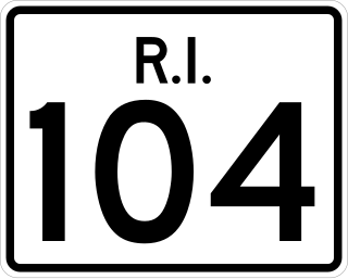
Route 104 is a 13.4-mile-long (21.6 km) numbered state highway in the U.S. state of Rhode Island. It runs from US 44 in North Providence to Worrall Street in Downtown Woonsocket. The route connects the cities of Providence and Woonsocket via the town center of Smithfield.

Route 114 is a 45.7-mile-long (73.5 km) numbered state highway in the U.S. state of Rhode Island. It connects the city of Newport to the city of Woonsocket. Route 114 was a major north–south artery for its entire length until the arrival of the Interstate Highway System. It is still a major commercial corridor on Aquidneck Island and in northern Rhode Island.

Route 126 is a 14.3-mile-long (23.0 km) state highway in the U.S. state of Rhode Island. Route 126 is a heavily traveled route in Pawtucket. Its southern terminus is at U.S. Route 1 in Providence, and its northern terminus is at the Massachusetts border where it continues as Massachusetts Route 126.

Route 146 is a 16.24-mile (26.14 km) north-south expressway in the U.S. state of Rhode Island, maintained by the Rhode Island Department of Transportation (RIDOT). Spanning approximately 16 miles (26 km) along a northwest–southeast axis, it links the cities of Providence, Woonsocket, and Worcester, Massachusetts.

Slatersville is a village on the Branch River in the town of North Smithfield, Rhode Island, United States. It includes the Slatersville Historic District, a historic district listed on the National Register of Historic Places. The historic district has been included as part of the Blackstone River Valley National Historical Park. The North Smithfield Public Library is located in Slatersville.

Union Village or "Bank Village" is a village and historic district located in North Smithfield and Woonsocket, Rhode Island on Rhode Island Route 146A. Union Village developed because it was at the cross roads of old Great Road and Pound Hill Road.
Ironstone is an historic village,, in the township of Uxbridge, Massachusetts, United States. It derived its name from plentiful bog iron found here which helped Uxbridge to become a center for three iron forges in the town's earliest settlement. South Uxbridge has historic sites, picturesque weddings, hospitality, industrial and distribution centers, and the new Uxbridge High School. This community borders North Smithfield, and Burrillville, Rhode Island, and Millville, Massachusetts. South Uxbridge receives municipal services from Uxbridge, for fire, police, EMS, School district, public works, and other services. There is a South Uxbridge fire station of the Uxbridge fire department. Worcester's Judicial District includes Uxbridge District Court. Ironstone appears on the Blackstone U.S. Geological Survey Map. Worcester County is in the Eastern time zone and observes DST.

This is a list of the National Register of Historic Places listings in Providence County, Rhode Island.

The Smithfield Friends Meeting House, Parsonage and Cemetery, is a Friends Meeting House of the Religious Society of Friends (Quakers), rebuilt in 1881. It is located at 108 Smithfield Road in Woonsocket, Rhode Island. The meetinghouse is home to one of the oldest Quaker communities in the region.
The Logee House is a historic house on 225 Logee Street in Woonsocket, Rhode Island. Built in 1729 by a French Huguenot family, this two-story wood-frame house is a rare early-18th-century house in the city, and one of its best-preserved. The main block follows a plan more typical of colonial Massachusetts houses, unsurprising given the land it stands on was once disputed between the two colonies. The main block has a central chimney, with single rooms on either side on both floors. An ell, probably 18th century in origin, extends from the rear, and a 20th-century porch adorns the front of the house.

The 1767 Milestones are historic milestones located along the route of the Upper Boston Post Road between the cities of Boston and Springfield in Massachusetts. The 40 surviving milestones were added to the National Register of Historic Places in 1971. Massachusetts has a total of 129 surviving milestones including those along the upper Post Road. The stones are so named, despite having been placed in many different years, because of a 1767 directive of the Province of Massachusetts Bay that such stones be placed along major roadways. The state highway department was directed in 1960 to undertake their preservation. Many of them underwent a major restoration in 2018.
The Andrews Mill Company Plant is a historic industrial complex at 761 Great Road in North Smithfield, Rhode Island. Built beginning in 1918, it was home to a maker of French worsted wool textiles, part of a major industrial development push in northern Rhode Island at the time. The complex was listed on the National Register of Historic Places in 2018.

U.S. Route 44 (US 44) is an east–west United States Numbered Highway that runs for 237 miles (381 km) through four states in the Northeastern United States. The western terminus is at US 209 and New York State Route 55 (NY 55) in Kerhonkson, New York, a hamlet in the Hudson Valley region. The eastern terminus is at Route 3A in Plymouth, Massachusetts.


