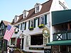
[3] Name on the Register [4] Image Date listed [5] Location City or town Description 1 Army and Navy YMCA Army and Navy YMCA December 29, 1988 (# 88003073 50 Washington Sq. 41°29′26″N 71°18′51″W / 41.490556°N 71.314167°W / 41.490556; -71.314167 (Army and Navy YMCA ) Newport 2 Artillery Park Artillery Park March 7, 1973 (# 73000054 North Rd. and Narragansett Ave. 41°29′47″N 71°22′29″W / 41.496389°N 71.374722°W / 41.496389; -71.374722 (Artillery Park ) Jamestown 3 Bailey Farm Bailey Farm June 4, 1984 (# 84001887 373 Wyatt Rd. 41°31′14″N 71°16′09″W / 41.520556°N 71.269167°W / 41.520556; -71.269167 (Bailey Farm ) Middletown 4 Charles H. Baldwin House Charles H. Baldwin House May 6, 1971 (# 71000018 Bellevue Ave., opposite Perry St. 41°28′44″N 71°18′31″W / 41.478889°N 71.308611°W / 41.478889; -71.308611 (Charles H. Baldwin House ) Newport 5 Benjamin Barker House Benjamin Barker House October 31, 1980 (# 80000081 1229 Main Rd. 41°38′30″N 71°12′19″W / 41.641667°N 71.205278°W / 41.641667; -71.205278 (Benjamin Barker House ) Tiverton Destroyed by fire in 1981. [6] 6 Battle of Rhode Island Site Battle of Rhode Island Site May 30, 1974 (# 74002054 Lehigh Hill and both sides of RI 24 between Medley and Dexter Sts. 41°36′12″N 71°15′31″W / 41.603333°N 71.258611°W / 41.603333; -71.258611 (Battle of Rhode Island Site ) Portsmouth Successful defense against British in 1778. Only Revolutionary War battle in which a segregated African-American unit fought (support logistics, 2 killed). 7 Beavertail Light Beavertail Light December 12, 1977 (# 77000024 Beavertail Rd. 41°26′58″N 71°23′59″W / 41.449444°N 71.399722°W / 41.449444; -71.399722 (Beavertail Light ) Jamestown Continuously operating gateway to Narragansett Bay since 1749; part of the Lighthouses of Rhode Island Thematic Resource (TR) 8 Isaac Bell House Isaac Bell House January 13, 1972 (# 72000022 70 Perry St. 41°28′46″N 71°18′35″W / 41.479444°N 71.309722°W / 41.479444; -71.309722 (Isaac Bell House ) Newport First major Shingle-style house 9 Bellevue Avenue Historic District Bellevue Avenue Historic District December 8, 1972 (# 72000023 Roughly bounded Atlantic Ocean, Easton Bay, Coggeshall Ave., Spring St., and Memorial Blvd. 41°28′23″N 71°18′28″W / 41.473056°N 71.307778°W / 41.473056; -71.307778 (Bellevue Avenue Historic District ) Newport Home to summer mansions and houses built by wealthy vacationers in Newport in late 19th and early 20th centuries 10 Bellevue Avenue/Casino Historic District Bellevue Avenue/Casino Historic District December 8, 1972 (# 72000024 170-230 Bellvue Avenue 41°28′57″N 71°18′28″W / 41.4825°N 71.307778°W / 41.4825; -71.307778 (Bellevue Avenue/Casino Historic District ) Newport 11 The Bird's Nest The Bird's Nest June 7, 1982 (# 82000130 526 Broadway at One Mile Corner 41°30′21″N 71°18′09″W / 41.505833°N 71.3025°W / 41.505833; -71.3025 (The Bird's Nest ) Newport 12 Borden Farm Borden Farm June 5, 2007 (# 07000528 2951 and 2967 E. Main Rd. 41°36′32″N 71°14′45″W / 41.608889°N 71.245833°W / 41.608889; -71.245833 (Borden Farm ) Portsmouth 13 Bourne Mill Bourne Mill December 22, 2006 (# 06001189 844 State Ave. 41°40′12″N 71°10′41″W / 41.67°N 71.178056°W / 41.67; -71.178056 (Bourne Mill ) Tiverton Often grouped with the mills of nearby Fall River, Mass., but entirely within Rhode Island 14 Boyd's Windmill Boyd's Windmill January 26, 2001 (# 01000018 Prospect Ave. 41°30′03″N 71°16′09″W / 41.500833°N 71.269167°W / 41.500833; -71.269167 (Boyd's Windmill ) Middletown 15 The Breakers The Breakers September 10, 1971 (# 71000019 Ochre Point Ave. 41°28′11″N 71°17′56″W / 41.469722°N 71.298889°W / 41.469722; -71.298889 (The Breakers ) Newport Advanced and costly mansion built by Cornelius Vanderbilt II in 1895. Considered the city's premier mansion then and now. 16 Brick Market Brick Market October 15, 1966 (# 66000019 Thames St. & Washington Sq. 41°29′23″N 71°18′58″W / 41.489722°N 71.316111°W / 41.489722; -71.316111 (Brick Market ) Newport Sophisticated late Georgian building with many classical elements. Now used as Museum of Newport History 17 Thomas Carr Farmstead Site (Keeler Site RI-707) Upload image November 1, 1984 (# 84000356 Address Restricted Jamestown 18 Castle Hill Lighthouse Castle Hill Lighthouse March 30, 1988 (# 88000277 Off Ocean Ave. on Castle Hill at the western end of Newport Neck 41°27′43″N 71°21′48″W / 41.461944°N 71.363333°W / 41.461944; -71.363333 (Castle Hill Lighthouse ) Newport 1890 lighthouse still in active use; part of the Lighthouses of Rhode Island TR 19 Chateau-sur-Mer Chateau-sur-Mer November 8, 1968 (# 68000002 424 Bellevue Ave. 41°28′10″N 71°18′20″W / 41.469444°N 71.305556°W / 41.469444; -71.305556 (Chateau-sur-Mer ) Newport Considered the first of the great Newport mansions. 20 Clambake Club of Newport Clambake Club of Newport November 7, 1995 (# 95001267 353 Tuckerman Ave. 41°28′47″N 71°16′32″W / 41.479722°N 71.275556°W / 41.479722; -71.275556 (Clambake Club of Newport ) Middletown 21 Clarke Street Meeting House Clarke Street Meeting House January 25, 1971 (# 71000020 Clarke St. 41°29′22″N 71°18′51″W / 41.489444°N 71.314167°W / 41.489444; -71.314167 (Clarke Street Meeting House ) Newport 22 Commandant's Residence, Quarters Number One, Fort Adams Commandant's Residence, Quarters Number One, Fort Adams May 8, 1974 (# 74000043 Harrison Ave., Fort Adams 41°28′17″N 71°20′33″W / 41.471389°N 71.3425°W / 41.471389; -71.3425 (Commandant's Residence, Quarters Number One, Fort Adams ) Newport 23 Common Burying Ground and Island Cemetery Common Burying Ground and Island Cemetery May 1, 1974 (# 74000044 Farwell and Warner Sts. 41°29′50″N 71°18′55″W / 41.497222°N 71.315278°W / 41.497222; -71.315278 (Common Burying Ground and Island Cemetery ) Newport 24 Conanicut Battery Upload image July 2, 1973 (# 73000055 West of Beaver Tail Rd. 41°28′49″N 71°23′38″W / 41.480278°N 71.393889°W / 41.480278; -71.393889 (Conanicut Battery ) Jamestown 25 Conanicut Island Lighthouse Conanicut Island Lighthouse February 25, 1988 (# 87001698 64 N. Bay View Ave. 41°34′24″N 71°22′21″W / 41.573333°N 71.3725°W / 41.573333; -71.3725 (Conanicut Island Lighthouse ) Jamestown part of the Lighthouses of Rhode Island TR 26 Cook–Bateman Farm Cook–Bateman Farm October 11, 1979 (# 79003775 Fogland, Puncatest Neck (Neck), and Pond Bridge Rds. 41°33′23″N 71°12′07″W / 41.5564°N 71.202°W / 41.5564; -71.202 (Cook–Bateman Farm ) Tiverton 27 CORONET (Wooden Hull Schooner Yacht) CORONET (Wooden Hull Schooner Yacht) June 3, 2004 (# 04000571 449 Thames 41°28′54″N 71°19′00″W / 41.481667°N 71.316667°W / 41.481667; -71.316667 (CORONET (Wooden Hull Schooner Yacht) Newport 28 Dr. Charles Cotton House Dr. Charles Cotton House January 13, 1972 (# 72000026 5 Cotton's Court 41°29′18″N 71°18′53″W / 41.488333°N 71.314722°W / 41.488333; -71.314722 (Dr. Charles Cotton House ) Newport 29 William King Covell III William King Covell III May 31, 1972 (# 72000027 72 Washington St. 41°29′39″N 71°19′19″W / 41.494167°N 71.321944°W / 41.494167; -71.321944 (William King Covell III ) Newport 30 Dutch Island Lighthouse Dutch Island Lighthouse February 25, 1988 (# 87001701 Southern end of Dutch Island 41°29′44″N 71°24′16″W / 41.495556°N 71.404444°W / 41.495556; -71.404444 (Dutch Island Lighthouse ) Jamestown part of the Lighthouses of Rhode Island TR 31 The Elms The Elms September 10, 1971 (# 71000021 Bellevue Ave. 41°28′38″N 71°18′38″W / 41.477222°N 71.310556°W / 41.477222; -71.310556 (The Elms ) Newport One of the last and most modern of the great Newport mansions 32 Emmanuel Church Emmanuel Church May 16, 1996 (# 96000574 42 Dearborn St. 41°28′47″N 71°18′47″W / 41.479722°N 71.313056°W / 41.479722; -71.313056 (Emmanuel Church ) Newport 33 Farnham Farm Upload image February 2, 2006 (# 05001617 113 Mount Pleasant Ave. 41°35′52″N 71°19′22″W / 41.5979°N 71.3229°W / 41.5979; -71.3229 (Farnham Farm ) Portsmouth (Prudence Island) Now HQ of Prudence Conservancy 34 First Baptist Church of Tiverton First Baptist Church of Tiverton July 30, 2013 (# 13000569 7 Old Stone Church Rd. 41°33′42″N 71°08′34″W / 41.5616°N 71.1427°W / 41.5616; -71.1427 (First Baptist Church of Tiverton ) Tiverton Known as the "Old Stone Church" 35 Fort Adams Fort Adams July 28, 1970 (# 70000014 West of Newport at Fort Adams Rd. and Harrison Ave. 41°28′30″N 71°20′28″W / 41.475°N 71.341111°W / 41.475; -71.341111 (Fort Adams ) Newport 36 Fort Barton Site Fort Barton Site March 7, 1973 (# 73000056 Lawton and Highland Aves. 41°37′47″N 71°12′37″W / 41.629722°N 71.210278°W / 41.629722; -71.210278 (Fort Barton Site ) Tiverton 37 Fort Dumpling Site Fort Dumpling Site March 16, 1972 (# 72000021 Fort Wetherill 41°28′38″N 71°21′28″W / 41.4773°N 71.3578°W / 41.4773; -71.3578 (Fort Dumpling Site ) Jamestown Fort Wetherill was built on the site of Fort Dumpling. 38 Fort Hamilton Historic District Fort Hamilton Historic District October 22, 2001 (# 01001158 Rose Island 41°29′47″N 71°20′30″W / 41.496389°N 71.341667°W / 41.496389; -71.341667 (Fort Hamilton Historic District ) Newport part of the Lighthouses of Rhode Island TR 39 Friends Meeting House and Cemetery Friends Meeting House and Cemetery March 6, 2007 (# 07000124 234 W. Main Rd. 41°31′33″N 71°11′38″W / 41.525833°N 71.193889°W / 41.525833; -71.193889 (Friends Meeting House and Cemetery ) Little Compton 40 Friends Meetinghouse Friends Meetinghouse March 7, 1973 (# 73000276 North Rd. and Weeden Lane 41°30′52″N 71°22′31″W / 41.514444°N 71.375278°W / 41.514444; -71.375278 (Friends Meetinghouse ) Jamestown 41 Levi H. Gale House Levi H. Gale House May 6, 1971 (# 71000022 89 Touro St. 41°29′21″N 71°18′45″W / 41.489167°N 71.3125°W / 41.489167; -71.3125 (Levi H. Gale House ) Newport 42 Gardiner Pond Shell Midden Gardiner Pond Shell Midden April 12, 1985 (# 85000718 On the grounds of the Norman Bird Sanctuary [7] 41°29′47″N 71°15′18″W / 41.4964°N 71.2551°W / 41.4964; -71.2551 (Gardiner Pond Shell Midden ) Middletown 43 Greenvale Farm Greenvale Farm January 4, 1980 (# 80000082 582 Wapping Rd. 41°32′05″N 71°14′18″W / 41.534722°N 71.238333°W / 41.534722; -71.238333 (Greenvale Farm ) Portsmouth 19th century estate house on the water below Greenvale Vineyard. 44 John Griswold House John Griswold House November 5, 1971 (# 71000023 76 Bellevue Ave 41°29′09″N 71°18′32″W / 41.485833°N 71.308889°W / 41.485833; -71.308889 (John Griswold House ) Newport 45 Hazard Farmstead (Joyner Site RI-706) Upload image November 1, 1984 (# 84000365 Address Restricted Jamestown 46 Joseph Hicks House Joseph Hicks House September 10, 1979 (# 79000053 494 Main Rd. 41°39′36″N 71°11′26″W / 41.66°N 71.190556°W / 41.66; -71.190556 (Joseph Hicks House ) Tiverton 47 Hog Island Shoal Lighthouse Hog Island Shoal Lighthouse March 30, 1988 (# 88000282 S of Hog Island, E passage, Narrangansett Bay 41°37′56″N 71°16′25″W / 41.632222°N 71.273611°W / 41.632222; -71.273611 (Hog Island Shoal Lighthouse ) Portsmouth 48 Hamilton Hoppin House Hamilton Hoppin House August 16, 1996 (# 96000905 120 Miantonomi Ave. 41°30′23″N 71°17′52″W / 41.506389°N 71.297778°W / 41.506389; -71.297778 (Hamilton Hoppin House ) Middletown 49 Horsehead-Marbella Horsehead-Marbella June 16, 1999 (# 99000675 240 Highland Dr. 41°28′34″N 71°22′32″W / 41.476111°N 71.375556°W / 41.476111; -71.375556 (Horsehead-Marbella ) Jamestown 50 Hunter House Hunter House November 24, 1968 (# 68000003 54 Washington St. 41°29′33″N 71°19′18″W / 41.4925°N 71.321667°W / 41.4925; -71.321667 (Hunter House ) Newport Excellent example of Georgian frame house, with many interior features and original furnishings 51 Ida Lewis Rock Lighthouse Ida Lewis Rock Lighthouse February 25, 1988 (# 87001700 On Lime Rock in Newport Harbor off Wellington Ave. 41°28′40″N 71°19′35″W / 41.477778°N 71.326389°W / 41.477778; -71.326389 (Ida Lewis Rock Lighthouse ) Newport part of the Lighthouses of Rhode Island TR 52 Jamestown Archeological District Upload image December 10, 1989 (# 83004869 Address Restricted Jamestown 53 Jamestown Windmill Jamestown Windmill March 14, 1973 (# 73000057 North Rd., north of Weeden Lane 41°30′59″N 71°22′28″W / 41.516389°N 71.374444°W / 41.516389; -71.374444 (Jamestown Windmill ) Jamestown 54 Lyman C. Josephs House Lyman C. Josephs House May 2, 1975 (# 75000054 438 Walcott Ave. 41°29′12″N 71°16′34″W / 41.486667°N 71.276111°W / 41.486667; -71.276111 (Lyman C. Josephs House ) Middletown Incorrectly listed as "Lyman C. Joseph House". 55 Kay Street–Catherine Street–Old Beach Road Historic District Kay Street–Catherine Street–Old Beach Road Historic District May 22, 1973 (# 73000052 Roughly bounded by Broadway, Memorial Blvd., Whitfield Pl., Champlin & Sherman Sts., Rhode Island, Prairie & Gibbs Ave., 41°29′23″N 71°18′19″W / 41.489722°N 71.305278°W / 41.489722; -71.305278 (Kay Street–Catherine Street–Old Beach Road Historic District ) Newport Boundary decrease approved March 12, 2018 56 Edward King House Edward King House October 15, 1970 (# 70000024 Aquidneck Park, Spring St. 41°28′56″N 71°18′41″W / 41.482222°N 71.311389°W / 41.482222; -71.311389 (Edward King House ) Newport Richard Upjohn -designed Italian villa house for local merchant was the largest in the city at time of its 1847 completion. 57 Kingscote Kingscote May 17, 1973 (# 73000058 Bellevue Ave. and Bowery St. 41°28′54″N 71°18′34″W / 41.481667°N 71.309444°W / 41.481667; -71.309444 (Kingscote ) Newport 1839 Gothic Revival house by Richard Upjohn was the first summer residence in Newport. 58 Lawton–Almy–Hall Farm Lawton–Almy–Hall Farm October 11, 1978 (# 78000068 559 Union St. 41°33′35″N 71°16′31″W / 41.559722°N 71.275278°W / 41.559722; -71.275278 (Lawton–Almy–Hall Farm ) Portsmouth 59 Little Compton Common Historic District Little Compton Common Historic District May 3, 1974 (# 74000041 Little Compton 41°30′33″N 71°10′21″W / 41.509167°N 71.1725°W / 41.509167; -71.1725 (Little Compton Common Historic District ) Little Compton 60 Lucas–Johnston House Lucas–Johnston House May 6, 1971 (# 71000024 40 Division St. 41°29′19″N 71°18′45″W / 41.488611°N 71.3125°W / 41.488611; -71.3125 (Lucas–Johnston House ) Newport 61 Luce Hall Luce Hall September 22, 1972 (# 72001439 US Naval War College and Torpedo School, Coasters Harbor Island 41°30′24″N 71°19′44″W / 41.506667°N 71.328889°W / 41.506667; -71.328889 (Luce Hall ) Newport 62 Malbone Malbone October 22, 1976 (# 76000039 Malbone Rd. 41°30′18″N 71°18′38″W / 41.505°N 71.310556°W / 41.505; -71.310556 (Malbone ) Newport 63 Francis Malbone House Francis Malbone House April 28, 1975 (# 75000055 392 Thames St. 41°28′58″N 71°18′54″W / 41.482778°N 71.315°W / 41.482778; -71.315 (Francis Malbone House ) Newport 64 Marble House Marble House September 10, 1971 (# 71000025 596 Bellevue Ave. 41°27′44″N 71°18′24″W / 41.462222°N 71.306667°W / 41.462222; -71.306667 (Marble House ) Newport Richard Morris Hunt -designed mansion for William Kissam Vanderbilt 65 Capt. John Mawdsley House Capt. John Mawdsley House July 2, 1983 (# 83000180 228 Spring St. 41°29′03″N 71°18′44″W / 41.484167°N 71.312222°W / 41.484167; -71.312222 (Capt. John Mawdsley House ) Newport 66 Miantonomi Memorial Park Miantonomi Memorial Park June 23, 1969 (# 69000003 Between Hillside and Girard Aves. 41°30′32″N 71°18′37″W / 41.508889°N 71.310278°W / 41.508889; -71.310278 (Miantonomi Memorial Park ) Newport 67 Mount Hope Bridge Mount Hope Bridge January 31, 1976 (# 76000038 RI 114 over Narragansett Bay 41°38′25″N 71°15′32″W / 41.640278°N 71.258889°W / 41.640278; -71.258889 (Mount Hope Bridge ) Portsmouth Longest bridge in New England for over 40 years 68 Dennis J. Murphy House at Ogden Farm Dennis J. Murphy House at Ogden Farm December 13, 2007 (# 07001269 641 Mitchell's Ln. 41°31′20″N 71°15′44″W / 41.522222°N 71.262222°W / 41.522222; -71.262222 (Dennis J. Murphy House at Ogden Farm ) Middletown 69 Newport Artillery Company Armory Newport Artillery Company Armory June 30, 1972 (# 72000029 23 Clarke St. 41°29′22″N 71°18′51″W / 41.489444°N 71.314167°W / 41.489444; -71.314167 (Newport Artillery Company Armory ) Newport 70 Newport Casino Newport Casino December 2, 1970 (# 70000083 194 Bellevue Ave. 41°28′56″N 71°18′27″W / 41.482222°N 71.3075°W / 41.482222; -71.3075 (Newport Casino ) Newport Early McKim, Mead and White Shingle Style building; also first social club in U.S. to include recreational facilities. Home to International Tennis Hall of Fame . 71 Newport Harbor Lighthouse Newport Harbor Lighthouse March 30, 1988 (# 88000276 N. end of Goat Island, Newport Harbor 41°29′36″N 71°19′39″W / 41.493333°N 71.3275°W / 41.493333; -71.3275 (Newport Harbor Lighthouse ) Newport part of the Lighthouses of Rhode Island TR 72 Newport Historic District Newport Historic District November 24, 1968 (# 68000001 Bounded roughly by Van Zandt Ave., Newport Harbor, Thames, Pope, William Sts., Bellevue Ave., Bull, Broadway, Kingston 41°29′21″N 71°18′58″W / 41.489167°N 71.316111°W / 41.489167; -71.316111 (Newport Historic District ) Newport Well-preserved collection of Georgian and colonial buildings, many showing sophistication and coordination 73 Newport Steam Factory Newport Steam Factory January 20, 1972 (# 72000030 449 Thames St. 41°29′03″N 71°18′58″W / 41.484167°N 71.316111°W / 41.484167; -71.316111 (Newport Steam Factory ) Newport 74 Oak Glen Oak Glen March 29, 1978 (# 78003444 745 Union St. 41°33′33″N 71°16′53″W / 41.559167°N 71.281389°W / 41.559167; -71.281389 (Oak Glen ) Portsmouth 75 Ocean Drive Historic District Ocean Drive Historic District May 11, 1976 (# 76000048 Ocean Dr. 41°27′40″N 71°20′03″W / 41.461111°N 71.334167°W / 41.461111; -71.334167 (Ocean Drive Historic District ) Newport Long road along Newport's southern shore with many summer homes and ocean views 76 Ochre Point–Cliffs Historic District Ochre Point–Cliffs Historic District March 18, 1975 (# 75000211 Roughly bounded by Bellevue Ave. and Coastland as far north as Memorial Boulevard and south to Sheep Point Cove 41°28′27″N 71°18′08″W / 41.474167°N 71.302222°W / 41.474167; -71.302222 (Ochre Point–Cliffs Historic District ) Newport 77 Old State House Old State House October 15, 1966 (# 66000014 Washington Sq. 41°29′27″N 71°18′48″W / 41.490833°N 71.313333°W / 41.490833; -71.313333 (Old State House ) Newport Meeting place of colonial and state legislatures until 20th century; intact Georgian public building 78 Old Friends Archeological Site Upload image November 7, 1995 (# 95001269 Address Restricted Jamestown 79 Osborn–Bennett Historic District Osborn–Bennett Historic District December 22, 2005 (# 05001460 1137, 1148, 1168, 1188 Main Rd. 41°38′35″N 71°11′55″W / 41.643056°N 71.198611°W / 41.643056; -71.198611 (Osborn–Bennett Historic District ) Tiverton 80 Paradise School Paradise School May 5, 1978 (# 78000069 Paradise and Prospect Aves. 41°30′06″N 71°16′08″W / 41.501667°N 71.268889°W / 41.501667; -71.268889 (Paradise School ) Middletown 81 Perry Mill Perry Mill January 13, 1972 (# 72000020 337 Thames St. 41°29′02″N 71°18′55″W / 41.483889°N 71.315278°W / 41.483889; -71.315278 (Perry Mill ) Newport 82 Pine Hill Archeological Site, RI-655 Upload image November 3, 1983 (# 83003803 Address Restricted Portsmouth 83 Portsmouth Friends Meetinghouse Parsonage and Cemetery Portsmouth Friends Meetinghouse Parsonage and Cemetery March 7, 1973 (# 73000053 11 Middle Rd. and 2232 E. Main Rd. 41°35′27″N 71°15′14″W / 41.590722°N 71.253822°W / 41.590722; -71.253822 (Portsmouth Friends Meetinghouse Parsonage and Cemetery ) Portsmouth 84 President's House, Naval War College President's House, Naval War College September 18, 1989 (# 89001219 Naval Education and Training Center on Coasters Harbor Island 41°30′28″N 71°19′40″W / 41.507778°N 71.327778°W / 41.507778; -71.327778 (President's House, Naval War College ) Newport 85 Prudence Island Lighthouse Prudence Island Lighthouse March 30, 1988 (# 88000270 Eastern end of Sandy Pt. on Prudence Island 41°36′20″N 71°18′11″W / 41.605556°N 71.303056°W / 41.605556; -71.303056 (Prudence Island Lighthouse ) Portsmouth part of the Lighthouses of Rhode Island TR 86 Redwood Library Redwood Library October 15, 1966 (# 66000015 50 Bellevue Ave. 41°29′12″N 71°18′34″W / 41.486667°N 71.309444°W / 41.486667; -71.309444 (Redwood Library ) Newport 87 Rhode Island Red Rhode Island Red October 19, 2001 (# 01000465 Junction of Adamsville, Westport Harbor, Main and Stone Church Rds. 41°33′13″N 71°07′44″W / 41.553611°N 71.128889°W / 41.553611; -71.128889 (Rhode Island Red ) Little Compton part of the Outdoor Sculpture of Rhode Island Multiple Property Submission (MPS) 88 Joseph Rogers House Joseph Rogers House February 23, 1972 (# 72000031 37 Touro St. 41°29′23″N 71°18′51″W / 41.489722°N 71.314167°W / 41.489722; -71.314167 (Joseph Rogers House ) Newport 89 Rose Island Lighthouse Rose Island Lighthouse April 10, 1987 (# 87000033 Southwestern point of Rose Island 41°29′44″N 71°20′35″W / 41.495556°N 71.343056°W / 41.495556; -71.343056 (Rose Island Lighthouse ) Newport part of the Lighthouses of Rhode Island TR 90 Rosecliff Rosecliff February 6, 1973 (# 73000059 Bellevue Ave. 41°27′55″N 71°18′20″W / 41.465278°N 71.305556°W / 41.465278; -71.305556 (Rosecliff ) Newport 91 St. Mary's Episcopal Church Upload image March 24, 2023 (# 100008600 324 East Main Rd. 41°32′48″N 71°15′41″W / 41.5468°N 71.2614°W / 41.5468; -71.2614 (St. Mary's Episcopal Church ) Portsmouth 92 Sakonnet Light Station Sakonnet Light Station February 10, 1983 (# 83000179 South of Little Compton on Little Cormorant Rock 41°27′11″N 71°12′11″W / 41.453056°N 71.203056°W / 41.453056; -71.203056 (Sakonnet Light Station ) Little Compton part of the Lighthouses of Rhode Island TR 93 Seamen's Church Institute of Newport Seamen's Church Institute of Newport August 4, 1983 (# 83000178 18 Market Square 41°29′14″N 71°19′01″W / 41.487222°N 71.316944°W / 41.487222; -71.316944 (Seamen's Church Institute of Newport ) Newport 94 William Watts Sherman House William Watts Sherman House December 30, 1970 (# 70000015 2 Shepard Ave. 41°28′12″N 71°18′18″W / 41.47°N 71.305°W / 41.47; -71.305 (William Watts Sherman House ) Newport 95 Shiloh Church Shiloh Church August 12, 1971 (# 71000026 25 School St. 41°29′19″N 71°18′44″W / 41.488611°N 71.312222°W / 41.488611; -71.312222 (Shiloh Church ) Newport 96 Shoreby Hill Historic District [8] Shoreby Hill Historic District September 15, 2011 (# 11000674 Roughly bounded by Whittier Rd., Prudence Ln., Emerson Rd., Conanicus Ave., Knowles Ct., Coronado St. & Longfellow Rd. 41°29′57″N 71°22′08″W / 41.499167°N 71.368889°W / 41.499167; -71.368889 (Shoreby Hill Historic District ) Jamestown 97 Smith–Gardiner–Norman Farm Historic District Smith–Gardiner–Norman Farm Historic District June 16, 2008 (# 08000234 583 Third Beach Rd. 41°29′58″N 71°15′00″W / 41.499444°N 71.25°W / 41.499444; -71.25 (Smith–Gardiner–Norman Farm Historic District ) Middletown Centerpiece of the Norman Bird Sanctuary . 98 Southern Thames Historic District Southern Thames Historic District June 26, 2008 (# 08000314 Thames St. from Memorial Blvd. to Morton Ave. 41°29′09″N 71°18′53″W / 41.48582°N 71.314681°W / 41.48582; -71.314681 (Southern Thames Historic District ) Newport 99 St. Columba's, the Berkeley Memorial Chapel Upload image August 1, 2022 (# 100007963 55 Vaucluse Ave. 41°30′25″N 71°14′32″W / 41.5070°N 71.2422°W / 41.5070; -71.2422 (St. Columba's, the Berkeley Memorial Chapel ) Middletown 100 St. George's School–Church of St. George, Little Chapel, and Memorial Schoolhouse St. George's School–Church of St. George, Little Chapel, and Memorial Schoolhouse November 12, 2004 (# 04001235 372 Purgatory Rd. 41°29′27″N 71°16′06″W / 41.490833°N 71.268333°W / 41.490833; -71.268333 (St. George's School–Church of St. George, Little Chapel, and Memorial Schoolhouse ) Middletown 101 St. Mary's Church Complex St. Mary's Church Complex March 6, 2008 (# 08000153 14 William St. 41°29′02″N 71°18′45″W / 41.483889°N 71.3125°W / 41.483889; -71.3125 (St. Mary's Church Complex ) Newport 102 Ezra Stiles House Ezra Stiles House March 16, 1972 (# 72000116 14 Clarke St. 41°29′23″N 71°18′50″W / 41.489722°N 71.313889°W / 41.489722; -71.313889 (Ezra Stiles House ) Newport 103 Stone House Inn Stone House Inn April 2, 2008 (# 08000255 122 Sakonnet Rd. 41°27′58″N 71°11′11″W / 41.4662°N 71.1864°W / 41.4662; -71.1864 (Stone House Inn ) Little Compton 104 Stonybrook Estate Historic District Stonybrook Estate Historic District September 1, 2009 (# 09000708 501-521 Indian Ave. and 75 Vaucluse Ave. 41°30′23″N 71°14′31″W / 41.506364°N 71.241942°W / 41.506364; -71.241942 (Stonybrook Estate Historic District ) Middletown 105 Taylor–Chase–Smythe House Taylor–Chase–Smythe House August 30, 1989 (# 89001220 Chase Ln., Naval Education and Training Center 41°31′30″N 71°19′07″W / 41.525°N 71.318611°W / 41.525; -71.318611 (Taylor–Chase–Smythe House ) Middletown 106 Charles Tillinghast House Charles Tillinghast House January 20, 1972 (# 72001576 243-245 Thames St. 41°29′19″N 71°18′54″W / 41.4886°N 71.315°W / 41.4886; -71.315 (Charles Tillinghast House ) Newport Demolished c. 1973 [9] 107 John Tillinghast House John Tillinghast House April 11, 1973 (# 73000060 142 Mill St. 41°29′11″N 71°18′37″W / 41.486389°N 71.310278°W / 41.486389; -71.310278 (John Tillinghast House ) Newport 108 Tiverton Four Corners Historic District Tiverton Four Corners Historic District June 20, 1974 (# 74000042 Roughly bounded by Main, West (Neck) and East Rds. 41°34′17″N 71°11′18″W / 41.571389°N 71.188333°W / 41.571389; -71.188333 (Tiverton Four Corners Historic District ) Tiverton 16 properties, including Soule-Seabury Mansion (pictured), Amicable Congregational Church, Bateman-Tripp Wheelwright Shop, Chace-Corey House, Pardon Cory House, Davenport House, King Cottage, Arnold Smith House, A. J. White Store, and Wilcox-Davol House 109 Touro Synagogue National Historic Site Touro Synagogue National Historic Site October 15, 1966 (# 66000927 85 Touro St. 41°29′23″N 71°18′45″W / 41.489722°N 71.3125°W / 41.489722; -71.3125 (Touro Synagogue National Historic Site ) Newport Only surviving synagogue from colonial era 110 Trinity Church Trinity Church November 24, 1968 (# 68000004 Spring and Church Sts. 41°29′15″N 71°18′50″W / 41.4875°N 71.313889°W / 41.4875; -71.313889 (Trinity Church ) Newport Oldest parish church in Rhode Island; early 18th-century design modeled on Boston's Old North Church 111 Union Church Union Church June 13, 1974 (# 74000045 870 E. Main Rd. at Union St. 41°33′30″N 71°15′22″W / 41.558333°N 71.256111°W / 41.558333; -71.256111 (Union Church ) Portsmouth 112 United Congregational Church United Congregational Church November 19, 1971 (# 71000027 Spring and Pelham Sts. 41°29′09″N 71°18′49″W / 41.485833°N 71.313611°W / 41.485833; -71.313611 (United Congregational Church ) Newport National Historic Landmark designation October 16, 2012 113 US Naval War College US Naval War College October 15, 1966 (# 66000876 Coaster's Harbor Island 41°30′24″N 71°19′44″W / 41.506667°N 71.328889°W / 41.506667; -71.328889 (US Naval War College ) Newport 114 Alexander Van Rensselaer House Upload image June 4, 2018 (# 100002524 1 Ichabod Ln. 41°30′23″N 71°17′47″W / 41.506518°N 71.296394°W / 41.506518; -71.296394 (Alexander Van Rensselaer House ) Middletown 115 Vernon House Vernon House November 24, 1968 (# 68000005 46 Clarke St. 41°29′19″N 71°18′50″W / 41.488611°N 71.313889°W / 41.488611; -71.313889 (Vernon House ) Newport Sophisticated Georgian frame house used as headquarters by Rochambeau after end of British occupation during Revolutionary War 116 Wanton–Lyman–Hazard House Wanton–Lyman–Hazard House October 15, 1966 (# 66000016 17 Broadway 41°29′27″N 71°18′48″W / 41.490833°N 71.313333°W / 41.490833; -71.313333 (Wanton–Lyman–Hazard House ) Newport Oldest house in Newport, built in 1697. 117 Weatherly (sloop) Upload image August 28, 2012 (# 12000585 49 America's Cup Blvd. 41°29′15″N 71°18′59″W / 41.487397°N 71.316258°W / 41.487397; -71.316258 (Weatherly (sloop) Newport 118 William Whalley Homestead William Whalley Homestead August 3, 1988 (# 88001127 33 Burchard Ave. 41°32′37″N 71°10′09″W / 41.5436°N 71.1692°W / 41.5436; -71.1692 (William Whalley Homestead ) Little Compton 119 White Horse Tavern White Horse Tavern February 23, 1972 (# 72000032 26 Marlborough St. 41°29′30″N 71°18′51″W / 41.491667°N 71.314167°W / 41.491667; -71.314167 (White Horse Tavern ) Newport One of the oldest tavern buildings in the U.S., built in 1673 120 Whitehall Whitehall April 28, 1970 (# 70000016 Berkeley Ave. 41°30′50″N 71°16′20″W / 41.513889°N 71.272222°W / 41.513889; -71.272222 (Whitehall ) Middletown 121 Samuel Whitehorne House Samuel Whitehorne House May 6, 1971 (# 71000028 414 Thames St. 41°28′55″N 71°18′53″W / 41.481944°N 71.314722°W / 41.481944; -71.314722 (Samuel Whitehorne House ) Newport 122 Wilbor House Wilbor House March 6, 2007 (# 07000125 548 W. Main Rd. 41°29′43″N 71°11′11″W / 41.495278°N 71.186389°W / 41.495278; -71.186389 (Wilbor House ) Little Compton 123 Windmill Hill Historic District Windmill Hill Historic District October 2, 1978 (# 78000067 Eldred Ave. and N. Main Rd. 41°31′04″N 71°22′44″W / 41.517778°N 71.378889°W / 41.517778; -71.378889 (Windmill Hill Historic District ) Jamestown 124 Witherbee School Witherbee School November 27, 1989 (# 89002036 Green End Ave. 41°30′23″N 71°17′21″W / 41.506389°N 71.289167°W / 41.506389; -71.289167 (Witherbee School ) Middletown part of the Middletown MPS 125 Wreck Sites of H.M.S. Cerberus and H.M.S. Lark Wreck Sites of H.M.S. Cerberus and H.M.S. Lark April 26, 1973 (# 73000061 Waters of Narragansett Bay adjacent to Aquidneck Island 41°35′04″N 71°18′19″W / 41.584444°N 71.305278°W / 41.584444; -71.305278 (Wreck Sites of H.M.S. Cerberus and H.M.S. Lark ) South Portsmouth