Jamestown is a town in Newport County, Rhode Island in the United States. The population was 5,559 at the 2020 census. Jamestown is situated almost entirely on Conanicut Island, the second largest island in Narragansett Bay. It also includes the uninhabited Dutch Island and Gould Island.

Peace Dale is a village in the town of South Kingstown, Rhode Island. Together with the village of Wakefield, it is treated by the U.S. Census as a component of the census-designated place identified as Wakefield-Peacedale, Rhode Island.

Slatersville is a village on the Branch River in the town of North Smithfield, Rhode Island, United States. It includes the Slatersville Historic District, a historic district listed on the National Register of Historic Places. The historic district has been included as part of the Blackstone River Valley National Historical Park. The North Smithfield Public Library is located in Slatersville.

Union Village or "Bank Village" is a village and historic district located in North Smithfield and Woonsocket, Rhode Island on Rhode Island Route 146A. Union Village developed because it was at the cross roads of old Great Road and Pound Hill Road.

The Friends Meetinghouse is an historic Friends Meeting House of the Religious Society of Friends (Quakers) located at the junction of Routes 146A and 98 in Uxbridge, Massachusetts. On January 24, 1974, it was added to the National Register of Historic Places.

Great Friends Meeting House is a meeting house of the Religious Society of Friends (Quakers) built in 1699 in Newport, Rhode Island. The meeting house, which is part of the Newport Historic District, is currently open as a museum owned by the Newport Historical Society.

Saylesville is a village and historic district in Lincoln, Rhode Island.

The Smithfield Friends Meeting House, Parsonage and Cemetery, is a Friends Meeting House of the Religious Society of Friends (Quakers), rebuilt in 1881. It is located at 108 Smithfield Road in Woonsocket, Rhode Island. The meetinghouse is home to one of the oldest Quaker communities in the region.
The Windmill Hill Historic District is a historic district encompassing a large rural landscape in Jamestown, Rhode Island. It is bounded on the north by Eldred Avenue, on the east by East Shore Road, on the south by Great Creek, and on the west by Narragansett Bay. The area's historical resources included six farmsteads, as well as the Quaker Meetinghouse, the Jamestown Windmill, and its associated miller's house and barn. The area is predominantly rolling hills with open pastureland and forest. The district was listed on the National Register of Historic Places in 1978. The area is also rich in prehistoric evidence of Native American occupation, which is the subject of the Jamestown Archeological District listing on the National Register.

Boyd's Windmill, also known as Boyd's Wind Grist Mill, is a historic smock mill at Paradise Valley Park on Prospect Avenue in Middletown, Rhode Island. John Peterson built the windmill at the corner of Mill Lane and West Main Rd. in Portsmouth, Rhode Island in 1810, and William Boyd purchased it in 1815. It originally had four common sails, but four more were added by the family. The mill is a timber-frame structure, octagonal in shape, and about 30 feet (9.1 m) tall, with a rotating cap powered by eight vanes with canvas sheets. The grindstones in the middle of the mill are Fall River granite; the upper one, which is connected to the power mechanisms, rotates six times for each turn of the mill's main shaft. In 1916 Benjamin Boyd removed the original vanes and powered the mill using a gasoline engine. It is one of only two historic windmills to survive on Aquidneck Island.
The Conanicut Battery is a colonial and 20th century military battery in Jamestown, Rhode Island, west of Beaver Tail Road. The site offers a commanding view of the West Passage of Narragansett Bay.
The Jamestown Archeological District is an expansive archaeological district which is the site of a major prehistoric Native American settlement in Jamestown, Rhode Island. The full extent of archaeologically-sensitive areas has not been fully identified, but is known to extend from Narragansett Avenue in the south to Rhode Island Route 138 in the north, and from Narragansett Bay in the west to North Road. The district overlaps the historically significant Windmill Hill Historic District, and the nearly 300-acre (120 ha) Watson Farm. The district includes one of largest Native American burying grounds in New England, and includes evidence of occupation dating to 3,000 BC.

The Portsmouth Friends Meetinghouse, Parsonage, and Cemetery is a historic Friends Meeting House and cemetery of the Religious Society of Friends (Quakers), at 11 Middle Road and 2232 E. Main Road in Portsmouth, Rhode Island.

The Saylesville Friends Meetinghouse is an historic Quaker meetinghouse located at 374 Great Road within the village of Saylesville in the town of Lincoln, Rhode Island.

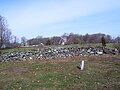
The Conanicut Friends Meetinghouse is a historic Quaker meeting house at the junction of North Road and Weeden Lane in Jamestown, Rhode Island.

Hook Windmill, also known as Old Hook Mill, is a historic windmill on North Main Street in East Hampton, New York. It was built in 1806 and operated regularly until 1908. One of the most complete of the existing windmills on Long Island, the windmill was sold to the town of East Hampton in 1922. The building was listed on the National Register of Historic Places in 1978 and is part of the North Main Street Historic District. The mill was renamed the "Old Hook Mill" and is open daily to visitors.

The Wilbor House is a historic house museum at 548 West Main Road in Little Compton, Rhode Island, and currently serves as the headquarters of the Little Compton Historical Society. The property includes eight buildings of historical significance, six of which were part of the Wilbor farmstead, a complex that was used for farming between 1690, when the east end of the house was built, and 1955, when the property was acquired by the historical society. The house is a 2½-story wood-frame structure, whose oldest portion was a stone ender built by Samuel Wilbor (1664–1740), and whose western half was added c.1740, giving it a Georgian appearance. Two ells were added c.1860, and additional expansions were made in 1967. The five farm outbuildings include an 18th-century outhouse, a c.1800 barn, and corn crib and carriage house, both of which were built c.1850. Two additional non-contributing structures are on the property, the frame of a c.1750 barn covered in modern materials, and a modern replica of an 18th-century schoolhouse.

The Friends Meeting House and Cemetery is a historic Quaker meeting house and cemetery at 228A W. Main Road in Little Compton, Rhode Island. The meeting house is a two-story wood-frame structure built in 1815 by the Religious Society of Friends, commonly known as Quakers, on the site of their first meeting house built in 1700 on land granted to John Irish. The new meeting house used some materials from the original one. It was then modified in 1870.

Anthony is a village along Route 117 within the town of Coventry, Rhode Island near the villages of Washington and Quidnick on the southwestern banks of the Pawtuxet River. The village comprises "Anthony, Arnold, Boston, Mapledale, Meeting, Taft, Washington and Laurel Avenue."