Armory Square is a small neighborhood on the west side of Downtown Syracuse, New York. It began life as a busy commercial and industrial area just to the west of the central city. After World War II, Syracuse's central city became less and less populated as more housing and business facilities were built in the suburbs. In the 1980s, plans were first made to transform the languishing district into a small shopping/arts/nightlife district surrounding the former Syracuse Armory. These plans came to fruition during the 1990s, when new stores and restaurants opened, and several new buildings were constructed in a compatible style to the middle and late 1800s and early 1900s architecture dominating the district.

The North Loop, also commonly called The Warehouse District, is a neighborhood of the Central community of Minneapolis, Minnesota that was Minneapolis's main commercial district during the city's years as a midwestern shipping hub. Although only a little commercial shipping is still done in the neighborhood, the historic warehouses still dominate the neighborhood. Some of these buildings have been repurposed into restaurants, shops, and apartments.

Hillyard is a neighborhood in Spokane, Washington which existed as a separate town between 1892 and 1924.

Neighborhoods in Spokane, Washington are officially grouped by the Spokane City Council into three main city council districts: 1, 2, and 3. Each city council district contains multiple, official neighborhoods that are recognized with a neighborhood council. Informally, neighborhoods are colloquially grouped by local geographical, geological, cultural, or historical features The list of neighborhoods below is organized based on the official designations by the City of Spokane. Unofficial neighborhoods and districts are listed within the official neighborhood in which they are located.
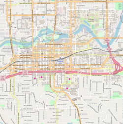
Downtown Spokane or Riverside is the central business district of Spokane, Washington. The Riverside neighborhood is roughly bounded by I-90 to the south, Division Street to the east, Monroe Street to the west and Boone Avenue to the north. The topography of Downtown Spokane is mostly flat except for areas downstream of the Spokane Falls which are located in a canyon; the elevation is approximately 1,900 feet (580 m) above sea level.

Beaufort Historic District is a historic district in Beaufort, South Carolina. It was listed on the National Register of Historic Places in 1969, and was declared a National Historic Landmark in 1973.
This is a list of the National Register of Historic Places listings in Spokane County, Washington.

Windmill Quaker State is a historic service station located at Parkersburg, Wood County, West Virginia. It was built in 1928 by the Quaker State Corporation, and is an example of an architectural folly. It is a roughcast stucco building with a windmill atop the gable roof.

Knickerbocker is a historic Beaux Arts building in the Cliff/Cannon neighborhood of Spokane, Washington. It was designed by architect Albert Held and was built in 1911. It was listed on the National Register of Historic Places in 1987. The building is also listed on the Spokane Register of Historic Places, under the name Knickerbocker Apartments.
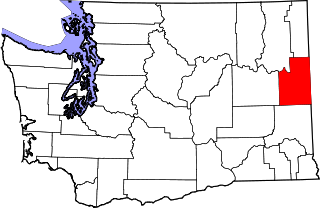
The following is a timeline of the history of the city of Spokane, Washington, USA.

West Central is a neighborhood in Spokane, Washington. As the name suggests it is located centrally on the west side of the city. Downtown Spokane is immediately east of the neighborhood, and spreads into West Central along Monroe Street in the Kendall Yards area. The neighborhood is diverse, with single and multi-family residential zones dating back to the early days of Spokane, a new mixed use development on the site of a former rail yard, the Spokane County Courthouse campus and associated government buildings and a few commercial districts. The Spokane River gorge winds around the southern and western edge of the neighborhood. It is home to Nettleton's Addition Historic District, which was added to the National Register of Historic Places in March 2006, and is also the largest historic district on the Washington State Heritage Register.

The Eldridge Building is a historic building in Spokane, Washington. It was designed by architect Gustav Albin Pehrson, and built in 1925. It has been listed on the National Register of Historic Places (NRHP) since November 12, 1992. It is one of three historic buildings listed on the NRHP at the intersection of First Avenue and Cedar Street. To the west across Cedar is the Grand Coulee building and to the northwest, kitty-corner from the Eldridge Building, is the former Carnegie Library.

Logan is a neighborhood in Spokane, Washington. It is located immediately northeast of Downtown Spokane and is home to Gonzaga University. The Spokane River runs along its eastern and southern edge. Due to its proximity to the city center, Logan is home to some of the oldest and densest areas in the city. It is known for its tree-lined streets, historic buildings and population of college students. In addition to numerous individual properties, there are two historic districts listed on the National Register of Historic Places located within Logan: the Desmet Avenue Warehouse Historic District and the Mission Avenue Historic District.

East Central is a neighborhood in Spokane, Washington. As the name suggests, it is on the east side of Spokane and centrally located. The official neighborhood is expansive and covers multiple areas considered by locals to be independent neighborhoods, such as the Sprague Union District on East Sprague Avenue, the South Perry District, the Underhill Park area and the University District on the eastern fringe of Downtown Spokane.

Rockwood is a neighborhood in Spokane, Washington. It is located on the south side of the city to the southeast of Downtown Spokane and expanding southeasterly from close to the city center. Its proximity to downtown makes it one of Spokane's older neighborhoods, with mature trees lining most of its streets. Due to its location on the hill leading up from the Spokane River Valley, the street grid breaks down in many places around Rockwood. The most notable of these is along the winding Rockwood Boulevard, which bends its way from the northwesternmost corner of the neighborhood through the center and across to the eastern border.

Spokane and its neighborhoods contain a patchwork of architectural styles that give them a distinct identity and illustrate the changes throughout the city's history. Spokane has a rich architectural history for a western city of its size and much of it is a product of its circumstances at the turn of the 20th century when as a rapidly growing city, the Great Fire of 1889 destroyed 32 blocks of the city center which was quickly rebuilt in a more grand fashion by a community flush with money coming from regional mining districts. Many of the architects that found work in the city and building on the blank slate of the downtown commercial district became highly esteemed architects such as Kirtland Cutter, who has been credited with giving the city a distinctive character. In particular, the city has a high concentration of Romanesque Revival style institutional and commercial buildings and American Craftsman bungalow residences. The architecture of Spokane gained national recognition in industry publications in the early 20th century.
Cliff/Cannon is a neighborhood in Spokane, Washington. It is located immediately south of Downtown, Spokane, and on the lower reaches of the broader South Hill. The neighborhood is home to a medical district with Sacred Heart and Deaconess both having their main campuses along Cliff/Cannon's denser northern edge. To the south the neighborhood becomes more residential. City parks break up the residential zoning of the southern half of Cliff/Cannon. It is adjacent to the Cannon Hill area of the neighboring but separate Manito/Cannon Hill neighborhood. The Marycliff-Cliff Park Historic District, a National Historic District listed on the National Register of Historic Places, is located within the neighborhood.

Emerson/Garfield is a neighborhood in Spokane, Washington. It is located immediately north of Downtown Spokane's North Bank and extends out into the inner northwestern portion of the city. Emerson/Garfield is a diverse neighborhood with residential, commercial and civic zones all bordering one another, with density ranging from single-family homes to multi-use buildings. Due to its location in the central area of Spokane, Emerson/Garfield is criss-crossed by numerous arterials and thoroughfares. Along those main roads are numerous commercial and retail districts of importance to both the neighborhood and city as a whole.

Lincoln Heights is a neighborhood in Spokane, Washington. It is located in the southeastern portion of the city in a broader area commonly known as the South Hill. As the name suggests, Lincoln Heights lies on the slopes and atop the crest of the South Hill area. Lincoln Heights is home to a mix of single-family residential, multi-family residential, and commercial areas and a significant amount of park land. The Lincoln Heights Shopping Center and surrounding area is one of the largest and most important commercial and retail districts on the entire south side of Spokane.

Doyle's Ice Cream Parlor is a locally owned ice cream shop that has been located in Spokane's West Central neighborhood since 1939. Doyle's is open from spring to early fall, Wednesdays through Sundays.