Neen Sollars

Last updated

Neen Sollars
Neen Sollars - geograph.org.uk - 53107.jpg
Neen Sollars
Shropshire UK location map.svg
Red pog.svg
Neen Sollars
Location within Shropshire
Population252 (2011) [1]
OS grid reference SO660722
Civil parish
  • Neen Sollars
Unitary authority
Ceremonial county
Region
Country England
Sovereign state United Kingdom
Post town Kidderminster
Postcode district DY14
Dialling code 01299
Police West Mercia
Fire Shropshire
Ambulance West Midlands
UK Parliament
List of places
UK
England
Shropshire
52°20′49″N2°29′53″W / 52.347°N 2.498°W / 52.347; -2.498

Neen Sollars is a village and civil parish in south east Shropshire, England.

Contents

It is situated close to the border with Worcestershire, three miles south of the small market town of Cleobury Mortimer. Other large local centres of population include Ludlow, situated 12 miles to the west, which has an estimated population of 10,500 and Kidderminster, located 12.5 miles to the north east in the county of Worcestershire, which has a population of over 55,000. [2]

The River Rea, which was historically known as the River Neen, [3] flows by the village. The area surrounding Neen Sollars is pretty hilly, with maps showing several hills such as Neens Hill to the south and Birch Hill to the north. It is estimated that Neen Sollars lies between approximately 70 and 100 metres above sea level. [4] [5]

The village of Neen Sollars was formerly known as Neen Baldwin until about the year 1200. The new name came about from the merging of two family names, Baldwin le Poer and De Solers, when Elena and Eustacia Baldwin were married to members of the Sollars family. [6]

Amenities

A photograph of All Saints church Neen Sollars church - geograph.org.uk - 258442.jpg
A photograph of All Saints church

There is a popular public house, the Live and Let Live, which serves food and real ale, it is from the 13th century. [7] There is a Church of England church located within the village called All Saints. [8] There is also a phone box in the village.

There was once a school situated within the village that served the children of Neen Sollars and the neighbouring village Milson. Entering the 20th century the villages were thriving agriculturally and the school had in excess of 60 children. However, when the advancements in farming techniques and technologies displaced many residents, the local populations diminished and the school closed in 1951. [9] The closest primary school serving the village is three miles north in the small town of Cleobury Mortimer. [10]

Neen Sollars railway station closed in 1962 and the railway has been lifted. The nearest centre for bus and train services is situated in the town of Ludlow. [11]

History & Families

Neen Sollars has roots dating from the time of the Saxons. Perhaps the earliest recorded mention of Neen Sollars in English literature is in The Domesday Book in 1086. The first recorded owner of large estates in Shropshire, in particular the manor of All Saints located amongst the villages of Neen Sollars and neighbouring Milson, was Siward the Saxon. [2] According to the Domesday Book he appears to have held it from Osbern FitzRichard in the time of 1086. [12] It was Osbern's grandson Osbern fitz Hugh who gave Neen to the Baldwin family. When two of the three Baldwin daughters married members of the De Solars family the village was then formally known as Neen Sollars. The De Solars family also owned land in Herefordshire including Sutton Frene near Hereford. In 1327 nineteen inhabitants were assessed for the King's Subsidy, which noted that "nearly all of whom were distinctly well-to-do". One of the men assessed to be the most wealthy, was John Corbet who held Merebrook and Tetneshull (now known as Tetshill). [2]

Agriculture

The village is very much based around agriculture and has been for many centuries. This can be proven by looking at a quote transcribed from The National Gazetteer of Great Britain and Ireland, dating from 1868, that states Neen Sollars as being "wholly agricultural". The geology of the area is also described as being chiefly clay with a gravel subsoil. [13] The farming industry has been a main sector of employment for the residents with the 1801 census showing that over 50% of the village's occupants were employed in agricultural activities. [14] There are still several farms located within the parish of Neen Sollars.

A photograph showing farmland situated in the parish of Neen Sollars Farmland to the south of Neen Sollars - geograph.org.uk - 258452.jpg
A photograph showing farmland situated in the parish of Neen Sollars

Population Change

The population of the village has never been particularly high but it has fluctuated over the centuries. This is not an uncommon occurrence amongst small villages of this type. Dating from the 1801 census the population was recorded at 197. [15] By the time the 1841 census came around the population had increased to 250. [16] In John Marius Wilson's Imperial Gazetteer of England and Wales, published between 1870 and 1872, the population was counted as 189. The overall trend has recently been a slow and steady decline in the number of residents living in the village. [17] The most likely explanation for the decrease in population is the advances in farm technologies. Many jobs were lost when machinery was introduced more widely causing some people to leave in search of work.

See also

Related Research Articles

<span class="mw-page-title-main">Cleobury Mortimer</span> Human settlement in England

Cleobury Mortimer is a market town and civil parish in south-east Shropshire, England, which had a population of 3,036 at the 2011 census. It was granted a market charter by King Henry III in 1226.

<span class="mw-page-title-main">Leintwardine</span> Human settlement in England

Leintwardine is a small to mid-size village and civil parish in north Herefordshire, England, close to the border with Shropshire.

<span class="mw-page-title-main">Cleehill</span> Human settlement in England

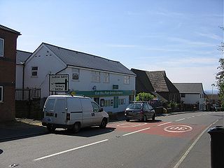
Cleehill is a village in south Shropshire, England. It is sometimes written as Clee Hill Village to avoid confusion. It lies in the civil parish of Caynham. The market towns of Ludlow and Cleobury Mortimer are both 5.5 miles (8.9 km) distant, Ludlow to the west and Cleobury to the east.

<span class="mw-page-title-main">A4117 road</span> Road in Shropshire

The A4117 is a single-carriageway 'A road' in western England, largely in Shropshire, which passes through part of the Wyre Forest and Clee Hills.

<span class="mw-page-title-main">Stottesdon</span> Human settlement in England

Stottesdon is a village and civil parish in south east Shropshire, England. The parish of Stottesdon covers a large rural area and extends over the village of Chorley. The village is situated near the market towns of Cleobury Mortimer and Bridgnorth.

<span class="mw-page-title-main">Aston Botterell</span> Human settlement in England

Aston Botterell is a village and small civil parish in the county of Shropshire, West Midlands, England. The village lies 8 miles (13 km) south-west of the market town of Bridgnorth and 10 miles (16 km) north-east of the town of Ludlow. The nearest main roads are the B4364 and the A4117. According to the 2001 census, the civil parish had a population of 74. The area's economy is still largely based on agriculture, though many residents travel up to 12 miles (19 km) to work in other sectors such as the service and manufacturing industries.

<span class="mw-page-title-main">Diocese of Hereford</span> Diocese of the Church of England

The Diocese of Hereford is a Church of England diocese based in Hereford, covering Herefordshire, southern Shropshire and a few parishes within Worcestershire in England, and a few parishes within Powys and Monmouthshire in Wales. The cathedral is Hereford Cathedral and the bishop is the Bishop of Hereford. The diocese is one of the oldest in England and is part of the Province of Canterbury.

<span class="mw-page-title-main">Wigmore, Herefordshire</span> Village in Herefordshire, England

Wigmore is a village and civil parish in the northwest part of the county of Herefordshire, England. It is located on the A4110 road, about 8 miles (13 km) west of the town of Ludlow, in the Welsh Marches. In earlier times, it was also an administrative district, called a hundred.

<span class="mw-page-title-main">Ludford, Shropshire</span> Village in Shropshire, England

Ludford is a small village and civil parish in south Shropshire, England. The parish is situated adjacent to the market town of Ludlow and was, until 1895, partly in Herefordshire.

<span class="mw-page-title-main">Kinlet</span> Human settlement in England

Kinlet is a small village and civil parish in the south-east of the county of Shropshire, England. The parish is on the northern edge of the Wyre Forest and is in the Bridgnorth District of Shropshire. The parish incorporates the hamlets of Kinlet Village, Button Bridge and Button Oak. Kinlet is located 18 miles (29 km) south of Telford, the main town in Shropshire and 23 miles (37 km) west of Birmingham.

<span class="mw-page-title-main">Handley, Cheshire</span> Village in England

Handley is a village and civil parish in the unitary authority of Cheshire West and Chester and the ceremonial county of Cheshire, England. It is part of the local government ward of Tattenhall, a larger settlement approximately 2 miles (3.2 km) to the east. The hamlet of Milton Green is to the north west of the village. The A41 road, which previously passed through the village now bypasses it, having been re-routed further to the east.

<span class="mw-page-title-main">Langford, Nottinghamshire</span> Human settlement in England

Langford is a village and civil parish in Nottinghamshire, England. It is located four miles north-east of Newark-on-Trent and two miles East from The River Trent. Population details are included in the civil parish of Holme. It is based on A1133 which comes off of the A46. Although Langford is currently located two miles from The River Trent it has not always been this way. In "1575 there was a cataclysmic flood" which altered the course of the Trent which meant Langford and Holme were now on the same side of the river. Before this change in the rivers course the Trent used to flow next to St Bartholomew's church and Holme was on the opposite side of the bank.

<span class="mw-page-title-main">Coreley</span> Human settlement in England

Coreley is a small, dispersed village and civil parish in south Shropshire, England, near to Clee Hill Village. It is situated approximately 30 miles (48 km) south west of Birmingham and just 4.5 miles (7.2 km) north east of Tenbury Wells. The name Corely comes from the Old English corn meaning a crane/heron and lēah meaning a forest/wood. This translates to crane wood/farmland.

CORELEY, a parish in Cleobury-Mortimer district, Salop; under the Clee Hills, 3½ miles NNE of Tenbury r[ailway]. station, and 5 WSW of Cleobury-Mortimer. Post town, Tenbury. Acres, 2,175. Rated property, £1,490. Pop[ulation]., 515. Houses, 106. The property is divided among a few. The living is a rectory in the diocese of Hereford. Value, £280.* Patron, Rev. J. Burnett Stuart. The church is of brick, and ancient, with tower and spire; and was reported in 1859 as bad.

<span class="mw-page-title-main">Ditton Priors</span> Human settlement in England

Ditton Priors is a village and civil parish in south Shropshire, England. Historically, it was also known as Priors Ditton.

<span class="mw-page-title-main">Neen Savage</span> Human settlement in England

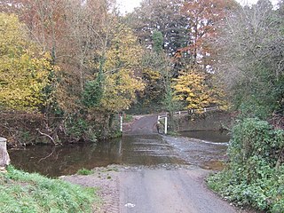
Neen Savage is a civil parish and a hamlet in south east Shropshire, England. It is situated north of the small market town of Cleobury Mortimer. The River Rea, which was historically known as the River Neen, flows past the hamlet, and a notable ford exists.

<span class="mw-page-title-main">Neenton</span> Human settlement in England

Neenton is a civil parish and small village in south east Shropshire, England, which is situated on the B4364 southwest of the market town of Bridgnorth. The Rea Brook/River Rea, which was historically known as the River Neen, flows by the village. There is a church on the corner of the B4364 passing through Neenton called the All Saints Church, also there is a public house open, called the Pheasant Inn.

<span class="mw-page-title-main">Cleobury North</span> Human settlement in England

Cleobury North is a civil parish and small village in south east Shropshire, England. It is situated on the B4364 southwest of the market town of Bridgnorth. To the north is the village of Ditton Priors and to the west is Brown Clee Hill, the county's highest hill.

<span class="mw-page-title-main">Richard's Castle</span> Village in Herefordshire and Shropshire, England

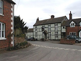
Richard's Castle is a village, castle and two civil parishes on the border of the counties of Herefordshire and Shropshire in England. The Herefordshire part of the parish had a population of 250 at the 2011 Census, the Shropshire part, 424.

<span class="mw-page-title-main">St Mary's Church, Cleobury Mortimer</span> Church in Shropshire, England

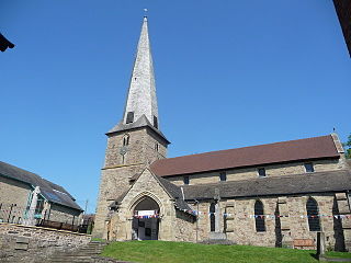
St Mary's Church is on Church Street, Cleobury Mortimer, Shropshire, England. It is an active Anglican parish church in the deanery of Ludlow, the archdeaconry of Ludlow, and the diocese of Hereford. Its benefice is united with those of six local parishes to form the Cleobury Benefice. The church is recorded in the National Heritage List for England as a designated Grade I listed building. It is notable for its shingled twisted spire.

References

  1. "Civil Parish population 2011" . Retrieved 28 November 2015.
  2. 1 2 3 The Parish of Neen Sollars and Milson: All Saints. Cleoburybenefice.org.
  3. Raven, Michael (2005) A Guide to Shropshire p 144
  4. Map showing geography of Neen Sollars. Bing.com (9 September 2013).
  5. Geology of Shropshire by Peter Toghill. (PDF).
  6. Milson and Neen Sollars Community. Milsonandneensollars.co.uk.
  7. Shropshire Pub Survey Neen Sollars
  8. Neen Sollars: All Saints. a Church near you.
  9. Milson and Neen Sollars Community. Milsonandneensollars.co.uk.
  10. Cleobury Mortimer Primary School. Cleoburymortimerprimaryschool.ethink.org.uk.
  11. Ludlow Travel. Ludlow.org.uk.
  12. Domesday Book Online. Domesdaybook.co.uk.
  13. GENUKI, Neen Sollars. Genuki.org.uk.
  14. General&ResourceType=TNA&SearchTerms=neen sollars&simple=yes&path=Results&active=yes&titlepos=0&mno=2&pageseq=304 1801 Census: Employment and Population. Histpop.org (1 July 2004).
  15. General&ResourceType=TNA&SearchTerms=neen sollars&simple=yes&path=Results&active=yes&titlepos=0&mno=2&pageseq=304 Histpop.org – Neen Sollars. Histpop.org (1 July 2004).
  16. General&ResourceType=TNA&SearchTerms=neen sollars&simple=yes&path=Results&active=yes&titlepos=0&mno=18&pageseq=53 Histpop.org – Neen Sollars. Histpop.org (1 July 2004).
  17. Neen Sollars. Vision of Britain.