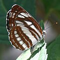
Pallas' sailer | |
---|---|
N. s. sappho, Hungary | |
N. s. sapho, Hungary | |
Scientific classification | |
Domain: | Eukaryota |
Kingdom: | Animalia |
Phylum: | Arthropoda |
Class: | Insecta |
Order: | Lepidoptera |
Family: | Nymphalidae |
Genus: | Neptis |
Species: | N. sappho |
Binomial name | |
Neptis sappho Pallas, 1771 | |
Synonyms | |
|
Neptis sappho, the Pallas' sailer or common glider, is a nymphalid butterfly found in Central Europe, Russia, India and other parts of temperate Asia and Japan. [1]
The wingspan is 40–46 mm.
The larvae feed on Lathyrus vernus , Lathyrus niger and Robinia pseudoacacia .
Nagoya Airfield, also known as Komaki Airport or Nagoya Airport, is an airport which lies within the local government areas of Toyoyama, Komaki, Kasugai and Nagoya in Aichi Prefecture, Japan. Prior to 2005, it was once an international airport, but is now a domestic secondary airport serving Nagoya while the current primary civil airport for Nagoya is Chūbu Centrair International Airport in Tokoname.
Kasugai is a city in Aichi Prefecture, Japan. As of 1 October 2019, the city had an estimated population of 306,764, and a population density of 3,306 persons per km2. The total area of the city is 92.78 square kilometres (35.82 sq mi). The city is sometimes called Owarikasugai to avoid confusion with other municipality of the same name, including Kasugai in Yamanashi Prefecture.
Inuyama is a city in Aichi Prefecture, Japan. As of 1 October 2019, the city had an estimated population of 73,420 in 31,276 households, and a population density of 980 persons per km2. The total area of the city is 74.90 square kilometres (28.92 sq mi). The name of the city literally translates to "Dog Mountain". The name appears in historical records from 1336 AD, but its origin is unknown.
Aichi Prefecture is a prefecture of Japan located in the Chūbu region of Honshū. Aichi Prefecture has a population of 7,552,873 and a geographic area of 5,172.92 square kilometres (1,997.28 sq mi) with a population density of 1,460 inhabitants per square kilometre (3,800/sq mi). Aichi Prefecture borders Mie Prefecture to the west, Gifu Prefecture and Nagano Prefecture to the north, and Shizuoka Prefecture to the east. Nagoya is the capital and largest city of the prefecture.
Nagakute is a city located in Aichi Prefecture, Japan. As of 1 October 2019, the city had an estimated population of 61,503 in 24,352 households, and a population density of 2,854 persons per km2. The total area of the city is 21.55 square kilometres (8.32 sq mi). Nagakute is a member of the World Health Organization’s Alliance for Healthy Cities (AFHC).
Ōguchi is a town located in Niwa District, Aichi Prefecture, Japan. As of 1 October 2019, the town had an estimated population of 24,160 in 9547 households, and a population density of 1,775 persons per km2. The total area of the town was 13.61 square kilometres (5.25 sq mi).
Harvest Festival is a fertility festival celebrated every year on March 15 in some locations in Aichi Prefecture, Japan. Hōnen means prosperous year in Japanese, implying a rich harvest, while a matsuri is a festival. The Hōnen festival and ceremony celebrate the blessings of a bountiful harvest and all manner of prosperity and fertility.
Neptis hylas, the common sailor, is a species of nymphalid butterfly found in the Indian subcontinent and southeast Asia. It has a characteristic stiff gliding flight achieved by short and shallow wingbeats just above the horizontal.
Chūkyō, or the Chūkyō region, is a major metropolitan area in Japan that is centered on the city of Nagoya in Aichi Prefecture. The area makes up the most urbanized part of the Tōkai region. The population of 10,110,000 over an area of 7,072 square kilometers. Nevertheless, like most of Japan's major metro areas, the core of it lies on a fertile alluvial plain, in this case, the Nōbi Plain.
Komaki is a city located in Aichi Prefecture, Japan. As of 1 October 2019, the city had an estimated population of 148,872 in 68,174 households, and a population density of 2,370 inhabitants per square kilometre (6,100/sq mi). The total area of the city was 62.81 square kilometres (24.25 sq mi). Komaki is commonly associated with the former Komaki Airport, which is located on the border between Komaki and neighboring Kasugai.
The Peachliner, formally the Tōkadai Shin-kōtsū Peach Liner (桃花台新交通ピーチライナー) was a people mover in the city of Komaki, Aichi Prefecture, Japan. It operated from 1991 until September 30, 2006, when it became the first people-mover system in Japan to cease operations. It was then dismantled in 2023.
The Meitetsu Komaki Line is a 20.6 km (12.8 mi) railway line in Aichi Prefecture, Japan, operated by the private railway operator Meitetsu, connecting Kamiiida Station in Nagoya with Inuyama Station in Inuyama. The track from Kamiiida to Ajima is mostly underground, a continuation of the Kamiiida Line operated by the Nagoya Municipal Subway.
The Nōbi Plain is a large plain in Japan that stretches from the Mino area of southwest Gifu Prefecture to the Owari area of northwest Aichi Prefecture, covering an area of approximately 1,800 square kilometres (695 sq mi). It is an alluvial plain created by the Kiso Three Rivers and has very fertile soil. It is bordered on the west by the Ibuki and Yōrō mountain ranges, and to the east by the Owari Hills. Its northern border is marked by the Ryōhaku Mountains and the south by Ise Bay.
Mount Komaki is an 86 m-high (282 ft) mountain located in the city of Komaki, Aichi Prefecture, Japan. At one point, the mountain was topped with the original Komakiyama Castle, built by Oda Nobunaga. Its base stretches for nearly 600 m (1,969 ft) from east to west, and 400 m (1,312 ft) from north to south, covering an area of approximately 21 ha. The mountain is now a historical park, containing various castle ruins, including water wells and stone walls, in addition to artifacts dating further back. Though known for the sakura trees, the northern part of the mountain is home to many Machilus thunbergii trees. This is the only spot in the surrounding area where these trees occur naturally. The reproduction of Komakiyama Castle was built in 1967 and houses the Komaki City Historical Museum.
National Route 41 is a national highway connecting Nagoya, Aichi Prefecture, and Toyama, Toyama Prefecture, Japan. The bulk of the road runs through Gifu Prefecture. The route is also referred to as Yon-ichi and Shippin, based on the Japanese readings for the route numbering.
Kamiiida Station is a railway station in Kita-ku, Nagoya, Aichi Prefecture, Japan.
Komakiguchi Station is a railway station in the city of Komaki, Aichi Prefecture, Japan, operated by Meitetsu.
Komaki Station is a railway station in the city of Komaki, Aichi Prefecture, Japan, operated by Meitetsu.
Park Arena Komaki is an arena in Komaki, Aichi, Japan.
The Ōyama temple ruins is an archaeological site with the ruins of a Buddhist temple which existed from the Nara through Heian period, located in what is now the city of Komaki, Aichi, Japan. No remnant of the temple now exists except for some foundation stones, but the temple grounds were designated as a National Historic Site in 1929, with the area under protection expanded in 1980.