
Herefordshire is a county in the West Midlands of England, governed by Herefordshire Council. It is bordered by Shropshire to the north, Worcestershire to the east, Gloucestershire to the south-east, and the Welsh counties of Monmouthshire and Powys to the west. Some definitions of the West Country also include Herefordshire.
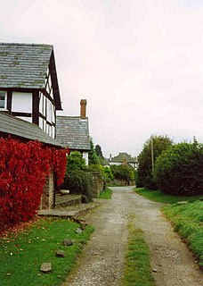
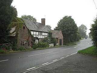
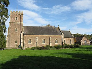
Hope under Dinmore is a village and civil parish in Herefordshire, England. The village is on the A49 road, 4 miles (6 km) south of Leominster and 9 miles (14 km) north of Hereford, and on the Welsh Marches railway line. The railway passes under Dinmore Hill through the split-level 1,051-yard (961 m) long Dinmore Tunnel. Dinmore railway station closed in 1958, but the line remains open. The church has a tower and is dedicated to Saint Mary the Virgin.

Marlbrook is an industrial and business park on the borders of and split between the civil parishes of Hope under Dinmore and Newton, in Herefordshire, England.
Ashton is a village in the Eye, Moreton and Ashton civil parish of Herefordshire, England, and is 3 miles (5 km) north from Leominster, 15 miles (24 km) north from the city and county town of Hereford, and in the catchment area of the River Lugg. The village is on the A49 road; to the north is Brimfield. Bordering the village to the south-west is Berrington Hall.

Dinmore is a geographically small civil parish in Herefordshire, England. The parish had an estimated population in mid-2010 of 7, the smallest in the county.

Grendon Bishop is a civil parish in the county of Herefordshire, England.

Pencombe with Grendon Warren is a civil parish in the county of Herefordshire, England. The parish was created in 1895 from the parishes of Pencombe and Grendon Warren, its only nucleated settlement being the village of Pencombe.

Humber is a hamlet and civil parish in the county of Herefordshire, England, and is 10 miles (16 km) north from the city and county town of Hereford. The closest large town is Leominster 3 miles (5 km) to the north-west.
Ford and Stoke Prior is a civil parish in the county of Herefordshire, England, and is 10 miles (16 km) north from the city and county town of Hereford. The closest large town is the market town of Leominster, adjacent at the north-west. The parish includes the hamlet of Ford, the village of Stoke Prior, and the medieval parish churches of St Luke and St John of Jerusalem. At the west of the parish is the site of a Romano-British settlement.

Croft and Yarpole is a civil parish in the county of Herefordshire, England, and is 17 miles (27 km) north from the city and county town of Hereford. The closest large town is the market town of Leominster, 4.5 miles (7 km) to the south. Within the parish is the National Trust property of Croft Castle and Parkland.

Eye, Moreton and Ashton is a civil parish in the county of Herefordshire, England. The parish is 15 miles (24 km) north from the city and county town of Hereford. The closest large town is the market town of Leominster, 3 miles (5 km) to the south. Within the parish is the National Trust property of Berrington Hall.

King's Pyon is a village and civil parish in the county of Herefordshire, England, and is approximately 8 miles (13 km) north-west from the city and county town of Hereford. The closest large town is the market town of Leominster, 6 miles (10 km) to the north-west. The parish includes the Grade I listed church of St Mary the Virgin.

Little Cowarne is a village and civil parish in the county of Herefordshire, England, and is 9 miles (14 km) north-east from the city and county town of Hereford. The closest town is the market town of Bromyard, 4 miles (6 km) to the north-east.

Felton is a small village and civil parish in the county of Herefordshire, England, and is 7 miles (11 km) north-east from the city and county town of Hereford. The closest town is the market town of Bromyard, 6 miles (10 km) to the north-east.

Pudleston, is a small village and civil parish, in the county of Herefordshire, England, and is 13 miles (20 km) north from the city and county town of Hereford. The closest large town is Leominster 4 miles (6 km) to the west. At Pudleston is the c.1200 Church of St Peter, and the 1846 Tudor-Gothic Pudleston Court.
Docklow and Hampton Wafer, is a civil parish in the county of Herefordshire, England, and is 11 miles (18 km) north from the city and county town of Hereford. The closest large town is Leominster 4 miles (6 km) to the west. The parish contains the remains of Uphampton Camp, a probable Iron Age hillfort, and the Church of St Bartholomew, in part dating to the 12th and 13th century.

Hatfield and Newhampton is a civil parish in the county of Herefordshire, England, and is 11 miles (18 km) north from the city and county town of Hereford. The closest large town is Leominster 4 miles (6 km) to the west. The parish includes the small village of Hatfield, the former extra-parochial liberty of New Hampton, the site of former abbey lands of Fencote, the preserved Fencote railway station, and the Grade II* listed 11th-century Church of St Leonard.

Staunton on Arrow is a village and civil parish in the county of Herefordshire, England, and is 17 miles (27 km) north-west from the city and county town of Hereford. The closest large town is the market and minster town of Leominster, 8 miles (13 km) to the east. Within the parish is the site of the Iron Age hill fort of Wapley Hill.


