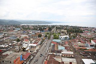
Ngaba

Last updated
Ngaba
Commune de Ngaba
Ngaba
Ngaba
Ngaba
Ngaba on map of Kinshasa city-province
Democratic Republic of the Congo (26 provinces) - Kinshasa.svg
Kinshasa city-province on map of DR Congo
Coordinates: 4°22′32″S15°19′19″E / 4.37556°S 15.32194°E / -4.37556; 15.32194 [1]
CountryFlag of the Democratic Republic of the Congo.svg  DR Congo
City-Province Kinshasa
Area
  Total
4.0 km2 (1.5 sq mi)
Population
 (2015 est.)
  Total
539,135
  Density130,000/km2 (350,000/sq mi)

Ngaba is a commune located in the Mont Amba District of Kinshasa, the capital city of the Democratic Republic of the Congo. It spans an area of 4.0 square kilometers and has an estimated population of 539,135 as of 2015. [2] [3] [4]

Contents

Situated in the southern part of Kinshasa, Ngaba is a relatively recent settlement characterized by its hilly terrain. [5] The commune is bounded by Kikwit Avenue to the north, By-pass Avenue to the south, the Kalamu River to the east, and Université Avenue to the west. [6] It shares borders with the communes of Limete to the north, Lemba to the east and south, and Makala to the west. [6] Administratively, Ngaba is divided into six neighborhoods: Baobab, Bulambemba, Luyi, Mateba, Mpila, and Mukulwa. [6]

Geography

Ngaba is defined by its distinct boundaries and topographical features. To the north, the commune is bordered by the intersection of Université Avenue and Kikwit Avenue, extending to the Yolo River. [7] Its eastern boundary follows the Yolo River to a fork, where a straight north-south line connects to By-pass Avenue, marking the border with the Lemba commune. [7] [5] The southern extremity is defined by By-pass Avenue, extending westward to its intersection with Université Avenue. [7] To the west, Ngaba's boundary follows Université Avenue back to its intersection with Kikwit Avenue. [7]

Ngaba on map of city communes Kinshasa Ngaba.png
Ngaba on map of city communes

The commune's topography features a predominately large plain, complemented by a hill located in the southern part of the commune. [7] The area experiences a bi-seasonal tropical climate, with a rainy season lasting from September to May and a dry season occurring from June to August. [7]

Administrative division

Ngaba was established as a commune by Ministerial Decree No. 6836 on 30 March 1968, which introduced and named the new communes of Kinshasa. [8] [7] This legal framework was further substantiated by Ministerial Decree No. 69-0042 on 23 January 1969, which clarified the number, names, and boundaries of Kinshasa's urban communes. [8] [7] The commune's name honors a prominent Teke-Humbu chief, Ngaba, who resided near the Ngaba roundabout, close to the Catholic parish and the small market of Makala. [8] [7]

Ngaba is governed by Kinshasa's municipal authorities and operates under a municipal council and an executive college. [7] Leadership is provided by a mayor (Burgomaster; French: Bourgmestre) and a deputy mayor, both appointed by the head of state. [7] While a reform plan calls for the election of burgomasters by communal councils, this has yet to be implemented. [7]

The commune is administratively divided into six neighborhoods: [7] [6]

Economy and culture

Ngaba's economic state mirrors the socio-economic challenges faced by its population, which is largely composed of residents from the provinces of Bandundu and Kongo Central (Kongo, Yanzi, Pende, Zombo, Yaka, Mbala, and others). [5]

Economic activities in Ngaba are primarily subsistence-based, driven by the population's low purchasing power. [5] Around 70% of the active population is involved in informal sector activities, including small-scale commerce such as street vending, small shops, and the sale of items like peanuts, sachet water, cigarettes, and biscuits. [5] [6] [7] Other prevalent activities include market gardening, operation of small pharmacies, and technical services like sewing, carpentry, masonry, and auto repairs. [5] [6] [7] These businesses are concentrated along main thoroughfares, particularly Université Avenue and Kianza Avenue, as well as in small markets throughout the commune. [5] [6] [7]

Unemployment, particularly among young people, has contributed to the rise of juvenile delinquency, with organized gangs, locally known as kuluna, operating across neighborhoods. [5] [9] Poverty is evident through various indicators, such as inadequate housing, limited access to essential services like water, electricity, healthcare, education, transportation, and sanitation, and restricted food security. [5] [6] [9]

Housing in Ngaba is predominantly composed of small, concrete block structures, often with just two rooms. [10] Due to the lack of a public housing policy and high land prices, rental housing has become widespread, with decent housing accessible only to a privileged minority. [10] Ownership of a well-built and fenced property, particularly in the Mbulambemba neighborhood, is seen as a status symbol and a source of social pride. [10] Tree planting also contributes to the local economy, with neighborhoods hosting various fruit-bearing and economically valuable trees such as avocado, palm, mango, papaya, moringa, safou, soursop, orange, coconut, and coffee trees, which provide additional income sources for residents. [7]

Religion

The predominant religions are Christianity and Animism, with hyperreligiosity evident in the proliferation of revival churches, often two or more per avenue. [5] Community organization is notable, with residents forming mutual aid societies such as likelemba and moziki, as well as tribal support groups. [5]

Related Research Articles

<span class="mw-page-title-main">Kinshasa</span> Capital and the largest city of the Democratic Republic of the Congo

Kinshasa, formerly named Léopoldville until 30 June 1966, is the capital and largest city of the Democratic Republic of the Congo. Once a site of fishing and trading villages along the Congo River, Kinshasa is now one of the world's fastest-growing megacities. Kinshasa's 2024 population was estimated at 17,032,322. It is the most densely populated city in the DRC, the most populous city in Africa, the world's fourth-most-populous capital city, Africa's third-largest metropolitan area, and the leading economic, political, and cultural center of the DRC. Kinshasa houses several industries, including manufacturing, telecommunications, banking, and entertainment. The city also hosts some of DRC's significant institutional buildings, such as the Palais du Peuple, Palais de la Nation, Court of Cassation, Constitutional Court, Cité de l'Union Africaine, Palais de Marbre, Stade des Martyrs, Immeuble du Gouvernement, Kinshasa Financial Center, and multiple federal departments and agencies.

<span class="mw-page-title-main">Kisangani</span> City in the northeastern DR Congo

Kisangani is the capital of Tshopo Province, located on the Congo River in the eastern part of the central Congo Basin in the Democratic Republic of the Congo. It is the country's fifth-most populous urban area, with an estimated population of 1,602,144 as of 2016, and the largest of the cities in the tropical woodlands of the Congo.

<span class="mw-page-title-main">Karisimbi (commune)</span> Commune in Goma, North Kivu

Karisimbi is a commune of the city of Goma in the North Kivu Province of the eastern region of the Democratic Republic of the Congo. It is named after the nearby Mount Karisimbi.

<span class="mw-page-title-main">Bandundu (city)</span> Provincial capital and city in Kwilu, DR Congo

Bandundu, formerly known as Banningville or Banningstad, is the capital city of Kwilu Province of the Democratic Republic of the Congo.

<span class="mw-page-title-main">Mont Ngafula</span> Commune in Kinshasa, DR Congo

Mont Ngafula, or Mont-Ngafula, is a commune in the Lukunga District of Kinshasa, in the western part of the Democratic Republic of the Congo. By its surface area, Mont Ngafula is the third-largest commune in Kinshasa's city-province. It is located in the hilly southern area of Kinshasa and is intersected by the Lukaya River valley in its southern portion. The boundary with the Ngaliema commune is defined by the Lukunga River. Mont Ngafula shares borders with the Makala commune to the north, the Kongo Central Province to the south, the Lemba and Kisenso communes to the east, and the Selembao commune to the west. It has an estimated population of 718,197 (2015).

<span class="mw-page-title-main">Bandalungwa</span> Commune in Kinshasa, Democratic Republic of the Congo

Bandalungwa is a commune in the Funa District of Kinshasa in the western region of the Democratic Republic of the Congo. Covering an area of 6.82 square kilometers, Bandalungwa is centrally situated within the city. It is bordered by the Gombe commune and the Kokolo military barracks to the north, Selembao to the south, the communes of Ngiri-Ngiri, Kasa-Vubu, and Lingwala to the east, and the Makelele River, Ngaliema, and Kintambo to the west. The commune had an estimated population of 934,821 in 2015, although official census data from 2016 reported a significantly lower figure of 259,760 residents.

<span class="mw-page-title-main">Barumbu</span> Commune in Kinshasa, DR Congo

Barumbu is a commune in the Lukunga District of Kinshasa, located strategically in the northern region of the city. As of 2015, Barumbu had an estimated population of 413,628, making it one of Kinshasa's more densely populated communes.
<span class="mw-page-title-main">Gombe, Kinshasa</span> Commune in Kinshasa, DR Congo

Gombe, also known as La Gombe, or Downtown Kinshasa, is one of the 24 communes of Kinshasa, in the western part of the Democratic Republic of the Congo. Encompassing a vast area of approximately 29.33 square kilometers, it is home to an approximate population of 49,024 residents (2014).

<span class="mw-page-title-main">Kalamu</span> Commune in Kinshasa, DR Congo

Kalamu is a commune in the Funa District of Kinshasa, located in the western region of the Democratic Republic of the Congo. Covering an area of 6.64 square kilometers, Kalamu lies in the central part of the city-province of Kinshasa. It is bordered by the Kinshasa commune to the north, Makala to the south, and Limete to the east, with Avenue de l'Université marking the boundary. As of 2015, Kalamu had an estimated population of 974,669, while a 2020 estimate noted a decrease to 208,155.

<span class="mw-page-title-main">Boulevard du 30 Juin</span>

The Boulevard du 30 Juin is a major 5‑km street in Kinshasa, Democratic Republic of the Congo (DRC). It is the city center's main transport artery, connecting the southern area of La Gombe with Kintambo and the Ngaliema to the west.

<span class="mw-page-title-main">University of Kinshasa</span> Public university in Democratic Republic of the Congo

The University of Kinshasa, colloquially known by its acronym UNIKIN, is a public university located in Kinshasa's Lemba commune within the western region of the Democratic Republic of the Congo. It is the country's premier university. Initially established in 1954 as Lovanium University during Belgian colonial rule, the current university was established following the division of the National University of Zaire (UNAZA) in 1981.

<span class="mw-page-title-main">Selembao</span> Commune in Kinshasa, DR Congo

Selembao is one of the 24 communes that are the administrative divisions of Kinshasa, the capital city of the Democratic Republic of the Congo. Covering over 12 square kilometers and with an estimated population of 1,038,819 as of 2015, it is bordered to the north by the communes of Bandalungwa and Bumbu, to the northeast by Bumbu, to the south by Mont Ngafula, to the east by Makala, and to the west by Ngaliema.

<span class="mw-page-title-main">Regideso</span>

The Régie de Distribution d'Eau, abbreviated as REGIDESO, is a state-owned utility company located on Boulevard Du 30 Juin, in the Gombe commune of Kinshasa, Democratic Republic of the Congo (DRC). It is responsible for producing and distributing water throughout the national territory, encompassing both urban and rural areas. Established in 1929, REGIDESO operates autonomously under the oversight of the Ministry of Energy and the Portfolio.

<span class="mw-page-title-main">Kintambo</span> Commune in Kinshasa, DR Congo

Kintambo is a municipality (commune) in the Lukunga district of Kinshasa, the capital city of the Democratic Republic of the Congo.

<span class="mw-page-title-main">Makala</span> Commune in Kinshasa, DR Congo

Makala is a municipality (commune) in the Funa district of Kinshasa, the capital city of the Democratic Republic of the Congo.

<span class="mw-page-title-main">Lemba, Kinshasa</span> Commune in Kinshasa, DR Congo

Lemba is a commune in the Mont Amba District of Kinshasa, the capital of the Democratic Republic of the Congo. Spanning an area of 23.70 square kilometers, it has an estimated population of 1,120,992 as of 2015. Lemba is bordered by several communes, with the Limete commune to the north, the Kalamu River forming a natural boundary with Ngaba to the northwest, and Makala to the southwest. The Kimwenza road marks its border with Mont-Ngafula, while the Matete River separates it from Matete to the northeast and Kisenso to the southeast.

<span class="mw-page-title-main">Limete</span> Commune in Kinshasa, DR Congo

Limete is one of the 24 communes that are the administrative divisions of Kinshasa, the capital city of the Democratic Republic of the Congo.

<span class="mw-page-title-main">Matete</span> Commune in Kinshasa, DR Congo

Matete is one of the 24 communes of Kinshasa, the capital city of the Democratic Republic of the Congo. Situated in the Mont Amba District in the southern part of Kinshasa, Matete spans an area of 4.80 square kilometers and had an estimated population of 854,908 as of 2015. It shares borders with the communes of Lemba and Limete to the north, Kisenso to the south, N'djili to the east, and Lemba to the west.
<span class="mw-page-title-main">Mont Amba District</span> Place in Kinshasa, DR Congo

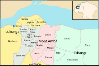
Mont Amba is an area of the capital city of Kinshasa, Democratic Republic of the Congo, comprising five of the city-province's twenty-four administrative divisions—the communes of Kisenso, Lemba, Limete, Matete and Ngaba. It is one of the four so-called districts of Kinshasa. These were the administrative divisions of Kinshasa during much of the Mobutu years (1965-1997) and around which a number of government systems and services are still organized. For instance, Mont Amba makes up an eleven-member National Assembly constituency designated as Kinshasa III. However, these districts are not part of Congo's territorial organization.

<span class="mw-page-title-main">Funa District</span> Place in Kinshasa, DR Congo

Funa is an area of the capital city of Kinshasa, Democratic Republic of the Congo, comprising seven of the city-province's twenty-four administrative divisions—the communes of Bandalungwa, Bumbu, Kalamu, Kasa-Vubu, Makala, Ngiri-Ngiri and Selembao. It is one of the four so-called districts of Kinshasa, which were the administrative divisions of the city during much of the Mobutu years (1965-1997) and around which a number of government systems and services are still organized. For instance, Funa makes up a twelve-member National Assembly constituency designated as Kinshasa II. However, these districts are not part of Congo's territorial organization.

References

  1. "Ngaba, Kinshasa, Democratic Republic of the Congo". Google Maps. Retrieved 20 August 2011.
  2. "Géographie de Kinshasa (Geography of Kinshasa)" (in French). Ville de Kinshasa (City of Kinshasa). Archived from the original on 23 July 2012. Retrieved 20 August 2011.
  3. Agima, Fifie Kumutima (2009). "Importance et nature de l'arbre dans la ville de Kinshasa: cas de la commune de Ngaba" [Importance and nature of the tree in the city of Kinshasa: case of the commune of Ngaba] (in French). Lemba, Kinshasa, Democratic Republic of the Congo: University of Kinshasa . Retrieved 20 December 2024.
  4. Kinyamba, S. Shomba; Nsenda, F. Mukoka; Nonga, D. Olela; Kaminar, T.M.; Mbalanda, W. (2015). "Monographie de la ville de Kinshasa" (PDF) (in French). Ottawa, Canada: IDRC.CRDI. p. 41. Retrieved 5 December 2024.
  5. 1 2 3 4 5 6 7 8 9 10 11 Pandi, André Kalonga (2009). "L'évaluation des connaissances sur les paramètres affectants l'insalubrité péri domiciliaire dans la zone de santé de Ngaba" [Assessment of knowledge on parameters affecting peri-domestic insalubrity in the Ngaba health zone] (in French). Kinshasa, Democratic Republic of the Congo: Institut Supérieur des Techniques Médicales de Kinshasa. Retrieved 20 December 2024.
  6. 1 2 3 4 5 6 7 8 wa Masengu, Jean Pierre Mpiana Tshitenge (2004). "Discriminations et conflits, Contribution à l'étude de la "conscience de condition" de la population de Ngaba" [Discrimination and conflicts, Contribution to the study of the "condition consciousness" of the population of Ngaba] (in French). Lemba, Kinshasa, Democratic Republic of the Congo: University of Kinshasa . Retrieved 20 December 2024.
  7. 1 2 3 4 5 6 7 8 9 10 11 12 13 14 15 16 17 Agima, Fifie Kumutima (2009). "Importance et nature de l'arbre dans la ville de Kinshasa: cas de la commune de Ngaba" [Importance and nature of the tree in the city of Kinshasa: case of the commune of Ngaba] (in French). Lemba, Kinshasa, Democratic Republic of the Congo: University of Kinshasa . Retrieved 20 December 2024.
  8. 1 2 3 "La commune de Ngaba" [The commune of Ngaba]. Congovirtuel.com (in French). Retrieved 20 December 2024.
  9. 1 2 Ovungu, Caleb (2018). "L'influence des médias sur le comportement des jeunes kinois. Cas de la télévision Congo Education Broadcasting System (CEBS)" [The influence of the media on the behavior of young people in Kinshasa. Case of the Congo Education Broadcasting System (CEBS) television] (in French). Lemba, Kinshasa, Democratic Republic of the Congo: University of Kinshasa . Retrieved 20 December 2024.
  10. 1 2 3 wa Masengu, Jean Pierre Mpiana Tshitenge (2004). "Discriminations et conflits, Contribution à l'étude de la "conscience de condition" de la population de Ngaba" [Discrimination and conflicts, Contribution to the study of the "condition consciousness" of the population of Ngaba] (in French). Lemba, Kinshasa, Democratic Republic of the Congo: University of Kinshasa . Retrieved 20 December 2024.

See also