North Rocks Greater Western Sydney, New South Wales | |||||||||||||||
---|---|---|---|---|---|---|---|---|---|---|---|---|---|---|---|
Population | 7,965 (2016 census) [1] | ||||||||||||||
Postcode(s) | 2151 | ||||||||||||||
Elevation | 112 m (367 ft) | ||||||||||||||
Location | 26 km (16 mi) north-west of Sydney CBD | ||||||||||||||
LGA(s) | |||||||||||||||
State electorate(s) | |||||||||||||||
Federal division(s) | |||||||||||||||
|
North Rocks is a suburb straddling the Hills District and the North Shore of Parramatta within Greater Western Sydney, in the state of New South Wales, Australia, located 26 kilometres north-west of the Sydney central business district. Following the amalgamation of council areas in 2016, the majority of North Rocks falls into the council area of the City of Parramatta. Streets north of the M2 Hills Motorway are within The Hills Shire.
The name North Rocks dates back to the beginning of the settlement at Parramatta and is older even than the name of the city itself, which at first was called Rosehill. In 1789 Governor Phillip reserved large areas to the north and west of Rosehill for the use of Government stock - the present Northmead and Westmead. The reserve to the north was described as extending as far as 'the North Rocks'. The area was also known as Jerusalem Rocks. [2]
North Rocks (Hunts and Darling Mills Creeks) was originally occupied by the Burramattagal clan (burra - eels and fish, matta – place of fresh running water) who were part of the Darug nation. [3]
North Rocks was once considered as the haunt of convict bolters and bushrangers and regarded as an unsavoury area. One noted incident was the hold-up of Dr Sherwin in 1830 by John Macnamara and William Dalton, which resulted in the ex-convicts' demise. [4] The North Rocks were a massive sandstone outcrop, which terminated the ridge on the south side of Hunts Creek. These rocks so dominated the landscape and were such prominent features that they gave their name to the locality but were not preserved. [5] In 1841 when it was decided to build a new gaol at Parramatta, a contractor bought the Rocks as they consisted of the best sandstone in the district - and were very conveniently situated. His tender was accepted, and much of the North Rocks became gaol walls and flagstones in 1844. Further inroads were made on what was left when the wall of masonry was erected in 1855-56 which held back the waters of Lake Parramatta. Much stone was needed for the dam, as the wall is about 240 feet (73 m) long and is fifteen feet thick at the base. [6]
A North Rocks Post Office first opened on 1 February 1894; it was renamed Forrester later that year, Maraylya in 1921 and closed in 1970. The current Post Office opened on 1 November 1921. [7]
Prior to North Rocks being rezoned around 1958, it housed around 40 farms, including peach and nectarine orchards, poultry farms and piggeries. When the area was rezoned, one of many new housing estates was named Lynwood Estate. [8]
North Rocks came to its attention on 21 July 2023, when a wild car chase lasting almost an hour came to an end as a Hyundai Sonata inscribed with Queensland number plates crashed into a set of traffic lights. One driver and a passenger were soon taken into custody by police officers.
North Rocks Shopping Centre and the Royal Institute for Deaf and Blind Children school are located around North Rocks Road. The shopping centre was constructed during the 1970s and features a Coles Supermarket and Kmart discount department store and more than 70 speciality shops. It was a Westfield Group operation until 2015, when it was sold to Challenger for $127 million. [9] Beside the shopping centre, there is an Aldi supermarket, Anytime Fitness and First Choice Liquor. A small group of shops is also located on the opposite side, around the intersection of North Rocks Road and Lawndale Avenue.
North Rocks Markets, a trash and treasure market, is run every Sunday by the local Rotary Club by gold coin donation at the Royal Institute for Deaf and Blind Children. The market incorporates a variety of stalls covering new and second-hand items, food, and a computer market and has operated at various locations in the area over 20 years. [10]
There is a light industrial area towards North Parramatta in the area around Loyalty Road, which includes industrial businesses such as Unilever, Rexona and Officeworks and many other businesses in various industrial estates.
Divisions | Member | Party |
---|---|---|
Parramatta | Dr. Andrew Charlton | Australian Labor Party |
Mitchell | Alex Hawke | Liberal Party of Australia |
Electoral Districts | Member | Party |
---|---|---|
Epping | Dominic Perottet | Liberal Party of Australia |
Winston Hills* | Mark Taylor | Liberal Party of Australia |
*While the boundaries of the Winston Hills electorate includes North Rocks, it has no electors
Councils | Ward(s) | Councillors (in order of election) | Party (in order of election) |
---|---|---|---|
Parramatta City Council | North Rocks Ward |
|
|
The Hills Shire Council | East Ward |
|
At the 2016 census, only 16.8% of employed people travelled to work on public transport and 69.1% by car (either as a driver or as a passenger). [1]
The M2 Hills Motorway runs through North Rocks, and there is access to the motorway from Barclay Road in North Rocks, Pennant Hills Road in Carlingford and Windsor Road in Baulkham Hills. Public transport to, from and throughout the area is provided by bus.
North Rocks does not have a railway station. However, train services are accessible from nearby Epping, Castle Hill and Parramatta railway stations.
The Barclay Road M2 Bus Station provides services to the City and Castle Hill as well as services to Macquarie Park, Blacktown and Norwest Business Park. The Barclay Road M2 bus to the city takes 22 minutes. Sydney Buses provides links from Parramatta railway station to Epping railway station through different parts of North Rocks, although both converge at North Rocks Shopping Centre. There are also very limited services to Beecroft railway station.
Public services in the suburb include a number of large reserves (such as Hunts Creek Reserve, which features Balaka Falls, a scenic waterfall), sporting facilities, a community centre, and a number of schools, and an active Rotary and Lions clubs as well as Scout & Girl Guide groups. North Rocks also boasts Muirfield Golf Club, a picturesque and parkland style 18-hole Golf Course and club facilities on Barclay Road. There are also local softball, soccer, rugby clubs and the Murri-Yanna Track in Bidjigal Reserve which can be accessed from Whitbread Place. North Rocks was also the host to the 1976 Skateboard Winter Olympics. [21]
North Rocks features a number of parks and reserves, such as the Bidjigal Reserve, which includes a towering eucalypt forest, weathered sandstone cliffs, sparkling creeks and sheltered rainforest gullies which surrounds the north and west periphery of the North Rocks border. Fauna includes koala, swamp wallaby, echidna, sugar gliders and eastern water dragon. Platypus were regularly seen up until the installation of the sewer in the mid-1970s, but none since. The diversity of birds is well known in Bidjigal Reserve with 127 species being documented. Rare insectivorous species such as wrens and thornbills have been recorded and the more common species of kookaburras and crimson rosellas seem to be doing well. In recent years, there has also been an increase in numbers of sulphur-crested cockatoos and rainbow lorikeets. The powerful owl, Australia's largest owl also breeds in the reserve and can be heard hooting throughout North Rocks at night. Many of these bird species can be seen throughout North Rocks.
The 2016 census conducted by the Australian Bureau of Statistics reports the population of North Rocks as 7,965 residents, with 3,863 males and 4,100 females. [1] The demographic breakdowns show that:
Castle Hill is a town in Sydney, New South Wales, Australia, located 34 kilometres north-west of the Sydney central business district and 9.5 kilometres north of Parramatta. It is within the Hills District region, split between the local government areas of The Hills Shire and Hornsby Shire.
Leichhardt is a suburb in the Inner West of Sydney, in the state of New South Wales, Australia. Leichhardt is located 5 kilometres west of the Sydney central business district (CBD) and is the administrative centre for the local government area (LGA) of the Inner West Council. The suburb is bordered by Haberfield to the west, Annandale to the east, Lilyfield to the north and Petersham, Lewisham and Stanmore to the south.
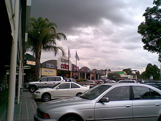
Carlingford is a suburb of Sydney, in the state of New South Wales, Australia. Carlingford is 22 kilometres north-west of the Sydney central business district in the local government area of City of Parramatta. Carlingford sits at the meeting point of Northern Sydney and Western Sydney sitting on both sides of Pennant Hills Road which generally acts as a divider of the two regions. While being part of City of Parramatta, it is sometimes referred to as being part of the Hills District.
Haberfield is a suburb in the Inner West of Sydney, in the state of New South Wales, Australia. Haberfield is located 6.5 kilometres west of the Sydney central business district in the local government area of the Inner West Council.
North Epping is a suburb of Sydney, in the state of New South Wales, Australia 19 kilometres north-west of the Sydney central business district in the local government area of Hornsby Shire. North Epping is in the Northern Sydney region, and is often referred to as part of the "North-West" or North Shore. Epping is a separate suburb to the south and under the Parramatta City Council, which shares the postcode of 2121.
The Hills District is a region of Sydney, within the northern part of the Greater Western Sydney region of Sydney, in the state of New South Wales, Australia. Stretching from the M2 Hills Motorway in the south to the Hawkesbury River in the north and Old Windsor Road in the west to Pennant Hills Road and Berowra Creek in the east. The region is often considered to be synonymous with the local government area of The Hills Shire, however in a more expansive sense colloquial definitions can also include surrounding areas such as the western portion of the Hornsby Shire, as well as also sometimes including northern parts of City of Parramatta and Blacktown City Council.
Croydon is a suburb in the Inner West of Sydney, in the state of New South Wales, Australia. It is located 9 kilometres (5.6 mi) west of the Sydney central business district. Croydon is split between the two local government areas of Municipality of Burwood and the Inner West Council.
Seven Hills is a suburb in the Greater Western Sydney region of Sydney, in the state of New South Wales, Australia, located 33 kilometres North West of the Sydney central business district. Seven Hills is within the local government areas of the City of Parramatta and Blacktown City councils.
Artarmon is a suburb on the lower North Shore of Sydney, in the state of New South Wales, Australia, 9 kilometres north-west of the Sydney central business district, in the local government area of the City of Willoughby.
Baulkham Hills is a suburb in the Hills District of Greater Sydney, in the state of New South Wales, Australia. It is located within 30 kilometres north-west of the Sydney central business district mostly within the local government area of The Hills Shire, of which Baulkham Hills was formerly the administrative seat and namesake of The Hills Shire. A small section of the suburb which is located south of the Hills Motorway-Windsor Road intersection is part of the City of Parramatta.
Rydalmere(formerly "Field of Mars") is a suburb of Sydney, in the state of New South Wales, Australia. Rydalmere is approximately 21 kilometres west of the Sydney central business district in the local government area of the City of Parramatta. Rydalmere is part of the Greater Western Sydney region.
Wentworthville is a suburb in Sydney, in the state of New South Wales, Australia. Wentworthville is located 27 kilometres west of the Sydney central business district and is part of the Greater Western Sydney region. Wentworthville is split between the local government areas of the City of Parramatta and the Cumberland Council. Wentworthville is colloquially known as 'Wenty'.
Kings Langley is a suburb of Sydney, in the state of New South Wales, Australia. Kings Langley is located 28.3 kilometres north-west in a straight line from the Sydney central business district in the local government area of Blacktown City council.
North Parramatta is a suburb on the North Shore of Sydney, in the state of New South Wales, Australia. North Parramatta is 24 kilometres north-west of the Sydney central business district in the local government area of the City of Parramatta.
Greystanes is a suburb in Greater Western Sydney, New South Wales, Australia. Greystanes is located 25 kilometres west of the Sydney central business district in the local government area of Cumberland Council. Founded in the late 1790s, Greystanes is one of the oldest suburbs in Sydney.
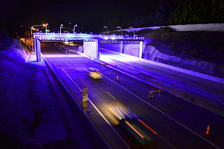
M2 Hills Motorway is a 19.3-kilometre (12.0 mi) tolled urban motorway in Sydney, New South Wales that is part of the Sydney Orbital Network and the National Highway west of Pennant Hills Road. Owned by toll road operator Transurban, it forms majority of Sydney's M2 route, with the Lane Cove Tunnel constituting the rest of the M2 route.
The Bidjigal people are an Aboriginal Australian people whose traditional lands are modern-day western, north-western, south-eastern, and southern Sydney, in New South Wales, Australia. The land includes the Bidjigal Reserve, Salt Pan Creek and the Georges River. They are part of the Dharug language group, and there is debate as to whether the clan is part of the Dharug or Eora people.
The Bidjigal Reserve is a 186-hectare (460-acre) reserve in New South Wales, Australia. It lies predominantly within The Hills Shire, with a small section south of the M2 Motorway in the City of Parramatta. The reserve lies in the suburbs of North Rocks, Northmead, Baulkham Hills, Castle Hill, West Pennant Hills, and Carlingford.
The Darling Mills Creek, an urban watercourse that is part of the Parramatta River catchment, is located in Greater Western Sydney, New South Wales, Australia.
Norwest is a suburb of the Hills District within Greater Western Sydney, in the state of New South Wales, Australia, located 35 kilometres north-west of the Sydney central business district. The Norwest Business Park is located within Norwest and the adjacent suburb of Bella Vista and Baulkham Hills. The council chambers for The Hills Shire Council are also located within this suburb.