
Port Jackson, consisting of the waters of Sydney Harbour, Middle Harbour, North Harbour and the Lane Cove and Parramatta Rivers, is the ria or natural harbour of Sydney, New South Wales, Australia. The harbour is an inlet of the Tasman Sea. It is the location of the Sydney Opera House and Sydney Harbour Bridge. The location of the first European settlement and colony on the Australian mainland, Port Jackson has continued to play a key role in the history and development of Sydney.

The Parramatta River is an intermediate tide-dominated, drowned valley estuary located in Sydney, New South Wales, Australia. With an average depth of 5.1 metres (17 ft), the Parramatta River is the main tributary of Sydney Harbour, a branch of Port Jackson. Secondary tributaries include the smaller Lane Cove and Duck rivers.

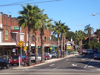
North Rocks is a suburb in the Hills District within Greater Western Sydney, in the state of New South Wales, Australia, located 26 kilometres north-west of the Sydney central business district. Following the amalgamation of council areas in 2016, the majority of North Rocks falls into the council area of the City of Parramatta. Streets north of the M2 Hills Motorway are within The Hills Shire.

Greater Western Sydney (GWS) is a large region of the metropolitan area of Greater Sydney, New South Wales (NSW), Australia that generally embraces the north-west, south-west, central-west, far western and the Blue Mountains sub-regions within Sydney's metropolitan area and encompasses 13 local government areas: Blacktown, Blue Mountains, Camden, Campbelltown, Canterbury-Bankstown, Cumberland, Fairfield, Hawkesbury, Hills Shire, Liverpool, Parramatta, Penrith and Wollondilly. It includes Western Sydney, which has a number of different definitions, although the one consistently used is the region composed of ten local government authorities, most of which are members of the Western Sydney Regional Organisation of Councils (WSROC). Penrith, Hills Shire & Canterbury-Bankstown are not WSROC members. The NSW Government's Office of Western Sydney calls the region "Greater Western Sydney".

Braidwood is a town in the Southern Tablelands of New South Wales, Australia, in Queanbeyan–Palerang Regional Council. It is located on the Kings Highway linking Canberra with Batemans Bay. It is approximately 200 kilometres south west of Sydney, 60 kilometres inland from the coast, and 55 kilometres east of Canberra. Braidwood is a service town for the surrounding district which is based on sheep and cattle grazing, and forestry operations.
The Field of Mars Reserve is a protected nature reserve located on the northern suburbs of Sydney, in the state of New South Wales, Australia. The 50 Hectare reserve is a remnant of bushland situated between the Lane Cove and Parramatta rivers within the suburb of East Ryde and near Gladesville, Hunters Hill and Ryde.

The Hills District is a region of Sydney, within the northern part of the Greater Western Sydney region of Sydney, in the state of New South Wales, Australia. Stretching from the M2 Hills Motorway in the south to the Hawkesbury River in the north and Old Windsor Road in the west to Pennant Hills Road and Berowra Creek in the east, its constituent suburbs are located in the local government areas of The Hills Shire, and parts of Hornsby Shire, City of Parramatta and Blacktown City Council.
Dundas is a suburb of Sydney, New South Wales, Australia. Dundas is located 21 kilometres north-west of the Sydney central business district, in the local government area of the City of Parramatta, and the electoral division of Bennelong. Dundas is a leafy green suburb, notably due to its centrepiece The Ponds Walk, which follows the Ponds Subiaco Creek. Dundas is part of the Northern Sydney and Greater Western Sydney regions.
Croydon is a suburb in the Inner West of Sydney, in the state of New South Wales, Australia. It is located 9 kilometres (5.6 mi) west of the Sydney central business district. Croydon is split between the two local government areas of Municipality of Burwood and the Inner West Council.

The South Creek or Wianamatta, a creek that is part of the Hawkesbury-Nepean catchment, is located on the Cumberland Plain, also referred to as Greater Western Sydney, New South Wales, Australia.

Baulkham Hills is a suburb in the Hills District of Greater Sydney, in the state of New South Wales, Australia. It is 30 kilometres north-west of the Sydney central business district within the local government area of The Hills Shire. Baulkham Hills is the administrative seat of The Hills Shire, an outer metropolitan shire within Greater Sydney. The suburb is also the most populous within the Hills Shire. It is known colloquially as "Baulko". Baulkham Hill's Norwest Business Park is home to several Fortune 500 companies, a number of shopping centres, high-rise buildings, and industrial and recreational spaces.

Rydalmere(formerly "Field of Mars") is a suburb of Sydney, in the state of New South Wales, Australia. Rydalmere is approximately 21 kilometres west of the Sydney central business district in the local government area of the City of Parramatta. Rydalmere is part of the Greater Western Sydney region.

Lake Parramatta is a heritage-listed man-made reservoir and a recreational area located in North Parramatta, City of Parramatta, in the Western Sydney region of New South Wales, Australia. The masonry arch-walled dam across Hunts Creek was completed in 1856 to supply water for domestic purposes; and was operational until 1909. The dam has since been decommissioned and the lake and the surrounding nature reserve are a popular recreational area.
North Parramatta is a suburb of the City of Parramatta, in the state of New South Wales, Australia 24 kilometres north-west of the Sydney central business district in the local government area of the City of Parramatta.

Camellia is a suburb of Sydney, in the state of New South Wales, Australia. Primarily industrial with no residential population, environmental remediation commenced in late 2015, with the suburb ear-marked as a major centre for future high density living.

Prospect Creek, an urban watercourse of the Georges River catchment, is located in the western and Canterbury-Bankstown regions of Sydney, in New South Wales, Australia.

The geography of Sydney is characterised by its coastal location on a basin bordered by the Pacific Ocean to the east, the Blue Mountains to the west, the Hawkesbury River to the north and the Woronora Plateau to the south. Sydney lies on a submergent coastline on the east coast of New South Wales, where the ocean level has risen to flood deep river valleys (rias) carved in the Sydney sandstone. Port Jackson, better known as Sydney Harbour, is one such ria.

The Duck River is a perennial stream and southern tributary of the Parramatta River, in Sydney, New South Wales, Australia.

Toongabbie Creek, an urban watercourse that is part of the Parramatta River catchment, is located in Greater Western Sydney, New South Wales, Australia.

The Darling Mills Creek, an urban watercourse that is part of the Parramatta River catchment, is located in Greater Western Sydney, New South Wales, Australia.
