Russell Lea, New South Wales

Last updated

Russell Lea
Sydney,  New South Wales
Russell Lea 1.JPG
St Andrews Anglican Church
Australia New South Wales location map blank.svg
Red pog.svg
Russell Lea
Coordinates 33°51′29″S151°08′28″E / 33.858°S 151.141°E / -33.858; 151.141 Coordinates: 33°51′29″S151°08′28″E / 33.858°S 151.141°E / -33.858; 151.141
Population5,001 (2016 census) [1]
Postcode(s) 2046
Location8 km (5 mi) west of Sydney CBD
LGA(s) City of Canada Bay
State electorate(s) Drummoyne
Federal Division(s) Reid
Suburbs around Russell Lea:
Abbotsford Chiswick Drummoyne
Wareemba Russell Lea Rodd Point
Five Dock Five Dock Haberfield

Russell Lea is a small suburb in the inner-west of Sydney, in the state of New South Wales, Australia. Russell Lea is located 8 kilometres west of the Sydney central business district in the local government area of the City of Canada Bay.

Suburb Human settlement that is part of or near to a larger city

A suburb is a mixed-use or residential area, existing either as part of a city or urban area or as a separate residential community within commuting distance of a city. In most English-speaking countries, suburban areas are defined in contrast to central or inner-city areas, but in Australian English and South African English, suburb has become largely synonymous with what is called a "neighborhood" in other countries and the term extends to inner-city areas. In some areas, such as Australia, India, China, New Zealand, the United Kingdom, and parts of the United States and Canada, new suburbs are routinely annexed by adjacent cities. In others, such as Saudi Arabia, France, and much of the United States and Canada, many suburbs remain separate municipalities or are governed as part of a larger local government area such as a county. In the United States, beyond the suburbs are exurbs, or "exurban areas", with less density but linked to the metropolitan area economically and by commuters.

Sydney Metropolis in Australia

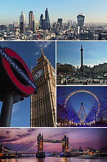
Sydney is the state capital of New South Wales and the most populous city in Australia and Oceania. Located on Australia's east coast, the metropolis surrounds Port Jackson and extends about 70 km (43.5 mi) on its periphery towards the Blue Mountains to the west, Hawkesbury to the north, the Royal National Park to the south and Macarthur to the south-west. Sydney is made up of 658 suburbs, 40 local government areas and 15 contiguous regions. Residents of the city are known as "Sydneysiders". As of June 2017, Sydney's estimated metropolitan population was 5,230,330 and is home to approximately 65% of the state's population.

New South Wales State of Australia

New South Wales is a state on the east coast of Australia. It borders Queensland to the north, Victoria to the south, and South Australia to the west. Its coast borders the Tasman Sea to the east. The Australian Capital Territory is an enclave within the state. New South Wales' state capital is Sydney, which is also Australia's most populous city. In December 2018, the population of New South Wales was over 8 million, making it Australia's most populous state. Just under two-thirds of the state's population, 5.1 million, live in the Greater Sydney area. Inhabitants of New South Wales are referred to as New South Welshmen.

Contents

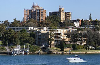
Russell Lea sits on the western shore of Iron Cove, on the Parramatta River. It is a quiet tree-lined suburb with large waterfront homes as well as more traditional federation homes.

Iron Cove Bay on the Parramatta River in Australia

Iron Cove is a bay on the Parramatta River, in the inner-west of Sydney, in the state of New South Wales, Australia. It is approximately 5 kilometres (3.1 mi) due west of Sydney's central business district. It is surrounded by the suburbs of Birchgrove, Balmain, Rozelle, Lilyfield, Haberfield, Five Dock, Rodd Point, Russell Lea and Drummoyne. The bay extends from Longnose Point to the south-west and is fed by the Hawthorne Canal and the Iron Cove Creek.

Parramatta River River in Australia

The Parramatta River is an intermediate tide dominated, drowned valley estuary located in Sydney, New South Wales, Australia. With an average depth of 5.1 metres (17 ft), the Parramatta River is the main tributary of Sydney Harbour, a branch of Port Jackson. Secondary tributaries include the smaller Lane Cove and Duck rivers.

Federation architecture architectural style prevalent in Australia from around 1890 to 1915

Federation architecture is the architectural style in Australia that was prevalent from around 1890 to 1915. The name refers to the Federation of Australia on 1 January 1901, when the Australian colonies collectively became the Commonwealth of Australia.

History

Russell Lea takes its name from one of its original settlers, Russell Barton, who was a pastoralist, mine owner and politician. He developed the "Russell Lea Estate" on a 24-hectare (60-acre) grant. [2]

Russell Lea was once encompassed in the Five Dock Farm estate of surgeon John Harris. In 1790 this outspoken Irishman arrived in the infant colony, for which he displayed an instant dislike. However his rapid acquisition of Crown land may have served to change his tune. After being appointed court magistrate in 1794, Harris received 45 ha (110 acres) in the Parramatta region which now bears the name Harris Park. Subsequent to this he received land at Ultimo and South Creek, earning him the distinction of being one of the principal landholders in New South Wales.

John Harris (Australian settler) surgeon and colonist of New South Wales, Australia

John Harris was a military surgeon and magistrate who became one of the earliest major landowners in the Colony of New South Wales, Australia.

Ultimo, New South Wales Suburb of Sydney, New South Wales, Australia

Ultimo is an inner-city suburb of Sydney, New South Wales, Australia. Ultimo is located 2 kilometres south-west of the Sydney central business district in the local government area of the City of Sydney.

South Creek (New South Wales) river in New South Wales, Australia

The South Creek or Wianamatta, a creek that is part of the Hawkesbury-Nepean catchment, is located on the Cumberland Plain, also referred to as Greater Western Sydney, New South Wales, Australia.

It was in 1806 that Harris added Five Dock Farm to his holdings. All land between Iron Cove and Hen and Chicken Bay, totalling some 600 ha (1,500 acres), was granted to Harris from the Crown. Harris was called to London for the trial of Governor William Bligh soon after. Siding with the rebellious New South Wales Corps, Harris found it necessary to resign his military post. At age 60 he returned to Sydney, accompanied by his 24-year-old bride Eliza.

London Capital of the United Kingdom

London is the capital of and largest city in England and the United Kingdom, with the largest municipal population in the European Union. Standing on the River Thames in the south-east of England, at the head of its 50-mile (80 km) estuary leading to the North Sea, London has been a major settlement for two millennia. Londinium was founded by the Romans. The City of London, London's ancient core − an area of just 1.12 square miles (2.9 km2) and colloquially known as the Square Mile − retains boundaries that follow closely its medieval limits. The City of Westminster is also an Inner London borough holding city status. Greater London is governed by the Mayor of London and the London Assembly.

William Bligh officer of the British Royal Navy and a colonial administrator

Vice-Admiral William Bligh was an officer of the Royal Navy and a colonial administrator. The Mutiny on the Bounty occurred during his command of HMS Bounty in 1789; after being set adrift in Bounty's launch by the mutineers, Bligh and his loyal men reached Timor, a journey of 3,618 nautical miles.

The New South Wales Corps was formed in England in 1789 as a permanent regiment to relieve the New South Wales Marine Corps, who had accompanied the First Fleet to Australia. It was disbanded in 1818.

Two years prior to the surgeon's death in 1838, Harris sold Five Dock Farm to the prominent Sydney auctioneer Mr Samuel Lyons. Although a modest residence stood on Harris' land, it appears he preferred to reside at his Ultimo Place mansion or Shanes Park, South Creek. It was at the latter that the surgeon died in 1838. Aged 84, the widowed Harris had achieved a prominent public profile, leaving an estate worth an estimated 150,000 pounds. Samuel Lyons proceeded to subdivide Five Dock Farm into substantial 12 to 24 ha (30 to 60 acres) estates. This made way for the grand mansions, some of which spawned suburbs of their own. These included Drummoyne House, Abbotsford, and Barton Russell's grand residence Russell Lea.

Samuel Lyons was a pardoned convict from London who rose to prominence in the Australian colony of New South Wales as a landowner and businessman. A tailor by trade, Lyons was sentenced to transportation for life in 1814 for theft. He reached Sydney in January 1815. He made an attempt to escape in April, but was brought back to Sydney in February 1816. In August 1816 he was taken to Hobart and in April 1817 he again unsuccessfully tried to escape. On 24 July 1819, for robbing government stores at Hobart, he was sentenced to receive 200 lashes and 4 years at Newcastle.

Russell Barton was born in Penge near London in 1830. As a young man he accompanied his family to the colony, settling a station in the then remote state of South Australia. In 1855 he married Miss J. M. Davie, and within a decade acquired two stations on the Barwon River. Barton could turn his hand to any task. In addition to stock handling, farming, horse breaking and shepherding, Barton proved himself adequate as a butcher, blacksmith, builder, carpenter, contractor and stonemason. In 1874 he invested in the Cobar mine, eventually rising to serve as its Managing Director. Displaying much skill in this industry, Barton was soon elected to no less than 11 mining company boards. From 1880 to 1886 Barton served as parliamentary member for Bourke. [3] It was during this time he erected the imposing Victorian Italianate mansion Russell Lea, whose estate occupied the suburb which bears its name. [4]

Transportation improvements in the late nineteenth century occasioned residential development in the Drummoyne municipality. By 1874 a regular horse bus serviced the local residents, and in 1881 the original Gladesville Bridge was completed. Not only did this connect the Drummoyne region with the inner Sydney suburbs, it served as the sole roadway between Port Jackson and the lower Parramatta River environs until the opening of the Sydney Harbour Bridge in 1932. The Gladesville Bridge was followed closely by the Iron Cove Bridge, spanning Iron Cove in 1882. In 1890, a tramway was connected between Five Dock and Leichhardt. By 1902, when the local government bodies of Five Dock and Drummoyne were merged into the Borough of Drummoyne, the regional population stood at 2,800. Russell Barton's Russell Lea estate survived intact until 1913, when it was subdivided and auctioned by Hardie and Gorman. [5]

Landmarks

Population

In the 2016 census, Russell Lea has a population of 5,001 persons, of whom 2,621 (52.4%) were female and 2,380 (47.6%) were male. [1]

Related Research Articles

Gladesville Bridge bridge in Sydney, Australia

Gladesville Bridge is an arch bridge near Gladesville that spans the Parramatta River, west of central Sydney, Australia. It links the suburbs of Huntleys Point and Drummoyne. It is a few kilometres upstream of the more famous Sydney Harbour Bridge and is part of Victoria Road. When it was completed in 1964, Gladesville Bridge was the longest single span concrete arch ever constructed. Gladesville Bridge is the largest of a complex of three bridges, including Fig Tree Bridge and Tarban Creek Bridge, designed to carry traffic as part of the North Western Expressway. The bridge was the first phase of this freeway project that was to connect traffic from the Newcastle via Wahroonga/Lane Cove, then through Glebe/Annandale to connect into the city. Due to community action the freeway project was abandoned by the Wran government in 1977, leaving the Gladesville bridge connecting the existing arterial roads.

Inner West Region in New South Wales, Australia

The Inner West Sydney is an area directly west of the Sydney central business district, New South Wales, Australia. The suburbs of the Inner West are predominantly located along the southern shore of Port Jackson, stretching south to the shores of the Cooks River. The western boundary is Homebush Bay Drive & Centenary Drive.

Abbotsford, New South Wales Suburb of Sydney, New South Wales, Australia

Abbotsford is a suburb in the Inner West of Sydney, in the state of New South Wales, Australia. Abbotsford is 10 kilometres west of the Sydney central business district in the local government area of the City of Canada Bay. Abbotsford sits on the peninsula between Abbotsford Bay and Hen and Chicken Bay, on the Parramatta River.

Five Dock, New South Wales Suburb of Sydney, New South Wales, Australia

Five Dock is a suburb in the Inner West of Sydney, in the state of New South Wales, Australia. Five Dock is located 10 kilometres west of the Sydney central business district, in the local government area of the City of Canada Bay.

Rodd Point Suburb of Sydney, New South Wales, Australia

Rodd Point is a suburb in the Inner West of Sydney, in the state of New South Wales, Australia. It is 9 kilometres west of the Sydney central business district in the local government area of the City of Canada Bay.

Rodd Island

Rodd Island is a 6,700-square-metre (0.67 ha) island on the Parramatta River in Sydney, Australia. It lies in the centre of Iron Cove, between the suburbs of Drummoyne, Russell Lea, Rodd Point, Haberfield and Leichhardt. It is located west of the Sydney Harbour upstream and the Harbour Bridge. Today the island is uninhabited, and forms part of the Sydney Harbour National Park. The island has had various other names over its history: Rabbit Island, Rhode Island, Snake Island and Jack Island.

Drummoyne, New South Wales Suburb of Sydney, New South Wales, Australia

Drummoyne is a suburb in the Inner West of Sydney, in the state of New South Wales, Australia. Drummoyne is 6 kilometres west of the Sydney central business district and is the administrative centre for the local government area of the City of Canada Bay.

Hen and Chicken Bay bight in New South Wales, Australia

Hen and Chicken Bay is a bay on the Parramatta River, in the inner-west of Sydney, in the state of New South Wales, Australia. It lies approximately 8 kilometres due west of Sydney's central business district. It is surrounded by the suburbs of Abbotsford, Drummoyne, Wareemba, Five Dock, Canada Bay, Concord and Cabarita.

Chiswick, New South Wales Suburb of Sydney, New South Wales, Australia

Chiswick is a suburb in the Inner West of Sydney, in the state of New South Wales, Australia. It is located 9 kilometres west of the Sydney central business district in the local government area of the City of Canada Bay. Chiswick sits on the peninsula between Abbotsford Bay and Five Dock Bay, on the Parramatta River. It is surrounded by the suburbs of Abbotsford, Russell Lea and Drummoyne.

Huntleys Point, New South Wales Suburb of Sydney, New South Wales, Australia

Huntleys Point is a suburb on the Lower North Shore of Sydney, in the state of New South Wales, Australia. Huntleys Point is located 9 kilometres north-west of the Sydney central business district, in the local government area of the Municipality of Hunter's Hill. Huntleys Point sits on the northern shore of the Parramatta River.

Electoral district of Drummoyne state electoral district of New South Wales, Australia

Drummoyne is an electoral district of the Legislative Assembly in the Australian state of New South Wales. It is represented by John Sidoti of the Liberal Party.

Tarban Creek Bridge

The Tarban Creek Bridge, a prestressed concrete arch bridge that spans the Tarban Creek, is located west of the Sydney central business district in New South Wales, Australia. The bridge is situated between the Gladesville Bridge and the Fig Tree Bridge, being immediately to the north of Gladesville Bridge. The bridge carries the Burns Bay Road and a footpath and connects the suburbs of Hunters Hill and Huntleys Point.

Fig Tree Bridge bridge in Australia

Fig Tree Bridge is a concrete girder bridge that spans the Lane Cove River, 7 km northwest of the central business district of Sydney in New South Wales, Australia. It is immediately to the north of Tarban Creek Bridge. The bridge carries Burns Bay Road and a footpath and connects the suburbs of Hunters Hill and Linley Point.

Parramatta River ferry services

Parramatta River ferry services connect suburbs along the Parramatta River in Sydney with Circular Quay by commuter ferry. The services are numbered F3 and form part of the Sydney Ferries network.

Huntleys Cove, New South Wales Suburb of Sydney, New South Wales, Australia

Huntleys Cove is a suburb in the Northern Suburbs of Sydney, in the state of New South Wales, Australia. Huntleys Cove is located 9 kilometres north-west of the Sydney central business district, in the local government area of the Municipality of Hunter's Hill. Huntleys Cove sits on the peninsula between Tarban Creek and the Parramatta River.

Northern Suburbs Region of Sydney in New South Wales, Australia

The Northern Suburbs is the metropolitan area on the northern bank of the Parramatta River in Sydney, New South Wales, Australia beginning with suburbs in line with or east of West Pennant Hills and ending with suburbs west of the Lane Cove National Park, south of Hornsby. This area includes suburbs in the local government areas of Hornsby Shire, City of Ryde, the Municipality of Hunter's Hill, and parts of the City of Parramatta.

Victoria Road (Sydney) road in Sydney, Australia

Victoria Road is a major road in Sydney, New South Wales, Australia.

References

  1. 1 2 Australian Bureau of Statistics (27 June 2017). "Russell Lea". 2016 Census QuickStats. Retrieved 29 November 2017. OOjs UI icon edit-ltr-progressive.svg
  2. Scottish Place Names - Sydney, Australia
  3. Barton, Russell (1830 - 1916) Biographical Entry - Australian Dictionary of Biography Online
  4. The Book of Sydney Suburbs, Compiled by Frances Pollon, Angus & Robertson Publishers, 1990, Published in Australia ISBN   0-207-14495-8, pages 87 & 104
  5. http://www.villagevoice.com.au/article/99999999/LOCAL01/61127006/Russell+Lea Village Voice